- Benton Charter Township, Michigan
-
There is also Benton Township, Cheboygan County, Michigan and Benton Township, Eaton County, Michigan.
Benton Charter Township, Michigan — Charter township — Location within the state of Michigan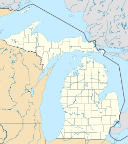
 Benton Charter Township, Michigan
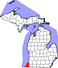
Coordinates: 42°6′37″N 86°24′58″W / 42.11028°N 86.41611°WCoordinates: 42°6′37″N 86°24′58″W / 42.11028°N 86.41611°W Country United States State Michigan County Berrien Area - Total 32.7 sq mi (84.6 km2) - Land 32.6 sq mi (84.4 km2) - Water 0.1 sq mi (0.2 km2) Elevation 633 ft (193 m) Population (2000) - Total 16,404 - Density 503.6/sq mi (194.5/km2) Time zone Eastern (EST) (UTC-5) - Summer (DST) EDT (UTC-4) FIPS code 26-07400[1] GNIS feature ID 1625918[2] Website bentonchartertwp.org Benton Charter Township is a charter township of Berrien County in the U.S. state of Michigan. At the 2000 census, the township population was 16,404.
Contents
Communities
- Millburg is an unincorporated community in the township at 42°07′22″N 86°20′30″W / 42.12278°N 86.34167°W[3] near the boundary with Bainbridge township in Berrien County. It is situated several miles east of Benton Harbor and just east of the intersection of Interstate 94 and Interstate 196/U.S. Highway 31. It was the site of the first settlement within the township.[4] Jehiel Enos settled there in 1834.[5]
History
The township was established on March 11, 1837, and was named after Thomas Hart Benton, U.S. Senator from Missouri. It remained attached to St. Joseph Township for administrative purposes until 1841.[4]
The commune of the House of David was located in the township.
In 1967, the Benton Harbor Fruit Market, established in 1860 in Benton Harbor, moved to the township.[6]
Geography
According to the United States Census Bureau, the township has a total area of 32.7 square miles (85 km2), of which, 32.6 square miles (84 km2) of it is land and 0.1 square miles (0.26 km2) of it (0.31%) is water.
The township is in the northwest portion of the county, with Lake Michigan to the west in the north of the township and Benton Harbor to the east in the south of the township. St. Joseph and St. Joseph Charter Township lie to the southwest. Hagar Township is to the north, Coloma Charter Township to the northeast, Bainbridge Township is to the east, Pipestone Township is to the southeast, and Sodus Township to the south.
Interstate 94 traverses the township diagonally from northeast to southwest. The southern terminus of Interstate 196 is at the junction with I-94. U.S. Highway 31 follows parts of I-196, I-94, Napier Avenue, and all of the completed portion of the St. Joseph Valley Parkway within the township. M-139 lies in the southwest of the township and runs from I-94 to a junction with Business Route I-94 just east of Benton Harbor (the southbound direction begins on the Benton Harbor/Benton Township border).
Demographics
At the 2000 census[1], there were 16,404 people, 6,485 households and 4,221 families residing in the township. The population density was 503.6 per square mile (194.5/km²). There were 7,082 housing units at an average density of 217.4 per square mile (84.0/km²). The racial makeup of the township was 44.11% White, 51.86% African American, 0.37% Native American, 0.36% Asian, 0.01% Pacific Islander, 1.48% from other races, and 1.82% from two or more races. Hispanic or Latino of any race were 3.14% of the population.
There were 6,485 households of which 32.6% had children under the age of 18 living with them, 35.9% were married couples living together, 24.3% had a female householder with no husband present, and 34.9% were non-families. 29.6% of all households were made up of individuals and 11.4% had someone living alone who was 65 years of age or older. The average household size was 2.49 and the average family size was 3.05.
Age distribution was 30.0% under the age of 18, 8.9% from 18 to 24, 26.8% from 25 to 44, 20.8% from 45 to 64, and 13.4% who were 65 years of age or older. The median age was 33 years. For every 100 females there were 88.9 males. For every 100 females age 18 and over, there were 81.8 males.
The median household income was $25,942, and the median family income was $30,899. Males had a median income of $31,563 versus $20,484 for females. The per capita income for the township was $14,137. About 22.5% of families and 27.7% of the population were below the poverty line, including 42.3% of those under age 18 and 16.6% of those age 65 or over.
Economy
Whirlpool Corporation has its headquarters in the township.[7][8] Whirlpool employs a total of 2,058 employees in the metropolitan area.[4]
Education
Benton Charter Township is served by the Benton Harbor Public Library located in Benton Harbor, Michigan.
Sports and Recreation
Point O'Woods Golf & Country Club is located in the township, just northwest of Millburg.
Sarett Nature Center, a 300-acre (1.2 km2) wildlife sanctuary which offers trails, an interpretative building, and classes, and named for Lew R. Sarett, father of Lewis Hastings Sarett,[9] is located in the northern portion of the township.
References
- ^ a b "American FactFinder". United States Census Bureau. http://factfinder.census.gov. Retrieved 2008-01-31.
- ^ U.S. Geological Survey Geographic Names Information System: Benton Charter Township, Michigan
- ^ U.S. Geological Survey Geographic Names Information System: Millburg, Michigan
- ^ a b c Benton Charter Township, Berrien County Community Development Department, January 2008.
- ^ Coolidge, Orville W. (1906). A Twentieth Century History of Berrien County Michigan, p. 232. The Lewis Publishing Company.
- ^ Matuszak, John (2010-08-09). "150 and still growing". The Herald-Palladium. http://www.heraldpalladium.com/articles/2010/08/09/local_news/1689763.txt. Retrieved 2010-08-20.
- ^ "Contact Us." Whirlpool Corporation. 5 (6/30). Retrieved on April 28, 2010.
- ^ "Benton charter township, Michigan." U.S. Census Bureau. Retrieved on April 28, 2010.
- ^ Lew Sarett (1888-1954) Papers, 1902-1978, p.2. Northwestern University archives.
External links
Municipalities and communities of Berrien County, Michigan Cities Benton Harbor | Bridgman | Buchanan | Coloma | New Buffalo | Niles‡ | St. Joseph | Watervliet
Villages Baroda | Berrien Springs | Eau Claire | Galien | Grand Beach | Michiana | Shoreham | Stevensville | Three Oaks
Charter
townshipsBenton | Coloma | Lake | Lincoln | Niles | Oronoko | St. Joseph | Watervliet
General law
townshipsBainbridge | Baroda | Berrien | Bertrand | Buchanan | Chikaming | Galien | Hagar | New Buffalo | Pipestone | Royalton | Sodus | Three Oaks | Weesaw
Unincorporated
communitiesBenton Heights | Berrien Center | Dayton | Fair Plain | Glendora | Harbert | Lake Michigan Beach | Lakeside | Millburg | New Troy | Paw Paw Lake | Riverside | Sawyer | Scottdale | Shorewood Hills | Union Pier
Footnotes ‡This populated place also has portions in an adjacent county or counties
Categories:- Townships in Berrien County, Michigan
- Charter townships in Michigan
- Populated places in Michigan with African American majority populations


Wikimedia Foundation. 2010.