- Chikaming Township, Michigan
-
Chikaming Township, Michigan — Township — Lake Michigan from the beach at Harbert Location within the state of Michigan
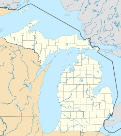
 Chikaming Township, Michigan
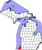
Coordinates: 41°51′54″N 86°38′10″W / 41.865°N 86.63611°WCoordinates: 41°51′54″N 86°38′10″W / 41.865°N 86.63611°W Country United States State Michigan County Berrien Area – Total 22.1 sq mi (57.3 km2) – Land 22.1 sq mi (57.1 km2) – Water 0.1 sq mi (0.1 km2) Elevation 640 ft (195 m) Population (2000) – Total 3,678 – Density 166.7/sq mi (64.4/km2) Time zone Eastern (EST) (UTC-5) – Summer (DST) EDT (UTC-4) FIPS code 26-15480[1] GNIS feature ID 1626076[2] Website http://www.chikamingtownship.org/ Chikaming Township is a civil township of Berrien County in the U.S. state of Michigan. As of the 2000 census, the township population was 3,678. The township is located in the west central portion of the county. Lake Michigan lies to the west, Lake Township is to the north and northeast, Weesaw Township is to the east, Three Oaks Township is to the south, and New Buffalo Township to the southwest.
Contents
Communities
The unincorporated communities of Sawyer, Harbert, and Lakeside are all within the township and Union Pier is partially located in both Chikaming and New Buffalo Township.
Geography
According to the United States Census Bureau, the township has a total area of 22.1 square miles (57 km2), of which, 22.1 square miles (57 km2) of it is land and 0.1 square miles (0.26 km2) of it (0.27%) is water.
Interstate 94 passes northeast-southwest through the township, parallel to the Lake Michigan shoreline.
Warren Woods State Park is within the township. The Galien River flows from northeast to southwest through the township.
Demographics
As of the census[1] of 2000, there were 3,678 people, 1,646 households, and 1,097 families residing in the township. The population density was 166.7 per square mile (64.4/km²). There were 3,473 housing units at an average density of 157.4 per square mile (60.8/km²). The racial makeup of the township was 95.70% White, 2.26% African American, 0.38% Native American, 0.30% Asian, 0.03% Pacific Islander, 0.35% from other races, and 0.98% from two or more races. Hispanic or Latino of any race were 0.95% of the population.
There were 1,646 households out of which 21.5% had children under the age of 18 living with them, 56.9% were married couples living together, 6.3% had a female householder with no husband present, and 33.3% were non-families. 28.8% of all households were made up of individuals and 12.7% had someone living alone who was 65 years of age or older. The average household size was 2.23 and the average family size was 2.73.
In the township the population was spread out with 19.8% under the age of 18, 4.2% from 18 to 24, 24.0% from 25 to 44, 30.1% from 45 to 64, and 21.9% who were 65 years of age or older. The median age was 46 years. For every 100 females there were 97.5 males. For every 100 females age 18 and over, there were 95.0 males.
The median income for a household in the township was $47,778, and the median income for a family was $53,942. Males had a median income of $37,292 versus $22,500 for females. The per capita income for the township was $30,868. About 2.2% of families and 3.8% of the population were below the poverty line, including 4.8% of those under age 18 and 2.6% of those age 65 or over.
References
External links

Lake Michigan Lake Township and Lake Michigan Lake Township Lake Michigan 
Weesaw Township  Chikaming Township

Lake Michigan and New Buffalo Township New Buffalo and Three Oaks townships Weesaw Township Municipalities and communities of Berrien County, Michigan Cities Benton Harbor | Bridgman | Buchanan | Coloma | New Buffalo | Niles‡ | St. Joseph | Watervliet
Villages Baroda | Berrien Springs | Eau Claire | Galien | Grand Beach | Michiana | Shoreham | Stevensville | Three Oaks
Charter
townshipsBenton | Coloma | Lake | Lincoln | Niles | Oronoko | St. Joseph | Watervliet
General law
townshipsBainbridge | Baroda | Berrien | Bertrand | Buchanan | Chikaming | Galien | Hagar | New Buffalo | Pipestone | Royalton | Sodus | Three Oaks | Weesaw
Unincorporated
communitiesBenton Heights | Berrien Center | Dayton | Fair Plain | Glendora | Harbert | Lake Michigan Beach | Lakeside | Millburg | New Troy | Paw Paw Lake | Riverside | Sawyer | Scottdale | Shorewood Hills | Union Pier
Footnotes ‡This populated place also has portions in an adjacent county or counties
Categories:- Townships in Berrien County, Michigan


Wikimedia Foundation. 2010.