- Oronoko Charter Township, Michigan
-
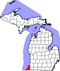
Oronoko Charter Township, Michigan — Charter township — Location within the state of Michigan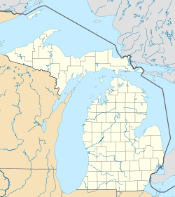
 Oronoko Charter Township, Michigan
Coordinates: 41°56′45″N 86°21′51″W / 41.94583°N 86.36417°WCoordinates: 41°56′45″N 86°21′51″W / 41.94583°N 86.36417°W Country United States State Michigan County Berrien Area – Total 33.4 sq mi (86.4 km2) – Land 32.5 sq mi (84.3 km2) – Water 0.8 sq mi (2.2 km2) Elevation 689 ft (210 m) Population (2000) – Total 9,843 – Density 302.5/sq mi (116.8/km2) Time zone Eastern (EST) (UTC-5) – Summer (DST) EDT (UTC-4) FIPS code 26-61180[1] GNIS feature ID 1626861[2] Oronoko Charter Township is a charter township of Berrien County in the U.S. state of Michigan. The population was 9,843 at the 2000 census.
The Village of Berrien Springs is the only incorporated municipality within the township. Much of the eastern portion of the township is considered to be part of the Berrien Springs urban area. The western portion is primarily agricultural.
The township was organized on March 11, 1837 from a portion of Berrien Township. Oronoko initially included what is now Lake Township, which was organized in 1846. Originally, portions of both Oronoko and Berrien townships were on either side of the St. Joseph River and at the time, a large portion of the village of Berrien Springs was in Berrien Township, even though it was on the other side of the river from most of the township. In 1847, the river was made the dividing line between the townships.[3]
There are several accounts given for the name of the township. One is that it was named by Governor Stevens T. Mason after the Indian Chief named "Oronoko". However, apart from this story, there is no record that there ever was such a chief. Another is that it is a variant spelling of Orinoco, the name of a South American river that was adopted with various spellings in other states besides Michigan: Oronoco, Minnesota and Oronoque, Kansas. Others believe the township was named after the literary character Oroonoko, which was also derived from the South American river. A final possibility suggested by Vogel is that the name was taken from a variety of tobacco known as oronoco, orinoko, or oronooka.[4][5]
Andrews University (Seventh-day Adventist) is located in the township.
Geography
The St. Joseph River forms the eastern boundary of the township. Berrien Charter Township lies across the river directly to the east and Sodus Township to the north and northeast. Buchanan Township is to the south, Baroda Township to the west, and Royalton Township to the north,
U.S. Highway 31 passes through the eastern corner of the township.
According to the United States Census Bureau, the township has a total area of 33.4 square miles (87 km2), of which, 32.5 square miles (84 km2) of it is land and 0.8 square miles (2.1 km2) of it (2.52%) is water.
Demographics
As of the census[1] of 2000, there were 9,843 people, 3,295 households, and 2,303 families residing in the township. The population density was 302.5 per square mile (116.8/km²). There were 3,545 housing units at an average density of 109.0 per square mile (42.1/km²). The racial makeup of the township was 66.54% White, 17.48% African American, 0.40% Native American, 7.03% Asian, 0.27% Pacific Islander, 4.38% from other races, and 3.89% from two or more races. Hispanic or Latino of any race were 8.53% of the population.
There were 3,295 households out of which 31.8% had children under the age of 18 living with them, 57.4% were married couples living together, 10.0% had a female householder with no husband present, and 30.1% were non-families. 23.7% of all households were made up of individuals and 8.5% had someone living alone who was 65 years of age or older. The average household size was 2.62 and the average family size was 3.11.
In the township the population was spread out with 22.0% under the age of 18, 18.9% from 18 to 24, 26.9% from 25 to 44, 20.3% from 45 to 64, and 11.9% who were 65 years of age or older. The median age was 31 years. For every 100 females there were 91.8 males. For every 100 females age 18 and over, there were 87.0 males.
The median income for a household in the township was $35,980, and the median income for a family was $45,998. Males had a median income of $36,341 versus $26,330 for females. The per capita income for the township was $16,904. About 9.9% of families and 18.3% of the population were below the poverty line, including 20.4% of those under age 18 and 10.0% of those age 65 or over.
References
- ^ a b "American FactFinder". United States Census Bureau. http://factfinder.census.gov. Retrieved 2008-01-31.
- ^ U.S. Geological Survey Geographic Names Information System: Oronoko Charter Township, Michigan
- ^ Ellis, Franklin (2005) [1880]. "Township of Oronoko". History of Berrien and Van Buren counties, Michigan. Ann Arbor, Mich.: University of Michigan Library. pp. 287. http://www.hti.umich.edu/cgi/t/text/pageviewer-idx?c=micounty;cc=micounty;idno=arh7541.0001.001;q1=Oronoko;size=l;frm=frameset;seq=364;view=image;page=root. Retrieved 2006-06-28.
- ^ Vogel, Virgil J. (1986). Indian Names in Michigan. Ann Arbor, Michigan: The University of Michigan Press. ISBN 0-472-10069-6. Vogel also mentions Oronogo, Missouri, but popular accounts indicate that name does not derive from the South American river.
- ^ Arent, Jennifer (June 2005). "Community Profile of Oronoko Charter Township" (PDF). Berrien County Economic Development Department. pp. 4. Archived from the original on 2006-07-11. http://web.archive.org/web/20060711072443/http://www.berriencounty.org/econdev/pdfs/Oronoko+Township+2005.pdf. Retrieved 2006-06-28.
Municipalities and communities of Berrien County, Michigan Cities Benton Harbor | Bridgman | Buchanan | Coloma | New Buffalo | Niles‡ | St. Joseph | Watervliet
Villages Baroda | Berrien Springs | Eau Claire | Galien | Grand Beach | Michiana | Shoreham | Stevensville | Three Oaks
Charter
townshipsBenton | Coloma | Lake | Lincoln | Niles | Oronoko | St. Joseph | Watervliet
General law
townshipsBainbridge | Baroda | Berrien | Bertrand | Buchanan | Chikaming | Galien | Hagar | New Buffalo | Pipestone | Royalton | Sodus | Three Oaks | Weesaw
Unincorporated
communitiesBenton Heights | Berrien Center | Dayton | Fair Plain | Glendora | Harbert | Lake Michigan Beach | Lakeside | Millburg | New Troy | Paw Paw Lake | Riverside | Sawyer | Scottdale | Shorewood Hills | Union Pier
Footnotes ‡This populated place also has portions in an adjacent county or counties
Categories:- Townships in Berrien County, Michigan
- Charter townships in Michigan


Wikimedia Foundation. 2010.