- Chippewa Township, Chippewa County, Michigan
-
There is also Chippewa Township, Isabella County, Michigan and Chippewa Township, Mecosta County, Michigan.
Chippewa Township, Michigan — Township — Location within the state of Michigan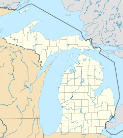
 Chippewa Township, Michigan
Coordinates: 46°20′20″N 84°59′58″W / 46.33889°N 84.99944°WCoordinates: 46°20′20″N 84°59′58″W / 46.33889°N 84.99944°W Country United States State Michigan County Chippewa Area – Total 95.5 sq mi (247.3 km2) – Land 94.9 sq mi (245.8 km2) – Water 0.6 sq mi (1.5 km2) Elevation 830 ft (253 m) Population (2000) – Total 238 – Density 2.5/sq mi (1.0/km2) Time zone Eastern (EST) (UTC-5) – Summer (DST) EDT (UTC-4) FIPS code 26-15560[1] GNIS feature ID 1626078[2] Chippewa Township is a civil township of Chippewa County in the U.S. state of Michigan. As of the 2000 census, the township population was 238.
Contents
Communities
- Eckerman is an unincorporated community in the township on M-123 at 46°21′55″N 85°02′07″W / 46.36528°N 85.03528°W about two miles north of M-28[3]
- Strongs is an unincorporated community in the township on M-28 at 46°21′28″N 84°58′10″W / 46.35778°N 84.96944°W about two miles east of M-123.[4]
Geography
According to the United States Census Bureau, the township has a total area of 95.5 square miles (247 km2), of which, 94.9 square miles (246 km2) of it is land and 0.6 square miles (1.6 km2) of it (0.62%) is water.
Demographics
As of the census[1] of 2000, there were 238 people, 92 households, and 65 families residing in the township. The population density was 2.5 per square mile (1.0/km²). There were 273 housing units at an average density of 2.9 per square mile (1.1/km²). The racial makeup of the township was 89.08% White, 5.88% Native American, 1.68% Asian, and 3.36% from two or more races. Hispanic or Latino of any race were 0.84% of the population.
There were 92 households out of which 33.7% had children under the age of 18 living with them, 59.8% were married couples living together, 7.6% had a female householder with no husband present, and 28.3% were non-families. 25.0% of all households were made up of individuals and 10.9% had someone living alone who was 65 years of age or older. The average household size was 2.59 and the average family size was 3.08.
In the township the population was spread out with 26.9% under the age of 18, 7.1% from 18 to 24, 26.1% from 25 to 44, 24.4% from 45 to 64, and 15.5% who were 65 years of age or older. The median age was 41 years. For every 100 females there were 108.8 males. For every 100 females age 18 and over, there were 114.8 males.
The median income for a household in the township was $32,500, and the median income for a family was $34,306. Males had a median income of $27,500 versus $18,750 for females. The per capita income for the township was $12,433. About 9.1% of families and 13.2% of the population were below the poverty line, including 16.2% of those under the age of eighteen and 3.3% of those sixty five or over.
Businesses
The Strongs intersection -- at M-28 and S. Salt Point Road -- is home to a handful of businesses, including two bars, two general stores, and two motels, e.g. the Lumberjack Tavern, the Strongs General Store, and the Strongs Tavern and Motel.
References
- ^ a b "American FactFinder". United States Census Bureau. http://factfinder.census.gov. Retrieved 2008-01-31.
- ^ U.S. Geological Survey Geographic Names Information System: Chippewa Township, Chippewa County, Michigan
- ^ U.S. Geological Survey Geographic Names Information System: Eckerman, Michigan
- ^ U.S. Geological Survey Geographic Names Information System: Strongs, Michigan
Municipalities and communities of Chippewa County, Michigan City 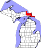
Village Charter
townshipGeneral law
townshipsUnincorporated
communitiesCategories:- Townships in Chippewa County, Michigan


Wikimedia Foundation. 2010.