Hoogezand-Sappemeer

Hoogezand-Sappemeer

Infobox Settlement
official_name = Hoogezand-Sappemeer
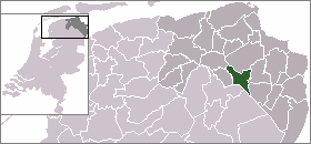

mapsize = 280px
subdivision_type = Country
subdivision_name = Netherlands
subdivision_type1 = Province
subdivision_name1 = Groningen
leader_name = Mirjam Salet
leader_party = PvdA
area_footnotes = (2006)
area_total_km2 = 73.05
area_land_km2 = 67.53
area_water_km2 = 5.52
population_as_of = 1 January, 2007
population_note = Source: CBS, [http://statline.cbs.nl/ Statline] .
settlement_type = Municipality
population_total = 34403
population_density_km2 = 509
timezone = CET
utc_offset = +1
timezone_DST = CEST
utc_offset_DST = +2
latd = 53.163639
latNS = N
longd = 6.755771
longEW = E
website = [http://www.hoogezand-sappemeer.nl www.hoogezand-sappemeer.nl]

Hoogezand-Sappemeer (Pronunciation|009 Hoogezand-Sappemeer.ogg) is a municipality in the northeastern Netherlands. It is the second largest municipality in the province of Groningen, after the city of Groningen. It is well known for its ship building industry.

The A7 motorway (European Highway E 22, Amsterdam-Groningen-Germany) crosses the municipality. There is also a railway line providing service to Groningen and Nieuweschans/Leer(Germany). Trains serve four stations in the municipality, Kropswolde, Martenshoek, Hoogezand-Sappemeer, and Sappemeer Oost. Since this year(2007), trains will stop 3 times an hour.

Population centres

* Achterdiep
* Borgercompagnie
* Borgweg
* Foxham
* Foxhol
* Foxholsterbosch
* Hoogezand
* Jagerswijk
* Kalkwijk
* Kiel-Windeweer
* Kleinemeer
* Kropswolde
* Lula
* Martenshoek
* Meerwijck
* Nieuwe Compagnie
* Sappemeer
* Tripscompagnie
* Waterhuizen
* Westerbroek
* Wolfsbarge

External links

* [http://www.hoogezand-sappemeer.nl Official website]


Wikimedia Foundation. 2010.

Игры ⚽ Поможем написать курсовую

Look at other dictionaries:

  • Hoogezand-Sappemeer — Héraldique …   Wikipédia en Français

  • Hoogezand-sappemeer — Hoogezand Sappemeer …   Wikipédia en Français

  • Hoogezand-Sappemeer —   [hoːxə zant sapə meːr], Gemeinde in der Provinz Groningen, Niederlande, am schiffbaren Winschoterdiep, 33 900 Einwohner; Kartoffelstärkeerzeugung, Glasfaser , elektrotechnische, Gummiwaren , Druckindustrie, Schiffbau; Erdgasförderung;… …   Universal-Lexikon

  • Hoogezand-Sappemeer — Gemeinde Hoogezand Sappemeer Flagge Wappen Provinz Groningen …   Deutsch Wikipedia

  • Hoogezand-Sappemeer — Sp Hogezándas Sãpemeris Ap Hoogezand Sappemeer L Nyderlandai …   Pasaulio vietovardžiai. Internetinė duomenų bazė

  • Hoogezand-Sappemeer — Sp Hogezándas Sãpemeris Ap Hoogezand Sappemeer L Olandija …   Pasaulio vietovardžiai. Internetinė duomenų bazė

  • Gemeente Hoogezand-Sappemeer — Admin ASC 2 Code Orig. name Gemeente Hoogezand Sappemeer Country and Admin Code NL.04.0018 NL …   World countries Adminstrative division ASC I-II

  • Hoogezand — is a village in the municipality Hoogezand Sappemeer, located in the northeast Netherlands. The name refers to a higher sanded (Hooge Sandt) place in the peatlands cut through when the Winschoterdiep channel was dug. Near this channel in 1618 the …   Wikipedia

  • Sappemeer Oost railway station — Sappemeer Oost Station statistics Coordinates 53°09′32″N …   Wikipedia

  • Hoogezand — ist ein Ort in der niederländischen Provinz Groningen. Hoogezand gehört seit 1949 zur Gemeinde Hoogezand Sappemeer. Der Name leitet sich von einem Flurnamen her, Hooge Sandt. Seit 1618 führt ein Kanal durch die Gemarkung, der Winschoterdiep, der… …   Deutsch Wikipedia

Share the article and excerpts

Direct link
Do a right-click on the link above
and select “Copy Link”