- Islais Creek
-
Islais Creek Creek  Islais Creek with an abandoned five-story-high copra crane,[1] Interstate 280 and Sutro Tower in the background
Name origin: Los Islais, Spanish and slay or islay, Salinan (Native American) for Prunus ilicifolia wild cherries[2][3][4] Country USA State California Counties City and County of San Francisco City San Francisco Source Cesar Chavez Street - location Near Potrero Hill, City and County of San Francisco, California - elevation 1 ft (0 m) [5] - coordinates 37°44′51″N 122°23′16″W / 37.7475°N 122.38778°W [6] Mouth San Francisco Bay - location Near Bayview-Hunters Point, City & County of San Francisco, California - elevation -10 ft (-3 m) [6] - coordinates 37°44′54″N 122°22′32″W / 37.74833°N 122.37556°W [6] Length 1 mi (1.6 km) [6] Islais Creek or Islais Creek Channel (previously known as Du Vrees Creek, Islais Channel and Islais Swamp)[7] is a small creek in San Francisco, California. The name of the creek is derived from a Salinan Native American word "slay" or "islay", the name for the Prunus ilicifolia wild cherries. Around the time of the Gold Rush, the area became an industrial hub, and the condition of the creek worsened. After the devastating earthquake in 1906, the city decided to reclaim the creek using earthquake debris, reducing the waterbody to its present size. Though much of Islais Creek has been converted to an underground culvert, remnants still exist today at both Glen Canyon Park and Third Street. Several community organizations are dedicated to preserve these remnants, as they are important wildlife habitats.
Contents
Course
The historic Islais Creek, the largest body of water in the city covering an area of nearly 5,000 acres (7.812 sq mi; 20.234 km2),[4] had two main branches. One originated near the southern slope of Twin Peaks, slightly north of Portola Drive. It flowed downstream southeastward through the Glen Canyon Park paralleling Bosworth Street and eventually reaching the bottom of the Mission Street viaduct at I-280.[8][9] The other branch began at the intersection of Cayuga Avenue and Regent Street. It flowed generally eastward along Mission Street and reached the I-280 viaduct. Together, as a wider creek, it ran parallel to Alemany Boulevard and I-280 and emptied into the Islais Creek estuary, near Industrial Street and Oakdale Avenue.[4][10] Precita Creek, a nearby creek that originated from Noe Valley, also joined Islais Creek at the César Chávez Boulevard and Evans Avenue intersection.[11][12]
From its sources in the Glen Canyon, the entire creek stretched about 3.5 miles (5.6 km) to the San Francisco Bay. The mouth was nearly 2 miles (3.2 km) wide, providing up to 85% of the drinking water in San Francisco.[9][12] Due to urban development, however, the watershed of Islais Creek has been reduced by roughly 80% from its historical extent.[8] A large number of neighborhoods in San Francisco today, such as Bernal Heights, Hunters Point, Visitacion Valley, parts of the Mission and Potrero Hill, was once covered by the extent of the creek.
In 2007, the San Francisco Public Utilities Commission, which manages the city's water, began investigating the possibility of "daylighting" underground portions of the creek.[13] As of 2009, remnants of the creek remain inside the Glen Canyon Park[8] and a 1-mile (1.6 km) channel near Third Street where Islais Creek emptied into the bay.
History
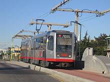 A T-Third Street train crossing the Islais Creek
The history of Islais Creek dates to the 18th century.[12] The name Los Islais first appeared on Mexican maps in 1834,[14] named for the Islay cherries that grew wildly in the area. By 1850, water from the creek was used by farmers to irrigate crops.[1] The Gold Rush marked the decline of the creek as large numbers of gold rushers swarmed into the city.[1] In 1871, the area along the creek became known as the city’s "New Butchertown" when more than 100 slaughterhouses opened. Since then, the condition of the creek deteriorated, literally becoming a dumping place of garbage, sewage, animal waste, and unsold meat products. The condition became so bad that the creek was commonly referred to as "Shit Creek" by San Franciscans, according to historian Karl Kortum.[14][15][16]
After the 1906 earthquake, San Francisco Board of Supervisors voted to fill the creek with earthquake debris, reducing the creek to its present size.[12] During World War II, it served as docking areas for large ocean-going tugs. The area also located the largest copra coconut processing plant in the United States West Coast.[4] In fact, the abandoned five-story high copra crane, used to transport large amount of copras from ships to the plant as late as 1974, still remains on the creek bank preserved as a historic landmark.[1][17] In the 1950s, Islais Creek was home to the largest sardine canning industry in the world. The deteriorated condition of the creek gradually improved after the construction of a water treatment plant in 1970.[1] Today, the majority of the creek is covered and transformed into a culvert with its remnants flowing at Glen Canyon and near the bay.
Many local community organizations were set up to improve the condition of the creek and nearby areas. Friends of Islais Creek, established back in 1984, and David Erickson, a local community figure, were committed to build a waterfront park in Islais Creek. The initial plan for a park was finally launched in 1988 with a $50,000 grant from the State Department of Water Resources as well as community groups in The Bayview. With an additional of $100,000 federal and local grants as well as supports from non-profit organizations and governmental agencies, namely the Sierra Club, San Francisco Municipal Railway (Muni), Department of Public Works, Public Utilities Commission, Port of San Francisco, and Caltrans, the park was finished in 1998.[1][18][19] Located adjacent to Pier 80 on the shores of the creek, the Muwekma Ohlone Park or the Muwekma Ohlone Sanctuary is named after the native inhabitants and has since became an important habitat for a wide array of wildlife, including the Pacific Chorus Frog and Mission blue butterfly.[9][12]
On November 19, 2001, construction crews, while preparing to drill an electrical conduit (consisting of six large 115kV electrical cables) across the creek for the Muni Metro T Third Street light rail line, cracked the concrete sewer underground which carries more than 80 million gallons of sewage a day. The incident flooded the creek and its adjacent Muwekma Ohlone Park with sewage. The park had to be excavated to make way for the repairing of the sewer pipe.[18][20] It was estimated that it would take more than $101,660 to repair and $65,000 for wildlife habitat restoration.[18]
Health hazard
Since Islais Creek is a culvert that carries storm water, domestic sewage, and industrial wastewater, it is possible for the sewage to overflow. Such overflow can cause a public health hazard as Islais Creek displays higher level of heavy metals, PCBs, bacteria, as well as organochlorines than other parts of the San Francisco Bay.[21][22]
Transportation
The Third Street Bridge is the major crossing of the creek, carrying T Third Street light rail line and Third Street.[23] The Port of San Francisco extended Illinois Street across Islais Creek in 2006 to relieve traffic for Third Street.[24]
Notes and references
- ^ a b c d e f Jeanne Alexander. "Islais Creek History". National Park Council. http://www.sfnpc.org/islaiscreekhistory. Retrieved May 25, 2008.
- ^ Ron Sullivan (December 7, 2002). "Roots of native names". San Francisco Chronicle. http://www.sfgate.com/cgi-bin/article.cgi?f=/c/a/2002/12/07/HO199208.DTL&hw=Islais+Creek&sn=021&sc=235. Retrieved November 3, 2007.
- ^ E. G. Gudde (1946). "The Solution of the Islay Problem". California Folklore Quarterly (Western States Folklore Society) 5 (3): 298–299. doi:10.2307/1495525. JSTOR 1495525. "Gudde concludes that the word "islay" originated in a Salinan word slay; Islay was the Spanish version of their word"
- ^ a b c d Pearl Winaker; Bernard C. Winn. "History of Islais Creek". islaiscreek.org. http://www.islaiscreek.org/IslaisCreekHistoryRenaker.htm. Retrieved May 25, 2008.
- ^ Source elevation derived from Google Earth search using GNIS source coordinates.
- ^ a b c d "Islais Creek Channel". Geographic Names Information System, U.S. Geological Survey. 2000-06-14. http://geonames.usgs.gov/pls/gnispublic/f?p=gnispq:3:::NO::P3_FID:254827. Retrieved December 10, 2007.
- ^ According to the Geographic Names Information System by USGS, other lesser known variant names for Islais Creek or Islais Creek Channel include Arroyo Islais, El Arroyo De Los Yslais, Islar Creek, and Du Urees Creek.
- ^ a b c (PDF) Glen Canyon Park and O’Shaughnessy Hollow, San Francisco Recreation and Parks Department, 2006, pp. Section 6.3 of Significant Natural Resources Areas Management Plan, http://www.parks.sfgov.org/wcm_recpark/SNRA50/Sections/6.3%20O'Shaughnessy%20Glen%20Park.pdf, retrieved February 3, 2007, "This section contains several detailed maps on "Soils, Land Features, and Trails," "Vegetation," and "Sensitive Species and Bird Habitat."
- ^ a b c Amber Hasselbring; David Erickson (April 20, 2007). "Conversation about Islais Creek and the Now Destroyed Muwekema Ohlone Park". Neighborhood Public Radio. http://www.art-eco.org/islaiscreek.html. Retrieved August 20, 2008.
- ^ William C. Sharpsteen. "Vanished Waters of Southeastern San Francisco". California Historical Society Quarterly, Vol. XXI, No. 2, June 1941. The Virtual Museum of the City of San Francisco. http://www.sfmuseum.org/hist5/vanish.html. Retrieved May 25, 2008.
- ^ M.T. Ramirez-Herrera, J.M. Sowers, C.M. Richard (2006). Creek & Watershed Map of San Francisco (Map). 1 : 25,800. Cartography by Oakland Museum of California. http://www.museumca.org/creeks/1630-RescIslais.html. Retrieved March 16, 2009.
- ^ a b c d e "Islais Creek Basin P.1-5" (PDF). San Francisco Public Utilities Commission. September 2007. http://sfwater.org/Files/Reports/Islais_Basin_Context_pgs1-5.pdf. Retrieved August 21, 2008.
- ^ "Urban Watershed Planning". San Francisco Public Utilities Commission. http://sfwater.org/mto_main.cfm/MC_ID/14/MSC_ID/361/MTO_ID/550. Retrieved 10 April 2010.
- ^ a b Carl Nolte (November 30, 1996). "New Current for Historic S.F. Waterway". San Francisco Chronicle. http://www.sfgate.com/cgi-bin/article.cgi?f=/c/a/1996/11/30/MN50463.DTL. Retrieved November 2, 2007.
- ^ Kevin Cutler (April 2006). "Islais Creek: From Stream to Sewer". The Noe Valley Voice. http://www.noevalleyvoice.com/2006/April/Byli.html. Retrieved August 20, 2008.
- ^ Joe Eaton, Ron Sullivan (January 14, 2009). "S.F. history lesson runs through Islais Creek". San Francisco Chronicle. http://www.sfgate.com/cgi-bin/article.cgi?f=/c/a/2009/01/14/HOB71557F2.DTL. Retrieved March 15, 2009.
- ^ Jeanne Alexander. "A bird’s eye view of The Blue Greenway: Islais Creek". Neighborhood Parks Council. http://www.bluegreenway.org/alexander_birdseye.html. Retrieved August 20, 2008.
- ^ a b c Joe Garofoli (July 28, 2003). "Urban oasis garden in legal limbo in S.F.". San Francisco Chronicle. http://www.sfgate.com/cgi-bin/article.cgi?file=/chronicle/archive/2003/07/28/MN283123.DTL. Retrieved November 2, 2007.
- ^ Paul McHugh (June 28, 2001). "Ultimate dream: a bay water trail". San Francisco Chronicle. http://www.sfgate.com/cgi-bin/article.cgi?f=/c/a/2001/06/28/SP140784.DTL. Retrieved November 2, 2007.
- ^ Maurice B. George (July 29, 2004). "Muni destroys park, dumps sewage, wastes millions crossing Islais Creek". Indybay. http://www.indybay.org/newsitems/2004/07/29/16905921.php. Retrieved August 21, 2008.
- ^ Randall Frost (March 26, 2005). "Storm Runoffs May Pose Health, Environmental Risks". Neighborhood Newswire. Archived from the original on October 3, 2006. http://web.archive.org/web/20061003064001/http://www.sfpower.org/newswire/water2.php. Retrieved August 21, 2008.
- ^ Kennish, Michael (November 19, 1991). Ecology of Estuaries: Anthropogenic Effects. CRC Press. pp. 512. ISBN 0849380413. http://books.google.com/?id=LR9OJ2SrZ64C&pg=PA237&lpg=PA237&dq=islais+creek. Retrieved August 24, 2008.
- ^ Michael Cabanatuan (January 6, 2007). "3rd Street light rail nearly at finish line". San Francisco Chronicle. http://www.sfgate.com/cgi-bin/article.cgi?f=/c/a/2007/01/06/BAGTRNDU001.DTL. Retrieved November 3, 2007.
- ^ "Illinois Street Bridge". http://www.incainc.com/inca/movable-bridges/illinois-street-bridge.html. Retrieved May 7, 2011.
See also
External links
- Guide to San Francisco Bay Area Creeks - Islais Creek
- Urban Paradise Lost
- Some images of Islais Creek from the book San Francisco: A Natural History
- 360° views of Islais Creek Basin from Third Street Bridge: 1, 2
- The Attempted Homicide of a Sanctuary
Coordinates: 37°44′50″N 122°23′15″W / 37.747253°N 122.387368°W
Categories:- Neighborhoods in San Francisco, California
- Rivers of San Francisco County, California


Wikimedia Foundation. 2010.