- Cripple Creek Historic District
-
Cripple Creek Historic District
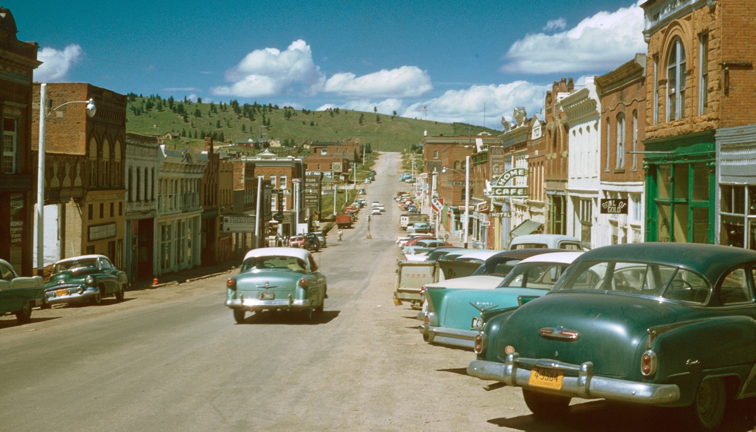
 Cripple Creek, 1957
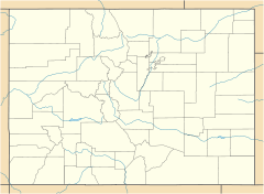

Location: Cripple Creek, Colorado Coordinates: 38°45′7″N 105°10′31″W / 38.75194°N 105.17528°WCoordinates: 38°45′7″N 105°10′31″W / 38.75194°N 105.17528°W Built: 1890 Governing body: Local NRHP Reference#: 66000939 Significant dates Added to NRHP: October 15, 1966[1] Designated NHLD: July 4, 1961[2] Cripple Creek Historic District is a historic district including Cripple Creek, Colorado, USA and is significant for its gold mining era history.
It was declared a National Historic Landmark in 1961.[2][3]
Many Cripple Creek buildings post-date the gold mining era. The district includes a number of surviving structures, possibly including the following seven:
- The Midland Terminal Depot
- Teller County Courthouse
- The Imperial Hotel
- The Old Homestead
- St. Paul's Catholic Church
- Mansard Roof House, on Warren Avenue
- The El Paso County Hospital, a brick Greek Revival style two story building.
A photograph of each of the seven above is included in the NRHP Inventory documentation.
The boundary of the district is defined by high points around Cripple Creek to include the "natural setting reminiscent of the historic environment. Additionally, it encloses part of the extent of Poverty Gulch where some of the original ore discoveries were made as well as the County Hospital building which is located outside the town limits." [3] (p.10) It runs from the peak of Mineral Hill (elevation 10,255 feet) southwest to a peak (elevation 9,855 feet), then to northeast corner of Mount Pisgah cemetery, then south along the east border of the cemetery to its southeast corner, then southeast to the peak that is 1600 feet to the northwest of Signal Hill (at elevation 9731), then northeast to the summit of Globe Hill (elevation 10,436), then northwest to peak of Carbonate Hill (elevation 10,335), finally east back to the peak of Mineral Hill.
Colorado State Highway 67 is the principal road through the area.
References
- ^ "National Register Information System". National Register of Historic Places. National Park Service. 2007-01-23. http://nrhp.focus.nps.gov/natreg/docs/All_Data.html.
- ^ a b "Cripple Creek Historic District". National Historic Landmark summary listing. National Park Service. http://tps.cr.nps.gov/nhl/detail.cfm?ResourceId=712&ResourceType=District. Retrieved 2007-10-15.
- ^ a b Joseph Scott Mendinghall (December 9, 1975). National Register of Historic Places Inventory-Nomination: Cripple Creek Historic DistrictPDF (396 KB). National Park Service. and Accompanying 7 photos, exteriors, from 1975.PDF (950 KB)
External links
Protected Areas of the State of Colorado Federal National ParksNational MonumentsNational Recreation AreasNational Historic SitesNational Historic TrailsOld Spanish Trail · Pony Express Trail · Santa Fe TrailNational Scenic TrailContinental Divide TrailArapaho · Grand Mesa · Gunnison · Pike · Rio Grande · Roosevelt · Routt · San Isabel · San Juan · Uncompahgre · White RiverNational WildernessBlack Canyon of the Gunnison · Black Ridge Canyons · Buffalo Peaks · Byers Peak · Cache La Poudre · Collegiate Peaks · Comanche Peak · Dominguez · Eagles Nest · Flat Tops · Fossil Ridge · Great Sand Dunes · Greenhorn Mountain · Gunnison Gorge · Holy Cross · Hunter-Fryingpan · Indian Peaks · James Peak · La Garita · Lizard Head · Lost Creek · Maroon Bells-Snowmass · Mesa Verde · Mount Evans · Mount Massive · Mount Sneffels · Mount Zirkel · Neota · Never Summer · Platte River · Powderhorn · Ptarmigan Peak · Raggeds · Rawah · Sangre de Cristo · Sarvis Creek · South San Juan · Spanish Peaks · Uncompahgre · Vasquez Peak · Weminuche · West ElkNational Conservation AreasGunnison Gorge · McInnis CanyonsNational Wildlife RefugesAlamosa · Arapaho · Baca · Browns Park · Monte Vista · Rocky Flats · Rocky Mountain Arsenal · Two PondsState Arkansas Headwaters · Barr Lake · Bonny Lake · Boyd Lake · Castlewood Canyon · Chatfield · Cherry Creek · Cheyenne Mountain · Crawford · Eldorado Canyon · Eleven Mile · Golden Gate Canyon · Harvey Gap · Highline Lake · Jackson Lake · James M. Robb - Colorado River · John Martin Reservoir · Lake Pueblo · Lathrop · Lone Mesa · Lory · Mancos · Mueller · Navajo · North Sterling · Paonia · Pearl Lake · Ridgway · Rifle Falls · Rifle Gap · Roxborough · San Luis · Spinney Mountain · St. Vrain · Stagecoach · State Forest · Staunton · Steamboat Lake · Sweitzer Lake · Sylvan Lake · Trinidad Lake · Vega · Yampa RiverByers-Evans House · Colorado History Museum · El Pueblo · Fort Garland · Fort Vasquez · Georgetown Loop · Healy House Museum and Dexter Cabin · Pearce-McAllister Cottage · Pike Stockade · Trinidad History Museum · Ute Indian MuseumOther Beaver Meadows · Burlington Carousel · Black Hawk · Central City · Colorado Chautauqua · Cripple Creek · Durango-Silverton Railroad · Georgetown · Granada · Leadville · Lindenmeier Site · Lowry Ruin · Mesa Verde · Pikes Peak · Pike's Stockade · Raton Pass · Shenandoah-Dives Mill · Silver Plume · Silverton · Telluride · U.S. Air Force Academy Cadet AreaGarden of the Gods · Garden Park Fossil Area · Indian Springs Trace Fossil · Lost Creek Scenic Area · Morrison Fossil Area · Raton Mesa · Roxborough Park · Russell Lakes · Sand Creek · Slumgullion Earthflow · Spanish Peaks · Summit LakeAmerican Discovery Trail · Colorado Trail · Continental Divide Trail · Great Divide Trail · Kokopelli's Trail · Paradox Trail · Tabeguache TrailAlpine Loop · Cache la Poudre-North Park · Colorado River Headwaters · Dinosaur Diamond · Flat Tops · Frontier Pathways · Gold Belt · Grand Mesa · Guanella Pass · Highway of Legends · Lariat Loop · Los Caminos Antiguos · Mount Evans · Pawnee Pioneer · Peak to Peak · San Juan Skyway · Santa Fe Trail · Silver Thread · South Platte River Trail · Top of the Rockies · Trail of the Ancients · Trail Ridge · Unaweep/Tabeguache · West Elk LoopColorado Department of Natural Resources (web) U.S. National Register of Historic Places Topics Lists by states Alabama • Alaska • Arizona • Arkansas • California • Colorado • Connecticut • Delaware • Florida • Georgia • Hawaii • Idaho • Illinois • Indiana • Iowa • Kansas • Kentucky • Louisiana • Maine • Maryland • Massachusetts • Michigan • Minnesota • Mississippi • Missouri • Montana • Nebraska • Nevada • New Hampshire • New Jersey • New Mexico • New York • North Carolina • North Dakota • Ohio • Oklahoma • Oregon • Pennsylvania • Rhode Island • South Carolina • South Dakota • Tennessee • Texas • Utah • Vermont • Virginia • Washington • West Virginia • Wisconsin • WyomingLists by territories Lists by associated states Other  Category:National Register of Historic Places •
  Portal:National Register of Historic PlacesCategories:
- Historic districts in Colorado
- National Historic Landmarks in Colorado
- Geography of Teller County, Colorado
- Visitor attractions in Teller County, Colorado
- Colorado Registered Historic Place stubs

Wikimedia Foundation. 2010.