- Schiermonnikoog
-
Schiermonnikoog
Skiermûntseach— Municipality — Satellite image of Schiermonnikoog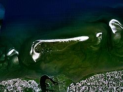

Flag
Coat of arms
Coordinates: 53°29′29″N 6°13′43″E / 53.49139°N 6.22861°E Country Netherlands Province Friesland Area(2006) – Total 199.07 km2 (76.9 sq mi) – Land 40.54 km2 (15.7 sq mi) – Water 158.52 km2 (61.2 sq mi) Population (1 January 2007) – Total 947 – Density 23/km2 (59.6/sq mi) Source: CBS, Statline. Time zone CET (UTC+1) – Summer (DST) CEST (UTC+2)  Lighthouse on Schiermonnikoog
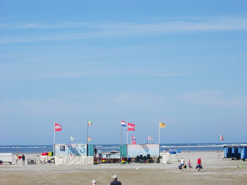
 Beach on Schiermonnikoog
 Marina at low tide
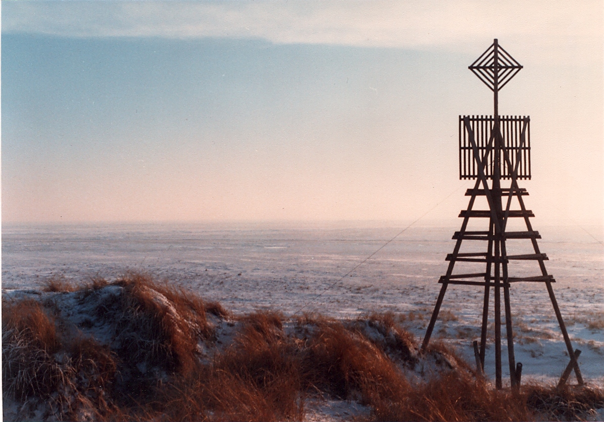
 The triangulation beacon on Willemsduin in wintertime
Schiermonnikoog (
 pronunciation (help·info); West Frisian: Skiermûntseach) is an island, a municipality, and a national park in the northern Netherlands. Schiermonnikoog is one of the West Frisian Islands, and is part of the province of Friesland.
The island is only 16 km long and 4 km wide and is the site of the Netherlands' first national park. The only village on the island is also called Schiermonnikoog. Just under 1,000 people permanently reside on the island, making the municipality the least densely populated in the Netherlands. Because the island is small and flat, only 200 islanders have taken out the special licence allowing them to keep their own car, with the result that the few streets are virtually car-free.
Up to 300,000 people visit the island every year, staying in the 5,500 beds available in holiday homes, apartments and hotels. Most visitors, however, are day trippers (about 4,000/day in July and August alone), with the result that after the last ferry leaves at 6.30pm, calm returns to Langestreek, the village high street.
Contents
History
The first known owners of Schiermonnikoog were the monks of Klaarkamp Abbey, a Cistercian monastery near Rinsumageest, on the mainland.[1] "Monnik" means "monk" and "schier" is an archaic word meaning "grey", referring to the colour of the monks' habits. "oog" translates as "island". The name Schiermonnikoog therefore translates as island of the grey monks.[2][3]
The tidal current, prevailing wind and the sea cause the island to slowly "move" to the south and the east. In the year 1250, it lay roughly 2 km to the north of its present position, and it had a significantly different shape.[4]
The oldest mention of Schiermonnikoog in writing dates from October 1440, in a document written by Philip the Good.
During the Reformation, the monasteries in the northern Netherlands were expropriated. In 1580, Schiermonnikoog became the property of the States of Friesland. Around 1640, the States sold the island to the wealthy Stachouwer family. For the next three centuries, Schiermonnikoog remained private property.
Around 1700, the population of Schiermonnikoog was divided among four villages or communities. The largest village was Westerburen, which had developed in the vicinity of the monks' buildings. In 1717 and 1720, storms flooded Westerburen, which had to be abandoned around 1725, prey to drifting sand and the advancing sea. In 1756 a new town, named Oosterburen, was built to the east. Nowadays this second village is named Schiermonnikoog, after the island. At about this time the residents revolted against Lady Catharina Maria Stachouwer, which forced the States of Friesland to send troops to protect her and restore law and order.
In August of 1799, a small Royal Navy squadron under Captain Adam Mackenzie of Groningen. The boats of the squadron then attacked a six gun Dutch schooner Vengeance and a battery on Schiermonnikoog. The British were able to burn the schooner and spike the guns of the battery.[Note 1]
In 1859, the Stachouwer family sold the island to John Eric Banck from The Hague. Amongst other works he started planting the sand dunes with marram grass to stabilize them. There is now a monument to him on the top of the dike that he built. In 1878 he sold the island to the German count, Hartwig Arthur van Bernstorff-Wehningen. When the count died in 1940, his son Bechtold Eugen Graf von Bernstorff inherited Schiermonnikoog. When World War II broke out and the German military occupied the island, he ensured that the islanders were largely left in peace. When von Bernstorff died in 1987, his family was allowed to bury him beside the Reformed Church in the village.
In 1940, KLM briefly initiated passenger and postal service to Schiermonnikoog and nearby Ameland, landing its Douglas DC-3s on the beach.
During World War II, the German Army heavily fortified the island as part of the Atlantic Wall defence line. The number of German troops came to equal the island’s own population of 600. Towards the end of the war, hundreds of SS troops along with members of the SD fled to the island, reinforcing the German contingent already there. After the war ended, the Germans on the island had not yet surrendered, and the Canadian forces, which were responsible for the sector, did not want to have to fight to force a surrender. Fortunately, the German commander agreed to surrender and the German soldiers were evacuated to Wilhelmshaven in Germany. On June 11, 1945, the island became the last part of Europe freed by the Allies.
After World War II, the Dutch government confiscated Schiermonnikoog as 'enemy property'. Schiermonnikoog became an independent municipality in 1949, as part of the Province of Friesland.
On 1 January 2006 the eastern border of the island was moved eastbound, further into the now former territory of the municipality of Eemsmond in the province of Groningen, for a compensation of about 30.000 euros. This was done to give the municipality of Schiermonnikoog the possibility to act in case of a calamity or disaster.
Tourism
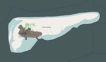 National Park Schiermonnikoog
The main source of income on Schiermonnikoog is tourism. The island houses a campground, a ferry pier, a tidal harbour for small vessels and approximately 15 hotels and hundreds of vacation houses and apartments. The eastern part of the island forms an important nature reserve, with access very restricted during the breeding season of the many birds that nest there. The island as a whole is one of The Netherlands' national parks, Schiermonnikoog National Park
Travel
The only public transport to Schiermonnikoog is a ferry from the lock and harbour complex of Lauwersoog. Even during the winter months there are more than two connections per day.
Tourists are not allowed to bring their cars with them on the ferry. Buses connect the village with the ferry. The most common form of transport is by bicycle; a network of cycle paths criss-crosses the island.
Note
- ^ This exploit would earn those seamen who survived until 1847 the Naval General Service Medal with clasp "SCHIERMONNIKOOG 12 AUGT. 1799".
See also
- Klozum
References
- ^ Stenvert, R. et al. (2000). Monumenten in Nederland: Friesland, p. 265–267. Zwolle: Waanders Uitgevers. ISBN 90-400-9476-4.
- ^ [1]
- ^ van Dale groot woordenboek der nederlandse taal, twaalfde druk
- ^ Van de Ven, G. (editor) (1996). Leefbaar laagland, p. 90. Utrecht: Uitgeverij Matrijs. ISBN 90-5345-031-9.
External links
- Website of Schiermonnikoog
- Tourism Office Website
- Wagenborg: Ferry Service to Schiermonnikoog and Ameland
- Circus Theater Dagen: Circus, Activities, Events in Schiermonnikoog, May 2008
- Barry Yeoman, Destination: Wadden Islands, Attaché magazine
- Dutch documentary soap opera about people living on Schiermonnikoog
- A travel account by a Yemeni who traveled to Schiermonnikoog, Yemen Observer newspaper
- Schiermonnikoog: An article
 Municipalities of Friesland (Fryslân)
Achtkarspelen · Ameland · Boarnsterhim · Dantumadiel · Dongeradeel · Ferwerderadiel · Franekeradeel · Gaasterlân-Sleat · Harlingen · Heerenveen · Het Bildt · Kollumerland c.a. · Leeuwarden · Leeuwarderadeel · Lemsterland · Littenseradiel · Menaldumadeel · Ooststellingwerf · Opsterland · Schiermonnikoog · Skarsterlân · Smallingerland · Súdwest-Fryslân · Terschelling · Tytsjerksteradiel · Vlieland · Weststellingwerf ·

Frisian Islands 

 West Frisian IslandsNoorderhaaks · Texel · Vlieland · Richel · Terschelling · Griend · Ameland · Rif · Engelsmanplaat · Schiermonnikoog · Simonszand · Rottumerplaat · Rottumeroog · Zuiderduintjes
 East Frisian IslandsBorkum · Lütje Hörn · Kachelotplate · Memmert · Juist · Norderney · Baltrum · Langeoog · Spiekeroog · Wangerooge · Minsener-Oldoog · Mellum
between East and North Frisian Islands Langlütjen I & II · Hoher Knechtsand · Heligoland · Neuwerk · Scharhörn · Nigehörn · Trischen · Tertius · Blauort North Frisian Islands (Germany)
 Danish Wadden Sea Islands
National Parks of the Netherlands Alde Feanen • Biesbosch • Drentsche Aa • Drents-Friese Wold • Dunes of Texel • Dwingelderveld • Groote Peel • Hoge Veluwe • Lauwersmeer • Loonse en Drunense Duinen • Maasduinen • Meinweg • Oosterschelde • Sallandse Heuvelrug • Schiermonnikoog • Utrechtse Heuvelrug • Veluwezoom • De Weerribben-Wieden • Zoom - Kalmthoutse Heide • Zuid-Kennemerland
More info on national parksCategories:- West Frisian Islands
- Municipalities of Friesland
- Populated places in Friesland
- Visitor attractions in Friesland
- National parks of the Netherlands


Wikimedia Foundation. 2010.