- Scarborough Southwest
Infobox Canada electoral district
province = Ontario
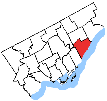
caption = Scarborough Southwest in relation to the other Toronto ridings
fed-status = active
fed-district-number = 35084
fed-created = 1996
fed-abolished =
fed-election-first = 1997
fed-election-last = 2006
fed-rep = Tom Wappel
fed-rep-link =
fed-rep-party = Liberal
fed-rep-party-link = Liberal Party of Canada
prov-status = active
prov-created = 1999
prov-abolished =
prov-election-first = 1999
prov-election-last = 2007
prov-rep = Lorenzo Berardinetti
prov-rep-link =
prov-rep-party = Liberal
prov-rep-party-link = Ontario Liberal Party
demo-census-date = 2006
demo-pop = 102196
demo-electors = 66307
demo-electors-date = 2007
demo-area = 31
demo-cd =Toronto
demo-csd = ScarboroughScarborough Southwest is a federal and provincial electoral district in
Ontario ,Canada , that has been represented in theCanadian House of Commons and in theLegislative Assembly of Ontario since 1999.On
Toronto City Council , the southeast portion is represented by Brian Ashton. The northwest section is represented byAdrian Heaps .Geography
It covers the southwestern part of the Scarborough part of Toronto. It stretches from
Lake Ontario in the south toEglinton Avenue in the north.It consists of the part of the City of Toronto bounded on the west by Victoria Park Avenue, on the south by Lake Ontario, and on the north and east by a line drawn from Victoria Park Avenue northeast along the hydroelectric transmission line situated north of Craigton Drive, south along the Canadian National Railway, east along Eglinton Avenue East, south along Bellamy Road South, southwest along Kingston Road, and southeast along Bellamy Ravine Creek.
The riding includes the neighbouhoods of
Birch Cliff , Oakridge,Birchmount Park ,Cliffside ,Kennedy Park ,Clairlea , Golden Mile,Ionview andCliffcrest in Scarborough, Toronto.Federal electoral district
The federal riding was created in 1996 from parts of
Scarborough Centre andScarborough West . It consisted initially of the part of the City of Scarborough lying south and west of a line drawn from the western city limit east along Eglinton Avenue East, north along Markham Road, east along the Canadian National Railway, southwest along Kingston Road, south along Scarborough Golf Club Road, southwest along Hill Crescent, southeast along Bellamy Ravine Creek.In 2003, it was given its current boundaries as described above.
Member of Parliament
This riding has elected the following member of the
Canadian House of Commons :OntElec5|1999
-Dan Newman
align="right"|15,349
align="right"|39.76
-Adrian Heaps
align="right"|12,992
align="right"|33.66
-
Michael Yorke
align="right"|8,962
align="right"|23.22
-
Wiktor Pawel Borkowski
align="right"|495
align="right"|1.28
-
Barbara Schaefer
align="right"|466
align="right"|1.21
-
Laurence Corp
align="right"|339
align="right"|0.88See also
*
List of Canadian federal electoral districts
*Past Canadian electoral districts External links
* [http://www.parl.gc.ca/information/about/process/house/hfer/hfer.asp?Language=E&Search=Det&Include=Y&rid=1061 Riding history from the]
Library of Parliament
* Elections Ontario [http://www.electionsontario.on.ca/results/1999_results/stat_summary.jsp?e_code=37&rec=0&] and [http://www.electionsontario.on.ca/results/2003_results/stat_summary.jsp?e_code=38&rec=0&
]
Wikimedia Foundation. 2010.