- Oxford Charter Township, Michigan
-
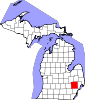
Oxford Charter Township, Michigan — Charter township — Location of Oxford Charter Township within Oakland County, Michigan. Location within the state of Michigan
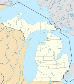
 Oxford Charter Township, Michigan
Coordinates: 42°49′25″N 83°16′14″W / 42.82361°N 83.27056°WCoordinates: 42°49′25″N 83°16′14″W / 42.82361°N 83.27056°W Country United States State Michigan County Oakland Area – Total 35.2 sq mi (91.2 km2) – Land 33.9 sq mi (87.8 km2) – Water 1.3 sq mi (3.4 km2) Elevation 1,037 ft (316 m) Population (2010) – Total 20,526 – Density 582.9/sq mi (225.1/km2) Time zone Eastern (EST) (UTC-5) – Summer (DST) EDT (UTC-4) ZIP codes 48462, 48370,48371 Area code(s) 248, 810 FIPS code 26-62040[1] GNIS feature ID 1626877[2] Oxford Charter Township is a charter township of Oakland County in the U.S. state of Michigan. The population was 20,526 at the 2010 census.[3] The village of Oxford is located within the township and is geographically and politically a part of the township.
Contents
Geography
According to the United States Census Bureau, the township has a total area of 35.2 square miles (91 km2), of which 33.9 square miles (88 km2) is land and 1.3 square miles (3.4 km2), or 3.78%, is water.
Demographics
As of the census[1] of 2000, there were 16,025 people, 5,787 households, and 4,317 families residing in the township. The population density was 472.9 per square mile (182.6/km²). There were 6,151 housing units at an average density of 181.5 per square mile (70.1/km²). The racial makeup of the township was 96.83% White, 0.45% African American, 0.26% Native American, 0.51% Asian, 0.02% Pacific Islander, 0.62% from other races, and 1.31% from two or more races. Hispanic or Latino of any race were 2.19% of the population.
There were 5,787 households out of which 40.6% had children under the age of 18 living with them, 62.7% were married couples living together, 8.8% had a female householder with no husband present, and 25.4% were non-families. 20.7% of all households were made up of individuals and 6.3% had someone living alone who was 65 years of age or older. The average household size was 2.75 and the average family size was 3.21.
In the township the population was spread out with 29.2% under the age of 18, 6.9% from 18 to 24, 35.0% from 25 to 44, 21.5% from 45 to 64, and 7.3% who were 65 years of age or older. The median age was 34 years. For every 100 females there were 97.3 males. For every 100 females age 18 and over, there were 93.9 males.
The median income for a household in the township was $63,494, and the median income for a family was $75,216. Males had a median income of $52,083 versus $32,258 for females. The per capita income for the township was $26,601. About 2.1% of families and 4.3% of the population were below the poverty line, including 3.9% of those under age 18 and 7.6% of those age 65 and over.
Culture
Oxford Township has a few notable golf courses, including Devil's Ridge Golf Club, Boulder Pointe Golf Club and Oxford Hills Golf and Country Club. The Polly Ann Trailway [1] is a scenic trail utilized by bikers, hikers, cross-country skiers, and horseback riders throughout the year; at over 14 miles (23 km) long, it connects the towns of Orion, Leonard, Addison, and Oxford. Oxford has four public parks [2] and one public library. There are several dance and gymnastic academies located throughout Oxford, many of which work with Oxford's Department of Parks and Recreation to offer introductory classes to various types and levels of gymnastics and dance. Oxford Parks and Recreation also continually offers programs to residents of all age groups; a few examples include ballroom dancing, foreign languages, ceramics, self-defense, and culinary classes [3].
History
Prior to the 1820s, what is now Oxford Township was known to be a hunting ground of the Nepessing Tribe of the Chippewa Indians, who inhabited large areas of what became Oakland, Lapeer and St. Clair counties. Between 1810 and the early 1820s, numerous settlers visited the Oxford area, primarily to hunt and trap. The first documented sale of public land in this area was recorded in 1823 to Elbridge Deming, who later built a log cabin on land in section 9 (in the area of M-24 and Metamora Road) of the township, around the spring of 1832.
Oxford Township was not officially created until after Michigan became a state in 1837. It was originally part of Oakland Township, as were Addison Township and Orion Township; Oxford Township was split away and separately organized in 1837. The 1830s saw an influx of settlers to the area, originally known as Demingsburgh, Demings Corners, and Oxford Corners, before becoming known as Oxford in 1836. The family names of many early settlers to the area are evident today in names of streets and buildings, such as Powell, Hovey, Burdick, and Axford.
New residents continued the trek to Oxford Township, many settling in sections 22 and 27 of what was to become the village of Oxford in 1876. Along with residents came commerce and industry. A downtown area was built in the village, but much of the area south of Burdick Street and west of Washington Street burned to the ground in 1878. When rebuilt, most of the buildings were of brick and masonry construction and are still in use today. The 1850s, 1860s, and 1870s found Oxford a prospering commercial center, with such businesses as Oxford Carriage Factory, Oxford Machine Works, Oxford Valley Mills, Oxford Brewery and several furniture and cabinetry shops.
In addition to the village of Oxford, two other smaller communities developed in other areas of the township. The first developed near Baldwin and Oakwood roads, on the boundary with Brandon Township; the community of Oakwood reached a population of nearly 200 people by 1876 with a foundry and "the usual shops and stores".
A railroad station and facilities were necessary near the northern edge of the township, and so the second community, Thomas, was developed. The place was platted by John Thomas in 1871.[4] Thomas had a store, hotel, grain elevator and gristmill by the late 1870s. These two areas of Oxford Township continued to prosper until May 1896, when they were largely devastated by a monster tornado which traveled across the entire north end of Oakland County. The tornado killed 41 people and injured 46 others in northern Oakland and southern Lapeer counties. Seventeen of the fatalities were in the northern portion of Oxford Township, from the Oakwood village area to Thomas. While many of the homes in Oakwood and Thomas were rebuilt, the two communities were never again centers of commerce. Railroads were largely responsible for change and continued growth in the Oxford area. No longer isolated from Detroit, and now joined with communities to the north, Oxford's commerce thrived. In addition to its businesses and factories, agriculture was a mainstay for the community. At one time in the in 1880s, Oxford earned the nickname, Bagatown, from the large number of rutabagas shipped out by train.
The early 1880s saw a second railroad constructed from the Pontiac area, through Oxford to Port Austin. Known as the Pontiac, Oxford, and Port Austin Railroad, or P.O. and P.A., it later became the Pontiac, Oxford, and Northern (P.O. and N.), and finally the Grand Trunk Western Railroad. With the expansion of the second rail line through town, it now became possible to travel to the tip of Michigan's thumb in one day. By 1900, a third, all electric powered passenger rail line known as the Detroit United Railway (D.U.R.) was extended through Oxford from Detroit to Flint and was noted for maintaining limited cars daily, both north and southbound. Over the years, the D.U.R. was involved in many collisions with automobiles, often resulting in death or injury to those whose automobiles tangled with the interurban cars at grade crossings. As automobile transportation became more reliable and roads improved, a growing percentage of the populace chose to travel by these means, forcing the demise of the D.U.R. in 1931.
One of the most recognizable voices throughout the nation was that of Brace Beemer, the radio Lone Ranger. Beemer lived in Oxford for many years. There is a street named for him in the southwest part of the township, where he lived. His collection of Lone Ranger items is on display in the Northeast Oakland Historical Museum in Oxford.
Industry
The following paragraph seems to have been copied and pasted directly from "A Brief History of Oxford Township" by Mildred Schmidt, who was a local historian. "Gravel, an abundant natural resource found throughout northeast Oakland County, played a major role in change and development of the Oxford area. Beginning in 1912 with establishment of a gravel mine by W.O. Smith, eventually five individual gravel mining companies were operating in Oxford by the mid 1920s. American Aggregates Corporation, became the most successful of the mining firms, when it acquired mining rights to vast tracts of land in 1982. Oxford became known and was until recent years was promoted as The Gravel Capital of the World."
References
- ^ a b "American FactFinder". United States Census Bureau. http://factfinder.census.gov. Retrieved 2008-01-31.
- ^ U.S. Geological Survey Geographic Names Information System: Oxford Charter Township, Michigan
- ^ "Race, Hispanic or Latino, Age, and Housing Occupancy: 2010 Census Redistricting Data (Public Law 94-171) Summary File (QT-PL), Oxford charter township, Oakland County, Michigan". U.S. Census Bureau, American FactFinder 2. http://factfinder2.census.gov. Retrieved August 22, 2011.
- ^ Scott, Gene. Michigan Shadow Towns: A Study of Vanishing and Vibrant Villages (no place: Gene Scott, 2005) p. 123
External links
Municipalities and communities of Oakland County, Michigan Cities Auburn Hills | Berkley | Birmingham | Bloomfield Hills | Clarkston | Clawson | Farmington | Farmington Hills | Fenton‡ | Ferndale | Hazel Park | Huntington Woods | Keego Harbor | Lake Angelus | Lathrup Village | Madison Heights | Northville‡ | Novi | Oak Park | Orchard Lake Village | Pleasant Ridge | Pontiac | Rochester | Rochester Hills | Royal Oak | South Lyon | Southfield | Sylvan Lake | Troy | Walled Lake | Wixom
Villages Beverly Hills | Bingham Farms | Franklin | Holly | Lake Orion | Leonard | Milford | Ortonville | Oxford | Wolverine Lake
Charter
townshipsBloomfield | Brandon | Commerce | Highland | Independence | Lyon | Milford | Oakland | Orion | Oxford | Royal Oak | Springfield | Waterford | West Bloomfield | White Lake
General law
townshipsUnincorporated
communitiesDrayton Plains | Goodison | Lakeville | Union Lake
Footnotes ‡This populated place also has portions in an adjacent county or counties
Metro Detroit Topics Architecture · Culture · Detroit River · Economy · Freeways · History · Historic places · International Riverfront · Lake St. Clair · Media · Music · Parks and beaches · People · Skyscrapers · Sports · Theatre · Tourism · Transportation
Major city Municipalities
over 80,000Canton Township · Clinton Township · Dearborn · Livonia · Sterling Heights · Troy · Warren · WestlandMunicipalities
45,000 to 80,000Dearborn Heights · Farmington Hills · Grosse Pointe · Macomb Township · Novi · Pontiac · Redford Township · Rochester Hills · Royal Oak · St. Clair Shores · Shelby Township · Southfield · Taylor · Waterford Township · West Bloomfield TownshipSatellite cities Counties in MSA Counties in CSA Regions Outlying regions Categories:- Charter townships in Oakland County, Michigan
- 1837 establishments in the United States
- Populated places established in 1837


Wikimedia Foundation. 2010.