- Clayton, West Yorkshire
-
Coordinates: 53°46′55″N 1°48′48″W / 53.782000°N 1.813450°W
Clayton 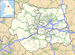
 Clayton
Clayton shown within West YorkshirePopulation 15,191 OS grid reference SE123317 Parish Clayton Metropolitan borough City of Bradford Metropolitan county West Yorkshire Region Yorkshire and the Humber Country England Sovereign state United Kingdom Post town BRADFORD Postcode district BD14 Dialling code 01274 Police West Yorkshire Fire West Yorkshire Ambulance Yorkshire EU Parliament Yorkshire and the Humber Website http://www.clayton-village.co.uk/ List of places: UK • England • Yorkshire Clayton is a civil parish in the City of Bradford metropolitan borough in West Yorkshire, England, situated 3 miles to the west of the city centre. It is listed in the Domesday Book, meaning it dates back to at least the 11th century and was privately owned from 1160 to 1866.[1] It was noted for its clay. More recently, Clayton was a key location in the British and international wool trade, being the home of the British Wool Marketing Board headquarters. The old building was demolished and converted into housing in the late 1990s.
Though no longer a village, as it has now been absorbed into the West Yorkshire conurbation of Bradford, the area maintains a village feel, and is often referred to as such.[citation needed] The village re-acquired civil parish status with a parish council in 2004.
The main street of the village – Clayton Lane – which runs alongside the park, includes several traditional pubs, a popular crawl route for many residents. Starting at the top of the lane is The Fleece, moving down past The Royal Hotel to The Albion and The Black Bull – the oldest pub in the area. Other pubs include The Fiddlers Three, however, The Quarry Arms has now shut down. There are also several shops, churches, and a nearby golf club and reservoir at Clayton Heights with views of the city of Bradford and the village of Thornton across the valley.
Contents
History
Evidence of presence of prehistoric people in Clayton was found in 1951 when a Neolithic stone axe was found in Thornlea Grove, the axe is now in the Cartwright Hall Museum.[2] Clayton was established prior to the Norman conquest in 1066 as it is listed in the Domesday Book in 1086 as the Manor Claitone when William the Conqueror granted it to Ilbert de Lacy.[3] Claitone probably derives from claeg meaning clay and tun, meaning farmstead, and so meant farmstead on clay.[4] The village was privately owned from 1160 to 1866 when a local board was formed to manage the village. The Local Government Act 1894 the Board was replaced by Clayton District Council.[1] During the 1870s "the wells", on the central village roundabout, was used as a site for open air preaching.
Governance
Clayton is situated within the Bradford Metropolitan District Council area having been incorporated into Bradford in 1930.[3] The village re-acquired civil parish status including a parish council in 2004 and the council designated the area an urban village in February 2007.[5] The village was privately owned from 1160 to 1866 when a local board was formed to manage the village. The board managed Clayton's roads, sewers, lighting and refuse collection. The board also laid gas and water pipes in the village. In the Local Government Act 1894 the Board was replaced by Clayton District Council. The council created a crew of local fire fighters for the village until Clayton grew too large for these to be able to cope at which point Bradford Corporation was paid to cover the village with their fire brigade and ambulance service.[1]
Geography
 Station Road, Clayton showing the steep valley sides with Clayton Heights at the top of hill.
Clayton is located at about 220 metres above sea level at the south end of a relatively flat ridge of land on the south side of Clayton beck valley. The valley drops steeply below this shoulder of land and rises steeply to the south, south east and south west.[6] The soil is mainly of a clay character but there are deposits of sandstone and gritstone.[4]
The village is three miles from Bradford city centre, with the village of Thornton located on the other side of the valley and the village of Queensbury further up the hill that Clayton is situated on. Clayton Beck runs though the bottom of the valley below Clayton and tributaries for this stream, including Bull Grieve Beck, run through the village.[7]
The centre of the village is designated as a conservation area in 1977.[3][8] The main street of the village – Clayton Lane – which runs alongside the park, includes several traditional pubs, a popular crawl route for many residents. Starting at the top of the lane is The Fleece, moving down past The Royal Hotel to The Albion and The Black Bull – the oldest pub in the area. There are also several shops, churches, and a nearby golf club and country park at Thornton View with views of the city of Bradford and the village of Thornton across the valley.
Demographics
The 2001 census recorded 15,191 people living in the Clayton area in 5,926 households.[9]
Clayton population
1831-1871Year Population 1831 3609[10] 1891 7,484 1901 5,119 1911 4,863 1921 5,043 1931 5,491 1951 7,103 1971 14,332 Data for Clayton parish
from UK Census results[11]Transport
Clayton is lies within the West Yorkshire Passenger Transport Executive area that is known as Metro. It has no rail service but the terminus for two regular bus routes. Buses to the village are run by First Group and are designated the orange route within Bradford district. The two bus services are the 636 and the 637 both of which follow the same route out of Bradford until the junction of Bradford Road and Pasture Lane at the end of Clayton Road and the start of the village. The 636 service terminates at the end of The Avenues in Clayton as do some of the buses in the 637 services with the rest terminating at Town End. Both services terminate, after passing through Bradford City centre, at Bradford Lane, Gain Lane, and Thornbury Leisure Complex. As of 2008 buses run from the village from around 5 am on weekdays and Saturday, then every 20 minutes from 9 am to around 6pm and the last bus just before 11 pm, the last bus for the village leaves Bradford city centre at around 11 pm. On Sunday the services are less regular and start around 8 am.[12][13]
Education
The village has four schools, three of which are state primary schools, Clayton Church of England Primary School, Bradford Road, Clayton Village Primary School, John Street, and St. Anthony's Roman Catholic Primary School, Bradford Road.[14] The first school in the village was built from public subscription in 1819, and was located on donated by the Lord of the Manor, Richard Hodgson.[1] In 1859 the original school was replaced by 1859 Clayton Village Primary School and this was joined by in 1897 by Methodist board school at Chrisharben Park.[3] St. Anthony's Primary School was opened on the 27 April 1954 and was named after the local Catholic Church.[15] A school for Muslim girls, Jaamiatul Imaam Muhammad Zakaria School,was recently opened in the old Thornton View hospital buildings on Thornton View Road.
Religious sites
 Clayton Baptist Church
The village has several Christian religious buildings representing different denominations of Christianity.
The Anglican Parish Church was opened on 19 January 1851 and is dedicated to St John the Baptist. Currently, fundraising is taking place so that an extension can be built.[16]
The independent Clayton Gospel Hall is on Bradford Road, by the edge of the estate, and was opened by Mr. Richard Stammers on 10 March 1928. Since 1978 the Gospel Hall has been used by a formerly Brethren congregation that began in Girlington.[17]
Clayton Baptist Church is located on School Street and was opened for worship on the 1 September 1984 replacing the previous Baptist Church building that dated from 1891 which had to be demolished due to dry rot.[18]
The village also has a Methodist church, on Clayton Lane, and St Anthony's Roman Catholic church is situated in the dip on Bradford Road.
Sports
Clayton has amateur sports teams in football, rugby, cricket and bowls. The local football team is Fleece Clayton FC. Clayton Rugby League Club play on Lidget Green Cricket Club their home kit is striped Burgundy Amber and their away kit is Blue.[19] Between 1973 and 2003 the club was coached by Paul Gill and during this time won two Pennine Premier Division Championships and were in finals including nine Bradford Cup and a Yorkshire County Cup.[20] The Club has several teams including those for those under sixteen years old.
Clayton Cricket Club have 2 senior Teams (1st & 2nd Team) while the Junior set up has 4 Teams (Under 9's, Under 13's, Under 15's & Under 17's) The Cricket Club is currently half way through building a new Pavilion to bring them up to the 21st Century with modern facilities. All building work is being completed by Paul Cornforth, ex Clayton Rugby League player. Clayton Cricket Club play in the Halifax League.
A nine-hole parkland golf course with a par of 65, managed by Clayton Golf Club, is located at Thornton View Road. The club, founded in 1906, is members only and their facilities include a club house at the course.[21]
Community facilities
Clayton Library occupies the original village school building on Clayton Lane and its services include free computer and Internet access.[22]
The Village Hall, on Reva Syke Road, serves tea and coffee every weekday morning and is available for function hire. A range of weekly groups also use The Village Hall on a regular basis.
The Friendship Centre on Thornaby Drive hosted activities for various age groups on the estate until the centre was set on fire in 2011. Many of these activites have been able to relocate to the Gospel Hall. These, along with summer trips, are organised by Clayton Estate Community Action Group.
Green End
There are a few established businesses in this area of Clayton Village, notably, Greenend Fisheries, The Flower Vase, Nail and Bodyworx,the Chiropodist, the Albion and Black Horse public house (or Black Bull, as most people call it) and the Tote Betting Shop.
Noted Clayton people
Clayton was the birthplace and home of Albert Pierrepoint, the Great Britain's last state executioner, he held the position between 1945 and 1963. His father Henery Albert Pierrepoint, born in Clayton in 1876, was also a state executioner.[23] Abe Waddington was born in Clayton on 4 February 1893 and was a bowler in the English cricket team from 1920 to 1921.
References
- ^ a b c d Dalgety, Margaret; Downey, Stuart (2005). Images of Clayton. Stoud: Tempus Publishing Limited. p. 7.
- ^ "MONUMENT NO. 49735". Pastscape - English Heritage. http://pastscape.english-heritage.org.uk/hob.aspx?hob_id=49735&search=all&criteria=clayton&p=4. Retrieved 2008-07-31.
- ^ a b c d "Key dates in the Clayton Village Story...". Clayton Village Online. http://www.clayton-village.co.uk/. Retrieved 2008-08-01.
- ^ a b "Clayton: Conservation Area Assessment". City of Bradford Metropolitan District Council. February 2006. p. 8. http://www.bradford.gov.uk/NR/rdonlyres/35F3D3BF-0C5C-48ED-8875-84D41204EC9F/0/ClaytonConservationAreaAssessmentFinal.pdf. Retrieved 2008-08-03.
- ^ "Clayton Urban Village". Bradford Metropolitan District Council. February 2007. http://www.bradford.gov.uk/life_in_the_community/neighbourhood_forums/bradford_west_nf/Projects/Urban_Villages/clayton_urban_village.htm. Retrieved 2008-08-02.[dead link]
- ^ "Clayton: Conservation Area Assessment". City of Bradford Metropolitan District Council. February 2006. p. 15. http://www.bradford.gov.uk/NR/rdonlyres/35F3D3BF-0C5C-48ED-8875-84D41204EC9F/0/ClaytonConservationAreaAssessmentFinal.pdf. Retrieved 2008-08-03.
- ^ "Search". Ordnance Survey. 2008. http://leisure.ordnancesurvey.co.uk/leisure/searchProcessing.jsp?q=BD14+6LJ&gazName=pc. Retrieved 2008-08-02.
- ^ "Environment: Clayton". Bradford Metropolitan District Council. 2008. http://www.bradford.gov.uk/the_environment/planning_service/heritage_and_conservation/clayton.htm. Retrieved 2008-08-01.[dead link]
- ^ The area recorded was the Clayton and Fairweather Green (Ward) "Area: Clayton and Fairweather Green (Ward) - Key Figures for 2001 Census: Census Area Statistics". UK: Office for National Statistics. 2001. http://www.neighbourhood.statistics.gov.uk/dissemination/LeadKeyFigures.do?a=7&b=6074677&c=BD14+6LJ&d=14&e=16&g=378896&i=1001x1003x1004&m=0&r=0&s=1217540205906&enc=1. Retrieved 2008-07-31.
- ^ Samuel, Lewis (1831). A Topographical Dictionary of England: Comprising the Several Counties, Cities, Boroughs, Corporate & Market Towns ...& the Islands of Guernsey, Jersey, and Man, with Historical and Statistical Descriptions; Illustrated by Maps of the Different Counties & Islands; ... and a Plan of London and .... S. Lewis & co.. p. 466. http://books.google.com/?id=L88qAAAAMAAJ&pg=PA466&dq=Clayton,+Bradford.
- ^ "Clayton Tn/CP: Total Population". A Vision of Britain Through Time. http://www.visionofbritain.org.uk/data_cube_table_page.jsp?data_theme=T_POP&data_cube=N_TPop&u_id=10411105&c_id=10001043&add=N. Retrieved 2008-07-31.
- ^ "Timetables". First Group. 2008. http://www.firstgroup.com/ukbus/yorkhumber/bradford/timetables/timetable.php?source_id=2&service=636/637&routeid=52431&operator=2&op_id=2&from_timetable1=1&day=1. Retrieved 2008-08-03.
- ^ "Bradford Network Map". First Group. 2008. http://www.firstgroup.com/ukbus/yorkhumber/bradford/map/Bradford_Network_Map.pdf. Retrieved 2008-08-03.
- ^ "State Primary Schools". Bradford Metropolitan District Council. 2008. http://www.bradford.gov.uk/NR/rdonlyres/E4DD30AC-D403-42E4-9089-9CC96D84CA8B/0/Stateprimaryschools.pdf. Retrieved 2008-08-01.
- ^ "School History 1954 - 2004 (50 years)". St. Anthony's Roman Catholic Primary School.. 2004. http://www.laurelmount.com/bradford/stanthonysclayton/home/history.htm. Retrieved 2008-08-02.
- ^ Dalgety, Margaret; Downey, Stuart (2005). Images of Clayton. Stoud: Tempus Publishing Limited. pp. 96–97.
- ^ Rushton, Christopher (2008) |The Complete History of Clayton Gospel Hall
- ^ Dalgety, Margaret; Downey, Stuart (2005). Images of Clayton. Stoud: Tempus Publishing Limited. pp. 110–113.
- ^ "Clayton A Team Info". Pennine Amateur Rugby League. 2008. http://www.pennineleague.co.uk/team.index.php?team=64. Retrieved 2008-07-31.
- ^ "Gill gutted by `out of blue' sacking". Telegraph and Argus. 28 May 2003. http://archive.thetelegraphandargus.co.uk/2003/5/28/112298.html. Retrieved 2008-08-01.
- ^ "Clayton Golf Club". Clayton Golf Club. http://www.claytongolfclub.co.uk/index.htm. Retrieved 2008-07-01.
- ^ "Clayton Library". Bradford Metropolitan District Council. 2008. http://www.bradford.gov.uk/information_and_communication/library_and_information_services/libraries_clayton_library.htm. Retrieved 2008-08-02.[dead link]
- ^ Hill, Marion (2004). The Honeypot Killers. Next Century Books Limited. p. 227. ISBN 9780954401146. http://books.google.com/?id=WlmlYuT7oKwC&pg=PA227&dq=Clayton,+Bradford.
External links
- Clayton Village Website
- Clayton at the Open Directory Project
- Clayton CE Primary
- Clayton Village Primary School
- Clayton Gospel Hall
- St. John the Baptist's Anglican Church
- Clayton Golf Club
Categories:- Wards of Bradford
- Geography of Bradford
- Villages in West Yorkshire
- Civil parishes in West Yorkshire


Wikimedia Foundation. 2010.