- Cottrellville Township, Michigan
-
Cottrellville Township, Michigan — Township — Location within the state of Michigan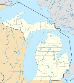
 Cottrellville Township, Michigan
Coordinates: 42°41′33″N 82°32′11″W / 42.6925°N 82.53639°WCoordinates: 42°41′33″N 82°32′11″W / 42.6925°N 82.53639°W Country United States State Michigan County St. Clair Area – Total 22.4 sq mi (58.0 km2) – Land 21.2 sq mi (54.9 km2) – Water 1.2 sq mi (3.1 km2) Elevation 597 ft (182 m) Population (2000) – Total 3,814 – Density 180.0/sq mi (69.5/km2) Time zone Eastern (EST) (UTC-5) – Summer (DST) EDT (UTC-4) FIPS code 26-18400[1] GNIS feature ID 1626136[2] Cottrellville Township is a civil township of St. Clair County in the U.S. state of Michigan. The population was 3,814 at the 2000 census.
Cottrellville was established in 1822.[3]
Geography
According to the United States Census Bureau, the township has a total area of 22.4 square miles (58 km2), of which, 21.2 square miles (55 km2) of it is land and 1.2 square miles (3.1 km2) of it (5.27%) is water.
Demographics
As of the census[1] of 2000, there were 3,814 people, 1,384 households, and 1,055 families residing in the township. The population density was 180.0 per square mile (69.5/km²). There were 1,497 housing units at an average density of 70.6 per square mile (27.3/km²). The racial makeup of the township was 98.69% White, 0.08% African American, 0.10% Native American, 0.16% Asian, 0.08% Pacific Islander, and 0.89% from two or more races. Hispanic or Latino of any race were 0.76% of the population.
There were 1,384 households out of which 35.9% had children under the age of 18 living with them, 63.0% were married couples living together, 8.8% had a female householder with no husband present, and 23.7% were non-families. 19.4% of all households were made up of individuals and 7.4% had someone living alone who was 65 years of age or older. The average household size was 2.75 and the average family size was 3.16.
In the township the population was spread out with 27.5% under the age of 18, 7.5% from 18 to 24, 30.6% from 25 to 44, 23.9% from 45 to 64, and 10.5% who were 65 years of age or older. The median age was 37 years. For every 100 females there were 101.8 males. For every 100 females age 18 and over, there were 99.1 males.
The median income for a household in the township was $47,396, and the median income for a family was $53,750. Males had a median income of $42,418 versus $29,600 for females. The per capita income for the township was $24,510. About 2.5% of families and 2.6% of the population were below the poverty line, including 1.4% of those under age 18 and 6.6% of those age 65 or over.
References
- ^ a b "American FactFinder". United States Census Bureau. http://factfinder.census.gov. Retrieved 2008-01-31.
- ^ U.S. Geological Survey Geographic Names Information System: Cottrellville Township, Michigan
- ^ Walter Roming. Michigan Place Names. (Grosse Point: Walter Roming, n.d.) p. 135
Municipalities and communities of St. Clair County, Michigan Cities Algonac | Marine City | Marysville | Memphis‡ | Port Huron | Richmond‡ | St. Clair | Yale

Villages Charter
townshipsGeneral law
townshipsUnincorporated
communitiesAdair | Allenton | Anchorville | Avoca | Berville | Jeddo | Lakeport | Pearl Beach | Riley Center | Sans Souci | Smiths Creek | Sparlingville
Footnotes ‡This populated place also has portions in an adjacent county or counties
Categories:- Townships in St. Clair County, Michigan
- 1922 establishments in the United States


Wikimedia Foundation. 2010.