- Culbone
-
Coordinates: 51°13′16″N 3°39′32″W / 51.221°N 3.659°W
Culbone 
 Culbone
Culbone shown within SomersetOS grid reference SS842482 Parish Oare District West Somerset Shire county Somerset Region South West Country England Sovereign state United Kingdom Post town MINEHEAD Postcode district TA24 Dialling code 01643 Police Avon and Somerset Fire Devon and Somerset Ambulance South Western EU Parliament South West England UK Parliament Bridgwater and West Somerset List of places: UK • England • Somerset Culbone (also called Kitnor) is a hamlet consisting of little more than the parish church and a few houses, in the parish of Oare in the Exmoor National Park, Somerset, England. As there is no road access it is a two-mile walk from Porlock Weir, and some four miles from Porlock itself.
The village is situated in a sheltered spot, near the coast of Porlock Bay. The cliffs behind the village rise to the height of 1,200 feet (366 m), over which a small stream falls down to the sea.[1]
The South West Coast Path goes through the village, parts of which were closed and diverted in February 2007 following landslips in the woods.[2] The woods around the village are home to the rare Sorbus vexans, a microspecies of self-cloning Sorbus trees which are only found in the coastal area between Culbone and Trentishoe in Devon. It is amongst the rarest trees in Britain.[3] Other Whitebeam and Rowan species found in the area include; Sorbus subcuneata, Sorbus ‘Taxon D’ and Sorbus aucuparia.[4]
Contents
History
Culbone was listed in the Domesday book as Kytenore,[5] or Chetnore.[6] The name "Culbone" is thought to derive from the Celtic cil beun' for "Church of St Beuno"[7].
The Culbone Stone, an early mediæval standing stone approximately one metre in height. It lies in woodland close to the parish boundary, and features an incised wheeled cross, the style of which suggests it dates from 7th to 9th century. The stone is legally protected as a scheduled ancient monument.[8] It has been suggested that the stone has been moved from its original site as part of the Culbone Hill Stone Row.[9]
Culbone woods were once the site of a major charcoal burning industry. The original burners were reputed to be a colony of lepers.[10]
Culbone was a civil parish until 1933 when, because of the small population (43 in 1931) it was merged into the parish of Oare.[11]
Culbone Cottage, Culbone Lodge, and the Parsonage Farmhouse are all Grade II listed buildings.
Church
Main article: Culbone ChurchCulbone Church is said to be the smallest parish church in England.[12] The chancel is 13.5 feet (4.1 m) x 10 feet (3.0 m), the nave 21.5 feet (6.6 m) x 12.33 feet (3.8 m) and the building has a total length of 35 feet (10.7 m).[13] It seats about 30 and is dedicated to St Beuno. Services are still held there, despite the lack of road access. The church is probably pre-Norman in origin, with a 13th-century porch, and late 15th-century nave. It was refenestrated and reroofed around 1810 and the spirelet added in 1888. It underwent further restoration in 1928. It has been designated by English Heritage as a Grade I listed building.[14]
Samuel Taylor Coleridge
The Person from Porlock is believed to have disturbed Samuel Taylor Coleridge during his composition of the oriental poem Kubla Khan. Coleridge was living at Coleridge Cottage, Nether Stowey (between Bridgwater and Minehead). It is likely that this encounter took place while he was staying at Ash Farm in Culbone.[15] It is also possible that Coleridge composed the poem at the Culbone Parsonage near to Ash Farm, now a collection of holiday cottages.[16]
References
- ^ "Culbone, Somerset". GENUKI. http://www.genuki.org.uk/big/eng/SOM/Culbone/index.html. Retrieved 2007-10-24.
- ^ "Culbone Woods access restricted". Exmoor National Park. http://www.exmoor-nationalpark.gov.uk/print/index/news_2007/2007_feb_7.htm. Retrieved 2007-10-24.
- ^ "Britain's eleven rarest trees". UK Tree Council. Archived from the original on 2007-07-31. http://web.archive.org/web/20070731093236/http://www.treecouncil.org.uk/tnews/sorbus.htm. Retrieved 2007-10-24.
- ^ Chester, Michael; Robyn S. Cowan, Michael F. Fay, Tim C. G. Rich (July 2007). "Parentage of endemic Sorbus L. (Rosaceae) species in the British Isles: evidence from plastid DNA". Botanical Journal of the Linnean Society 154 (3): 291–304. doi:10.1111/j.1095-8339.2007.00669.x. http://www.blackwell-synergy.com/doi/full/10.1111/j.1095-8339.2007.00669.x. Retrieved 2007-10-24.
- ^ Savage, James (1830). History of the Hundred of Carhampton. Longman, Rees, Orme, Brown, & Green.
- ^ Robinson, Stephen (1992). Somerset Place Names. Wimborne, Dorset: Dovecote Press. ISBN 1874336032.
- ^ St Beuno's Church, Culbone, leaflet on the history of the church, no author, no publisher, no date, page 4; leaflet acquired on site, 4 February 2011
- ^ "Culbone Stone". Megalithic Portal. http://www.megalithic.co.uk/article.php?sid=4129. Retrieved 2007-10-24.
- ^ "Culbone Stone". The Modern Antiquarian. http://www.themodernantiquarian.com/site/6805/culbone_stone.html. Retrieved 2007-10-24.
- ^ "Culbone". Everything Exmoor. http://www.everythingexmoor.org.uk/_C/Culbone.php. Retrieved 2007-10-24.
- ^ "Culbone". Vision of Britain. http://www.visionofbritain.org.uk/relationships.jsp;jsessionid=F56525645B6EE4E9C1C0EF22DFA356FD?u_id=10428014. Retrieved 2007-10-24.
- ^ "Parish Churches". Somerset County archives. http://www.somerset.gov.uk/archives/ASH/Parishchs.htm. Retrieved 2007-10-24.
- ^ "Culbone". Minehead Online. http://www.minehead-online.co.uk/culbone.htm. Retrieved 2007-10-24.
- ^ "Culbone church". Images of England. http://www.imagesofengland.org.uk/details/default.aspx?id=265441. Retrieved 2007-10-24.
- ^ Lively, Penelope (1994-09-18). "Exmoors rural ways and byways". New York Times. http://query.nytimes.com/gst/fullpage.html?res=9507E4D8113FF93BA2575AC0A962958260&sec=&spon=&pagewanted=print. Retrieved 2007-10-24.
- ^ "Samuel Taylor Coleridge (1772-1834)". Representative Poetry Online. http://rpo.library.utoronto.ca/poem/524.html. Retrieved 3 January 2010.
External links
- Details from listed building database (265443) - Culbone Cottage and retaining wall. Images of England. English Heritage.
- Details from listed building database (265444) - Culbone Lodge and adjoining bridge over sunken road. Images of England. English Heritage.
- Details from listed building database (265445) - Parsonage farmhouse. Images of England. English Heritage.
Towns, villages and hamlets in the West Somerset district of Somerset, England 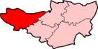 Allerford · Ashbeer · Bicknoller · Brandish Street · Brompton Ralph · Brompton Regis · Brushford · Carhampton · Clatworthy · Cockercombe · Crowcombe · Culbone · Cutcombe · Dulverton · Dunster · East Quantoxhead · Elworthy · Exford · Exton · Holford · Huish Champflower · Kilve · Lilstock · Luccombe · Luxborough · Minehead · Monksilver · Oare · Old Cleeve · Porlock · Roadwater · Sampford Brett · Selworthy · Simonsbath · Skilgate · Stogumber · Stogursey · Stringston · Timberscombe · Treborough · Upton · Washford · Watchet · West Quantoxhead · Williton · Winsford · Withycombe · Withypool · Wootton CourtenayCategories:
- Villages in West Somerset
- Exmoor
- Populated coastal places in Somerset


Wikimedia Foundation. 2010.