- Dayton Township, Tuscola County, Michigan
-
There is also Dayton Township, Newaygo County, Michigan.
Dayton Township, Michigan — Township — Location within the state of Michigan
 Dayton Township, Michigan
Coordinates: 43°22′29″N 83°16′27″W / 43.37472°N 83.27417°WCoordinates: 43°22′29″N 83°16′27″W / 43.37472°N 83.27417°W Country United States State Michigan County Tuscola Area – Total 36.1 sq mi (93.6 km2) – Land 35.8 sq mi (92.8 km2) – Water 0.3 sq mi (0.9 km2) Elevation 860 ft (262 m) Population (2000) – Total 1,869 – Density 52.2/sq mi (20.2/km2) Time zone Eastern (EST) (UTC-5) – Summer (DST) EDT (UTC-4) FIPS code 26-19980[1] GNIS feature ID 1626163[2] Dayton Township is a civil township of Tuscola County in the U.S. state of Michigan. The population was 1,869 at the 2000 census.
Contents
Communities
There are no incorporated municipalities in the township.
- East Dayton is an unincorporated community located on the boundary between Dayton Township and the adjacent Wells Township at Hurds Corner and M-46 (Sanilac Road) 43°24′39″N 83°17′07″W / 43.41083°N 83.28528°W.[3][4]
- Silverwood is an unincorporated community in the northeast corner of the township at 43°19′24″N 83°14′53″W / 43.32333°N 83.24806°W[5] on the boundary with Rich Township in Lapeer County to the north at Marlette, Clifford and Silverwood Roads. When the railroad (later part of the Pere Marquette Railway) was built through here in 1882, the residents applied for a post office. One suggested naming it something easy to remember, and the post office named "Easy" opened on April 13, 1882, with James R. Chapin as the first postmaster. The name changed to "Rollo" on March 27, 1890, and changed again on May 2, 1892 to "Silverwood", after the nearby stands of white pine.[6][7] A subdivision plat for the Village of Silverwood was filed on July 19, 1899.[8] The Silverwood post office, with ZIP code 48760, also serves the northeast portion of Rich Township, as well as the southeast portion of Dayton Township, and small areas in Koylton Township in Tuscola County, and Burlington Township in Lapeer County.[9]
Geography
The southern portion of the township is drained by tributaries of the Flint River while the northern part is drained by tributaries of the Cass River.
According to the United States Census Bureau, the township has a total area of 36.2 square miles (94 km2), of which 35.8 square miles (93 km2) is land and 0.3 square miles (0.78 km2) (0.94%) is water.
Demographics
As of the census[1] of 2000, there were 1,869 people, 679 households, and 530 families residing in the township. The population density was 52.2 per square mile (20.2/km²). There were 1,006 housing units at an average density of 28.1 per square mile (10.8/km²). The racial makeup of the township was 94.86% White, 2.41% African American, 0.16% Native American, 0.21% Asian, 0.05% Pacific Islander, 0.21% from other races, and 2.09% from two or more races. Hispanic or Latino of any race were 1.71% of the population.
There were 679 households out of which 33.6% had children under the age of 18 living with them, 67.0% were married couples living together, 6.8% had a female householder with no husband present, and 21.8% were non-families. 18.6% of all households were made up of individuals and 7.5% had someone living alone who was 65 years of age or older. The average household size was 2.73 and the average family size was 3.04.
In the township the population was spread out with 27.1% under the age of 18, 7.4% from 18 to 24, 25.9% from 25 to 44, 26.5% from 45 to 64, and 13.1% who were 65 years of age or older. The median age was 38 years. For every 100 females there were 103.6 males. For every 100 females age 18 and over, there were 102.4 males.
The median income for a household in the township was $42,000, and the median income for a family was $46,696. Males had a median income of $39,519 versus $21,950 for females. The per capita income for the township was $18,890. About 6.9% of families and 10.5% of the population were below the poverty line, including 10.5% of those under age 18 and 11.0% of those age 65 or over.
References
- ^ a b "American FactFinder". United States Census Bureau. http://factfinder.census.gov. Retrieved 2008-01-31.
- ^ U.S. Geological Survey Geographic Names Information System: Dayton Township, Tuscola County, Michigan
- ^ J. Shively (September 2007). "Tuscola County Map" (PDF). Couny Map Series. State of Michigan Department of Information Technology Technology Michigan Center for Geographic Information. http://www.michigan.gov/documents/CGI_COUNTY-v4_TUSCOLA_COUNTY_125309_7.pdf. Retrieved 2009-07-07.
- ^ U.S. Geological Survey Geographic Names Information System: East Dayton, Michigan
- ^ U.S. Geological Survey Geographic Names Information System: Silverwood, Michigan
- ^ Romig, Walter (1986) [1973]. Michigan Place Names. Detroit, Michigan: Wayne State University Press. ISBN 0-8143-1838-X.
- ^ U.S. Geological Survey Geographic Names Information System: Silverwood Post Office
- ^ "Silverwood, Village of". Statewide Results for Subdivision Plats. State of Michigan Bureau of Construction Code. 1899-07-19. http://www.dleg.state.mi.us/platmaps/dt_image.asp?BCC_SUBINDEX=13761. Retrieved 7 July 2009.
- ^ 48760 5-Digit ZCTA, 487 3-Digit ZCTA - Reference Map - American FactFinder, U.S. Census Bureau, 2000 census
Municipalities and communities of Tuscola County, Michigan Cities 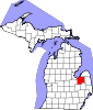
Villages Akron | Cass City | Fairgrove | Gagetown | Kingston | Mayville | Millington | Reese‡ | Unionville
Charter
townshipGeneral law
townshipsUnincorporated
communitiesBay Park | Bradleyville | Colling | Colwood | Dayton | Deford | Denmark Junction | East Dayton | Ellington | Elmwood | Fostoria | Gilford | Juniata | Karrs Corner | Oakhurst | Quanicassee | Richville | Silverwood | Thomas | Tuscola | Wahjamega | Watrousville | Wisner | Wilmot
Footnotes ‡This populated place also has portions in an adjacent county or counties
Categories:- Townships in Tuscola County, Michigan


Wikimedia Foundation. 2010.