- Duff Islands
-
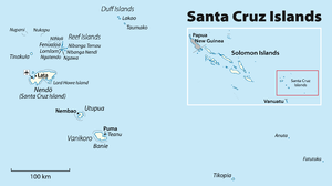
The Duff Islands (Pileni Taumako) are a small island group lying to the northeast of the Santa Cruz Islands in the Solomon Islands province of Temotu. They are also sometimes known as the Wilson Islands.

 The Duff Islands seen from space. Courtesy NASA.
 Map of 1797
The islands are located at 9°51'48" S. lat., 167°4'48" E. long.
The Duff Islands consist of:
- Taumako, the main island, with nearby Tahua and Tohua
- The Bass Islands: Lua, Kaa and Loreva
- Treasurer's Islands: Tuleki (Anula), Elingi (Obelisk Island), Te Aku (Te Ako), Lakao and Ulaka
Frequently, Hallie Jackson Reef is mentioned in the context of the Duff islands, although it is located 45 km west of the 32 km long island chain, and although it is no island, but at most a submarine reef. In the Sailing Directions of 1969 Hallie Jackson Reef is described as a reef 24 feet deep, at 9°44'S, 166°07'E.[1]. The corresponding current (2010) publication has no mention of the reef anymore.[2].
The inhabitants of the Duff Islands are Polynesians, and their language, Pileni, is a member of the Samoic branch of Polynesian languages. On the islands of Duff live about 500 people. The way of life is traditional by subsistence farming and fishing. Taumako has no roads, airport, telephones, or electricity. Contact with outsiders comes by battery-powered marine radio and the occasional cargo ship.
The Duff Islands were named after missionary ship Duff, captained by James Wilson, which reached them in 1797.
Contents
Studies of David Lewis and Marianne (Mimi) George uncovered that full traditional Polynesian navigational technique is still preserved in these islands (Finney and Lowe, 2006, p163).
See also
References
- Duff Islands, Solomon Islands, solomonislands.com.sb
- Ben Finney and Sam Low, "Navigation", in K.R.Howe(eds), "Vaka Moana:Voyages of the Ancestors", Bateman, 2007. ISBN 978-0824832131
references
External links
Coordinates: 9°48′00″S 167°06′00″E / 9.800°S 167.10°E
Central Choiseul Guadalcanal Isabel Makira-Ulawa Malaita Adagege · Alite · Anuta Paina · Funaafou · Langa Langa Lagoon · Lau Lagoon · Laulasi · Maana'omba · Malaita · Maramasike · Mbasakana · Ndai · Ontong Java · Roncador Reef · Sikaiana · SulufouRennell and Bellona Temotu Western Arundel · Faisi · Fauro · Ghizo · Ghoi · Kavachi · Kennedy · Kiambe · Kingguru · Kohinggo · Kolombangara · Liapari · Logha · Lola · Lumbari · Marovo · Matikuri · Mbava · Mborokua · Mbulo · Mondomondo · Mono · Nakaza · New Georgia · New Georgia Islands · Nggatokae · Nusatupe · Ranongga · Rendova · Shortland · Shortland Islands · Simbo · Stirling · Telina · Tetepare · Treasury Islands · Vella Lavella · Uepi · Vangunu · VonavonaCategories:- Islands of the Solomon Islands
- Polynesian outliers
- Archipelagoes of the Pacific Ocean
- Solomon Islands geography stubs


Wikimedia Foundation. 2010.