- Ball's Bluff Battlefield and National Cemetery
Infobox_nrhp | name =Ball's Bluff Battlefield and National Cemetery
nrhp_type =nhl
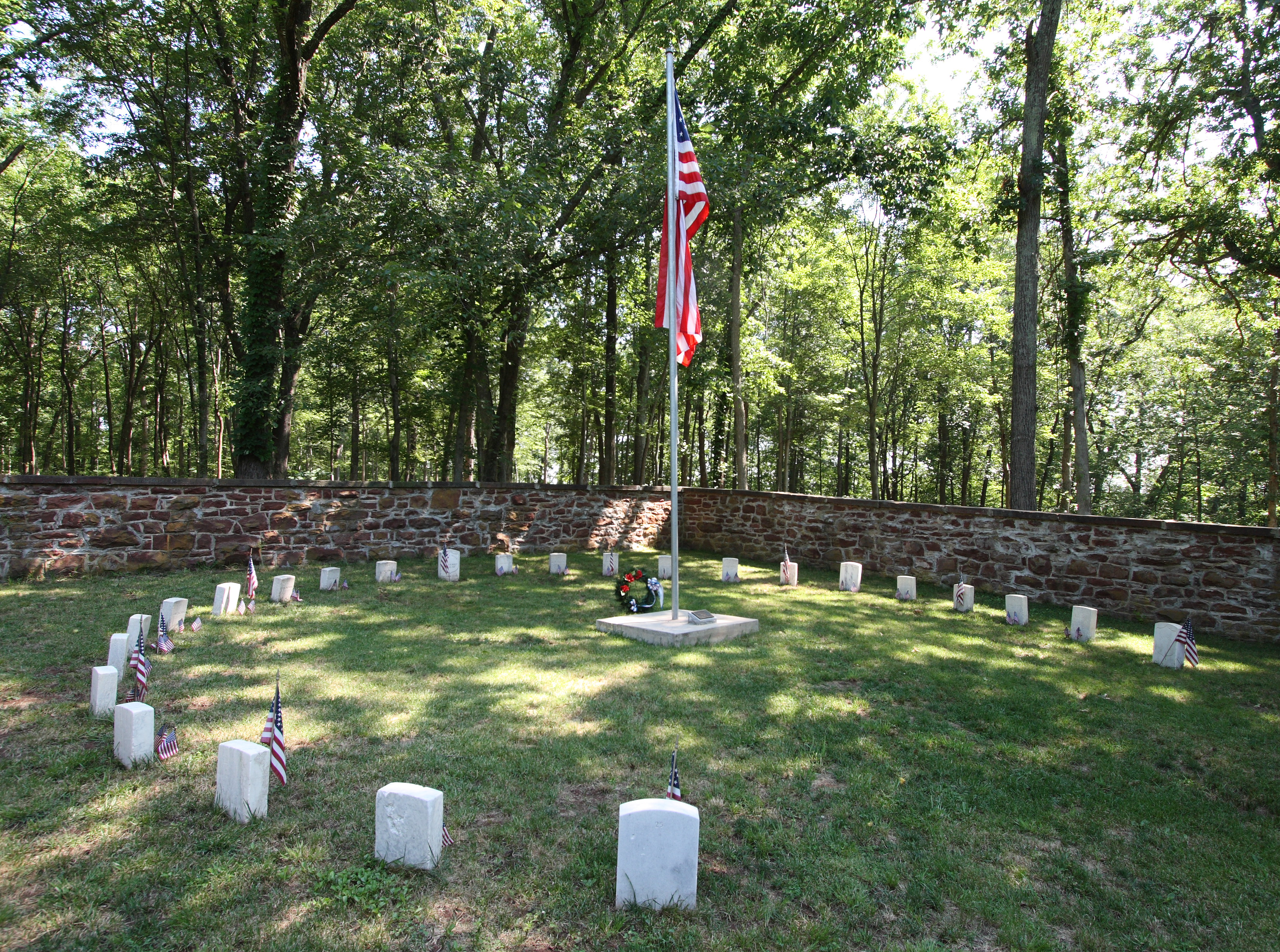
caption = The circle of 25 graves at Ball's Bluff
nearest_city=Leesburg, Virginia
locmapin = Virginia
area =
built =
architect=
architecture=
designated=April 27 ,1984 cite web|url=http://tps.cr.nps.gov/nhl/detail.cfm?ResourceId=1887&ResourceType=District
title=Ball's Bluff Battlefield and National Cemetery |accessdate=2007-10-26|work=National Historic Landmark summary listing|publisher=National Park Service]
added =April 27 ,1984 cite web|url=http://www.nr.nps.gov/|title=National Register Information System|date=2007-01-23|work=National Register of Historic Places|publisher=National Park Service]
governing_body = VETERANS ADMINISTRATION
refnum=84003880Ball's Bluff Battlefield and National Cemetery is a battlefield area and a national cemetery, located in
Ball's Bluff Battlefield Regional Park , two miles (3 km) northeast ofLeesburg, Virginia . The cemetery is the smallest national cemetery in theUnited States . 54 Union dead from theBattle of Ball's Bluff are interned in 25 graves in the half-acre cemetery. The identity of all of the interred except for one, James Allen of the 15 Mass. Infantry, are unknown. Monuments to Clinton Hatcher, CSA and GeneralEdward Baker USA are located in the cemetery. The cemetery is managed through theCulpeper National Cemetery .Battle
The
Battle of Ball's Bluff , on October 21, 1861, was a small but embarrassing defeat for the Union early in theAmerican Civil War , three months after the Union disaster at theFirst Battle of Bull Run . It reflected upon the political nature of Union appointments of officers, and their incompetence, and led to further compounding of politics in conduct of the war for its duration.In the incident, a sitting U.S. Senator, Colonel
Edward D. Baker , who was just pondering an offer of major generalship, directed Union troops to make a landing on the West side of the Potomac River, while the Confederates waited inland and built up a force. The Union troops positioned themselves poorly. Eventually the Confederates attacked, killed Baker, and pushed the Union troops off the cliffs and into the river, capturing 553. Only a transport that capsized and 3 small boats that could carry 10 men each were available, and had ferried Union troops into the trap over the course of many hours, so rapid evacuation was impossible. Some swam across to Harrison Island, but 161 were missing, many drowned, and bodies of Union troops who had drowned floated downstream towards Washington, D.C.citation|title=PDFlink| [http://pdfhost.focus.nps.gov/docs/NHLS/Text/84003880.pdf National Register of Historic Places Inventory-Nomination: Ball's Bluff Battlefield and National Cemetery] |1.35 MB|date=February 8, 1984 |author=Edwin C. Bearss |publisher=National Park Service and PDFlink| [http://pdfhost.focus.nps.gov/docs/NHLS/Photos/84003880.pdf Accompanying 1 aerial photograph, undated.] |110 KB]Aftermath
The significance of the battle is largely in its political consequences. A Joint Committee on the Conduct of the War was formed, with investigative powers, was formed to examine the causes of the debacle. Such congressional investigations, more common since, had only very weak precedents at the time. The committee's operations were an aggravation, at least, for the duration of the war, and ruined the career of General Stone. General McClellan, who was responsible at a larger level and had issued vague orders early on, escaped blame.
Cemetery, Landmark, Park
The land for a cemetery was donated in 1865.
The battlefield area was declared a
National Historic Landmark in 1984. At that time the convert|300|ft|m|sing=on tall bluff, the landing on the Potomac River, and almost all aspects of the site were substantially the same as the time of the battle 123 years before. An "intrusion" is the wall-enclosed Ball's Bluff National Cemetery, holding 54 graves of Union dead (53 unknown, and James Allen of the 15th Massachusetts Infantry). Another intrusion is a fenced convert|1.3|mi|km|sing=on approach road built in 1907. A grave marker for Confederate soldier Clinton Hatcher, of the 8th Virginia Regiment, and a marker of the site of Baker's mortal wounding, are nearby.Ball's Bluff National Cemetery is the only national cemetery in which the
Flag of the United States is not regularly flown due to repeated acts of vandalism against the flag at the site throughout its history.Fact|date=February 2008The park is maintained by the Northern Virginia Regional Park Authority. [ [http://www.nvrpa.org/parks/ballsbluff/index.php Northern Virginia Regional Park Authority] website]
References
External links
* [http://www.nvrpa.org/parks/ballsbluff/index.php Ball's Bluff Battlefield Regional Park state park site]
* [http://www.cem.va.gov/CEM/cems/nchp/ballsbluff.asp Ball's Bluff National Cemetery]
Wikimedia Foundation. 2010.