- Clutha District
-
The Clutha District is an administrative district of southern New Zealand, with its headquarters in the Otago town of Balclutha. The Clutha District has a land area of 6,362.86 km² (2,456.71 sq mi) and a 2006 census population of 16,839 usual residents. Clutha District occupies the majority of the geographical area known as South Otago.
Contents
Geography
 Lake Waihola
The geography of the Clutha District is dominated by the valley of the Clutha River, which flows southeast from the lakes of Central Otago, bisecting the Clutha District and reaching the Pacific Ocean via two river mouths, one of which is not far from Kaitangata, the other is closer to Kaka Point. The two branches of the river (the Matau and the Kouau) form the island of Inch Clutha. To the south of this is the rough bush country of the Catlins, with its forests and rugged coastline. To the north of the Clutha valley is mainly rolling hill country, with the plain of the Tokomairiro River to the northeast, along with Lake Waihola and Lake Waipori, which are part of the catchment of the Taieri River. The Waipori River, the Taieri's largest tributary, forms the northeastern border of Clutha District.
Administration
 Balclutha
Clutha District is under the local body administration of the Clutha District Council, based in Balclutha. It is administered at a regional level by the Otago Regional Council, based in Dunedin.
Clutha District was formerly composed of three separate counties (Clutha, Bruce, and Tuapeka), and two boroughs (Balclutha and Milton). These were amalgamated into one district authority in 1989 as part of a nationwide reorganisation of local government.
Bruce, an area surrounding Milton, and including the Tokomairiro Plains, had an area of 1,357 km². It included the townships of Waihola, Milburn and Waitahuna. Clutha, which included the delta of the Clutha River and extended down the Catlins coast, had an area of 2,664.5 km². It included the townships of Kaitangata, Stirling, Owaka, and Benhar. The remaining area, Tuapeka, was centred on Lawrence, and included the inland valleys of the Clutha River and its tributaries the Pomahaka River and Tuapeka River. It had an area of 2,323 km².
The current mayor is Bryan Cadogan, who defeated incumbent mayor Juno Hayes in the 2010 local body elections. Mr Cadogan's deputy is Hamish Anderson, who was also deputy under Juno Hayes in the last 2007-2010 term.
People
 Tokomairiro Presbyterian Church, Milton
For statistical purposes, the former divisions of Bruce, Clutha, and Tuapeka County are still used by Statistics New Zealand, along with the former boundaries of Balclutha and Milton Boroughs. The 2006 census populations of the three former county areas were respectively 2,658; 3,255; and 1,761.
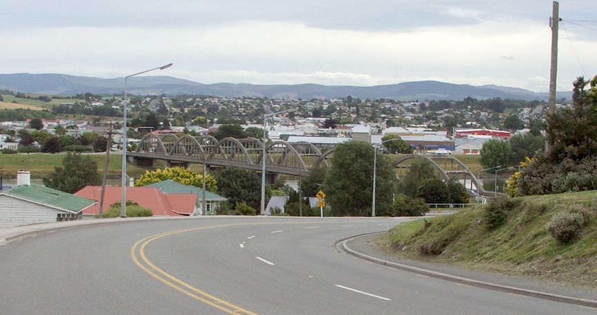
The most populous town in Clutha District is Balclutha, which lies 81km south of Dunedin by road. Balclutha's population, by the 2006 census, was 4,062 (down from 4,137 in 1996). Other towns are Milton (pop. 1,887), Kaitangata (pop. 810), Tapanui (pop. 744), Lawrence (pop. 432), Owaka (pop. 327), Stirling (pop. 309), Clinton (pop. 291), Kaka Point (pop. 201), and Benhar (pop. 96). For a while in the 1980s Balclutha was New Zealand's most wealthy town, per capita.
External links
Categories:


Wikimedia Foundation. 2010.