Fatra-Tatra Area

Fatra-Tatra Area

Geobox | Mountain Range
name = Fatra-Tatra
native_name =
other_name =
category = Mountain Area


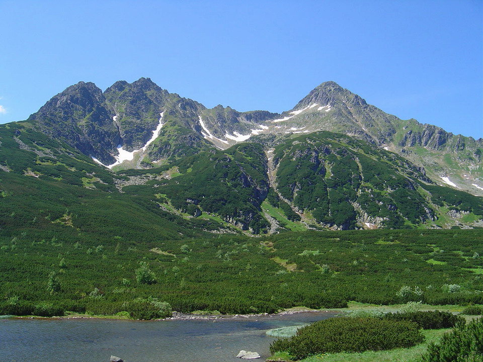
image_caption = Jahňačí štít over Veľké Biele Pleso
etymology =
nickname =
country = Slovakia
country_

country1 = Austria
country2 = Poland
state =
region =
district =
commune =
municipality =
parent = Inner Western Carpathians
border =
part_fold = 1
part =
Branisko
part1 = Choč Mountains
part2 = Greater Fatra
part3 = Horehronské podolie
part4 = Hornád Basin
part5 = Kozie chrbty
part6 = Lesser Fatra
part7 = Little Carpathians
part8 = Low Tatras
part9 = Považský Inovec
part10 = Staré Hory Mountains
part11 = Strážov Mountains
part12 = Sub-Tatra Basin
part13 = Súľov Mountains
part14 = Tatras
part15 = Tríbeč
part16 = Turiec Basin
part17 = Upper Nitra Basin
part18 = Žilina Basin
part19 = Žiar
city =
landmark =
river =
highest = Gerlachovský štít
highest_elevation = 2655
highest_lat_d = 49
highest_lat_m = 10
highest_lat_NS = N
highest_long_d = 20
highest_long_m = 8
highest_long_EW = E
free =


country1 = Austria
country2 = Poland
state =
region =
district =
commune =
municipality =
parent = Inner Western Carpathians
border =
part_fold = 1
part = Branisko
part1 = Choč Mountains
part2 = Greater Fatra
part3 = Horehronské podolie
part4 = Hornád Basin
part5 = Kozie chrbty
part6 = Lesser Fatra
part7 = Little Carpathians
part8 = Low Tatras
part9 = Považský Inovec
part10 = Staré Hory Mountains
part11 = Strážov Mountains
part12 = Sub-Tatra Basin
part13 = Súľov Mountains
part14 = Tatras
part15 = Tríbeč
part16 = Turiec Basin
part17 = Upper Nitra Basin
part18 = Žilina Basin
part19 = Žiar
city =
landmark =
river =
highest = Gerlachovský štít
highest_elevation = 2655
highest_lat_d = 49
highest_lat_m = 10
highest_lat_NS = N
highest_long_d = 20
highest_long_m = 8
highest_long_EW = E
free =


map_background = Slovakia - background map.png map_caption = Location of the Fatra-Tatra Area in Slovakia
map_locator =
commons =
statistics =
website =
footnotes =
The Fatra-Tatra Area is a part of the Inner Western Carpathians, a subprovince of the Carpathians. Most of the area lies in Slovakia with small parts reaching into Austria and Poland. The highest summit of the whole Carpathians, the Gerlachovský štít at Unit height|m|2655, lies in the High Tatras range which belongs to this area.

Wikimedia Foundation. 2010.

Игры ⚽ Нужно сделать НИР?

Look at other dictionaries:

  • Greater Fatra — Geobox | Mountain Range name = Greater Fatra native name = Veľká Fatra other name = category = image caption = Typical terrain of the Hôľna Fatra etymology = nickname = country = Slovakia country state = region = Žilina region1 = Banská Bystrica… …   Wikipedia

  • Lesser Fatra — (Malá Fatra) Mountain Range The main ridge of the Kriváň Lesser Fatra …   Wikipedia

  • Malá Fatra National Park — Národný park Malá Fatra IUCN Category II (National Park) Veľký Rozsutec (1,610 m) …   Wikipedia

  • Dunajské luhy Protected Landscape Area — CHKO Dunajské luhy IUCN Category V (Protected Landscape/Seascape) Floodplains and forests near Bratislava s b …   Wikipedia

  • Biele Karpaty Protected Landscape Area — White Carpathians Protected Landscape Area CHKO Biele Karpaty IUCN Category V (Protected Landscape/Seascape) Červenokamenské bradlo cliff near the village of …   Wikipedia

  • Cerová vrchovina Protected Landscape Area — CHKO Cerová vrchovina IUCN Category V (Protected Landscape/Seascape) …   Wikipedia

  • Carpathian Mountains — For other uses, see Carpathian (disambiguation). Carpathians Range Inner Western Carpathians, High Tatras, Poland …   Wikipedia

  • Divisions of the Carpathians — Map of the main divisions of the Carpathians. 1. Outer Western Carpathians 2. Inner Western Carpathians 3. Outer Eastern Carpathians 4. Inner Eastern Carpathians 5. Southern Carpathians 6. Western Romanian Carpathians 7. Transylvanian Plateau 8.… …   Wikipedia

  • Geomorphological division of Slovakia — This page gives an overview of the geomorphological division of Slovakia. It is ordered in a hierarchical form, belonging to the Alps Himalaya System and to the sub systems of the Carpathian Mountains and of the Pannonian Basin. These subsystems… …   Wikipedia

  • Geography of Slovakia — Slovakia is a landlocked Central European country with mountainous regions in the north and flat terrain in the south.AreaSlovakia lies between 49°36 48 and 47°44 21 northern latitude and 16°50 56 and 22°33 53 eastern longitude. The northernmost… …   Wikipedia

Share the article and excerpts

Direct link
Do a right-click on the link above
and select “Copy Link”