- Minerva Reefs
-
Coordinates: 23°46′S 179°1′W / 23.767°S 179.017°W
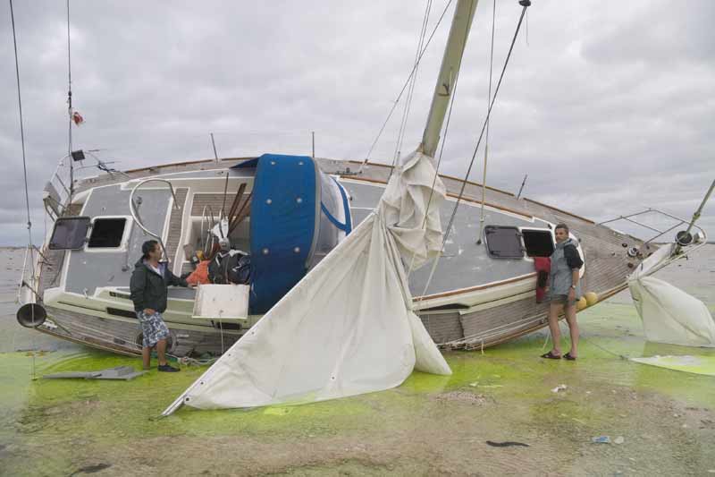
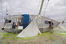 Sailboat wreck on North Minerva reef
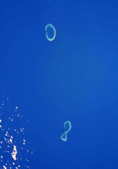
 A NASA Satellite Photo of the Minerva Reefs
The Minerva Reefs (Tongan: Ongo Teleki) are a group of two submerged atolls located in the Pacific Ocean south of Fiji and Tonga. The reefs were named after the whaleship Minerva, was wrecked on what became known as South Minerva after setting out from Sydney in 1829. Many other ships would follow, for example the Strathcona, which was sailing north soon after completion in Auckland in 1914. In both cases most of the crew saved themselves in whaleboats or rafts and reached the Lau Islands in Fiji. Of some other ships, however, no survivors are known.
The Tuaikaepau ('Slow But Sure'), a Tongan vessel on its way to New Zealand, became famous when it struck the reefs on 7 July 1962. (This 15 m wooden vessel was built in 1902 at the same yard as the Strathcona). The crew and passengers survived by living in the remains of a Japanese freighter. There they remained for 3 months in miserable circumstances and several of them died. Finally Captain Tēvita Fifita decided to get help. Without tools, he built a small boat from the wood left over from his ship. With this raft, named Malolelei ('Good Day'), he and a few of the stronger crew members sailed to Fiji in one week.
The reefs gained further notoriety in January 1972 in the Republic of Minerva 'incident'. Subsequently, on 24 February, Tonga laid claim to the Minerva Reefs and annexed them on 15 June the same year. The move was recognised by the South Pacific Forum in September.
Recently[when?] Fiji has made it clear that they do not recognize any maritime water claims by Tonga to the Minerva Reefs under the UNCLOS agreements. In November 2005, Fiji lodged a complaint with the International Seabed Authority concerning territorial claim over Minerva. Tonga lodged a counter claim, and the Minerva "principality" group claimed to have lodged a counter claim, see Republic of Minerva. In 2010 the Fijian Navy destroyed navigation lights at the entrance to the lagoon. In late May 2011, they again destroyed navigational equipment installed by Tongans. In early June 2011, two Royal Tongan Navy ships were sent to the Reef to replace the equipment, and to reassert Tonga's claim to the territory. Fijian Navy ships in the vicinity reportedly withdrew as the Tongans approached, leading New Zealand's One News to comment that a military conflict between the two countries had narrowly been averted.[1] [2]
Both North and South Minerva Reefs are used as anchorages by yachts traveling between New Zealand and Tonga or Fiji. While waiting for favourable weather for the approximately 800-mile passage to New Zealand, excellent scuba diving, snorkelling, fishing and clamming can be enjoyed. North Minerva (Tongan: Teleki Tokelau) offers the more protected anchorage, with a single, easily negotiated, west-facing pass that offers access to the large, calm lagoon with extensive sandy areas. South Minerva (Tongan: Teleki Tonga) is in shape similar to an infinity symbol, with its eastern lobe partially open to the ocean on the northern side. Due to the lower reef and large entrance, the anchorage at South Minerva can be rough at high tide if a swell is running. The lagoon also contains numerous coral heads that must be avoided. While presenting an attractive area to wait out harsh weather occurring farther south, the Minerva reefs are not a good place to be when the weather is bad locally. This does not occur often, but it is important to maintain awareness of the situation and put to sea if necessary.
Scuba diving the outside wall drop-offs at the Minerva Reefs is spectacular due to the superb water clarity and extensive coral, fish and other marine life. There are few suspended particles and the visibility is normally in excess of 100 feet due to there being no dry land at high tide. Of particular note are the numerous fan coral formations near the pass at North Minerva and the “shark bowl” area located by the narrow dinghy pass on the western lobe of South Minerva. The inside of the lagoon at South Minerva is also home to numerous giant clams. Divers at Minerva must be entirely self-sufficient, with their own compressor, and should also be aware that the nearest assistance is a multiple-day boat ride away in Tonga. Due to the vertical drop off and water clarity, divers must watch their depth carefully.
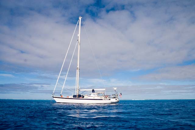
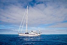 Yacht anchored at South Minerva. The surf that indicates the reef can just be seen in the background
References
- ^ "Fiji and Tonga govts continue talks on reef dispute". Radio New Zealand International. 8 February 2011. http://www.rnzi.com/pages/news.php?op=read&id=58661. Retrieved 25 October 2011.
- ^ "Showdown between Tonga and Fiji looms". One News. 11 June 2011. http://tvnz.co.nz/world-news/showdown-between-tonga-and-fiji-looms-4221560. Retrieved 25 October 2011.
- O. Ruhen; Minerva Reef; 1963
External links
Categories:- Coral reefs
- Reefs of the Pacific Ocean
- Landforms of Tonga
- Visitor attractions in Tonga
- Territorial disputes of Tonga
- Territorial disputes of Fiji
Wikimedia Foundation. 2010.