- Chattooga River
-
This article is about the river forming the boundary between Georgia and South Carolina; for the river with the same name in western Georgia and eastern Alabama, see Chattooga River (Alabama-Georgia).
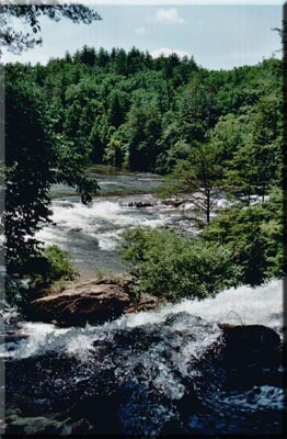
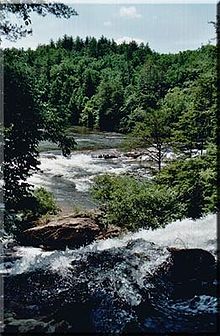 Chattooga River near Dick's Creek Falls
The Chattooga River (also spelled Chatooga, Chatuga, and Chautaga, variant name Guinekelokee River) is the main tributary of the Tugaloo River. Its headwaters are located southwest of Cashiers, North Carolina, and it stretches 57 miles (92 km)[1] to where it has its confluence with the Tallulah River within Lake Tugalo, held back by the Tugalo Dam. The Chattooga and the Tallulah combine to make the Tugaloo River starting at the outlet of Lake Tugalo. The Chattooga begins in southern Jackson County, North Carolina, then flows southwestward between northwestern Oconee County, South Carolina, and eastern Rabun County, Georgia. The "Chattooga" spelling was approved by the US Board on Geographic Names in 1897.[2]
The river was used as a setting for the fictional Cahulawassee River in the book and film Deliverance.
The Chattooga River flows into Tugalo Lake where it joins the Tallulah River. After flowing through Tugalo Dam the combined rivers become the Tugaloo River which, along with the Seneca River, becomes the Savannah River below Lake Hartwell. Downstream from that point, the water flows into the Atlantic Ocean near Savannah, Georgia.
Contents
Geology
The Chattooga River serves as part of the boundary between Georgia and South Carolina after leaving North Carolina near latitude 35°N. The Chattooga River was not the original boundary line between South Carolina and Georgia. A treaty of 1816 extended the South Carolina boundary to its current location. Prior to 1816, the Chattooga was on the lands of the Cherokee Indian Nation.
The Blue Ridge Mountains, where the Chattooga starts, are considered to be ancient, even by geological standards. The rock is mostly sandstone and shale which were laid down approximately 600 to 750 million years ago. Geologists believe that the Chattooga may have made one direction change during its life. Originally, it probably flowed southwesterly into the Chattahoochee riverbed and on to the Gulf of Mexico, but at some point, the Savannah River eroded its northern headland until it intersected the Chattooga and diverted it to the Atlantic.
The rocks in the riverbed probably fell from the ridge above, but those rocks do not necessarily remain where they fall. In times of great downpours, high water, and fast currents, rocks can become dislodged and move downstream, taking other rocks and debris with them. During Hurricane Ivan in 2004, the wind force and waters knocked down big boulders off the sides. The hurricane released enough water in the Chattooga watershed to bring the river to its highest recorded flow rate, around 26,000 cu ft/s (740 m3/s) to 28,000 cu ft/s (790 m3/s), rivaling the typical flow of the Grand Canyon.
Wild and Scenic River
Since May 10, 1974, the Chattooga River has been protected along a 15,432-acre (6,245 ha) corridor as a national Wild and Scenic River. 39.8 miles (64.1 km) of the river have been designated “wild”, about 2.5 miles (4.0 km) “scenic”, and 14.6 miles (23.5 km) “recreational” for a total of about 57 miles (92 km). On the commercially rafted sections (III and IV) there is a 1/4 to 1/2 mile buffer zone of National Forest on both sides of the river, allowing no roads or development of any kind within that distance. The Chattooga also bisects the Ellicott Rock Wilderness which straddles three states (Georgia, North Carolina and South Carolina) and three National Forests (the Chattahoochee, Nantahala and Sumter National Forests). Much of the Georgia portion of the river is within the Chattooga River Ranger District of the Chattahoochee National Forest. One of the many factors that contribute to this virtually unchanged river is its inaccessibility. In the 50-60 miles that is the Chattooga, only four bridges exist to cross, the most heavily-used being the Highway 76 bridge, which had to be reconstructed after the flood-stage water level brought on by Hurricane Ivan in 2004.
Tributaries
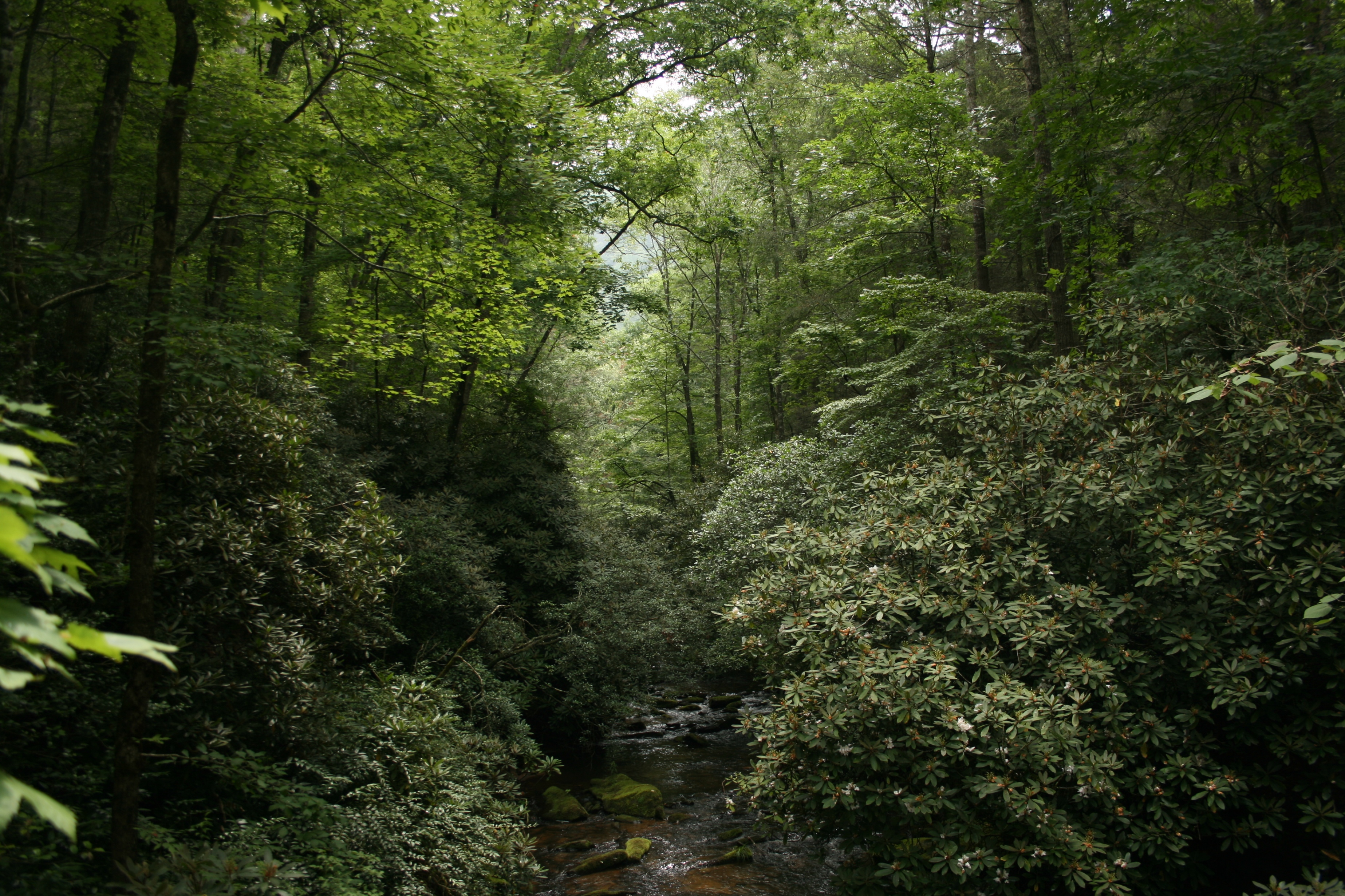
 East Fork of the Chatooga River
The river is split into three forks. The Chattooga River is the main fork, running along the state line. The East Fork Chattooga River (sometimes East Prong Chattooga River) runs in from Jackson County, North Carolina and then Oconee County, South Carolina, and is 7.4 miles (11.9 km) long.[1] The West Fork Chattooga River (variant name Gumekoloke Creek) runs 6.0 miles (9.7 km)[1] in from Rabun County, Georgia, and is also a variant name for that county's Holcomb Creek, one of its own tributaries.
One of the largest tributaries in the Chattooga basin that flows mainly through private lands is Stekoa Creek, which flows primarily southeast for approximately 18 miles (29 km)[1] from its headwaters in Mountain City, Georgia, through Clayton, Georgia, to its mouth at the Chattooga River. The Stekoa Creek Basin is approximately 45 square miles (120 km2) in size.
Rafting and boating
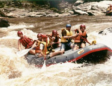
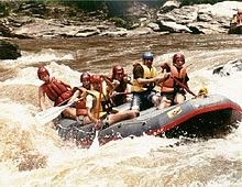 Whitewater rafting on the Chattooga River
In the late spring, the river is lined with blooming pink and white mountain laurel. Early spring is also a great time to go rafting, kayaking, or canoeing because of the higher flows and cooler temperatures. The Chattooga is a free-flowing river (no upstream dam to control the flow) which quickly responds to rainfall or drought conditions. As a drop-pool style river, rapids are followed by calm pools for swimming.
The Chattooga headwaters start near Cashiers as a small stream, but North Carolina Highway 28 is the start of the legally boatable section. Section I is the West Fork and is ideal for tubing and class II float trips.[3] Section II starting at Highway 28 is a class II float.[4] Section III has Class II-IV rapids which rafters and kayakers frequent.[5] The minimum age requirement to raft this section is 8 years old. Section IV includes Class II-IV+ rapids, including the famous Five Falls (five class IV+ rapids in roughly a 1/4 mile stretch).[6] The minimum age requirement to raft Section IV is 13. A number of signature rapids on this river were featured in the motion picture Deliverance.
The Forest Plan, issued in 1976 and revised in January 2004, restricted motorized craft, closed many roads to the river and prohibited floating on the upper 21 miles (34 km) of river. This plan was challenged by several boating advocacy groups, causing the United States Forest Service to withdraw the plan of 2004 and ordering a Visitor Use Capacity Analysis.[7] The USFS anticipates its final decision in the spring of 2010.[8] Until then no boating is allowed above Highway 28.
Notes
- ^ a b c d U.S. Geological Survey. National Hydrography Dataset high-resolution flowline data. The National Map, accessed April 26, 2011
- ^ U.S. Geological Survey Geographic Names Information System: Chattooga River
- ^ http://www.americanwhitewater.org/content/River/detail/id/2590/
- ^ http://www.americanwhitewater.org/content/River/detail/id/477/
- ^ http://www.americanwhitewater.org/content/River/detail/id/475/
- ^ http://www.americanwhitewater.org/content/River/detail/id/476/
- ^ http://www.cs.unca.edu/nfsnc/press/chattooga_news_release_10_27_06.pdf
- ^ http://www.fs.fed.us/r8/fms/sumter/resources/Chattooga.php
References
- ^ a b c d U.S. Geological Survey. National Hydrography Dataset high-resolution flowline data. The National Map, accessed April 26, 2011
- ^ U.S. Geological Survey Geographic Names Information System: Chattooga River
- ^ http://www.americanwhitewater.org/content/River/detail/id/2590/
- ^ http://www.americanwhitewater.org/content/River/detail/id/477/
- ^ http://www.americanwhitewater.org/content/River/detail/id/475/
- ^ http://www.americanwhitewater.org/content/River/detail/id/476/
- ^ http://www.cs.unca.edu/nfsnc/press/chattooga_news_release_10_27_06.pdf
- ^ http://www.fs.fed.us/r8/fms/sumter/resources/Chattooga.php
- Clay, Butch (1995). A Guide to the Chattooga River, Chattooga River Publishing.
- Tetra Tech EC, Inc. (August 25, 2006). Chattooga River History Project Literature Review and Interview Summary, USDA Forest Service.
External links
- Chattooga-river.net
- Photos & more info on Chattooga River Activities
- Francis Marion and Sumter National Forests official site
- Chattooga River History Project Literature Review and Interview Summary
- National Whitewater River Inventory: Section 00, paddling banned
- National Whitewater River Inventory: Section 0, paddling banned
- National Whitewater River Inventory: Section 1, paddling banned
- National Whitewater River Inventory: Section 2, Class II
- National Whitewater River Inventory: Section 3, Class III+
- National Whitewater River Inventory: Section 4, Class IV+
Protected Areas of North Carolina Federal National ParksCrabtree Falls · Craggy Gardens · Cumberland Knob · Doughton Park · E.B. Jeffress Park · Julian Price Memorial Park · Linville Falls · Moses H. Cone Memorial Park · Mount Pisgah · Waterrock Knob
Currituck Banks · Rachel Carson · Masonboro Island · Zeke’s Island
National Wildlife RefugesAlligator River · Cedar Island · Currituck · Mackay Island · Mattamuskeet · Pea Island · Pee Dee · Pocosin Lakes · Roanoke River · SwanquarterBirkhead Mountains · Catfish Lake South · Ellicott Rock · Joyce Kilmer-Slickrock · Linville Gorge · Middle Prong · Pocosin · Pond Pine · Sheep Ridge · Shining Rock · Southern Nantahala · Swanquarter
Craggy Mountain · Harper Creek · Lost Cove · Overflow · Snowbird
Chattooga River · Horsepasture River · Lumber River · New River · Wilson Creek
State Carolina Beach · Carvers Creek · Chimney Rock · Cliffs of the Neuse · Crowders Mountain · Dismal Swamp · Elk Knob · Eno River · Fort Macon · Goose Creek · Gorges · Grandfather Mountain · Hammocks Beach · Hanging Rock · Haw River · Jockey's Ridge · Jones Lake · Lake James · Lake Norman · Lake Waccamaw · Lumber River · Mayo River · Medoc Mountain · Merchants Millpond · Morrow Mountain · Mount Mitchell · New River · Pettigrew · Pilot Mountain · Raven Rock · Singletary Lake · South Mountains · Stone Mountain · William B. Umstead
Hemlock Bluffs · Masonboro Island · Mount Jefferson · Occoneechee Mountain · Weymouth Woods
See also List of North Carolina State Natural AreasBay Tree Lake · Jones Lake · Lake Phelps · Salters Lake · Singletary Lake · Lake Waccamaw · White Lake
State Historic SitesAlamance Battleground · Charles B. Aycock Birthplace · Historic Bath · Bennett Place · Bentonville Battleground · Brunswick Town / Fort Anderson · C.S.S. Neuse and Governor Caswell Memorial · Charlotte Hawkins Brown Memorial · Duke Homestead · Historic Edenton · Fort Dobbs · Fort Fisher · Historic Halifax · Horne Creek Living Historical Farm · House in the Horseshoe · North Carolina Transportation Museum · James K. Polk Memorial · Reed Gold Mine · Somerset Place · Stagville · State Capitol · Town Creek Indian Mound · Tryon Palace Historic Sites & Gardens · Zebulon B. Vance Birthplace · Thomas Wolfe Memorial
NC Coastal ReserveKitty Hawk Woods · Emily and Richardson Preyer Buckridge · Buxton Woods · Permuda Island · Bald Head Woods · Bird Island
Federal Charles Pinckney National Historic Site • Fort Sumter National Monument • Ninety Six National Historic SiteNational TrailsCape Romain • Carolina Sandhills • Ernest F. Hollings ACE Basin • Pinckney Island • Santee • Savannah • Tybee • WaccamawACE Basin • North Inlet-Winyah BayCape Romain • Congaree • Ellicott Rock • Hell Hole Bay • Little Wambaw Swamp • Wambaw Creek • Wambaw Swamp
Chattooga RiverState Andrew Jackson • Baker Creek • Barnwell • Caesars Head • Cheraw • Chester • Colleton • Devils Fork • Edisto Beach • Givhans Ferry • Goodale • Hickory Knob • Hunting Island • Huntington Beach • Jones Gap • Kings Mountain • Lake Warren • Landsford Canal • Lee • Little Pee Dee • Myrtle Beach • Oconee • Paris Mountain • Poinsett • Santee • Sesquicentennial • Table RockCharles Towne Landing • Colonial Dorchester • Hampton Plantation • Musgrove Mill • Oconee Station • Redcliffe Plantation • Rivers Bridge • Rose Hill PlantationAiken State Natural Area • Calhoun Falls State Recreation Area • Croft State Natural Area • Dreher Island State Recreation Area • Hamilton Branch State Recreation Area • Keowee-Toxaway State Natural Area • Lake Greenwood State Recreation Area • Lake Hartwell State Recreation Area • Lake Wateree State Recreation Area • Lee State Natural Area • Sadlers Creek State Recreation Area • Woods Bay State Natural AreaHarbison • Manchester • Poe Creek • Sand Hills • Wee TeeWildlife Management AreasBear Island Wildlife Management Area • Belfast Wildlife Management Area • Bonneau Ferry Wildlife Management Area • Campbell's Crossroads Wildlife Management Area • Crackerneck Wildlife Preserve • Donnelley Wildlife Management Area • Draper Wildlife Management Area • Edisto River Wildlife Management Area • Fant's Grove Wildlife Management Area • Gray Court Wildlife Management Area • Hickory Top Wildlife Management Area • James Ross Wildlife Reservation • Jim Timmerman Natural Resources Area • Keowee Wildlife Management Area • Mason Wildlife Preserve • McBee Wildlife Management Area • McConnells Tract Wildlife Management • Palachucola Wildlife Management Area • Pee Dee Wildlife Management Area • Samworth Wildlife Management Area • Santee-Delta Wildlife Management Area • Thurmond Wildlife Management Area • Turkey Creek Wildlife Management Area • Turtle Island Wildlife Management Area • Webb Wildlife Center/Preserve • Woodbury Wildlife Management Area • Worth Mountain Wildlife Management AreaCoordinates: 35°04′06″N 83°06′56″W / 35.0681968°N 83.115585°W
Categories:- Wild and Scenic Rivers of the United States
- Rivers of Georgia (U.S. state)
- Protected areas of Rabun County, Georgia
- Rivers of North Carolina
- Protected areas of Jackson County, North Carolina
- Rivers of South Carolina
- Protected areas of Oconee County, South Carolina
- Sumter National Forest
- Rivers used for whitewater recreation
- Borders of Georgia (U.S. state)
- Borders of South Carolina
- Chattahoochee-Oconee National Forest
Wikimedia Foundation. 2010.