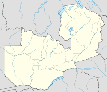
Chembe

Chembe
Chembe is located in Zambia
{{{alt}}}
Location of Chembe

Chembe is a small town in Milenge District of the Luapula Province of Zambia, which owes its existence to being the site of the Chembe Ferry across the Luapula River dividing Zambia and the Congo Pedicle territory of DR Congo. The ferry connects the principal Luapula highway to the Congo Pedicle road, a dirt highway maintained by Zambia through Congolese territory to link Mansa to the Copperbelt.

With peace in the Congo, in 2007 construction started of the 350-metre Chembe Bridge to by-pass the ferry, due for completion in 2008. Subsequent paving of the Pedicle road will do much to improve trade through the town.

References

  • Camerapix: Spectrum Guide to Zambia. Camerapix International Publishing, Nairobi, 1996.
  • Terracarta/International Travel Maps, Vancouver Canada: Zambia, 2nd edition, 2000.
  • Google Earth has high resolution photos of Chembe with ferry and bridge construction clearly visible at lat -11.984 lon 28.734.

Coordinates: 11°57′S 28°44′E / 11.95°S 28.733°E / -11.95; 28.733


Wikimedia Foundation. 2010.

Игры ⚽ Поможем решить контрольную работу

Look at other dictionaries:

  • Congo Pedicle road — Map showing the Congo Pedicle road, the direct route from Mufulira to Mansa, and the alternative route via Serenje, Mpika and Kasama, or, from 1983, Serenje and Samfya. The Congo Pedicle road (at one time referred to as the Zaire Pedicle road )… …   Wikipedia

  • Luapula River — The Luapula River is a section of Africa s second longest river, the Congo. It is a transnational river forming for nearly all its length part of the border between Zambia and the DR Congo. It joins Lake Bangweulu (wholly in Zambia) to Lake Mweru …   Wikipedia

  • Mansa, Zambia — This article is about the town in Zambia. For other uses, see Mansa (disambiguation). Mansa is the capital of the Luapula Province of Zambia, and headquarters of Mansa District. It takes its name from the local Chief Mansa and the small Mansa… …   Wikipedia

  • Río Luapula — (o Lwapula) País que atraviesa  Zambia …   Wikipedia Español

  • Mansa (Zambie) — Mansa Administration Pays …   Wikipédia en Français

  • Transport in Zambia — Railways in Zambia= Total: 2,164 km (1995)Zambia Rail Network Map [http://www.railtracker.org/RailAFFILIATES/Railways/ZR/zrrailnt.htm Railtracker (ACIS/UNCTAD) Zambia Railway Network Diagram] Principal lines* Zambia Railways Limited (ZRL) 1.067 m …   Wikipedia

  • Cape Maclear — Infobox Settlement official name = Cape Maclear other name = native name =Chembe nickname = The Capecite web|url=http://www.imt.ie/news/2008/06/life as a gp in malawi the war.html|title=Life as a GP in Malawi the warm heart of… …   Wikipedia

  • M'Tsangamouji — Marie de M tsangamouji Administration Pays France Collectivité Mayotte Canton …   Wikipédia en Français

  • M'tsangamouji — 12° 45′ 42″ S 45° 05′ 12″ E / 12.76167, 45.08665 …   Wikipédia en Français

  • Milenge District —   District   District location in Zambia Country …   Wikipedia

Share the article and excerpts

Direct link
Do a right-click on the link above
and select “Copy Link”