- Coppermine River
-
Coppermine River 
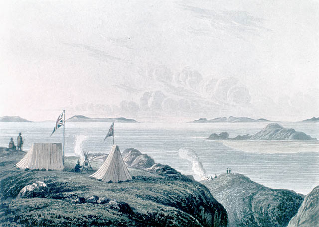
Mouth of the Coppermine River, 1821Origin Lac de Gras Mouth Coronation Gulf Basin countries Canada Length 845 km (525 mi) Source elevation 396 m (1,299 ft) Mouth elevation 0 m (0 ft) Basin area Arctic Ocean  One of many waterfalls along the river
 Canoeists camping along river
The Coppermine River is a river in the North Slave and Kitikmeot regions of the Northwest Territories and Nunavut in Canada. It is 845 km (525 mi)[1] long. It rises in Lac de Gras, a small lake near Great Slave Lake and flows generally north to Coronation Gulf, an arm of the Arctic Ocean. The river freezes in winter but may still flow under the ice.
The community of Kugluktuk (formerly Coppermine) is located at the river's mouth.
The river was named for the copper ores which could be found along the lower river. Samuel Hearne, travelled down the river to the Arctic Ocean in 1771. Sir John Franklin also travelled down the river during the Coppermine Expedition of 1819–1822.
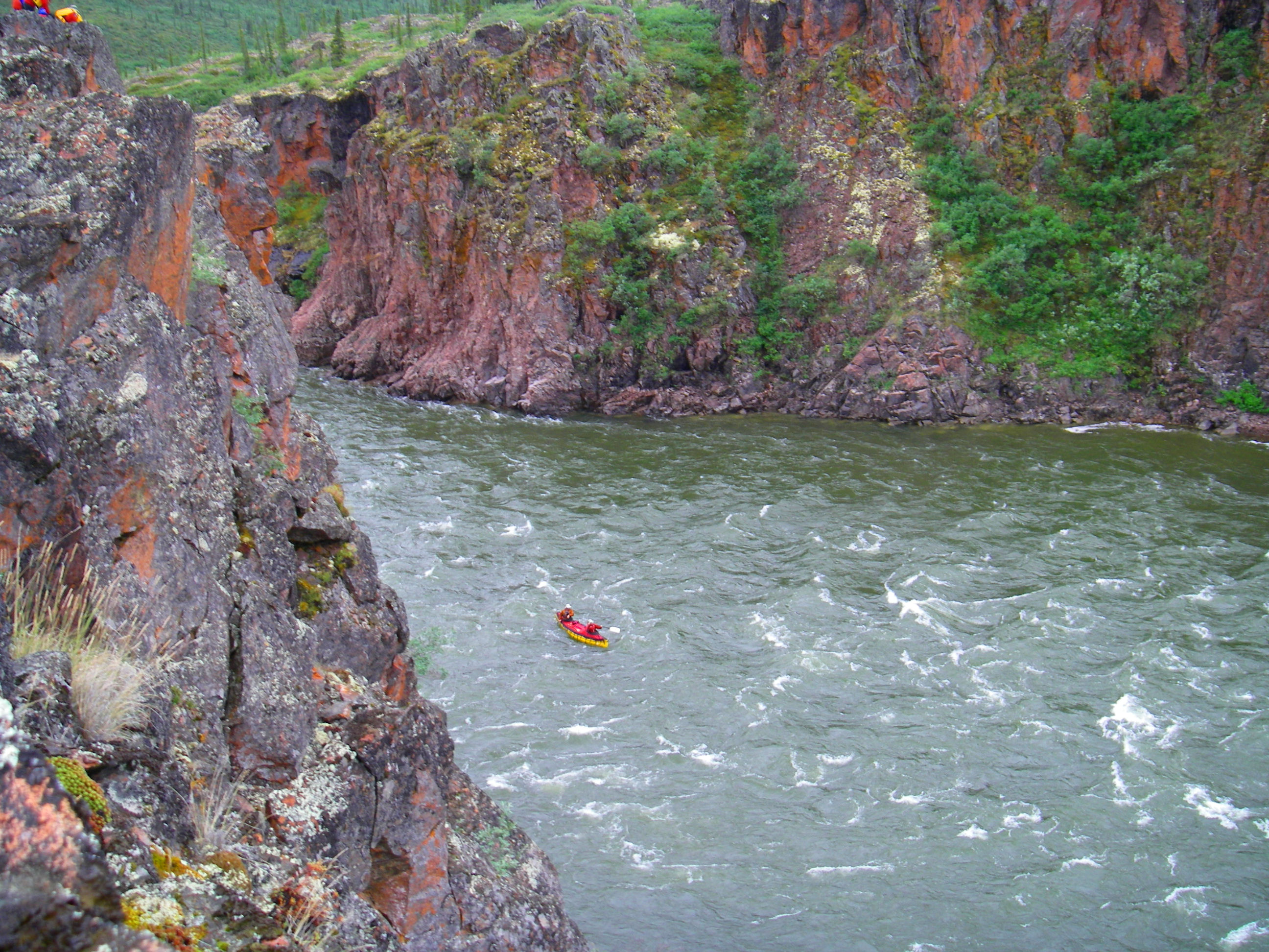
 Canoeing the Rocky Defile
Bloody Falls, part of the Kugluk/Bloody Falls Territorial Park, is located 18.5 km (11.5 mi) from Kugluktuk, and was home to the Kogluktogmiut a sub-group of the Copper Inuit. It is the site of the Bloody Falls Massacre, when Matonabbee, Samuel Hearne's guide, and his fellow Chipewyan warriors ambushed and massacred the local Inuit.
The river is used for wilderness canoeing and rafting, although it sees only a few groups each year. It features major rapids, such as Rocky Defile, Sandstone, Muskox, and Escape Rapids, as well as many unnamed smaller sets. Bloody Falls is the final major rapid of the river, and should be portaged.
The Coppermine River is the namesake of Coppermine Herald at the Canadian Heraldic Authority.
Contents
Geology of the region
Eruption of plateau lavas near the Coppermine River, built an extensive volcanic plateau about 1,200 million years ago with an area of about 170,000 km2 (66,000 sq mi) representing a volume of lavas of at least 500,000 km3 (120,000 cu mi). These lavas were formed during the same time as the large Muskox intrusion and the extensive Mackenzie dike swarm to the southeast. The lavas are thought to have originated from a mantle plume center called the Mackenzie hotspot.
Further reading
- Dredge, L. A. Where the river meets the sea geology and landforms of the lower Coppermine River Valley and Kugluktuk, Nunavut. [Ottawa]: Geological Survey of Canada, 2001. ISBN 0660185504
See also
- List of longest rivers of Canada
- List of rivers of the Northwest Territories
- List of rivers of Nunavut
References
External links
Coordinates: 67°49′N 115°4′W / 67.817°N 115.067°W
Rivers of Nunavut Kitikmeot Region Kivalliq Region Qikiqtaaluk Region Hydrography of the Northwest Territories Rivers Arctic Red · Back · Coppermine · Fond du Lac · Great Bear · Hay · Horn · Hornaday · Kagloryuak · Keele · Kotaneelee · Liard · Mackenzie · North Nahanni · Petitot · Redstone · Roscoe · Slave · South Nahanni · Trout · Yellowknife · more...Lakes Artillery · Aylmer · Blackwater · Boyd · Buffalo · Clinton-Colden · Colville · Faber · Firedrake · Great Bear · Great Slave · Hottah · Howard · Kakisa · Kasba · Keller · Lac Belot · Lac de Gras · Lac des bois (Northwest Territories) · Lac La Martre · Lynx · MacKay · Mosquito · Napaktulik · Nonacho · Point · Selwyn · Snowbird · Tahiryuak · Tathlina · Trout · Tulemalu · Wholdaia · more...Coastal features Amundsen Gulf · Beaufort Sea · Dolphin and Union Strait · Fitzwilliam Strait · Hazen Strait · Kellett Strait · Liddon Gulf · M'Clure Strait · Minto Inlet · Murray Inlet · Prince of Wales Strait · Richard Collinson Inlet · Prince Albert Sound · Wilkins StraitCanadian Heritage Rivers System 
Rivers Alsek • Arctic Red • Athabasca • Bay du Nord • Bloodvein • Bonnet Plume • Boundary Waters • Clearwater • Cowichan • Detroit • Fraser • French • Grand • Hayes • Hillsborough • Humber • Kazan • Kicking Horse • Main • Margaree • Mattawa • Missinaibi • North Saskatchewan • Red • Rideau • Seal • Shelburne • Soper • South Nahanni • St. Croix • St. Marys • Tatshenshini • Thames • Thelon • The Three Rivers • Upper Restigouche • YukonNominated See also: American Heritage Rivers • Category:American Heritage Rivers • Category:Canadian Heritage Rivers • Category:Rivers of Canada Categories:- Canadian Heritage Rivers
- Rivers of the Northwest Territories
- Rivers of Kitikmeot Region
- Volcanism of the Northwest Territories


Wikimedia Foundation. 2010.