- East 233rd Street (Bronx)
Infobox_road
highway_name=East 233rd Street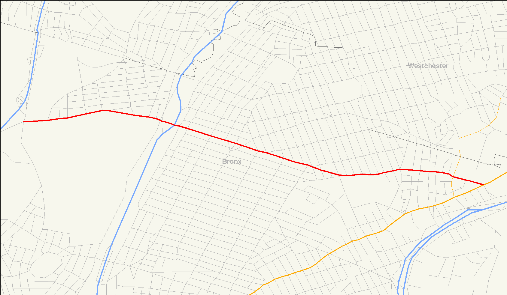
length_mi=3.0
length_round=2
length_ref=cite map|publisher=Google Maps |url=http://maps.google.com/maps?hl=en&rlz=1T4ADBF_enUS232US232&q=from:+E+233rd+St+%4040.895230,+-73.880030+to:+E+233rd+St+%4040.887610,+-73.824680&um=1&ie=UTF-8&sa=N&tab=wl|title=Overview Map of East 233rd Street|accessdate=2007-11-07]
direction_a=East
starting_terminus= (continues as Pinkley Avenue)
junction=
direction_b=West
ending_terminus=
counties=BronxEast 233rd Street is one of the major thoroughfares of the
Bronx . The road is 3 miles (4.83 kilometres) long and stretches fromU.S. Route 1 in the Eastchester section of the Bronx to the Major Deegan Expressway (I-87) in Woodlawn (nearVan Cortlandt Park ). The road changes names from East 233rd Street to Pinkley Avenue after the Route 1 terminus. There is one interchange with a highway along the way, which is for theBronx River Parkway . There are two subway stations along the road, one at Dyre Avenue and one atWhite Plains Road , serving the 2 and 5 trains.Street description
East 233rd Street begins at an interchange with U.S. Route 1 in the southwestern side of Pelham Manor. The road heads westward and into Parkside, where it intersects with Dyre Avenue and Route 22. There is a subway station located at the Dyre Avenue intersection. As East 233rd Street leaves Parkside, the road passes by Seton Falls Park in Eastchester. Baychester Avenue, former Route 164, intersects at the northwest corner of the park and 233rd Street continues to the northwest. White Plains Road, a divided highway, intersects in Woodlawn. The second subway station is located at the intersection. At the Carpenter Avenue intersection, Our Lady of Mercy Medical Center is off to the left. Soon afterwards is the
Bronx River Parkway , however, the road is only accessible from Bronx Boulevard. At the Webster Avenue intersection, a train station is present as well as the northwest corner ofWoodlawn Cemetery . East 233rd Street runs along the northern border of Woodlawn Cemetery until its terminus at Jerome Avenue and the Major Deegan Expressway.History
Between Webster and Provost Avenues, East 233rd Street was once part of
New York State Route 22 , which previously continued intoManhattan . [H.M. Gousha Company , [http://www.nycroads.com/history/1941_metro-4/ New York City] , 1941] [Rand McNally , [http://www.nycroads.com/history/1960_metro-1/ New York City] , 1960] The road was also part of the alignment for the proposed City Line Expressway.cite web|author=Steve Anderson|url=http://www.nycroads.com/roads/city-line/|title=NY-164 - City Line Expressway|publisher= NYCRoads.com|format=HTML|date=2007|accessdate=2007-11-07]Transportation
Subway
There are two subway stations along East 233rd Street. The first one is located at the intersection of 233rd and White Plains Road. It serves the 2 and 5 trains and has a connection a Metro-North line at the nearby Webster Avenue intersection.NYCS ref|http://www.nycsubway.org/perl/stations?199:162|IRT White Plains Road Line|233rd Street] The second one is located at the Dyre Avenue intersection with Eastchester. The station serves the 5 train alone and is the end of the
IRT Dyre Avenue Line .NYCS ref|http://www.nycsubway.org/perl/stations?199:1179|IRT White Plains Road Line|Dyre Avenue]Bus
There is access to the Bx16, Bx 31 and Bx34 buses provided by the Metropolitan Transportation Authority on East 233rd Street.cite web|author=Metropolitan Transportation Authority|url=http://www.mta.info/nyct/bus/schedule/bronx/bx016cur.pdf|title=Bx16 bus schedule|format=PDF|date=2007|accessdate=2007-11-07 Also see [http://www.mta.info/nyct/bus/schedule/bronx/bx031cur.pdf Bx31] and [http://www.mta.info/nyct/bus/schedule/bronx/bx034cur.pdf Bx34] ]
Major intersections
NYint
county=Bronx
cspan=5
mile=0.00
road= (Boston Road)
location_special=Eastchester
lspan=2
notes=Eastern terminus of East 233rd Street. NYint
mile=0.20
road= (Provost Avenue)NYint
mile=1.00
location=Wakefield
road=Baychester Avenue
notes=Former routing of NYint
mile=2.10
road=
location=Woodlawn
lspan=2NYint
mile=3.00
road=)
notes=Western terminus of East 233rd Street.References
Wikimedia Foundation. 2010.