- Metchosin, British Columbia
-
District of Metchosin — District — Location of Metchosin in British Columbia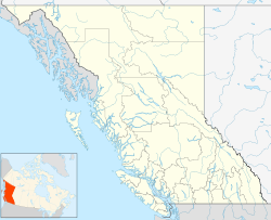
 District of Metchosin
Coordinates: 48°22′55″N 123°32′16″W / 48.38194°N 123.53778°WCoordinates: 48°22′55″N 123°32′16″W / 48.38194°N 123.53778°W Country  Canada
Province  British Columbia
Region Vancouver Island Regional district Capital Regional District Founded 1840 Incorporated 1984 Government - Governing body Metchosin Council - Mayor John Ranns Area - Total 71.32 km2 (27.5 sq mi) Elevation 40 m (131 ft) Population (2006) - Total 4,795 Time zone PST (UTC-8) Highways 14 Waterways Strait of Juan de Fuca Website District of Metchosin The District of Metchosin is a small, coastal community (just over 5000 people) in the metro Greater Victoria region of British Columbia. It is part of the Western Communities and one of the 13 regional municipalities. Many Metchosinites are small farmers (vegetables, orchards, poultry, sheep, some pigs and cattle). Most are retired or work outside the community. There are also many home based businesses (everything from massage and dentistry to international consulting). "Dogless in Metchosin" by Tom Henry is a first-hand account of life there; as the title indicates, dogs are popular pets and people without at least one stand out. Located on the edge of a rapidly growing urban area, Metchosin is subject to a variety of pressures. While the municipality has maintained its slow population growth, traffic has exploded due to growth in the larger region.
Metchosinites, especially the younger ones, are traditionally friendly rivals of neighbouring communities Sooke, East Sooke, Langford, and Colwood. A 1995 move to merge Metchosin and East Sooke, which has a similar rural-utopian character, failed; some East Sookese adopted the slogan "East Sooke Forever, Metchosin Never!" as they saw the proposition not as a merge but as an assimilation into larger Metchosin. Since then, several pieces of E.Sooke have been assimilated into its urban neighbour, Sooke. Remaining rural residents are seeking to join Metchosin, and a new set of studies and consultations started in 2007 and is ongoing.
Metchosin is known for its many regional nature/recreational parks, such as Devonian, Witty's Lagoon, Albert Head, and Matheson Lake. Their well-maintained trails and scenic vistas are popular with tourists and locals. While these outdoor attractions do not offer souvenirs, Victoria itself has most of the region's money-spending opportunities (e.g. souvenir shops and museums). As many Metchosinites work in Victoria, the tourists do indirectly benefit Metchosin's economy.
The name Metchosin is the anglicised version of the native "Smets-Schosen", which means "place of stinking fish". Local legend maintains that many years prior to the Europeans' arrival, an orca beached and died, and that everywhere that could smell it rotting became part of Metchosin. The town's museum, which was once its one-room school before an increasing population necessitated a larger building, claims to have vertebrae from the animal on display. Metchosin's community symbol is, perhaps unsurprisingly, an orca.
As a result of the municipal elections (November 15, 2008), Metchosin's Council-elect is John Ranns (Mayor), Larry Tremblay (Councillor), Bob Gramigna (Councillor), Jo Mitchell (Councillor), and Moralea Milne (Councillor).
Contents
Neighbourhoods of Metchosin
- Happy Valley
- Matheson Lake
- Rocky Point (includes the southernmost point in western Canada)
- William Head
- Nield Road
- Albert Head
- Wildwood Creek Estates
- Pears road subdivision
Physiography
Much of Metchosin is hilly, with shallow, stony soils over basalt bedrock. Lower-lying areas, as in Happy Valley, have deep deposits of clay, silt and sand. Alluvial loams occur along some of the streams. Mount Matheson rises above Matheson Lake in the southwest part of Metchosin.
Other facts
Metchosin is home to Lester B. Pearson College,[1] one of the thirteen United World Colleges around the world. Pearson College is named after former Canadian Prime Minister Lester B. Pearson, a winner of the Nobel Peace Prize and architect of the United Nations Peace Keeping program.
Metchosin is also home to the Albert Head Air Cadet Summer Training Centre at CFB Esquimalt, the main training centre for Royal Canadian Air Cadets in British Columbia.
The community newspaper, Metchosin Muse, is published monthly.
Events
- Fired Up pottery exhibition (May)
- Metchosin International Summer School of the Arts (July)[2]
- Sheep Dog Trials (July) [3]
- Bit Me Fishing Derby (August)[4]
- Stinking Fish Studio Tour (July-August)[5]
- Metchosin Day country fair (September)
- Metchosin Pony club AGM
- Metchosin 4-H club public speaking night
- Santa on firetruck for kids day
- Blue Moon Christmas - locals perform festive songs and stories
- "The annual Broom cleanup"
- Halloween at the firehall
Education
Metchosin is a part of the School District 62 Sooke.
Parks
- Albert Head Lagoon Regional Park[6]
- Blinkhorn Nature Park
- Buckbrush Swamp
- Devonian Regional Park[7]
- Matheson Lake Regional Park[8]
- Witty's Lagoon Regional Park[9]
References
External links
Victoria Saanich Beaver Lake – Elk Lake · Broadmead–Sunnymead · Cadboro Bay · Cedar Hill · Cloverdale · Cordova Bay · Glanford · Gordon Head · Gorge–Tillicum, · Interurban · Lake Hill · Maplewood · Marigold · Mount Douglas · Mount Tolmie – Lansdowne · Prospect Lake · Royal Oak · Strawberry Vale · Swan Lake · Ten Mile Point · Town and Country – Burnside · West SaanichWestern Communities Bear Mountain · Belmont Park · Colwood · Glen Lake · Goldstream · Happy Valley · Hatley Park · Langford · Luxton · Mill Hill · Millstream · Thetis Lake ·Other areas Brentwood Bay · Broom Hill · Cloak Hill · Craigflower · Dean Park · Deep Cove · Durrance Lake · East Sooke · Florence Lake · Gonzales · Gorge Vale · Island View · Kemp Lake · Lands End · Matheson Lake · Otter Point · Pat Bay · Ravenwood · Rockheights · Rocky Point · Saanichton · Saseenos · Songhees · Swartz Bay · Uplands · Whiffen Spit · William Head · Willis Point · Willows Beach · Windsor Park · Work PointMembers of the Capital Regional District Municipalities Central Saanich • Colwood • Esquimalt • Highlands • Langford • Metchosin • North Saanich • Oak Bay • Saanich • Sidney • Sooke • Victoria • View RoyalElectoral areas Subdivisions of British ColumbiaSubdivisions Regions · Regional districts · Forest Regions and Forest Districts · School districts · Land DistrictsSettlements Urban centres District municipalities Barriere · Central Saanich · Chetwynd · Clearwater · Coldstream · Delta · Elkford · Esquimalt · Fort St. James · Highlands · Hope · Houston · Hudson's Hope · Invermere · Kent · Lake Country · Langley · Lantzville · Lillooet · Logan Lake · Mackenzie · Maple Ridge · Metchosin · Mission · New Hazelton · North Cowichan · North Saanich · North Vancouver · Oak Bay · 100 Mile House · Peachland · Port Edward · Port Hardy · Saanich · Sechelt · Sicamous · Sooke · Spallumcheen · Sparwood · Squamish · Stewart · Summerland · Taylor · Tofino · Tumbler Ridge · Ucluelet · Vanderhoof · Wells · West Kelowna · West Vancouver Category:British Columbia ·
  Portal:British Columbia ·
  WikiProject:British ColumbiaCategories:
- District municipalities in British Columbia
- Populated places in the Capital Regional District
- Greater Victoria, British Columbia

Wikimedia Foundation. 2010.