- Greenisland
Infobox Irish Place
name = Greenisland
gaeilge = Inis Glas
crest
motto =
map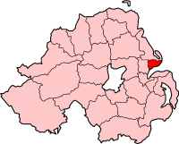
pin coords = left: 167px; top: 69px
north coord = 54.695 | west coord = 5.857
elevation =
province =Ulster
county =County Antrim
NI district = Carrickfergus Borough
UK constituency = East Antrim
EU constituency = Northern Ireland
stdcode = 028, +44 28
posttown =Carrickfergus
postcode = BT38
population = 5,050
census yr = 2001
web =
|Greenisland is a suburb in
County Antrim ,Northern Ireland , and lies 3miles to the south west ofCarrickfergus , 1mile north east ofJordanstown and itsUniversity of Ulster campus and lies 7miles east of Belfast City.Greenisland is a semi-rural community overlooked by the hill behind upon which stands Greenisland Knockagh Monument (a war memorial to those who died in the first and second world wars). The village stretches down from the foot of the hill to the shores of Belfast Lough.
There are direct rail links to Belfast, Carrickfergus and
Larne and there is also a regular bus service to Belfast and Carrickfergus.In 2001 the population of the Greenisland was 5,048, a fall from the 1972 figure of 5,638. Greenisland is a popular residential location due to its attractive setting on the Lough Shore and its proximity to Belfast. It is a dormitory commuter settlement for Belfast, with a small focus of local retail activity in the small shopping parade at Glassillan Court complemented by a number of local shops dispersed throughout the settlement.
Greenisland is about to benefit from the introduction of a new multi-million pound dual carriageway along A2 Shore Road. Construction is due to begin 2010/2011. This will help cut commuting times to both Belfast and Carrickfergus.
History
* Castle Lugg (owned by the National Trust) On an area of ground raised above the shoreline of Belfast Lough, with excellent views. The tower was described in the OS memoirs as "a square tower... nothing now remains but a portion of the N wall 27ft long & 25ft high - with a very small portion of the E side attached to it...There is no tradition or local record to throw any light on the origin, history or destruction of this castle". A small excavation was carried out at the site in 1980, but failed to establish a precise date of layout of the structure; documentary evidence suggest it existed by 1570. It is still much as it was when described in 1839, with the remains of the N wall, 8m long x 1.2m thick x c.5m high & a fragment of the E wall surviving at the NE corner. Two modern walls extend S from the E & W sides of the N wall & formed part of a forge.
*Knockagh Monument * The settlement of Greenisland developed rapidly after the introduction of the rail network in the nineteenth century. Its position was at an important railway junction on the Belfast to Ballymena railway line contributed to significant public and private house building rates during the 1960’s.
* More local History can be found at Greenisland Library where a book has been published on the History of Greenisland.
Shops & Services
Greenisland has a number of shops and services which include: a number of grocery shops and newsagents; a petrol filling station; a butcher's shop; 2 hair salons and a barber shop; a dental practice; a chemist; a number of fast food outlets; a hotel and restaurant ( [http://www.knockaghlodge.com/ Knockagh Lodge] ); a number of car sales and mechanic's garages; a cafe and 2 children's nurseries.
The area is also served by the local [http://www.neelb.org.uk/sys_upl/templates/PT_Directory/PT_Directory_Summary.asp?ltr=ALL&pgid=2761&tid=146 Greenisland Library] ; a Community Centre; a Youth Centre and a Scout Hall.
Transport
*
Greenisland railway station opened on11 April 1848 . [cite web | title=Greenisland station | work=Railscot - Irish Railways | url=http://www.railscot.co.uk/Ireland/Irish_railways.pdf | accessdate=2007-08-28]
* [http://www.translink.co.uk/ Translink Bus & Rail Website]Local Schools & Education
* Greenisland Primary School
* Silverstream Primary School
* [http://www.belfasthigh.co.uk/ Belfast High School]
* [http://www.ulster.ac.uk/ University of Ulster, Jordanstown Campus]Local Churches
Greenisland is home to a number of churches including:
* [http://www.gbcni.com Greenisland Baptist Church]
* [http://www.gpcnet.org Greenisland Presbyterian Church]
* [http://greenisland.connor.anglican.org/ Church of the Holy Name (COI)]
* [http://www.irishmethodist.org/ Greenisland Methodist Church]
* [http://www.nazarene.org.uk/ Church of the Nazarene]
* [http://www.gbcni.com/real.asp REAL: Youth Church]
* St. Colman's Church (RC)Sports Clubs
* [http://www.greenislandgolfclub.co.uk/ Greenisland Golf Club]
* Greenisland Bowling Green
* Greenisland War Memorial Sports Club (GWMSC)
* [http://www.greenislandladies.co.uk/ Greenisland Ladies Hockey Club]
* [http://www.greenislandboysfc.com/ Greenisland Boys Football Club]
* Knockagh View Equestrian Centre
* Knockagh Wrestling ClubLocal Hotels and B&B's
* [http://www.knockaghlodge.com/ Knockagh Lodge] (Hotel Opening 2008!)
* [http://www.discovernorthernireland.com/The-Stables-Greenisland-Carrickfergus-P7440 The Stables B&B]
* [http://www.discovernorthernireland.com/Whiteford-Lodge-Greenisland-Carrickfergus-P4166 Whiteford Lodge B&B]Local Councillors and MP's
Greenisland is part of
Carrickfergus Borough Council and covered by the Knockagh Monument Constituency.* [http://www.carrickfergus.org/site/civic/civic_councillers.htm Greenisland Councillors]
Local MP's for the area include:
* [http://www.niassembly.gov.uk/members/biogs_07/wilson_s.htm Sammy Wilson] (DUP)
* [http://www.niassembly.gov.uk/members/biogs_07/hilditch_d.htm David Hilditch] (DUP)
* [http://www.niassembly.gov.uk/members/biogs_07/ross_a.htm Alastair Ross] (DUP)
* [http://www.niassembly.gov.uk/members/biogs_07/beggs_r.htm Roy Beggs] (UUP)
* [http://www.niassembly.gov.uk/members/biogs_07/robinson_k.htm Ken Robinson] (UUP)
* [http://www.niassembly.gov.uk/members/biogs_07/neeson_s.htm Sean Neeson] (Alliance)2001 Census
Greenisland is a small settlement within Belfast Metropolitan Urban Area (BMUA). On Census day (
29 April 2001 ) there were 5,050 people living in Greenisland. Of these:
*21.6% were aged under 16 years and 22.1% were aged 60 and over
*47.5% of the population were male and 52.6% were female
*9.6% were from aCatholic background and 84.3% were from a Protestant background.
*3.34% of people aged 16-74 were unemployed.References
Wikimedia Foundation. 2010.