- Savage, Minnesota
Infobox Settlement
official_name = Savage, Minnesota
other_name = Hamilton, Glendale
native_name =
nickname =
motto =
imagesize =
image_caption =
flag_size =
image_
seal_size =
image_shield =
shield_size =
image_blank_emblem = SavageMNlogo.jpg
blank_emblem_size =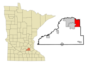
mapsize = 250px
map_caption = Location in Scott County and the state ofMinnesota
mapsize1 =
map_caption1 =
pushpin_
pushpin_label_position =
subdivision_type = Country
subdivision_name =United States
subdivision_type1 = State
subdivision_name1 =Minnesota
subdivision_type2 = County
subdivision_name2 = Scott
subdivision_type3 =
subdivision_name3 =
subdivision_type4 =
subdivision_name4 =
government_type =
leader_title =Mayor
leader_name = Janet Williams
leader_title1 =
leader_name1 =
leader_title2 =
leader_name2 =
leader_title3 =
leader_name3 =
leader_title4 =
leader_name4 =
established_title = Founded
established_date = 1852
established_title2 =
established_date2 =
established_title3 = Incorporated
established_date3 = 1892
area_magnitude =
unit_pref = Imperial
area_footnotes =
area_total_km2 = 42.8
area_land_km2 = 41.2
area_water_km2 = 1.6
area_total_sq_mi = 16.5
area_land_sq_mi = 15.9
area_water_sq_mi = 0.6
area_water_percent = 3.69%
area_urban_km2 =
area_urban_sq_mi =
area_metro_km2 =
area_metro_sq_mi =
population_as_of = 2000
population_footnotes = cite web| title=Twin Cities Region Population and Household Estimates, 2006 | url=http://www.metrocouncil.org/metroarea/2006PopulationEstimates.pdf | format=PDF | date=2006-04-01 | publisher=Metropolitan Council | accessdate= 2007-07-24] cite web |title=Table 2: Population Estimates for the 100 Most Populous Metropolitan Statistical Areas Based on July 1, 2006 Population Estimates: April 1, 2000 to July 1, 2006 |publisher=U.S. Census Bureau |url=http://www.census.gov/Press-Release/www/releases/archives/cb07-51tbl2.pdf | format = PDF | date =2007-04-05 |accessdate=2007-04-16]
population_note = 2006
settlement_type =City
population_total = 25065
population_density_km2 = 512.4
population_density_sq_mi = 1326.9
population_metro = 2968805
population_density_metro_km2 =
population_density_metro_sq_mi =
population_urban =
population_density_urban_km2 =
population_density_urban_sq_mi =
timezone = Central
utc_offset = -6
timezone_DST = Central
utc_offset_DST = -5
latd = 44 |latm = 46 |lats = 45 |latNS = N
longd = 93 |longm = 20 |longs = 11 |longEW = W
elevation_footnotes =
elevation_m = 220
elevation_ft = 722
postal_code_type = ZIP code
postal_code = 55378
area_code = 952
website = [http://www.ci.savage.mn.us www.ci.savage.mn.us]
blank_name = FIPS code
blank_info = 27-58738GR|2
blank1_name = GNIS feature ID
blank1_info = 0651242GR|3
footnotes =Savage (pronEng|ˈsævɪdʒ) is a
suburb an city 15 miles (25 km) south-southwest of downtown Minneapolis in Scott County in theU.S. state ofMinnesota . The city is situated on the south bank of theMinnesota River in a region commonly referred to as "South of the River," comprising the southern portion ofMinneapolis-St. Paul , the sixteenth largestmetropolitan area in theUnited States . The population of Savage was 21,115 at the 2000 census; the Census Bureau estimated its 2006 population at 27,292. [cite web | url = http://www.census.gov/popest/cities/files/SUB-EST2006_27.csv | title = Subcounty population estimates: Minnesota 2000-2006| format = CSV | publisher =United States Census Bureau , Population Division | date =2007-06-28 | accessdate = 2008-05-28]Minnesota State Highway 13 and County Road 42 are two of the main arterial routes in the city. Interstate 35W andU.S. Route 169 are in close proximity to the city.The landing point for Irish and Scottish immigrants in 1800, Savage has grown into a developing bedroom community, absorbing population growth from Burnsville, its larger neighbor to the east. Once a shipbuilding port for the U.S. Navy, Savage is now an industrial manufacturing job center in the southern metro.cite web | url=http://www.usace.army.mil/publications/eng-pamphlets/ep870-1-42/c-4-4.pdf | title=Mobilizing the Waterways: The Mississippi River Navigation System | author=Michael C. Robinson | publisher=U.S. Army Corp of Engineers | date= 18 December 1992|format=PDF] The city is still relatively undeveloped, rural, and wild with sections of the
Minnesota Valley National Wildlife Refuge and Murphy-Hanrehan Park Reserve within its borders.Previously named Hamilton after the city in
Ontario, Canada , the town was renamed Savage after Marion Willis Savage who owned and trained the nationally celebrated racing horseDan Patch . [cite web | url=http://www.ci.savage.mn.us/CommunityProfile/index.html | title= Have you ever wondered where the City of Savage got its name? | publisher=City of Savage | year=2006]History
In the 1600s, French fur traders and explorers explored the Minnesota River valley. After 1750,
Mdewakanton Dakota then settled at Chief Black Dog's camp--near what is now Black Dog Lake inBurnsville . Dakota used the Minnesota River valley region including present day Savage for fish, game, boating and camping. [cite web | url=http://www.mnrivervalley.com/stories/stories.php | title=Minnesota River Valley Scenic Byway | publisher= Explore Minnesota! | year=2007]In 1852, traders established a small post at the confluence of the Credit River and the
Minnesota River . William Byrne, who immigrated fromCounty Kilkenny, Ireland to Hamilton,Ontario ,Canada in 1840, arrived in the area shortly after, via steamboat fromFort Snelling . Already established in business and trade, he and other Irish and Scottish settlers build Hamilton Landing, a port for boats, named after the city he immigrated to in Canada. The town incorporated in 1892 as the village of Hamilton.cite web | url=http://www.ci.savage.mn.us/CommunityProfile/History/index.html | title= History of Savage - The Beginning | publisher= The City of Savage | year= 2006] [cite web | url=http://www.geocities.com/Heartland/Acres/6038/History_of_Dakota_County_1881.html | title=Byrnesville? | publisher=Burnsville '76, A History | author=Richard Brooks | year=1976] . Byrne later settled another nearby area which becameBurnsville .The Chicago Northwestern (present day
Union Pacific Railroad ) railway line reached the site in 1865, and in 1866 the town gained a post office. Hamilton became the crossroads of trade and service in the region with the Credit River, Minnesota River, the valley's wagon and road trails, and the rail line.cite web | url= http://www.danpatch.com/default.asp?id=4 | title= Savage Depot History | date= October 14, 2007 | publisher= Dan Patch Historical Society ]The post office was later renamed Glendale Post Station in 1894 and formed Glendale Township to the west of Hamilton but was later consolidated with Savage in 1969.cite web | url=http://www.swnewspapers.com/guidetosavage/index.php?s=67&ss=164&pt=edit&t=1&msid=6248 | title= Guide to Savage | publisher=Southwest Newspapers | year=2006] The roughly 17 blocks of the late 19th century town remain as Savage's downtown along
Highway 13 (Minnesota) .In 1902,
Minneapolis entrepreneur Marion Willis Savage purchased racing horseDan Patch and trained and raced him at his farm in the limits of Hamilton. Dan Patch's notoriety grew as the horse began breaking speed records and with it the prestige of the town. In 1904 the townspeople renamed the community after Savage with the post office officially confirming.cite web | url=http://www.standardbredcanada.ca/trot/iss0806/tr0806dp.html | title=A One-Horse Town | publisher=Standardbred Canada | month= August | year= 2006 | author=Nancy Huddleston] In 1906 at the Minnesota State Fair, Dan Patch broke the world pacing mile record at 1 minute and 55 seconds, a record that remained unsurpassed for 54 years.During
World War II , Savage was home toCamp Savage , a Military Intelligence School (MIS) language school, which taught Japanese to American military personnel. Established in 1942, the school trained withnisei s and improved military intelligence of the time. It was later relocated toFort Snelling and the camp is commemorated at Normandale College's Japanese garden.{ [cite web | url=http://www.ci.savage.mn.us/CommunityProfile/History/history_ww2.html | title= Savage in World War II | date=2006 | publisher=City of Savage| accessdate=2007-11-01] [cite web | url=http://www.geocities.com/Heartland/Acres/6038/Camp_Savage.html | title= CAMP SAVAGE | author= Bea Nordstrom | year= 1976 | publisher= Burnsville '76, A History ] At about the same time,Cargill , Incorporated, began building ships for the U.S. Navy at the newly constructed Meadowland Shipyard,renamed Port Cargill (former site of Hamilton Landing). To launch the ships, 14 miles of the Minnesota River were dredged down to 9 feet from Savage to the Mississippi River confluence. About 3,500 people were employed during peak production resulting in 18 auxiliary oil and gas carriers and 4 tugboats constructed. After World War II the port began shipping agricultural commodities.Savage remained undeveloped in the post-war housing boom, isolated by the Minnesota River and without a direct interstate connection. Lack of available construction materials in the immediate area also prevented development. By the 1980s, with the upgrade of
Highway 13 (Minnesota) and construction of the Highway 169Bloomington Ferry Bridge across the Minnesota River, Savage's population finally boomed as one of the growing exurb cities with low cost greenfield land in the metropolitan area.cite news | url=http://minnesota.publicradio.org/display/web/2006/06/20/census/ | title= Census says suburbs, exurbs are big population winners | author= Brandt Williams | publisher= Minnesota Public Radio | date=June 21, 2006] [ [http://www.johnweeks.com/bridges/pages/mn06.html Bloomington Ferry Bridge] ] The citizens of Savage reclaimed some of their history in the early 2000s, when it relocated the displaced Savage Depot built in 1880 by the then Chicago, Minneapolis and Omaha Rail Road.cite news | url= http://www.danpatch.com/default.asp?id=6 | title=SAVAGE WANTS ITS PAST BACK | author= Shira Kantor | publisher= Copied from the Star Tribune by the Dan Patch Historical Society | date= April 6, 2005]Geography
According to the
United States Census Bureau , the city has a total area of 16.5square mile s (42.8km² ), of which, 15.9 square miles (41.2 km²) of it is land and 0.6 square miles (1.6 km²) of it (3.69%) is water. The city's northern boundary is theMinnesota River ; its tributary the Credit River flows northwardly through the city. [cite book| title= Minnesota Atlas & Gazetteer |year=1994 |publisher=DeLorme |location=Yarmouth, Me. |isbn= 0-89933-222-6 |pages= pp. 33, 41]Demographics
As of the
census GR|2 of 2000, there were 21,115 people, 6,807 households, and 5,717 families residing in the city. Thepopulation density was 1,326.9 people per square mile (512.4/km²). There were 6,994 housing units at an average density of 439.5/sq mi (169.7/km²). The racial makeup of the city was 90.65% White, 1.59% African American, 0.25% Native American, 5.39% Asian, 0.02% Pacific Islander, 0.66% from other races, and 1.45% from two or more races. Hispanic or Latino of any race were 1.63% of the population.There were 6,807 households out of which 56.4% had children under the age of 18 living with them, 74.0% were married couples living together, 6.6% had a female householder with no husband present, and 16.0% were non-families. 11.1% of all households were made up of individuals and 1.7% had someone living alone who was 65 years of age or older. The average household size was 3.10 and the average family size was 3.38.
In the city the population was spread out with 35.6% under the age of 18, 4.5% from 18 to 24, 43.5% from 25 to 44, 13.7% from 45 to 64, and 2.6% who were 65 years of age or older. The median age was 31 years. For every 100 females there were 103.6 males. For every 100 females age 18 and over, there were 101.2 males.
The median income for a household in the city was $75,097, and the median income for a family was $79,244. Males had a median income of $50,884 versus $35,824 for females. The
per capita income for the city was $26,858. About 1.9% of families and 2.3% of the population were below thepoverty line , including 2.4% of those under age 18 and 3.0% of those age 65 or over.Government and politics
The current mayor is Janet Williams and the four City Council seats are occupied by Gene Abbott, Al McColl, Jane Victorey, and Christine Kelly.
Savage is located in
Minnesota's 2nd congressional district , represented by John Kline, a Republican, scoring 2.8% progressive on a range of issues [cite web| last = Grossman| first = Joshua| title = ProgressivePunch Leading with the Left| work = All Issues| publisher = ProgressivePunch|url = http://www.progressivepunch.org/members.jsp?member=MN2| accessdate = 2007-09-08] and 88% conservative based on 2006 House votes. [cite web | title = ACU Ratings of Congress, 2006| publisher = American Conservative Union | year = 2006 | url = http://www.acuratings.org/2006all.htm#MN | accessdate = 2007-09-08]References
External links
* [http://www.ci.savage.mn.us City website]
* [http://www.ci.savage.mn.us/history.html History of Savage]
* [http://www.priorlake-savage.k12.mn.us Prior Lake-Savage School District Website]
* [http://www.isd191.org Burnsville, Eagan, Savage School District Website]
* [http://www.savagepacer.com Savage Pacer]

Wikimedia Foundation. 2010.