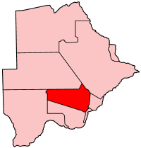
- Molepolole
-
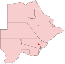
Molepolole is Botswana's biggest village. It lies in the south east of the county. The people who reside in Molepolole are the Bakwena, who are one of the eight major tribes in Botswana. The Bakwena chief was among the three chiefs who went to England to seek protection from the British in the colonial era. Molepolole serves as the capital of the Bakwena. It was named after the Molepolole river. Molepolole is 50km away from the capital city of Botswana, Gaborone.
It is one of the largest traditional villages in Africa with a population of over 69,789 people as of 2008. It lies 50 kilometres west of the capital Gaborone, and acts as gateway for exploring the Kalahari desert.
It has a large traditional court (or kgotla) and is the location of the Scottish Livingstone Hospital, one of the nation's largest.
Contents
History of Molepolole
Ntsweng was the capital of Bakwena before they moved to Molepolole. Ntsweng is a historic site located a few kilometers southeast of Molepolole. The area was first occupied by Bakwena, led by Sechele I, in 1864. It was abandoned in 1937 when Bakwena were forced to move to Molepolole by Kgari II, assisted by the colonial administrators (Schapera, 1943). Ntsweng today consists of a large area covered with traces of occupation. Most notable are the patterns of stones laid on their edges to form house foundations which are still visible on the surface. There are also the ruins of what used to be Sebele II's office which is at present referred to as Mmakgosi' s house. The ruins of that building are situated next to an area which used to be the royal kraal at Ntsweng but is now the royal cemetery (Morton & Ramsay, 1990). Several clusters of ruins seem to represent different wards. Analyses of the settlement layout and soil samples suggest cattle were often kept in the center of each ward. This seems to follow the "central cattle pattern", a conceptual model for the organization of settlements among southern Bantu, where the central placement of the kraal reflects the central role of cattle in the culture and ideology of the people.
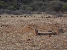 The archaeological site at Ntsweng in Molepololole showing the ruins of the old settlement
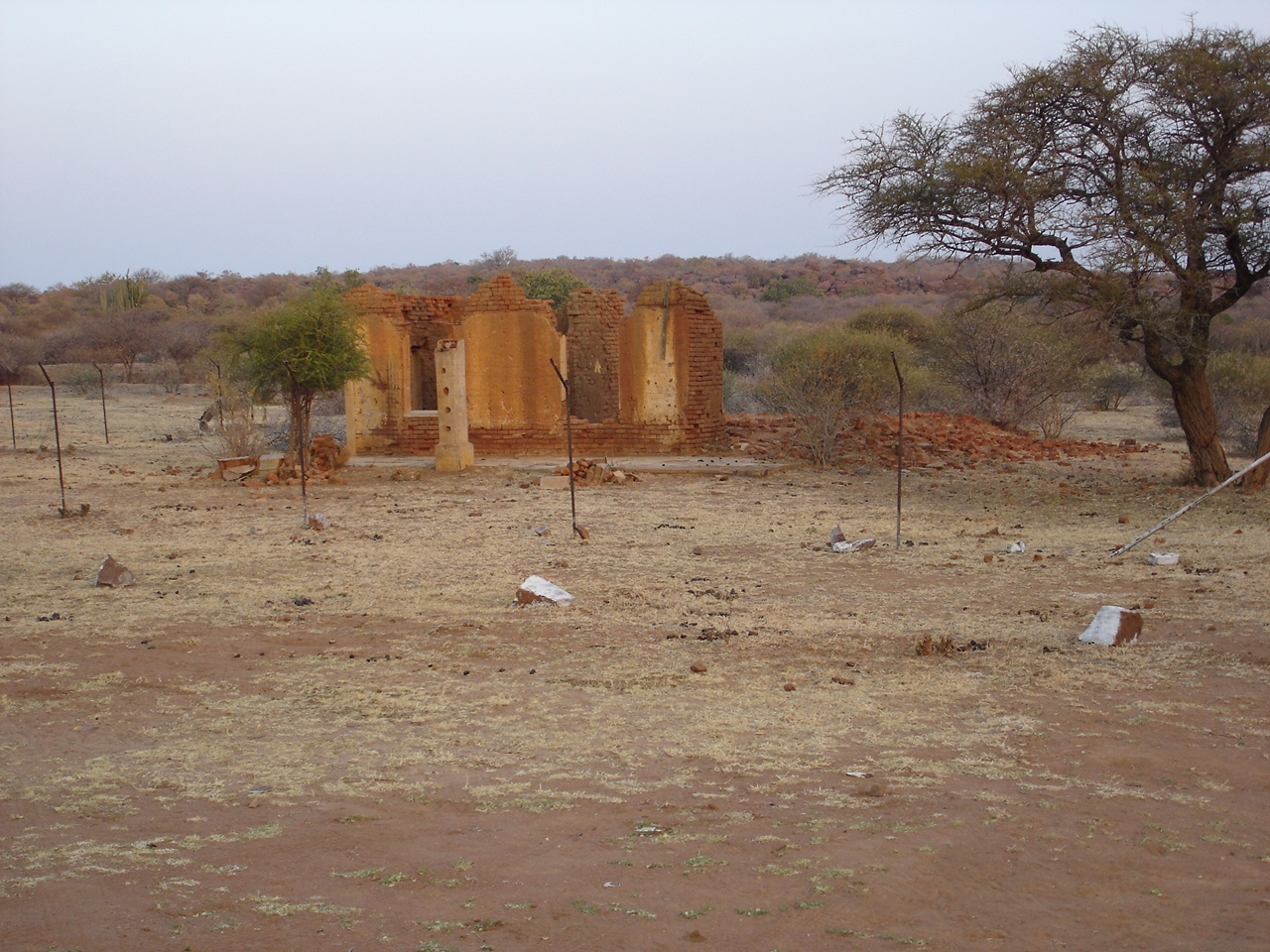
 the ruins of Bakwena Tribal Office at Ntsweng
 Bakwena Royal Cemetry, which used to be a royal kraal at Ntsweng
Education
Molepolole is the home to a number of educational institutions that offers education from primary school to tertiary level. The tertiary institutions in Molepolole include Molepolole College of Education which offers diploma in education and Institute of Health Sciences which offers diploma in Nursing. Kgari Sechele Senior Secondary School is the only government run senior secondary school in Molepolole and it offers Botswana General Certificate of Secondary Education(BGCSE). There are 7 government run junior community secondary schools namely Boitshoko Community Junior Secondary School, Kwena-Sereto Community Junior Secondary School,Sedumedi Community Junior Secondary School, Motswasele Community Junior Secondary School, Tshegetsang Community Junior Secondary School, Dithejwane Community Junior Secondary School and Moruakgomo Community Junior Secondary School.There are about 15 government run primary schools in Molepolole namely;Phuthudikobo Primary School,Bokaa Primary School, Magokotswane Primary School, Suping Primary School, Kutlwano Primary School, Boribamo Primary School, Neale Primary School, Bakwena National Primary School, Kealeboga Primary School,Sebele Primary School, Lewis Memorial Primary School, Bonewamang Primary School, Cannon Gordon Memorial Primary School,Borakalelo Primary School and Lekgwapheng Primary School. The private schools include Bluebows Englishmedium school which offers pre-school, primary school and secondary school. The other 2 privately own schools are Shephard English Medium and the Islamic Centre.
 Blue Bows English Medium School, a privately owned school in Molepolole
 Kgari Sechele Senior Secondary School in Molepolole
Gallery
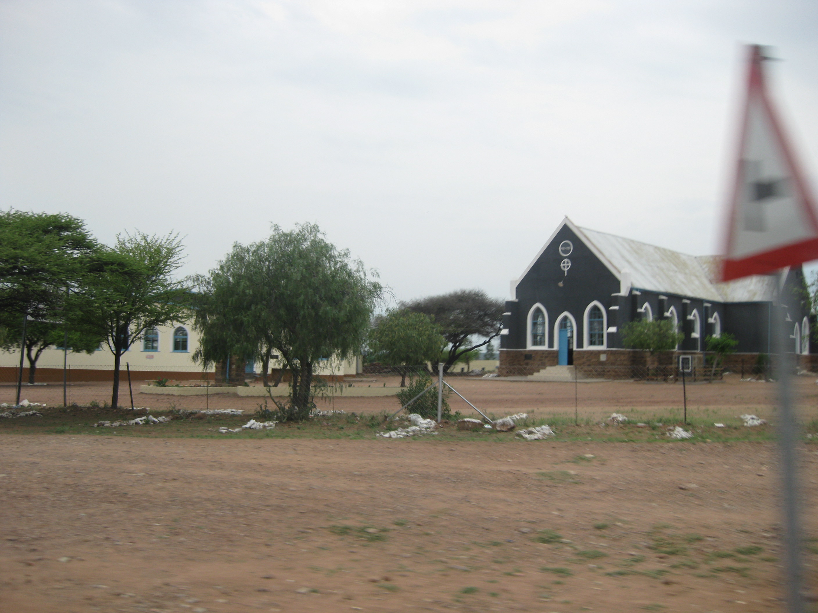
 Mall in Molepolole
 Church in Molepolole
 Scottish Livingstone Hospital in Molepolole
 The The New Scottish Livingstone Hospital located in Molepolole.
 The new Mafenyatlala Shopping Mall in Molepolole
Sites of Interest
Maphefo - This is an abandoned Kwena village site, situated 20–25 miles N-NE of Molepolole.
Maokagane Hills - Near "Kopong" caves. Among these hills are a) an iron smelting site; b) rock paintings and c) the Lowe cave at Kopong.
Ga Kala - in the Kopong hills. Old mining site about an hour's walk SE of Lentswe-le-tau, north of the Mochudi-Molepolole road. Lentswe-le-tau - An iron smelting site.
Kopong Hills - A cave; rock engravings in the hills and rock engravings some 18 miles north of Molepolole. Also Kopong water caves.
Molepolole - a) Execution Rock - Kobokwe; b) Sokwane, grave of Motswasele II situated NE of Molepolole; c) Footprints on the rock in Molepolole Hill; d) Burial cairns of Sechele I, Sebele I and Sebele II on kraal site of old Molepolole village site where Sebele I also stayed with favourite wife after village had moved to Borakalalo 1899/1900.
Borakalalo - a) Molepolole since 1899/1900; b) LMS Church in Borakalalo; c) Anglican Church built 1916.
Mokgophaneng - Sebele's cattle post and settlement of some Bakwena who left Molepolole Hill.
Logaga Lwa Ga Kabokwe - Livingstone and Sechele's Cave about 2 miles from Molepolole on Molepolole-Moshupa road. This cave is said to be the home of a spirit.
Dithubaruba - Kwena capital after Dimawe and Kolobeng; Livingstone arrived here in 1853.
Dithejwane - Situated 8 miles SSW of Molepolole on Kanye road. Has stone wall and hut foundation remains.
Kolobeng - a) Old Kwena capital until 1853. Dam on Kolobeng River for irrigation; b) Livingstone's house and workshop; c) Sechele's square house designed by Livingstone; d) Grave of Elizabeth Livingstone born and died there 1850.
Dimawe - Old Kwena capital after Kolobeng, settled in August 1851 and attacked by Boers in August 1852.
Letlhakane Valley - Rock engravings.
References
Urban villages 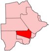
Rural villages Boatlaname · Botlhapatlou · Ditshegwane · Ditshukudu · Dutlwe · Gakgatla · Hatsalatladi · Kaudwane · Kgope · Khudumelapye · Kotolaname · Kubung · Kumakwane · Kweneng · Lentsweletau · Lephephe · Losilakgokong · Maboane · Mahetlwe · Malwelwe · Mantshwabisi · Metsimotlhaba · Mmankgodi · Mmanoko · Mmopane · Mogonono · Monwane · Moshaweng · Motokwe · Ngware · Salajwe · Sesung · Shadishadi · Sojwe · Sorilatholo · Takatokwane · Tsetseng · TswaaneCapitals of Districts of Botswana Capital, District 
Italics indicates national capital. Italics indicate capitals of districts - Gaborone
- Francistown
- Molepolole
- Serowe
- Selebi-Phikwe
- Maun
- Kanye
- Mahalapye
- Mogoditshane
- Mochudi
- Shakawe
- Lentsweletau
- Molapowabojang
- Gumare
- Tshabong
- Lerala
- Mmathethe
- Gweta
- Mathangwane
- Mmankgodi
Retrieved from Botswana's 2001 Population and Housing Census Coordinates: 24°25′S 25°32′E / 24.417°S 25.533°E
Categories:- Populated places in Botswana
- Capitals of Botswanan districts
- Kweneng District
- Botswana geography stubs


Wikimedia Foundation. 2010.