- Oakdale, Minnesota
-
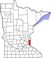
Oakdale, Minnesota — City — Location of Oakdale, Minnesota
Coordinates: 44°59′14″N 92°57′57″W / 44.98722°N 92.96583°W Country United States State Minnesota County Washington Area - Total 11.3 sq mi (29.2 km2) - Land 11.1 sq mi (28.7 km2) - Water 0.2 sq mi (0.5 km2) Elevation 1,070 ft (326 m) Population (2010)[1] - Total 27,378 - Density 2,408.4/sq mi (929.9/km2) Time zone Central (CST) (UTC-6) - Summer (DST) CDT (UTC-5) ZIP codes 55042, 55128 Area code(s) 651 FIPS code 27-47680[2] GNIS feature ID 0654516[3] Website www.ci.oakdale.mn.us Oakdale is a city in Washington County, Minnesota, United States, is a suburb of Saint Paul and is on the eastern side of the Twin Cities Metropolitan area. The population was 27,378 at the 2010 census.[1] Oakdale is the 32nd largest city in Minnesota, in terms of population.
The city of Oakdale today is the result of a consolidation of Oakdale and Northdale Townships in the 1970s, and continued to annex land well into the 1990s.
Oakdale lies entirely within the North St. Paul-Maplewood-Oakdale school district, but the city's students are split into two high schools. Tartan High School is located within the city's boundaries, and serves the southern half of Oakdale. The city's northern residents are served by North High School in North St. Paul.
Imation World Headquarters is located in Oakdale. Nearby 3M Headquarters employs many residents of the city.
Oakdale, Minnesota is currently the most populous of all municipalities that share the name 'Oakdale' in the United States.
Geography
According to the United States Census Bureau, the city has a total area of 11.3 square miles (29 km2), of which, 11.1 square miles (29 km2) of it is land and 0.2 square miles (0.52 km2) of it (1.86%)is water. Interstates 94 and 694 and Minnesota State Highways 5, 36, and 120 are five of the main routes in the community.
Demographics
Historical populations Census Pop. %± 1970 7,795 — 1980 12,123 55.5% 1990 18,374 51.6% 2000 26,653 45.1% 2010 27,378 2.7% U.S. Decennial Census As of the census[2] of 2000, there were 26,653 people, 10,243 households, and 7,129 families residing in the city. The population density was 2,408.4 people per square mile (929.6/km²). There were 10,394 housing units at an average density of 939.2 per square mile (362.5/km²). The racial makeup of the city was 92.21% White, 2.29% African American, 0.36% Native American, 2.45% Asian, 0.01% Pacific Islander, 0.77% from other races, and 1.91% from two or more races. Hispanic or Latino of any race were 2.75% of the population.
There were 10,243 households out of which 38.5% had children under the age of 18 living with them, 55.2% were married couples living together, 11.1% had a female householder with no husband present, and 30.4% were non-families. 25.2% of all households were made up of individuals and 7.2% had someone living alone who was 65 years of age or older. The average household size was 2.59 and the average family size was 3.14.
In the city the population was spread out with 29.0% under the age of 18, 7.2% from 18 to 24, 34.6% from 25 to 44, 20.7% from 45 to 64, and 8.4% who were 65 years of age or older. The median age was 34 years. For every 100 females there were 93.1 males. For every 100 females age 18 and over, there were 87.0 males.
The median income for a household in the city was $56,299, and the median income for a family was $66,680. Males had a median income of $42,371 versus $32,343 for females. The per capita income for the city was $24,107. About 2.9% of families and 3.6% of the population were below the poverty line, including 4.1% of those under age 18 and 3.9% of those age 65 or over.
Population projections put Oakdale's population at 30,000 by the year 2030.
References
- ^ a b "2010 Census Redistricting Data (Public Law 94-171) Summary File". American FactFinder. U.S. Census Bureau, 2010 Census. http://factfinder2.census.gov/faces/tableservices/jsf/pages/productview.xhtml?pid=DEC_10_PL_GCTPL2.ST13&prodType=table. Retrieved 23 April 2011.
- ^ a b "American FactFinder". United States Census Bureau. http://factfinder.census.gov. Retrieved 2008-01-31.
- ^ "US Board on Geographic Names". United States Geological Survey. 2007-10-25. http://geonames.usgs.gov. Retrieved 2008-01-31.
Municipalities and communities of Washington County, Minnesota County seat: Stillwater Cities Afton | Bayport | Birchwood Village | Cottage Grove | Dellwood | Forest Lake | Grant | Hastings‡ | Hugo | Lake Elmo | Lake St. Croix Beach | Lakeland Shores | Lakeland | Landfall | Mahtomedi | Marine on St. Croix | Newport | Oak Park Heights | Oakdale | Pine Springs | Scandia | St. Marys Point | St. Paul Park | Stillwater | Willernie | White Bear Lake‡ | Woodbury
Townships Baytown | Denmark | Grey Cloud Island | May | Stillwater | West Lakeland
Ghost towns Garen | Point Douglas
Footnotes ‡This populated place also has portions in an adjacent county or counties
Categories:- Cities in Minnesota
- Populated places in Washington County, Minnesota


Wikimedia Foundation. 2010.