- Durostor County
-
Judeţul Durostor — County (Judeţ) — 
Coat of arms
Country  Romania
Historic region Southern Dobruja County seat (Reşedinţă de judeţ) Silistra Established After the Treaty of Bucharest (1913) Ceased to exist Administrative and Constitutional Reform in 1938 Government – Prefect Area – Land 3,226 km2 (1,245.6 sq mi) Population (1930) – Total 211,413 Time zone EET (UTC+2) – Summer (DST) EEST (UTC+3) Durostor was a county (judeţ) of Romania, in Southern Dobruja, with the seat at Silistra (then Dârstor).
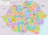
The county consisted of 4 districts (plăşi): Accadânlar, Curtbunar, Silistra and Turtucaia. The county was neighbored by the counties of Ilfov and Ialomiţa to the north, Caliacra and Constanţa to the east and the Kingdom of Bulgaria to the south.
The region was annexed by Romania as a result of the Balkan wars. Bulgaria managed to regain it between 1916 and 1918, but then lost it again after the end of World War I (see Treaty of Neuilly).
Contents
Etymology
The county was named after the Roman name of Silistra, Durostorum.
Coat of arms
The Coat of Arms depicted Mircea the Elder.
Population
According to the Romanian census of 1930 the population of Durostor County was 211,413, of which 42.8% were ethnic Turks, 34.2% ethnic Bulgarians, 19.0% ethnic Romanians and 1.4% Gypsies. Classified by religion: 54.0% Orthodox Christian, 45.1% Islam.
After 1938
After the 1938 Administrative and Constitutional Reform, the county was merged with counties of Constanţa, Caliacra and Ialomiţa to form the Ţinutul Mării.
On September 7, 1940, the former county (except for the north-eastern corner comprising Ostrov and Lipniţa communes) with the whole Southern Dobruja was returned to Bulgaria (see Treaty of Craiova).
See also
External links
- (Romanian) Durostor County on memoria.ro
- Alba
- Arad
- Argeş
- Bacău
- Baia
- Bălţi
- Bihor
- Botoşani
- Braşov
- Brăila
- Buzău
- Cahul
- Caliacra
- Câmpulung
- Caraş
- Cernăuţi
- Cetatea Albă
- Ciuc
- Cluj
- Constanţa
- Covurlui
- Dâmboviţa
- Dolj
- Dorohoi
- Durostor
- Făgăraş
- Fălciu
- Gorj
- Hotin
- Hunedoara
- Ialomiţa
- Iaşi
- Ilfov
- Ismail
- Lăpuşna
- Maramureş
- Mehedinţi
- Mureş
- Muscel
- Năsăud
- Neamţ
- Odorhei
- Olt
- Orhei
- Prahova
- Putna
- Rădăuţi
- Râmnicu Sărat
- Roman
- Romanaţi
- Satu Mare
- Sălaj
- Severin
- Sibiu
- Someş
- Soroca
- Storojineţ
- Suceava
- Târnava-Mare
- Târnava-Mică
- Tecuci
- Teleorman
- Tighina
- Timiş-Torontal
- Trei Scaune
- Tulcea
- Turda
- Tutova
- Vaslui
- Vâlcea
- Vlaşca
 Categories:
- Dobruja
- Former counties of Romania


Wikimedia Foundation. 2010.