- Ridgeland, Mississippi
Infobox Settlement
imagesize =
image_caption =
image_size =
official_name = Ridgeland, Mississippi
settlement_type =City
nickname =
motto =
imagesize =
image_caption =
image_size =
official_name = Ridgeland, Mississippi
settlement_type =City
nickname =
motto =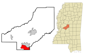
mapsize = 250px
map_caption =
mapsize1 =
map_caption1 =
subdivision_type = Country
subdivision_type1 = State
subdivision_type2 = County
subdivision_name =United States
subdivision_name1 =Mississippi
subdivision_name2 = Madison
government_type =
leader_title =Mayor
leader_name = Gene F. McGee
established_title = City
established_date =
area_magnitude =
area_total_sq_mi = 17.7
area_total_km2 = 45.9
area_land_sq_mi = 15.9
area_land_km2 = 41.2
area_water_sq_mi = 1.8
area_water_km2 = 4.7
population_as_of = 2000
population_note =
population_total = 20173
population_urban =
population_density_km2 = 240.8
population_density_sq_mi = 623.9
timezone = CST
utc_offset = -6
timezone_DST = CDT
utc_offset_DST = -5
latd = 32 |latm = 25 |lats = 8 |latNS = N
longd = 90 |longm = 7 |longs = 30 |longEW = W
elevation_m = 109
elevation_ft = 358
website = http://www.ridgelandms.org/
postal_code_type =ZIP code s
postal_code = 39157-39158
area_code = 601
blank_name = FIPS code
blank_info = 28-62520
blank1_name = GNIS feature ID
blank1_info = 0676656
footnotes =Ridgeland is a city in Madison County,
Mississippi ,United States . The population was 20,173 at the 2000 census. It is part of the Jackson Metropolitan Statistical Area.Geography
Ridgeland is located at coor dms|32|25|8|N|90|7|30|W|city (32.418847, -90.124933)GR|1, between Madison to the north and Jackson to the south. This suburban community enjoys its location adjacent to the
Ross Barnett Reservoir .According to the
United States Census Bureau , the city has a total area of 17.7square mile s (45.9km² ), of which, 15.9 square miles (41.2 km²) of it is land and 1.8 square miles (4.7 km²) of it (10.16%) is water mostly due to the location of the Ross Barnett Reservoir.Demographics
As of the
census GR|2 of 2000, there were 20,173 people, 9,267 households, and 39,022 families residing in the city. Thepopulation density was 1,267.4 people per square mile (489.2/km²). There were 9,930 housing units at an average density of 623.9/sq mi (240.8/km²). The racial makeup of the city was 77.05% White, 18.44% African American, 0.15% Native American, 2.95% Asian, 0.04% Pacific Islander, 0.55% from other races, and 0.82% from two or more races. Hispanic or Latino of any race were 1.55% of the population.There were 9,267 households out of which 28.8% had children under the age of 18 living with them, 40.7% were married couples living together, 10.4% had a female householder with no husband present, and 45.8% were non-families. 38.6% of all households were made up of individuals and 6.5% had someone living alone who was 65 years of age or older. The average household size was 2.15 and the average family size was 2.90.
In the city the population was spread out with 23.4% under the age of 18, 10.2% from 18 to 24, 40.3% from 25 to 44, 17.8% from 45 to 64, and 8.2% who were 65 years of age or older. The median age was 32 years. For every 100 females there were 89.9 males. For every 100 females age 18 and over, there were 86.7 males.
The median incomes for a household in the city was $43,066, and the median income for a family was $59,249. Males had a median income of $40,632 versus $29,634 for females. The
per capita income for the city was $28,704. About 5.5% of families and 7.4% of the population were below thepoverty line , including 9.2% of those under age 18 and 5.6% of those age 65 or over.History
In 1805, the
Choctaw Indian Agency was located in the area now known as Ridgeland. The Agency was called Turner Brashear's Stand. The agent in charge was Silas Dinsmor. Around 1850, Brashear's Stand was renamed King's Inn. The Inn was used as a headquarters by General Stephen Lee during theAmerican Civil War . King's Inn was lost to fire in 1896.In 1853, James B. Yellowley founded the community of Yellowley's Crossing (later named Jessamine, after his wife). Two Chicago developers, Edward Treakle and Gordon Nichols, purchased the land from Yellowley and founded Highland Colony. They laid out a city which they named Ridgeland and enticed settlers from the Northern US to move south. Farming thrived with pears and strawberries among the chief crops.
Education
The City of Ridgeland is served by the Madison County School District.
Residents
* Country music artist
Faith Hill was born in Ridgeland and raised in nearby Star.References
External links
Wikimedia Foundation. 2010.