- North Kansas City, Missouri
-
North Kansas City, Missouri — City — http://en.wikipedia.org/wiki/File:City_of_North_Kansas_City.jpg Nickname(s): Northtown, NKC Location of North Kansas City, Missouri U.S. Census map
Coordinates: 39°8′20″N 94°34′14″W / 39.13889°N 94.57056°WCoordinates: 39°8′20″N 94°34′14″W / 39.13889°N 94.57056°W Country United States State Missouri County Clay Area – Total 4.6 sq mi (12.0 km2) – Land 4.4 sq mi (11.3 km2) – Water 0.3 sq mi (0.7 km2) Elevation 741 ft (226 m) Population (2000) – Total 4,714 – Density 1,080.0/sq mi (417.0/km2) Time zone Central (CST) (UTC-6) – Summer (DST) CDT (UTC-5) ZIP code 64116 Area code(s) 816 FIPS code 29-53102[1] GNIS feature ID 0723477[2]  North Kansas City is depicted in the area on the left of the bend in the Missouri River.
North Kansas City is a city in Clay County, Missouri, United States and is an independent municipality that is a part of the Kansas City metropolitan area. The population was 4,714 as of the 2000 census but a large business/industrial base swells the daytime population by thousands more. Originally a northern suburb across the Missouri River from Kansas City, Missouri, it is now almost completely surrounded by Kansas City, which has annexed far to the north of North Kansas City's northern city limits. North Kansas City also adjoins the small municipality of Avondale.
Contents
Geography
North Kansas City is located at 39°8′20″N 94°34′14″W / 39.13889°N 94.57056°W (39.139007, -94.570518)[3].
According to the United States Census Bureau, the city has a total area of 4.6 square miles (12 km2), of which, 4.4 square miles (11 km2) of it is land and 0.3 square miles (0.78 km2) of it (5.82%) is water.
Transportation
Highways connecting North Kansas City with the surrounding area are Interstate 29/35/US 71, Missouri Route 1 (Vernon Street), Route 9 (Burlington Street), Route 210 (Armour Road), Route 269 (Chouteau Trafficway), and Route 283 (North Oak Trafficway). The US 169 (Broadway Extension) freeway runs immediately to the west of North Kansas City's city limits.
Four highway bridges connect North Kansas City with the portion of Kansas City, Missouri south of the Missouri River. They are the Broadway Bridge on US 169, Heart of America Bridge on Route 9, the Bond Bridge/ New Paseo Bridge on I-29/35/US 71, and the Chouteau Bridge on Route 269. A fifth bridge to the west of the Heart of America Bridge, the ASB Bridge, originally carried road and rail traffic, but is now only a rail bridge. A dedicated bicycle/pedestrian path on the Heart of America Bridge opened in October 2010.[4]
Demographics
As of the census[1] of 2000, there were 4,714 people, 2,546 households, and 1,013 families residing in the city. The population density was 1,080.0 people per square mile (417.5/km²). There were 2,779 housing units at an average density of 636.7 per square mile (246.1/km²). The racial makeup of the city was 82.48% White, 3.97% African American, 0.59% Native American, 4.29% Asian, 0.23% Pacific Islander, 3.31% from other races, and 5.13% from two or more races. Hispanic or Latino of any race were 8.44% of the population.
There were 2,546 households out of which 18.1% had children under the age of 18 living with them, 24.7% were married couples living together, 11.0% had a female householder with no husband present, and 60.2% were non-families. 51.1% of all households were made up of individuals and 12.9% had someone living alone who was 65 years of age or older. The average household size was 1.85 and the average family size was 2.77.
In the city the population was spread out with 18.0% under the age of 18, 12.7% from 18 to 24, 34.3% from 25 to 44, 20.9% from 45 to 64, and 14.1% who were 65 years of age or older. The median age was 36 years. For every 100 females there were 94.1 males. For every 100 females age 18 and over, there were 92.2 males.
The median income for a household in the city was $28,674, and the median income for a family was $33,906. Males had a median income of $27,487 versus $26,591 for females. The per capita income for the city was $18,967. About 10.6% of families and 12.5% of the population were below the poverty line, including 21.7% of those under age 18 and 5.9% of those age 65 or over.
History
In 1883, Willard E. Winner came to the area with plans to build a city north of Kansas City across the Missouri River, and connect the two by a bridge. He built a rock road that became Swift Avenue and he started constructing a bridge across the Missouri River. He then purchased land and laid subdivisions in town lots. The city was well planned and built with homes, commercial houses, paved and lighted streets, a water works system and parks in advance of its inhabitants. The district was incorporated on November 4, 1912, as the Town of North Kansas City.
While 4,714 people reside in North Kansas City, the industrial/business portion of the city comprises approximately 3/4ths of the land area making the daytime population much larger.
Municipal government
North Kansas City has a Mayor/Council/City Administrator form of government. Two council members are elected to two year terms from each of the four wards. The mayor serves a four year term. The current mayor, William Biggerstaff, was elected in 2009. Steve Fuller currently sits as Judge.
City services
The Fire Department has approximately 60 EMS personnel occupying two stations. The police department has approximately 40 sworn police officers and approximately 10 civilian personnel. North Kansas City has its own hospital, library and park system. Macken Park is an approximate 60-acre (240,000 m2) park with a walking trail, running track, picnic shelters, playgrounds, lighted tennis and handball courts, baseball fields, soccer fields and basketball courts. Dagg Park, located east of City Hall features picnic tables, children's playground, wading pool, and fountain. The North Kansas City Parks and Recreation Department offers an extensive list of programs and activities year-round. The city cooperates with local merchants in providing area residents and workers with entertainment events like Northtown's Noontime Friday in the Park concerts, parades and special displays.
North Kansas City Library, located at the southeast corner of 23rd and Howell, offers loans of books, magazines, video tapes, DVDs, and compact discs. The library is also North Kansas City High School's media center. The library is run by the city and is not a part of the Kansas City Public Library or the Mid-Continent Public Library systems. North Kansas City Hospital, founded in 1958, is a primary acute care center with 451 beds.
References
- ^ a b "American FactFinder". United States Census Bureau. http://factfinder.census.gov. Retrieved 2008-01-31.
- ^ "US Board on Geographic Names". United States Geological Survey. 2007-10-25. http://geonames.usgs.gov. Retrieved 2008-01-31.
- ^ "US Gazetteer files: 2010, 2000, and 1990". United States Census Bureau. 2011-02-12. http://www.census.gov/geo/www/gazetteer/gazette.html. Retrieved 2011-04-23.
- ^ Missouri Department of Transportation (1 October 2010). "Ribbon Cutting Opens Heart of America Bridge Bike/Pedestrian Path". http://www.modot.org/kansascity/newrelease/District4News.shtml?action=displaySSI&newsId=60867. Retrieved 9 January 2011.
External links
- City of North Kansas City
- North Kansas City Police Department
- North Kansas City Hospital
- North Kansas City Public Library
- North Kansas City Schools
- Historic maps of North Kansas City in the Sanborn Maps of Missouri Collection at the University of Missouri
Kansas City Metropolitan Area's cities and counties Central city 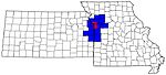
Largest cities (over 100,000 in 2000) Medium-sized cities (10,000 to 100,000 in 2000) Blue Springs • Belton • Excelsior Springs • Gladstone • Grandview • Lansing • Leawood • Leavenworth • Lee's Summit • Lenexa • Liberty • Merriam • Ottawa • Prairie Village • Raymore • Raytown • ShawneeCounties Municipalities and communities of Clay County, Missouri Cities Avondale | Excelsior Springs‡ | Gladstone | Glenaire | Holt‡ | Independence‡ | Kansas City‡ | Kearney | Liberty | Lawson‡ | Missouri City | Mosby | North Kansas City | Pleasant Valley | Smithville‡ | Sugar Creek‡

Villages Birmingham | Claycomo | Excelsior Estates‡ | Oaks | Oakview | Oakwood | Oakwood Park | Prathersville | Randolph
Townships Chouteau | Fishing River | Gallatin | Kearney | Liberty | Platte | Washington
Unincorporated
communityFootnotes ‡This populated place also has portions in an adjacent county or counties
Categories:- Kansas City metropolitan area
- Cities in Clay County, Missouri
- Missouri populated places on the Missouri River


Wikimedia Foundation. 2010.