- Boonville, Missouri
Infobox Settlement
official_name = Boonville, Missouri
settlement_type =City
nickname =
motto =
imagesize = 250px
image_caption = MKT Depot and Bridge on the Katy Trail
image_
image_
mapsize = 250x200px
map_caption = Location of Boonville, Missouri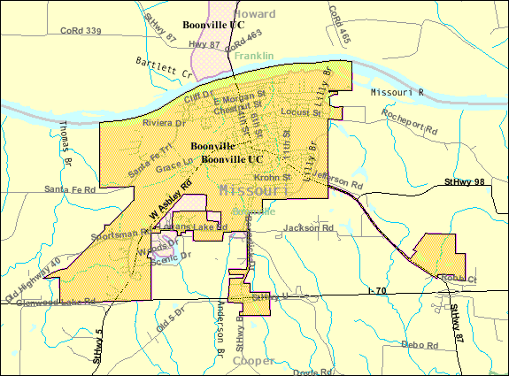
mapsize1 = 250px
map_caption1 = U.S. Census Mapsubdivision_type = Country
subdivision_name =United States
subdivision_type1 = State
subdivision_name1 =Missouri
subdivision_type2 = County
subdivision_name2 = Cooper
government_footnotes =
government_type =
leader_title =
leader_name =
leader_title1 =
leader_name1 =
established_title =
established_date =unit_pref = Imperial
area_footnotes =area_magnitude =
area_total_km2 = 19.0
area_land_km2 = 17.8
area_water_km2 = 1.2
area_total_sq_mi = 7.3
area_land_sq_mi = 6.9
area_water_sq_mi = 0.5population_as_of = 2000
population_footnotes =
population_total = 8202
population_density_km2 = 459.8
population_density_sq_mi = 1190.8timezone = Central (CST)
utc_offset = -6
timezone_DST = CDT
utc_offset_DST = -5
elevation_footnotes =
elevation_m = 203
elevation_ft = 666
latd = 38 |latm = 57 |lats = 54 |latNS = N
longd = 92 |longm = 44 |longs = 30 |longEW = Wpostal_code_type =
ZIP code
postal_code = 65233
area_code = 660
blank_name = FIPS code
blank_info = 29-07318GR|2
blank1_name = GNIS feature ID
blank1_info = 0714540GR|3
website =
footnotes =Boonville is a city in Cooper County,
Missouri , USA. The population was 8,202 at the 2000 census. It is thecounty seat of Cooper CountyGR|6. The city was the site of a skirmish early in theAmerican Civil War on July 17, 1861. Union forces easily brushed aside a small and poorly equipped force of theMissouri State Guard in the so-calledBattle of Boonville .Geography
Boonville is located at coor dms|38|57|54|N|92|44|30|W|city (38.965017, -92.741757)GR|1. According to the
United States Census Bureau , the city has a total area of 7.3square mile s (19.0km² ), of which, 6.9 square miles (17.8 km²) of it is land and 0.5 square miles (1.2 km²) of it (6.26%) is water.Demographics
As of the
census GR|2 of 2000, there were 8,202 people, 2,667 households, and 1,696 families residing in the city. Thepopulation density was 1,190.8 people per square mile (459.6/km²). There were 3,041 housing units at an average density of 441.5/sq mi (170.4/km²). The racial makeup of the city was 80.22% White, 16.84% African American, 0.51% Native American, 0.41% Asian, 0.04% Pacific Islander, 0.40% from other races, and 1.57% from two or more races. Hispanic or Latino of any race were 1.23% of the population.There were 2,667 households out of which 30.2% had children under the age of 18 living with them, 48.5% were married couples living together, 11.8% had a female householder with no husband present, and 36.4% were non-families. 31.2% of all households were made up of individuals and 15.9% had someone living alone who was 65 years of age or older. The average household size was 2.33 and the average family size was 2.93.
In the city the population was spread out with 19.6% under the age of 18, 20.8% from 18 to 24, 27.4% from 25 to 44, 16.7% from 45 to 64, and 15.4% who were 65 years of age or older. The median age was 30 years. For every 100 females there were 138.8 males. For every 100 females age 18 and over, there were 146.0 males.
The median income for a household in the city was $33,440, and the median income for a family was $40,294. Males had a median income of $28,498 versus $20,739 for females. The
per capita income for the city was $14,854. About 9.5% of families and 11.3% of the population were below thepoverty line , including 13.4% of those under age 18 and 6.7% of those age 65 or over.Recreation
Boonville is near the middle of the Katy Trail, a 225-mile state park enjoyed by cyclists and hikers. Katy Trail Bridge in Boonville, which crosses the Missouri near the [http://www.isleofcapricasinos.com/Boonville/ Isle of Capri Casino] and Historic Selwyn Shoe Factory (which has been refurnished as apartments), has been subject of controversy. The railroad would like the bridge to be taken down so the metal can be melted and reused. However, Friends of Historic Boonville and others across the state oppose the idea.
Annually, Boonville celebrates Boonville Heritage Days. This is a summer weekend event that focuses on heritage. There is a parade, craft booths, and much fun for people of all ages. Other annual events include the Festival of the Leaves, and an annual Halloween parade. There was also a local theater, but due to lack of sales since most people go to nearby Columbia, the theater has been converted to a church. The
Thespian Hall downtown is used for concerts, art shows, and plays. There is a small town commitment to the arts in this and surrounding towns.Notable residents
* Julia Lee, blues singer and pianist
*Minus Story (band)
*Joseph Franklin Rutherford (2nd President of the Jehovah's Witnesses)
*Frederick T. Kemper , founder of school later known asKemper Military School .
* ColonelThomas A. Johnston , Builder ofKemper Military School , Superintendent and President from 1881 to 1928.
* ColonelArthur M. Hitch , Superintendent ofKemper Military School , 1928-1948.
* Walter Williams, founder of theMissouri School of Journalism and former president of theUniversity of Missouri .
*George Graham Vest , U.S. Senator from Missouri
*Henry L. Myers , U.S. Senator from Montana
*Henry S. Benedict , U.S. Congressman fromCalifornia .
*Nathaniel Albertson , U.S. Congressman fromIndiana .
*John Cosgrove , U.S. Congressman from Missouri.
*Dorsey W. Shackleford , U.S. Congressman fromMissouri .
*John Gaines Miller , U.S. Congressman from Missouri.
*Robert Patterson Clark Wilson , U.S. Congressman fromMissouri .
*Theron Moses Rice , U.S. Congressman fromMissouri .
*George Ainslie , Congressional delegate fromIdaho Territory .References
External links
* [http://www.boonvillemo.org/indexmda.html Official Boonville site]
* [http://www.boonvillemochamberofcommerce.com/index.html Boonville Area Chamber of Commerce]
* [http://www.friendsofhistoricboonville.org/index.html Boonville Historical Society]
Wikimedia Foundation. 2010.