- Strafford, Missouri
Infobox Settlement
official_name = Strafford, Missouri
settlement_type =City
nickname =
motto =
imagesize =
image_caption =
image_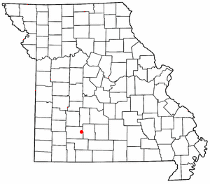
mapsize = 250px
map_caption = Location of Strafford, Missouri
mapsize1 =
map_caption1 =subdivision_type = Country
subdivision_name =United States
subdivision_type1 = State
subdivision_name1 =Missouri
subdivision_type2 = County
subdivision_name2 = Greene
government_footnotes =
government_type =
leader_title =
leader_name =
leader_title1 =
leader_name1 =
established_title =
established_date =unit_pref = Imperial
area_footnotes =area_magnitude =
area_total_km2 = 6.0
area_land_km2 = 6.0
area_water_km2 = 0.0
area_total_sq_mi = 2.3
area_land_sq_mi = 2.3
area_water_sq_mi = 0.0population_as_of = 2000
population_footnotes =
population_total = 1845
population_density_km2 = 305.0
population_density_sq_mi = 789.9timezone = Central (CST)
utc_offset = -6
timezone_DST = CDT
utc_offset_DST = -5
elevation_footnotes =
elevation_m = 454
elevation_ft = 1490
latd = 37 |latm = 16 |lats = 12 |latNS = N
longd = 93 |longm = 7 |longs = 19 |longEW = Wpostal_code_type =
ZIP code
postal_code = 65757
area_code = 417
blank_name = FIPS code
blank_info = 29-71062GR|2
blank1_name = GNIS feature ID
blank1_info = 0727168GR|3
website =
footnotes =Strafford is a city in eastern Greene County,
Missouri ,United States . The population was 1,845 at the 2000 census. It is part of theSpringfield, Missouri Metropolitan Statistical Area.Demographics
As of the
census GR|2 of 2000, there were 1,845 people, 683 households, and 499 families residing in the city. Thepopulation density was 789.9 people per square mile (304.4/km²). There were 720 housing units at an average density of 308.3/sq mi (118.8/km²). The racial makeup of the city was 97.67% White, 0.33% African American, 0.65% Native American, 0.05% Asian, 0.16% from other races, and 1.14% from two or more races. Hispanic or Latino of any race were 1.79% of the population.There were 683 households out of which 41.3% had children under the age of 18 living with them, 55.1% were married couples living together, 12.3% had a female householder with no husband present, and 26.9% were non-families. 22.7% of all households were made up of individuals and 8.5% had someone living alone who was 65 years of age or older. The average household size was 2.62 and the average family size was 3.08.
In the city the population was spread out with 28.9% under the age of 18, 9.1% from 18 to 24, 31.3% from 25 to 44, 20.4% from 45 to 64, and 10.3% who were 65 years of age or older. The median age was 32 years. For every 100 females there were 94.6 males. For every 100 females age 18 and over, there were 87.7 males.
The median income for a household in the city was $36,111, and the median income for a family was $39,722. Males had a median income of $28,167 versus $21,920 for females. The
per capita income for the city was $14,858. About 9.9% of families and 12.3% of the population were below thepoverty line , including 15.9% of those under age 18 and 12.0% of those age 65 or over.History
On
January 7 2008 Strafford was hit by an EF-3 Tornado.References
External links
* [http://www.straffordmissouri.org City website]
Wikimedia Foundation. 2010.