- Mljet
-
Mljet 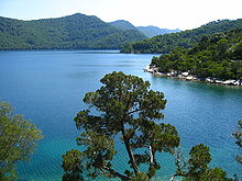
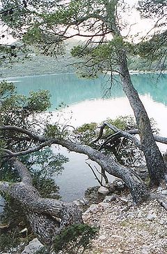
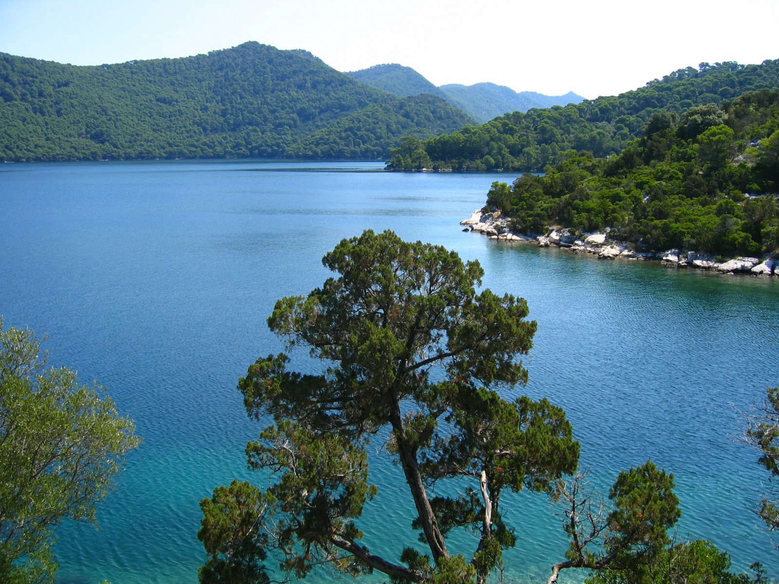
Great Lake of Mljet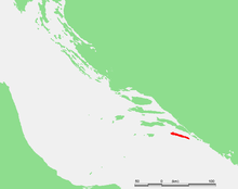
Geography Location Adriatic sea Coordinates 42°44′N 17°31′E / 42.733°N 17.517°ECoordinates: 42°44′N 17°31′E / 42.733°N 17.517°E Archipelago Adriatic islands Area 98.01 km2 (37.842 sq mi) Length 37 km (23 mi) Width 3.2 km (1.99 mi) Coastline 135.185 km (84.0001 mi) Highest elevation 514 m (1,686 ft) Highest point Veliki grad Country CroatiaCounty Dubrovnik-Neretva Largest city Babino Polje (pop. 336) Demographics Population 1,111 (as of 2001) Density 11.34 /km2 (29.37 /sq mi) Ethnic groups 97.93% Croats Mljet (pronounced [mʎɛ̂t]; Latin: Melita, Italian: Meleda) is the most southerly and easterly of the larger Adriatic islands of the Dalmatia region of Croatia. The National Park includes the western part of the island, Veliko jezero, Malo jezero, Soline Bay and a sea belt 500 m wide from the most prominent cape of Mljet covering an area of 54 km2. The central parts of the park are Veliko jezero with the Isle of St. Mary, Malo jezero and the villages of Govedari (179 inhabitants), Polače (123 inhabitants) and Pomena (50 inhabitants).[1]
Contents
Population
According to the 2001 census, Mljet has population of 1,111. Croats make up an absolute majority with 97.93% of the population.
History
Mljet was discovered by ancient Greco-Roman geographers, who wrote the first records and descriptions. The island was first described by Scylax of Caryanda in the 6th century BC; others prefer the text, Periplus of Pseudo-Scylax. In both texts, it is named Melite and supported by Apollonius of Rhodes.[2] [3] Agathemerus and Pliny the Elder call the island Melita.[3] Agesilaus of Anaxarba in Cilicia, the father of Oppian, was banished to Mljet by the Roman Emperor Septimus Severus (AD 145-211)[4] (or to Malta by Lucius Verus: see Oppian).
 Monastery of Saint Mary
Mljet is mentioned around 950 by the Byzantine Emperor Constantine VII Porphyrogenitos in his Of Ruling an Empire as one of the islands held by the Neretvians. The island was often a controversy of ownership between Pagania and Zachlumia until the stronger unifications of the Serbian realm in the 12th century.
Mljet has been regarded as the "Melita" on which Saint Paul was shipwrecked (Acts of the Apostles 27:39-28:11), this view being first expounded in the 10th century, by Eastern Roman Emperor Constantine Porphyrogenitus. Saint Paul's shipwreck is generally placed on the Mediterranean island of Malta. Mljet and Malta had the same name in the Greek and Roman sources; the mention of a viper in Acts 28:3-5 was thought to be in favour of Mljet (but there are snakes on both Mljet and Malta). A harbour named after the Saint exists on both islands.
The Benedictines from Pulsano in Apulia became the feudal lords of the island in 1151, having come from Monte Gargano in Italy. They came ashore in the Sutmiholjska cove and Serbian Prince Desa of the House of Vojislavljević built and donated to them the Church and Monastery of Saint Mary on the islet in the Big Lake (1187–1198). Pope Innocent III issued a document consecrating the church in 1198.
The island was under the rule of Stefan Nemanja in 1166-1168. In 1222, the Serbian King Stefan II the First-crowned of Nemanja gifted his lands and monasteries and church on Krkar to the Benedictine Order of Mljet. After serving as the last Serbian maritime bastion, Serbian Emperor Stefan Uroš V gifted the island to Balša I in 1357.[citation needed]
The Benedictines renounced their rule over the island in 1345, keeping only a third of the land. The island got a statute and a municipality in Babino Polje. It was formally annexed by the Republic of Ragusa in 1410. According to the Contract with the Benedictines, the municipality had to pay 300 perpers each year.
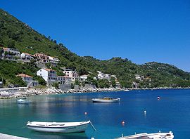
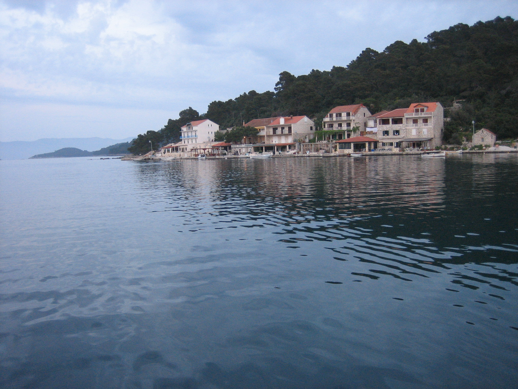
 Seaside of Pomena
In the 16th century, the monastery was the center of the Mljet Congregation (Congregatio Melitensis or Melitana), gathering all the monasteries of Benedictine monks in the area of the Republic of Ragusa. The first president of the Congregation was Mavro Vetranović, the abbot of the Mljet monastery and the famous poet. Another great poet was abbot there - Ignjat Đurđević in the 18th century. As time went by, the Benedictine monastery on Mljet lost its importance, while the seat of the Mljet Congregation moved to Sveti Jakov near Ragusa.
In 1809, during the rule of Napoleon, the Mljet monastery was disbanded. When Austria took over the island, it placed the forestry office in the building. Between the world wars, the building was owned by the Ragusa (Dubrovnik) Bishopric. In 1960 it became a hotel, and in 1998 it was returned to the bishopric.
The island has a long history of eco-damage. In order to ease their transport problems, the monks dug a channel to the south coast, from the lake, thus turning both fresh-water lakes into seawater-based ones.
The second incident involves mongooses. These were introduced onto the island in the Middle Ages in order to reduce the snake population (the island was apparently completely overrun). Whilst the mongooses completed this task, they also disposed of pretty much all the birdlife of the island, especially eggs. To this day, the island is notably short of hedgerow birds such as sparrows.
Geography
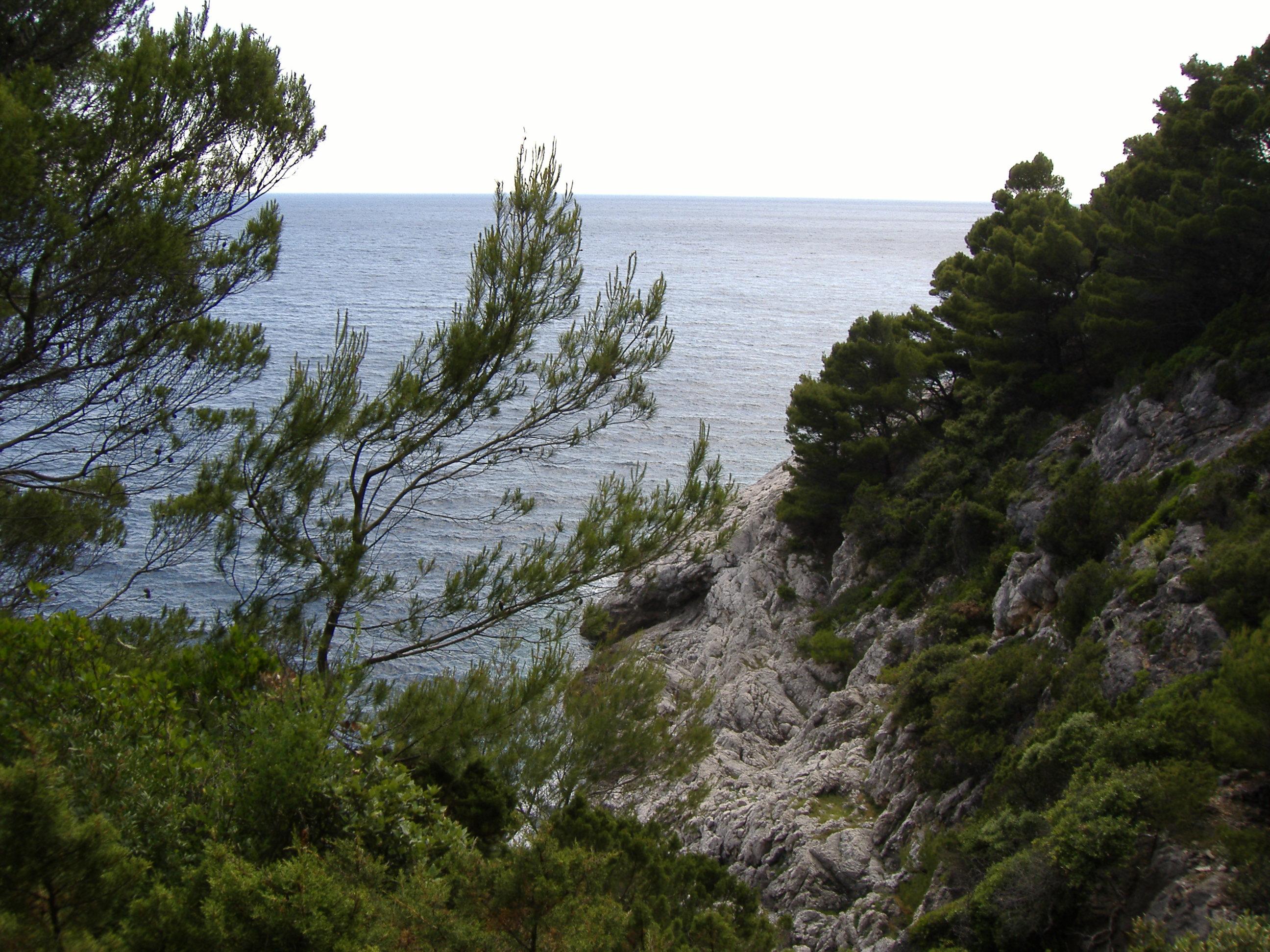
 Mljet Coastline
Mljet lies south of the Pelješac peninsula, from which it is divided by the Mljet Channel. Its length is 37 kilometres (23 mi); its average breadth 3.2 kilometres (2.0 mi). It is of volcanic origin,[citation needed] with numerous chasms and gorges, of which the longest, the Babino Polje, connects the north and south of the island. Port Polače, the principal harbour in the north, is a port of call for tourist ferries. Mljet contains one hotel - The Odisej (from the Greek Odysseus) in the north-west corner of the island.
The northwestern part of the island includes an inland sea as well as a small island within it. It has been a national park since November 12, 1960.
Ancient Greeks called the island "Melita" or "honey" which over the centuries evolved to become the Slavic name, Mljet (pronounced [mʎɛt]).
Over 84% of the island of 98.01 square kilometres (37.84 sq mi) is forest.[5] The island's geological structure consists of limestone and dolomite forming ridges, crests and slopes. A few depressions on the island of Mljet are below sea level and are known as blatine ("mud-lakes") or slatine ("salt-lakes"). During the rain seasons all blatine are filled with water and turn to brackish during dry seasons.
The climate is Mediterranean; an average air temperature in January is 9 °C (48 °F) and in July about 24 °C (75 °F).
Settlements
 Sobra, Mljet Island
According to the 2001 census, the settlements of Mljet have the following population.
- Babino Polje (336) - largest settlement, police station, school
- Goveđari (165)
-
- Babine Kuće
- Pristaniste
- Soline
- Pomena (37) - hotel odisej
- Polače (115) - ferry port, Roman ruins
- Blato (46)
- Ropa (32) - auto camp
- Kozarica (28)
- Sobra (102) - ferry port
- Prožura (53)
-
- Prožurska Luka (14)
- Maranovići (54)
- Okuklje (20)
- Korita (74)
- Saplunara (35) - beach
Transportation
The island of Mljet has no airport. Dubrovnik Airport on the mainland provides the main international connection for the island. Mljet has ferry lines with Pelješac peninsula and Dubrovnik. Transportation to the island is provided by Jadrolinija ferry service. Sobra, the main port on the island, is connected to Dubrovnik-Gruž and Ston via a car ferry. There is also a ferry between Polače and Trstenik (Pelješac peninsula). There are two type of ferries available: a car ferry and a faster catamaran ferry (2.5 hours and 90 minutes to Dubrovnik, respectively).
The two-lane paved road runs throughout the island. Scheduled buses on Mljet travel just once or twice a day.
References
- ^ Naklad Naprijet, The Croatian Adriatic Tourist Guide, pg. 338, Zagreb (1999), ISBN 953-178-097-8
- ^ Sanader, Mirjana. Kroatien in der Antike, Von Zabern, 2007., ISBN 380533740X, p 58. (German)
“ In der Antike hieß sie Melite (Pseudo-Skylax 23), obwohl sie bei Apollonios Rhodios (4, 5629) auch als Meleda erwähnt wird. ” - ^ a b Bryant, Jacob. (1715-1804) A New System, Or, An Analysis of Antient Mythology: Wherein an Attempt is Made to Divest Tradition of Fable and to Reduce the Truth to Its Original Purity, The Third Edition in Six Volumes, printed for J. Walker; W. J. and J. Richardson; by R. Faulder Press, 1807., Vol. V., pp 357-358. (English)
- ^ Text from ancientlibrary.com
- ^ "Priručnik o kartama staništa Dalmacije" (in Croatian and English) (PDF). June 2009. p. 103. http://www.undp.hr/upload/file/227/113690/FILENAME/31_07_Kartiranje_stanista_Dal...u_prioritetnim_podrucjima_S_.pdf. Retrieved 14 February 2011.
 This article incorporates text from a publication now in the public domain: Chisholm, Hugh, ed (1911). Encyclopædia Britannica (11th ed.). Cambridge University Press.
External links
- Mljet National Park
- Mljet Tourist Information (Croatian)
- Island of Mljet - Home Page
- / Excursions and day trips from Korčula to Mljet
- Mljet presented by Dubrovnik Guide
- Mljet Information - Zvonko's Travels
- Small Travel Guide to Mljet
- More information about Mljet
- More information about Mljet National Park
- Sobra & Pomena
Protected areas of Croatia National parks Nature parks Kopački rit • Papuk • Lonjsko polje • Medvednica • Žumberak-Samoborsko gorje • Učka • Velebit • Vransko lake • Telašćica • Biokovo • LastovoSubdivisions of Dubrovnik-Neretva County Cities and towns 
Municipalities Adriatic islands of Croatia Lists: Complete list · Inhabited islands > 100 km2 10–100 km2 1–10 km2 Arta Velika · Biševo · Dolin · Drvenik Mali · Goli otok · Ilovik · Ist · Jakljan · Kakan · Kaprije · Katina · Koločep · Kurba Vela · Lavdara · Lavsa · Levrnaka · Lopud · Mali Brijun · Maun · Mrčara · Piškera · Planik · Plavnik · Premuda · Prežba · Prvić (Šibenik) · Rava · Rivanj · Šćedro · Sit · Smokvica Vela (Kornat) · Škarda · Škrda · Sušac · Susak · Svetac · Sveti Grgur · Sveti Klement · Tijat · Tun Veli · Vele Orjule · Vele Srakane · Veliki Brijun · Vrgada · Zeča · Zlarin · Zmajan · ZverinacArchipelagos: Cres-Lošinj · Brijuni · Elaphites · Kornati · Paklinski Inhabited islands of Croatia Biševo • Brač • Čiovo • Cres • Drvenik Mali • Drvenik Veliki • Dugi otok • Hvar • Ilovik • Ist • Iž • Kaprije • Koločep • Kornat • Korčula • Krapanj • Krk • Lastovo • Lopud • Lošinj • Male Srakane • Mljet • Molat • Murter • Olib • Ošljak • Pag • Pašman • Premuda • Prvić • Rab • Rava • Rivanj • Sestrunj • Silba • Šipan • Šolta • Susak • Ugljan • Unije • Vele Srakane • Vir • Vis • Vrgada • Žirje • Zlarin • ZverinacCategories:- National parks of Croatia
- Islands of Croatia
- Islands of the Adriatic Sea
- Dubrovnik-Neretva County
- Municipalities of Croatia


Wikimedia Foundation. 2010.