- Maryland Route 2
-
Maryland Route 2
Solomons Island Road, Ritchie Highway 
Route information Maintained by MDSHA, Baltimore DOT Length: 79.24 mi[1][2][3] (127.52 km) Major junctions South end: 
 MD 4 / MD 765 near Solomons MD 4 near Sunderland


 I-595 / US 50 / US 301 near Annapolis
 MD 10 near Pasadena
 MD 100 near Pasadena
North end: 


 US 1 / US 40 Truck in Baltimore
Highway system Maryland highway system
Interstate • US • State • Minor • Former • Turnpikes← US 1MD 3  →
→Maryland Route 2 is the longest state highway in the U.S. state of Maryland.[1][2][3] The 79.24-mile (127.52 km) route runs from Solomons Island in Calvert County north to an intersection with U.S. Route 1 and U.S. Route 40 Truck (North Avenue) in Baltimore. The route runs concurrent with Maryland Route 4 through much of Calvert County along a four-lane divided highway known as Solomons Island Road, passing through rural areas as well as the communities of Lusby, Port Republic, Prince Frederick, and Huntingtown. In Sunderland, MD 2 splits from MD 4 and continues north as two-lane undivided Solomons Island Road into Anne Arundel County, still passing through rural areas. Upon reaching Annapolis, the route runs concurrent with U.S. Route 50 and U.S. Route 301 around the city. Between Annapolis and Baltimore, MD 2 runs along the Governor Ritchie Highway (also known as the Ritchie Highway), a multilane divided highway that heads through suburban areas of businesses and residences, passing through Arnold, Severna Park, Pasadena, Glen Burnie, and Brooklyn Park. In Baltimore, the route heads north on city streets and passes through the downtown area of the city.
The designation MD 2 was in use by 1927 for the road running between Solomons Island and Baltimore. The Ritchie Highway between Annapolis and Baltimore opened in 1939 with the original alignment of MD 2 along Baltimore Annapolis Boulevard becoming Maryland Route 648. By 1960, the route was designated to bypass Annapolis along with US 50 and US 301, resulting in the former route through the city becoming part of Maryland Route 450. MD 4 was routed to follow much of MD 2 in Calvert County by 1975, and in subsequent years this portion of the route was upgraded to become a divided highway. The Ritchie Highway portion of the route was originally the main route between Annapolis and Baltimore until Interstate 97 was completed in the 1990s.
Contents
Route description
MD 2 serves as a north–south route located a short distance to the west of the Chesapeake Bay in Calvert and Anne Arundel counties and in the city of Baltimore in Maryland. In Calvert County, the route runs through mostly rural areas, passing through the communities of Solomons Island, Lusby, Port Republic, Prince Frederick, Huntingtown, Sunderland, and Owings. Between Solomons Island and Sunderland, the route runs concurrent with Maryland Route 4. In Anne Arundel County, MD 2 runs through rural areas of the southern part of the county before reaching the Annapolis area, where it shares a concurrency with the John Hanson Highway. From Annapolis, the route heads through suburban areas in the northern part of Anne Arundel County as the Ritchie Highway, passing through Arnold, Severna Park, Pasadena, Glen Burnie, and Brooklyn Park. It continues north into Baltimore, where it heads toward its terminus north of the downtown area.[4] At 79.24 mi (127.52 km), it is the longest state highway in Maryland.[1][2][3]
Calvert County
 Highway marker for concurrent routes Maryland Routes 2 and 4
Maryland Route 2 heads north on Solomons Island Road, a two-lane undivided road with a speed limit of 35 mph (56 km/h) in Solomons Island, Calvert County from an intersection with Lore Road and an off-ramp from northbound Maryland Route 4 known as Maryland Route 2G.[1][4] A short distance later, a portion of Maryland Route 765 called MD 765R continues north along Solomons Island Road, while MD 2 merges onto MD 4 to form a concurrency with that route on a four-lane 45 mph (72 km/h) divided highway a short distance north of where MD 4 crosses the Patuxent River over the Governor Thomas Johnson Bridge. Upon merging with MD 4, the road continues north as Solomons Island Road, passing commercial areas to the east and a U.S. Navy Recreation Center to the west. It continues north-northeast into wooded areas as a 55 mph (89 km/h) road, with MD 765 running a short distance to the east of the road.[1][4] This portion of the road, also known as the Louis L. Goldstein Highway in honor of Louis L. Goldstein, a former Comptroller of Maryland, intersects with Maryland Route 760 (Rousby Hall Road).[1][5] MD 2/MD 4 heads north to an intersection with Maryland Route 497 (Cove Point Road) and turns north-northwest, passing near Calvert Cliffs State Park. MD 765 eventually crosses the route in Lusby and runs to the west of it as Pardoe Road, where it is officially called MD 765Q.[1][4] MD 765 ends at the road a short distance to the north and emerges to the east of the road again as Nursery Road a short distance later. Solomons Island Road intersects MD 2N (Calvert Cliffs Parkway), which provides access to the Calvert Cliffs Nuclear Power Plant and another segment of MD 765 which runs to the west of the route on Saw Mill Road. MD 2/MD 4 turns to the west, intersecting MD 765 in before turning north-northwest again with MD 765 running to the east of the route as St. Leonard Road through the community of St. Leonard.[1][4] MD 2/MD 4 continues through woodland with some residences and businesses, before turning west into a mix of farmland and woodland, intersecting Maryland Route 264 (Broomes Island Road) and MD 765 again in Port Republic.[1][4]
 MD 2/MD 4 southbound in Calvert County.
Past this intersection, the road continues west through a mix of farms, woods with some residences and businesses.[4] MD 2/MD 4 turns north as it intersects Maryland Route 506 (Sixes Road) and a different segment of MD 765 known as MD 765A branches off to the east of MD 2/MD 4 onto Main Street as the road approaches Prince Frederick.[1][4] The road passes woodland before heading northwest into commercial areas of Prince Frederick as a 45 mph (72 km/h) road. Here, MD 2/MD 4 crosses Maryland Route 231. Beyond this intersection, the road passes more businesses, turning north and intersecting MD 765 (Main Street) again. A short distance past MD 765, Solomons Island Road intersects Maryland Route 402 (Dares Beach Road). MD 2/MD 4 passes more businesses as well as the Calvert Memorial Hospital before heading into areas of farms, woods, and residences, with the speed limit increasing to 55 mph (89 km/h).[1][4] It intersects Maryland Route 263 (Plum Point Road),[1] then continues to Huntingtown, where Maryland Route 524 loops west of the route into Huntingtown as Old Town Road.[1][4] Past Huntingtown, the road continues through more rural areas of woodland and farmland with residential areas before MD 2 splits from MD 4 in Sunderland.[1][4]
At the split, MD 4 heads northwest on four-lane divided Southern Maryland Boulevard while MD 2 heads northeast on two-lane undivided Solomons Island Road, which has a 50 mph (80 km/h) speed limit.[1][4] Shortly after splitting from MD 4, the route intersects the eastern terminus of Maryland Route 262 (Lower Marlboro Road) before heading into woodland with areas of residences and businesses.[4] Another section of MD 765 called Wayside Drive loops to the west of MD 2 for a distance before MD 765 loops again to the east on Mt. Harmony Lane.[1][4] MD 765 returns to MD 2 past this intersection and Maryland Route 778 then loops to the east of the route on Old Solomons Island Road. The route continues north to an intersection with Maryland Route 260 (Chesapeake Beach Road) near Owings.[1][4]
In Calvert County, the daily traffic counts on MD 2 range from a high of 47,681 vehicles at the intersection with MD 402 along the MD 4 concurrency in Prince Frederick to a low of 6,051 vehicles at the southern terminus in Solomons Island in 2007.[1]
Anne Arundel County
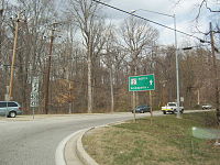 MD 2 northbound at Lothian roundabout with MD 408/MD 422
Just past the MD 260 intersection, MD 2 crosses into Anne Arundel County where it continues through a mix of farmland and woodland. It intersects Friendship Road/Sansbury Road at a roundabout, which connects to Maryland Route 261, before intersecting MD 778 again.[2][4] The route junctions with Maryland Route 423 (Fairhaven Road).[2] The road proceeds through rural areas with some residences, coming to an intersection with Maryland Route 256 (Deale Road). A short distance later, MD 2 crosses Maryland Route 258 (Bay Front Road) and continues north, with former alignments of the road designated as suffixed segments of MD 778.[2][4] The speed limit decreases to 40 mph (64 km/h) as the road reaches Lothian, where it intersects Maryland Route 408 (Mount Zion Road) and Maryland Route 422 (Bayard Road). At the roundabout, MD 2 makes a turn to the northeast, passing through agricultural areas with some homes as a 50 mph (80 km/h) road.[2][4] It intersects Maryland Route 255 (Owensville Road) before passing through the community of Harwood,[2] and then through Birdsville. The road heads northeast, with residential development increasing as the road approaches its intersection with Maryland Route 214 (Central Avenue). Here, MD 2 widens into a 40 mph (64 km/h) four-lane divided highway and heads through commercial areas, intersecting Maryland Route 253 (Mayo Road) adjacent to Lee Airport. Past this intersection, the road traverses residential areas before the speed limit increases to 50 mph (80 km/h) and it crosses over the South River. The former alignments of MD 2 around the bridge are designated as Maryland Route 553. Upon crossing the river, MD 2 continues past residential neighborhoods and widens to six lanes. It comes to an interchange with Maryland Route 665 (Aris T. Allen Boulevard). Past the MD 665 interchange, the route heads into commercial areas on the outskirts of Annapolis as a 40 mph (64 km/h) road, with Maryland Route 393 (Old Solomons Island Road) branching off from the route and paralleling it to the east. MD 2 crosses Maryland Route 450 (West Street) before the route merges onto U.S. Route 50, U.S. Route 301, and unsigned Interstate 595 (John Hanson Highway).[2][4]
At the point MD 2 merges onto the John Hanson Highway, the road is eight lanes wide and has a speed limit of 55 mph (89 km/h).[2] The road heads through wooded areas, narrowing to six lanes, before coming to an interchange with Maryland Route 70 (Rowe Boulevard). At this interchange, the unsigned I-595 designation ends, while US 50, US 301, and MD 2 continue northeast on the John Hanson Highway.[2][4] The route passes under Maryland Route 436 (Ridgely Avenue) and runs near residential neighborhoods before crossing over the Severn River on the Pearl Harbor Memorial Bridge.[4] After crossing the Severn River, the road comes to an interchange with the Governor Ritchie Highway. Here, MD 2 leaves US 50/US 301 by heading north on the Governor Ritchie Highway while MD 450 continues south into Annapolis on that road.[2][4]
MD 2 heads north on the Ritchie Highway, a four-lane divided highway with a 50 mph (80 km/h) speed limit, passing through wooded residential areas of Arnold. The route intersects the north end of a segment of Maryland Route 648 (Baltimore Annapolis Boulevard), which branches off and runs west of the route a short distance later. It passes the campus of Anne Arundel Community College and intersects College Drive. The road continues through wooded neighborhoods with some businesses, eventually reaching Severna Park. Here, the route heads through commercial areas, intersecting McKinsey Road near the Severna Park Marketplace (formerly the Severna Park Mall).[2][4] A short distance later, MD 2 intersects MD 648 (Baltimore-Annapolis Road), forming a brief concurrency with that route before MD 648 heads to the east of it again. The road continues past residences before reaching Pasadena.[2][4] Shortly after, MD 2 intersects the southern end of Maryland Route 10 (Arundel Expressway).[2] Past MD 10, the route heads into commercial areas as a six-lane 45 mph (72 km/h) road before coming to an interchange with Maryland Route 100.[2][4]
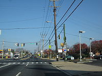 MD 2 northbound at MD 171 in Arundel Gardens
Immediately past this interchange, the route intersects Maryland Route 177 (Mountain Road) and continues north past more businesses and the Marley Station Mall.[4] MD 2 narrows to four lanes again and continues through residential neighborhoods in Glen Burnie.[2][4] Before the intersection with Fitzallen Road/Aquahart Road, the route passes Harundale Plaza, which was originally the Harundale Mall, the first enclosed mall on the East Coast, built in 1958.[4][6] The road passes more residences and then businesses before again crossing over MD 648.[4] Past MD 648, the route continues through commercial areas consisting of numerous car dealerships and runs a short distance to the east of Maryland Route 3 Business (Crain Highway).[4] It intersects Maryland Route 270 (Furnace Branch Road) before MD 3 Business merges into MD 2. The route continues north as a six-lane highway and intersects Maryland Route 710 (Ordnance Road). It passes more businesses before coming to an exit and southbound entrance with a spur of I-895 (I-895B) that provides access to and from Interstate 97, westbound Interstate 695, and Interstate 895. A short distance later, MD 2 interchanges with I-695 (Baltimore Beltway) at a partial interchange. At this interchange, Maryland Route 711 (Arundel Corporation Road) provides the access from eastbound I-695 to MD 2.[2][4] Past I-695, MD 2 continues north as a four-lane divided highway with a 35 mph (56 km/h) speed limit that runs through residential and commercial areas of Arundel Gardens, intersecting the western terminus of Maryland Route 171 (Church Street).[2][4] Past MD 171, the route passes through more commercial areas in Brooklyn Park before coming to an intersection with Maryland Route 170 (Belle Grove Road) at the boundary of Baltimore city.[4]
In Anne Arundel County, the daily traffic counts on MD 2 range from a high of 121,851 vehicles at the west end of the concurrency with the John Hanson Highway in Annapolis to a low of 14,192 vehicles at the intersection with MD 258 in the southern part of the county in 2007.[2]
Baltimore City
Main articles: St. Paul Street (Baltimore) and Calvert Street (Baltimore) Baltimore's Hanover Street Bridge
MD 2 enters Baltimore, where it becomes Potee Street and is maintained by the Baltimore Department of Transportation.[3] The route heads through urban residential and commercial areas in the Brooklyn neighborhood, intersecting Maryland Route 173 (Patapsco Avenue). A short distance later, it comes to an interchange with I-895 (Harbor Tunnel Thruway) a short distance later that has access from northbound MD 2 to northbound I-895 and from southbound I-895 to southbound MD 2. The route passes under a CSX railroad line and splits into a one-way pair consisting of four lanes in each direction, with the northbound direction of MD 2 following Hanover Street and the southbound direction of MD 2 following Potee Street.[3] The route crosses over the Patapsco River and continues into the Cherry Hill neighborhood, running to the west of the Middle Branch of the Patapsco River with Hanover Street passing by Harbor Hospital.[4] Past the Waterview Avenue intersection, MD 2 becomes two-way Hanover Street, a 35 mph (56 km/h) five-lane street.[3] It crosses over the Middle Branch on the Hanover Street Bridge and continues north through industrial areas.[4] Maryland Route 2 Truck heads east from the route on McComas Street prior to the interchange with Interstate 95.[7] Past the I-95 interchange, MD 2 heads through the Federal Hill neighborhood through areas of rowhomes as a two-lane street with a 25 mph (40 km/h) speed limit.[3][4]
At the intersection with Montgomery Street, MD 2 splits into another one-way pair with the northbound direction running east on Montgomery Street and then turning north on Light Street, intersecting MD 2 Truck (Key Highway) and passing by the Maryland Science Center, and the southbound direction following Hughes Street to Hanover Street. Along this one-way pair, the route carries one lane in each direction with the exception of Light Street, where the northbound direction has four lanes. Both directions of MD 2 join again along eight-lane divided Light Street and the route heads toward the Inner Harbor. Near Harborplace, the route splits into another one-way pair with northbound MD 2 running along three-lane Calvert Street and southbound MD 2 running along four-lane St. Paul Street.[3][4] The route crosses many streets in downtown Baltimore, including Pratt Street, Lombard Street, Baltimore Street, Fayette Street, and Saratoga Street. The one-way pair passes by Mercy Medical Center before coming to U.S. Route 40. Calvert Street passes under US 40 (the Orleans Street Viaduct) while St. Paul Street intersects US 40 as it follows the one-way pair of Franklin Street westbound and Mulberry Street eastbound. Past US 40, the route heads away from the downtown area and passes more rowhomes. It comes to an interchange with Interstate 83 (Jones Falls Expressway) and crosses over the Northeast Corridor rail line adjacent to Penn Station.[4] Past the train station, MD 2 intersects the southern terminus of Maryland Route 25, which follows a one-way pair along eastbound Lanvale Street (carrying the southbound direction) and westbound Lafayette Avenue (carrying the northbound direction), before it comes to its northern terminus at U.S. Route 1 and U.S. Route 40 Truck (North Avenue).[3][4]
In Baltimore, the daily traffic counts on MD 2 range from a high of 58,375 vehicles along Light Street near the Inner Harbor to a low of 6,075 vehicles along Hanover Street in the Federal Hill neighborhood in 2005.[3]
History
The designation MD 2 was first used by 1927 for the road running between Solomons Island and Baltimore. The route headed north through Calvert County and into Anne Arundel County, where it headed through Annapolis on what is now MD 450. From there, the route followed present-day MD 648 north to Glen Burnie before continuing north on its present alignment toward downtown Baltimore.[8] In 1939, the four-lane Ritchie Highway, named for former Maryland Governor Albert C. Ritchie, was built between Annapolis and Baltimore and MD 2 was rerouted to this road.[6][9][10] The former alignment of MD 2 along Baltimore-Annapolis Boulevard between Annapolis and Glen Burnie was designated MD 648 by 1940.[10] Throughout the mid 20th-century, a commercial district developed along MD 2 in Glen Burnie, which included several car dealerships and the Harundale Mall.[9] MD 2 was routed to bypass Annapolis along with US 50 and US 301 on a limited-access highway by 1960, with the former alignment through Annapolis being designated a part of MD 450.[11] By 1975, MD 4 was routed to be concurrent with MD 2 from north of Solomons Island, where it would cross the Patuxent River on the Governor Thomas Johnson Bridge that was completed in January 1978, to Sunderland.[12][13] Also by this time, the route was widened into a divided highway between Prince Frederick and Sunderland and from the South River to US 50/US 301.[12] The divided highway portions of MD 2 were further extended by 1983, with widening occurring between Port Republic and Prince Frederick and between MD 214 and the South River.[14] By the 1990s, MD 2/MD 4 was dualized from the southern spilt north of Solomons Island up to Port Republic.[15] The Ritchie Highway was originally the main route between Baltimore and Annapolis prior to the completion of Interstate 97 in 1995.[16][17] Originally, MD 10 was intended to provide a limited-access route between Baltimore and Annapolis, but this route was not completed south of Pasadena after it was deemed that an alternative freeway along the Maryland Route 3 corridor (present-day I-97), which required less destruction of residences and businesses, should be built.[18][19]
In 2010, a project improved the intersection of MD 2-4 and MD 231 in Prince Frederick.[20] This project is a prelude to a larger project to expand MD 2-4 to six lanes between MD 765 south of Prince Frederick and Stoakley Road north of Prince Frederick.[21]
Junction list
County Location Mile
[1][2][3]Exit Intersection Notes Calvert Solomons Island 0.00 MD 2G west (Lore Road) Off-ramp from MD 4 north to MD 2. Lore Road continues east, county maintained. 0.13 MD 765 north (Solomons Island Road)0.17 MD 4 south (Solomons Island Road)South end of MD 4 overlap Lusby 3.26  MD 760 south (Rousby Hall Road)
4.36  MD 497 east (Cove Point Road)
6.12 MD 765 (Pardoe Road)6.60 MD 765 south (Pardoe Road)7.00 MD 765 north (Nursery Road)8.00 MD 765 north (Saw Mill Road)8.84 MD 765 south (Saw Mill Road)St. Leonard 9.65 MD 765 north (St. Leonard Road)Port Republic 14.64  MD 264 south (Broomes Island Road)
14.66 MD 765 south (St. Leonard Road)16.28  MD 506 west (Sixes Road)
Prince Frederick 17.01 MD 765 north (Main Street)18.57  MD 231 north (Church Street)
19.12 MD 765 south (Main Street)19.27  MD 402 east (Dares Beach Road)
22.04  MD 263 east (Plum Point Road)
Huntingtown 24.28  MD 524 north (Old Town Road)
24.96 MD 524 south (Old Town Road)Sunderland 27.57 MD 4 north (Southern Maryland Boulevard)North end of MD 4 overlap 27.82  MD 262 west (Lower Marlboro Road)
28.80 MD 765 north (Wayside Drive)29.64 MD 765 south (Wayside Drive)29.95 MD 765 north (Mount Harmony Lane)30.74 MD 765 south (Mount Harmony Lane)Owings 31.39  MD 778 north (Old Solomons Island Road)
32.05  MD 260 north (Chesapeake Beach Road)
Anne Arundel 34.34 MD 778 south (Old Solomons Island Road)34.43  MD 423 east (Fairhaven Road)
35.98 MD 778 north (Old Solomons Island Road)36.14 MD 778 south (Old Solomons Island Road)36.19 MD 778 north (Old Solomons Island Road)Tracys Landing 36.41  MD 256 east (Deale Road) – Deale
36.67 MD 778 south (Old Solomons Island Road)36.84  MD 258 south (Bay Front Road)
38.17 MD 778 north (Old Solomons Island Road) – Upper Marlboro, DealeLothian 39.75 MD 778 north (Old Solomons Island Road)39.95 MD 778 south (Old Solomons Island Road)40.18 
 MD 408 west (Mount Zion Road) / MD 422 west (Bayard Road) – Upper Marlboro, Bayard
Lothian Roundabout 41.48  MD 255 east (Owensville Road) – Owensville, Galesville
42.08 MD 778 north (Old Solomons Island Road)42.21 MD 778 south (Old Solomons Island Road)Mayo 48.31  MD 214 (Central Avenue) – Mayo, Washington
49.33  MD 253 south (Mayo Road)
49.80  MD 553 north (South River Road)
50.61 MD 553 south (South River Road)Annapolis 51.80  MD 665 (Aris T. Allen Boulevard) to US 50 / US 301
Interchange 52.09  MD 393 north (Old Solomons Island Road)
52.66  MD 450 (West Street)
52.89 23A  I-595 / US 50 west / US 301 south (John Hanson Highway) to I-97 - Washington
South end of I-595/US 50/US 301 overlap 54.08 24  MD 70 (Rowe Boulevard/Bestgate Road) – Annapolis
Signed as exits 24A (MD 70 south) and 24B (MD 70 north to Bestgate Road) southbound 54.33 I-595 ends 55.07 Pearl Harbor Memorial Bridge over the Severn River Arnold 55.99 27 US 50 east / US 301 north (John Hanson Highway) / MD 450 south (Ritchie Highway) – Bay Bridge, Naval AcademyNorth end of US 50/US 301 overlap 56.39  MD 648 south (Baltimore Annapolis Boulevard)
57.56 MD 648 north (Baltimore Annapolis Boulevard)Severna Park 61.51 MD 648 south (Baltimore Annapolis Boulevard)South end of MD 648 overlap 62.03 MD 648 north (Baltimore Annapolis Boulevard)North end of MD 648 overlap Pasadena 64.39  MD 10 north (Arundel Expressway) to MD 100 west / I-695 – Baltimore
66.10 MD 100 to I-97 – Gibson Island, BaltimoreInterchange 66.24  MD 177 east (Mountain Road) to MD 10 north
Glen Burnie 68.45 MD 648 (Baltimore Annapolis Boulevard)69.87  MD 270 (Furnace Branch Road)
70.31
 MD 3 Bus. south (Crain Highway)
70.71  MD 710 east (Ordnance Road) to MD 10 / I-695 east
71.29  I-895 north (Harbor Tunnel Thruway) to I-695 west / I-97 south
Northbound exit, southbound entrance, exit 6B of I-895 71.46  MD 711 east (Arundel Corporation Road)
Provides access to MD 2 from I-695 east 71.58 I-695 west (Baltimore Beltway) to I-97 south – TowsonExit from MD 2 south to I-695 west, entrance to MD 2 north; exit 3A of I-695 Arundel Gardens 72.40  MD 171 east (Church Street)
Brooklyn Park 73.52  MD 170 south (Belle Grove Road)
Baltimore City 73.86  MD 173 south (Patapsco Avenue)
73.95 I-895 north (Harbor Tunnel Thruway)Northbound exit to northbound I-895, southbound exit from southbound I-895; exit 7 of I-895 75.32 Hanover Street Bridge over the Middle Branch of the Patapsco River 75.95
 MD 2 Truck north (McComas Street) – Fort McHenry
75.98 
 I-95 south / I-395 – Washington, Downtown
Northbound exit, southbound entrance; exit 54 of I-95 77.10
MD 2 Truck south (Key Highway)78.08 US 40 (Orleans Street Viaduct, Mulberry Street, Franklin Street)No connection between MD 2 north and US 40 78.93  I-83 (Jones Falls Expressway)
Exit from I-83 south to MD 2, exit 4 of I-83 79.08
79.15 MD 25 north (Lanvale Street/Lafayette Avenue)
79.24
US 1 / US 40 Truck (North Avenue)Maryland Route 2 Truck

Maryland Route 2 Truck
Location: Baltimore Length: 2.3 mi[22] (3.7 km) Maryland Route 2 Truck is a truck bypass of the Federal Hill neighborhood south of downtown Baltimore, Maryland, United States. The route runs east from MD 2 (Hanover Street) on McComas Street, paralleling I-95. From McComas Street, at exit 55 of Interstate 95 just west of the Fort McHenry Tunnel, the route continues onto Key Highway and heads north and west to Light Street (MD 2), mostly paralleling the Northwest Harbor and serving the piers on the harbor.[7]
The road was laid out to a width of 160 feet (50 m) from Light Street to Locust Point in the early 1910s, providing better access to the new city-owned piers in preparation for increased trade via the Panama Canal and existing steamship lines to Europe. It was named Key Highway because it was originally planned to extend to Fort McHenry, near where Francis Scott Key wrote "The Star-Spangled Banner."[23] However, the extension of the road to the fort was never built. A rail line ran the length of Key Highway, connecting to the tracks in Pratt Street via Light Street. A two-lane extension of the highway and rail line was built in 1930,[24] branching off the old route east of Ludlow Street and running south under Fort Avenue to McComas Street.[25][26] The short portion of the old road east of the extension is now East Key Highway; the rail tracks have been removed.[7]
References
- ^ a b c d e f g h i j k l m n o p q r s "Highway Location Reference: Calvert County" (PDF). Maryland State Highway Administration. 2009. http://sha.maryland.gov/Location/2009_CALVERT.pdf. Retrieved 2010-10-21.
- ^ a b c d e f g h i j k l m n o p q r s t u "Highway Location Reference: Anne Arundel County" (PDF). Maryland State Highway Administration. 2009. http://sha.maryland.gov/Location/2009_ARUNDEL.pdf. Retrieved 2010-10-21.
- ^ a b c d e f g h i j k "Highway Location Reference: Baltimore County" (PDF). Maryland State Highway Administration. 2005. http://www.marylandroads.com/Location/2005_BALTIMORECITY.pdf. Retrieved 2010-10-21.
- ^ a b c d e f g h i j k l m n o p q r s t u v w x y z aa ab ac ad ae af ag ah ai aj ak al am Google, Inc. Google Maps – overview of Maryland Route 2 (Map). Cartography by Google, Inc. http://maps.google.com/maps?f=d&source=s_d&saddr=Solomons+Island+Rd+S+%26+Lore+Rd,+Solomons,+Calvert,+Maryland+20688&daddr=MD-2%2FMD-4+to:MD-2%2FSolomons+Island+Rd+to:MD-2%2FRitchie+Hwy+to:MD-2%2FRitchie+Hwy+to:39.189691,-76.613503+to:MD+2+and+US+1+baltimore,+md&geocode=FaXmSAIdDDpx-w%3BFSr2SAIdiTZx-w%3BFZgGUAIdOjNv-w%3BFWgUVAId1C5w-w%3BFX9fVQIdAARv-w%3B%3B&hl=en&mra=dpe&mrcr=0&mrsp=5&sz=12&via=1,2,3,4,5&sll=39.165206,-76.58741&sspn=0.117655,0.219727&ie=UTF8&ll=38.895308,-76.552734&spn=1.889653,3.515625&t=h&z=8. Retrieved 2009-05-20.
- ^ "Louis L. Goldstein, Maryland Comptroller of the Treasury". Maryland State Archives. http://www.msa.md.gov/msa/mdmanual/08conoff/former/html/msa01579.html. Retrieved 2009-05-26.
- ^ a b Peck, Jamie (February 20, 2003). "Glen Burnie". The Baltimore Sun.
- ^ a b c Maryland State Highway Administration, County Map of Baltimore CityPDF (3.17 MiB), 2004
- ^ Maryland State Highway Administration (1927). Map of Maryland (Map). http://www.mdhighwaycentennial.com/images/template/gallery/maps/1927SIDE1.jpg. Retrieved 2009-03-03.
- ^ a b "American Legion Glen Burnie Post 40: Post History". American Legion Glen Burnie Post 40. http://www.glenburniepost40.org/content.php?id=2. Retrieved 2009-05-26.
- ^ a b Maryland State Highway Administration (1940). Map of Maryland (Map). http://www.mdhighwaycentennial.com/images/template/gallery/maps/1940SIDE1.jpg. Retrieved 2009-03-03.
- ^ Maryland State Highway Administration (1960). Map of Maryland (Map). http://www.mdhighwaycentennial.com/images/template/gallery/maps/1960SIDE1.jpg. Retrieved 2009-03-03.
- ^ a b Exxon (1975). Delaware, Maryland, Virginia, West Virginia (Map). Cartography by General Drafting.
- ^ "Development of Our Roadways". St. Mary's County, MD. http://www.co.saint-marys.md.us/dpw/dpwtemplate.asp?content=roaddevelopmentcontent.asp. Retrieved 2009-05-26.[dead link]
- ^ State Farm Insurance (1983). State Farm Road Atlas (Map). Cartography by Rand McNally.
- ^ Rand McNally (1996). United States-Canada-Mexico Road Atlas (Map).
- ^ "Appendix A – Summary of Meeting #5". Maryland Transportation Authority. http://www.mdta.state.md.us/mdta/BayCrossing/TaskForceReport/Task%20Force%20Report%20-%20Appendix%20A.pdf. Retrieved 2009-05-26.
- ^ "Major transportation milestones in the Baltimore region since 1940" (PDF). Baltimore Metropolitan Council. http://www.baltometro.org/reports/MajorTransMilestones.pdf. Retrieved 2009-04-21.
- ^ Hosler, Karen. (June 12, 1979). "State Backs Freeway on Route 3, Rules Out Rail Line to Airport". The Baltimore Sun.
- ^ "Baltimore-Annapolis Route Chosen for New Interstate". The Washington Post. June 12, 1979.
- ^ "Calvert County Transportation Priorities". Calvert County Board of Commissioners. May 11, 2010. http://www.mdot.maryland.gov/Planning/County_Priority_Letters/2010_Priority_Letters/2010_Calvert.pdf. Retrieved 2010-10-21.
- ^ "Project Information: MD 0002 SOLOMONS ISLAND ROAD NORTH OF STOAKLEY ROAD TO SOUTH OF MD 765". Maryland State Highway Administration. http://apps.roads.maryland.gov/WebProjectLifeCycle/ProjectInformation.asp?projectno=CA413214. Retrieved 2010-02-14.
- ^ Google Maps, driving directions along MD 2 Truck
- ^ John Wilber Jenkins, The New City of Baltimore, printed in Doubleday, Page & Company, The World's Work: A History of Our Time, Volume XXVII, May to October 1914, p. 586
- ^ National Bridge Inventory database, 2006
- ^ United States Geological Survey, Baltimore quadrangle, 1943
- ^ United States Geological Survey, Baltimore East quadrangle, 1950
External links
Annapolis Road · Aliceanna Street · Artmuseum Drive · Baltimore Street · Bellona Avenue · Biddle Street · Boston Street · Broadway · Broening Highway · Calvert Street · Cathedral Street · Caton Avenue · Centre Street · Charles Street · Chase Street · Coldspring Lane-Moravia Road · Druid Hill Avenue · Eager Street · Eastern Avenue · Eutaw Street · Falls Road · Fayette Street · Fleet Street · Franklin Street · Gay Street · Greene Street · Greenmount Avenue · Greene Street · Greenspring Avenue · Guilford Avenue · Gwynns Falls Parkway · Greenmount Avenue · Hanover Street · Harford Road · Hilton Street/Hilton Parkway · Howard Street · Key Highway · Liberty Heights Avenue · Loch Raven Boulevard · Lexington Street · Lombard Street · Madison Street · Maryland Avenue · McCulloh Street · Monument Street · Mt. Royal Avenue · Mulberry Street · North Avenue · Northern Parkway · Paca Street · Park Heights Avenue · Paca Street · Park Avenue · Patapsco Avenue · Pennsylvania Avenue · Pratt Street · Preston Street · Reisterstown Road · Roland Avenue · Russell Street · St. Paul Street · Saratoga Street · The Alameda · University Parkway · Wabash Avenue · York Road
Roads in Calvert County, Maryland State highways 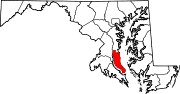 Categories:
- State highways in Maryland
- Roads in Baltimore, Maryland
- Roads in Anne Arundel County, Maryland
- Roads in Calvert County, Maryland


Wikimedia Foundation. 2010.