- Historic Locust Grove
Infobox_nrhp | name =Locust Grove
nrhp_type = nhl
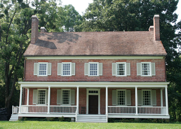
caption = Croghan Mansion at Locust Grove
location=Louisville, Kentucky
lat_degrees = 38 | lat_minutes = 17 | lat_seconds = 13.40 | lat_direction = N
long_degrees = 85 | long_minutes = 39 | long_seconds = 42.90 | long_direction = W
area =
built =1790
architect= William Croghan
architecture= Georgian, Other
designated=June 23 ,1986 cite web|url=http://tps.cr.nps.gov/nhl/detail.cfm?ResourceId=1097&ResourceType=Building
title=Locust Grove |accessdate=2008-02-23|work=National Historic Landmark summary listing|publisher=National Park Service]
added =March 11 ,1971 cite web|url=http://www.nr.nps.gov/|title=National Register Information System|date=2007-01-23|work=National Register of Historic Places|publisher=National Park Service]
governing_body = Local
refnum=71000347Historic Locust Grove is a 55-
acre 18th century farm site andNational Historic Landmark situated in easternJefferson County, Kentucky (now a part of Louisville Metro). The site is presently owned by the Louisville Metro government, and operated as a historic interpretive site by Historic Locust Grove, Inc.The main feature on the property is the ca. 1790 Georgian mansion that was the home of the Croghan family and gathering place for
George Rogers Clark , Lewis and Clark, and U.S. Presidents. In addition to the mansion there is the Visitors Center that houses a gift shop, museum and meeting space.History
The site was founded in 1790 by
William Croghan and his wifeLucy Clark Croghan . Lucy was the sister of the younger William Clark of theLewis and Clark Expedition and the olderGeorge Rogers Clark , former surveying partner of William Croghan.On
November 8 ,1806 ,Meriwether Lewis and William Clark, tracing their way back from thePacific Ocean , arrived at Locust Grove to a homecoming where Lucy Clark Croghan and her family welcomed them back from their journey. Locust Grove became the only residence still in existence west of theAppalachian Mountains to have sheltered Lewis and Clark. In the Fall of 2006, Locust Grove commemorated the 200th anniversary of Lewis and Clark's return.George Rogers Clark lived at the site in the final years of his life, from 1809 to 1818.
Following the death of William Croghan, the estate passed to
John C. Croghan , notable for his purchase ofMammoth Cave in 1838.In the winter of 1844, the farm was the site of the efforts of
African-American slave Stephen Bishop to produce a map of Mammoth Cave. The resulting map was published in 1845, and remained the most complete and accurate map of the period until modern survey techniques were applied in 1908. A significant epilogue to Bishop's story occurred in 1972, when a long-sought route connecting the caves of Flint Ridge and Mammoth Cave Ridge was discovered in an area which Bishop had mapped, but which had in the interim been almost completely flooded by the construction of adam on the surface nearby: the area of the 20th Century connection route is shown on Bishop's 19th century map.It was declared a
National Historic Landmark in 1986.citation|title=PDFlink| [http://pdfhost.focus.nps.gov/docs/NHLS/Text/71000347.pdf National Register of Historic Places Inventory-Nomination: Locust Grove] |32 KB|date=Undated |author=Stuart K. Johnson |publisher=National Park Service and PDFlink| [http://pdfhost.focus.nps.gov/docs/NHLS/Photos/71000347.pdf "Accompanying 3 photos, aerial and exterior, from 1971"] |32 KB]It is located at 561 Blankenbaker Lane in Louisville.
ee also
*
Farmington Historic Home
*List of attractions and events in Louisville, Kentucky
*List of parks in Louisville, Kentucky
*Riverside, The Farnsley-Moremen Landing References
External links
* [http://www.locustgrove.org/ Official Locust Grove website]
* [http://www.nps.gov/nr/travel/lewisandclark/loc.htm Locust Grove—Lewis and Clark Expedition: A National Register of Historic Places Travel Itinerary]
* [http://maps.google.com/maps?ll=38.287078,-85.661924&spn=0.003,0.003&t=h Google Satellite Map]
Wikimedia Foundation. 2010.