- Hampton Roads Transit
Infobox Bus transit
name = Hampton Roads Transit

logo_size = 144
image_size = 250px
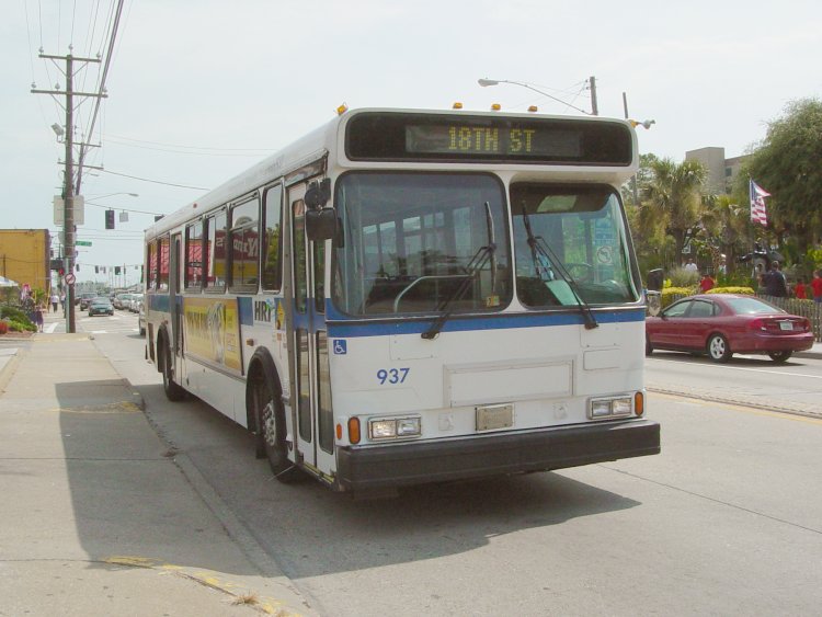
image_caption = Hampton Roads Transit #937 travels northbound on Pacific Avenue in Virginia Beach.
company_slogan =
parent =
founded = 1999
headquarters = 3400 Victoria Blvd.
Hampton, VA
locale =
service_area = Norfolk,Virginia Beach , Chesapeake, Portsmouth, Hampton, Newport News, Smithfield, Williamsburg
service_type =bus service
alliance =
routes = 52
destinations =
stops =
hubs =
stations =
lounge =
fleet =
ridership =
fuel_type =Diesel ,Diesel-electric hybrid
operator =
ceo =
website = [http://www.gohrt.com/ gohrt.com]Hampton Roads Transit (HRT) formed in October 1999 by the merging of
PENTRAN (Peninsula Transportation District Commission ) on theVirginia Peninsula and TRT (Tidewater Regional Transit also known as theTidewater Transit District Commission ) inSouth Hampton Roads .Hampton Roads Transit (also known as the "Transportation District Commission of Hampton Roads") currently serves over 22 million annual passengers in the
Hampton Roads metropolitan area.HRT currently serves 1.2 million people within its 369 square mile service area.Its service area consists of eight cities: Norfolk,
Virginia Beach , Chesapeake, Portsmouth, Hampton, Newport News, the town of Smithfield and the city of Williamsburg (Colonial Williamsburg ). Service to downtown Suffolk is handled by the city of Suffolk, which subleases buses from HRT. HRT directly runs the trolley route fromTidewater Community College . Portsmouth mayorJames W. Holley, III is the current chairman. [Citation |last=Messina |first=Debbie |title=HRT president named chairman of national transit group |url=http://content.hamptonroads.com/story.cfm?story=134235&ran=96034 |accessdate=2007-10-19]Timeline
{| class="wikitable" style="width: 90%;"
-
Year
|Activity
|Cities served
-
1944 || TheVirginia Transit Company begins operating rubber-wheeled bus service inHampton Roads . || Norfolk, VA
-
1945 || TheCitizens Rapid Transit Company begins operating rubber-wheeled bus service on theVirginia Peninsula , thus ending an era of streetcar service in Hampton Roads. || Newport News, VA and Hampton, VA
-
January 1973 ||Tidewater Regional Transit (TRT) service begins, with the creation of theTidewater Transportation District Commission (TTDC); and acquires theVirginia Transit Company , Norfolk Division || TRT service begins in Norfolk andVirginia Beach
-
January 1974 ||Peninsula Transportation District Commission (PTDC) created |
-
April 1975 ||PENTRAN service begins, as the PTDC acquires the Citizens Rapid Transit Company || PENTRAN service begins in Newport News and Hampton
-
May 1975 || The TTDC acquires theCommunity Motor Bus Company of Portsmouth ||TTDC expands, with TRT service to Portsmouth, VA
-
1977 ||James City County Transit begins service withinColonial Williamsburg andJames City County, Virginia || Williamsburg, VA not yet served by PENTRAN, nor TRT until 2004.
-
late-1970s/early-1980s || Service expansion to Chesapeake, VA, including communities such as South Norfolk, Great Bridge, Western Branch, Deep Creek and to the newly-openedGreenbrier Mall || Chesapeake, VA
-
early-1990s || Service expansion to Suffolk, VA, exclusively toTidewater Community College and downtown Suffolk || Suffolk, VA
-
1997 || Crossroads service begins, linking the Virginia Peninsula cities withSouth Hampton Roads with local bus service for the first time in the region ||
-
October 1st, 1999 || TRT merges with PENTRAN and forms Hampton Roads Transit (HRT). || HRT begins with bus service already existing in Norfolk, Virginia Beach, Chesapeake, Portsmouth, Newport News, Hampton, and Suffolk.
-Bus fleet
*
Gillig Phantom
*Gillig Advantage
* Optima Opus
* Orion V
*Flxible Metro
*Gillig BRT Hybrid
* Optima TrolleyPrimary Services
HRT operates 47 local fixed route and five express bus routes in the region.
Other Services
Handi-Ride
Handi-Ride is HRT's ADA
Paratransit service. Fare is $3.00. Certification and reservations are required.TRAFFIX
TRAFFIX is a service provided by Hampton Roads Transit. It encourages citizens throughout Hampton Roads to use alternative forms of transportation that reduces SOV. TRAFFIX oversees and promotes regional commuter initiatives, including carpooling and telecommuting, by reaching out to area employers. Some of its key clients include the U.S. Navy, Northrop Grumman, Wal-mart, and Canon. To date, TRAFFIX has removed nearly 800 vehicles off the road and has saved consumers over 600,000 gallons of gas and over $1.8 million in vehicle related expenses. For more information, visit www.traffixonline.org
Ferry service
HRT's Paddlewheel Ferry is a system of three 150-passenger paddle-wheel ferry boats, one of which is the world's first natural gas-powered pedestrian ferry. The Ferry travels between North Landing and High Street in Portsmouth and Downtown Norfolk at The Waterside.
The Ferry operates every 30 minutes, with 15-minute service at peak times on weekends. The Ferry is wheelchair accessible and allows boarding passengers to board with their bicycles. The general cost to board the ferry is $1.00, and 50 cents for seniors and disabled persons.
The ferry connects with buses at County & Court in Portsmouth using the Portsmouth Ferry Shuttle (formerly the Portsmouth Park & Sail).
Portsmouth Ferry Shuttle
A free shuttle runs from the Park and Ride next to the Downtown Tunnel to the High St ferry landing and the County & Court St bus transfer area in Portsmouth. This service is formerly known as the Park & Sail. The route is still labeled Route 49. Service will discontinue April 7th with the launch of The Loop [http://www.gohrt.com/PDF/passengeralert/Passenger_Alerts_route49.pdf] .
Norfolk Electric Transit
Norfolk Electric Transit or NET is the complimentary downtown bus service provided by the City of Norfolk and operated by Hampton Roads Transit. Service, using small battery powered
electric bus es [http://www.electricdrive.org/index.php?tg=fileman&idx=get&inl=1&id=3&gr=Y&path=Workshops%2FSanta+Barbara+Workshop&file=Joe_Ferguson-Rick_Hitchcock.PDF] , connects the park and ride lots with the major employment sites downtown.Virginia Beach Wave
The VB Wave runs through the main areas of Virginia Beach.
Route 30 Atlantic Ave (May 1-October 2 8am-2am, About every 15 minutes) which serves all the stops along the Atlantic Avenue boardwalk, This includes the Old Coast Station, the Virginia Beach Fishing Pier, plus the north beaches HRT transfer.
Route 31 Museum Express (Daily, Memorial Day-Labor Day 8am-2am, About every 15 minutes) Serves theVirginia Aquarium & Marine Science Center, Ocean Breeze Waterpark, Owl Creek Tennis Court, Holiday Trav-L-Park Campground, and KOA Campground.
Route 32 Shoppers Express (Daily, Memorial Day-Labor Day 10am-9pm, About every hour) Serves theShops at Hilltop, and ends at
Lynnhaven Mall .VB Wave Service Fares:Adults/Children $1.00 Child (under 38" tall) Free Seniors, persons with disabilities and Medicare card holders $0.50Farecard holders for regular bus routes: Officially, VB Wave does not accept the standard farecards, however many drivers will honor the pass.
MAX |metro area express
The MAX is the first regional express service connecting all of Hampton Roads. The bus service uses dedicated coach-style buses to make a more comfortable ride. The routes connect area Park and Ride lots to Downtown Norfolk and other major employment locations in the area.
Routes Include:
*960| VA Beach Oceanfront (19th & Pacific)- Silverleaf Park and Ride in Virginia Beach- Downtown Norfolk- Cedar Grove
*961| Newport News Transit Center- Northrop Grumman- Hampton Transit Center- Wards Corner- Cedar Grove
*962| Suffok/Magnolia Park and Ride- Chesapeake Square Mall- Victory Crossing- Downtown Norfolk- Cedar Grove
*963| Hampton Transit Center- Naval Station Norfolk
*967| Indian River Park and Ride- Greenbrier Mall Park and Ride- Chesapeake Square Mall- Northrop Grumman- Newport News Transit Center
*919| Silverleaf Park and Ride- Naval Station Norfolk +
*922| Greenbrier Mall- Indian River Park and Ride- Naval Station Norfolk+
"+ Routes available Sept. 2008"Projects under development
The Tide
The Tide, Norfolk's Light Rail System, is scheduled to run from Eastern Virginia Medical School through Downtown Norfolk to Newtown Rd (near Sentara Leigh Memorial Hospital). Groundbreaking is December 8th, 2007 [http://www.ridethetide.com/pressroom/articles/2007/11050907/First_contract_awarded_for_Norfolk.pdf] with primary construction is expected to begin in early 2008 and be fully operational by early 2010. For more information on The Tide, please visit [http://www.ridethetide.com/ The Tide website] .
Peninsula Rapid Transit Project
In conjunction with the cities of Hampton and Newport News, HRT is looking at three lines:
*A1: Downtown Newport News toFort Eustis running along U.S. Route 60 (Warwick Boulevard )
*A2: Downtown Newport News to Hampton Coliseum
*A3: Mariners' Museum to Mary Immaculate Hospital via State Route 143 (Jefferson Avenue )See [http://www.hrtransit.org/prt/Newsletter/Newsletter_Jan2005.pdf Peninsula Rapid Transit Project Newsletter (January 2005)] .
The Loop
Starting April 7th, 2008, The Loop will connect Portsmouth's High St Ferry Landing, County & Court (current transfer point for local buses), and the Naval Hospital. [http://hrtransit-ideas.blogspot.com/2008/03/route-49-discontinued.html] [http://www.gohrt.com/PDF/passengeralert/Passenger_Alerts_route49.pdf] [http://hamptonroads.com/2008/02/portsmouth-loop-shuttle-buses]
References
External links
* [http://www.gohrt.com/ Hampton Roads Transit]
* [http://www.ridethetide.com/ The Tide]
* [http://www.traffixonline.org/ Traffix] (Vanpool Services)
* [http://transit.schuminweb.com/bus/hampton-roads.asp The Schumin Web Transit Center: Hampton Roads]
Wikimedia Foundation. 2010.