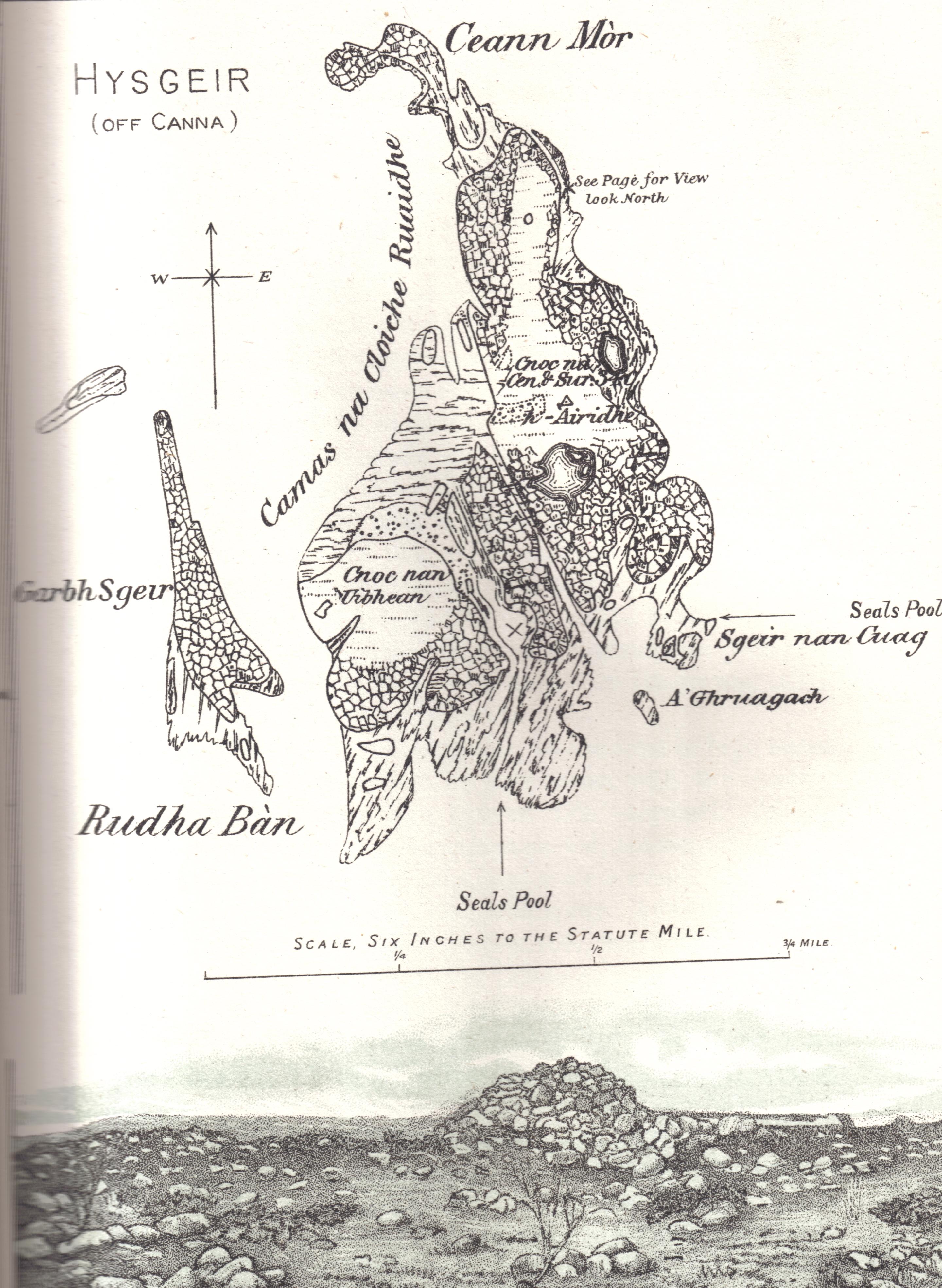
- Hyskeir
-
 The Island in 1892.[1]
 Not to be confused with the Monach Islands also known as "Heisker", or Haskeir.
Hyskeir (Scottish Gaelic: Òigh-sgeir) or Heyskeir is a low-lying rocky islet in the Inner Hebrides, Scotland. Its lighthouse marks the southern entrance to The Minch.
Contents
Geography
Hyskeir lies in the southern entrance to The Minch, 10 kilometres southwest of the island of Canna and 14 kilometres west of Rùm.[2] Garbh Sgeir is a rock that lies next to the islet and the landing place for Hyskeir lies in the channel between the two. Both islands are unoccupied.
Òigh-sgeir is composed of hexagonal basalt columns.[3]
The owner of the island in the 19th and early 20th centuries was Robert Thom. At that time sheep from Canna were brought to make use of the summer grazing.
Etymology
Hyskeir is from the Old Norse sker meaning skerry. Òigh-sgeir is Gaelic for 'maiden' or 'virgin rock', sgeir also meaning skerry. The English name 'Maiden Rock' has also been used.
Lighthouse
Hyskeir Lighthouse 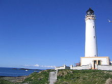
Hyskeir Light, May 2005 Coordinates 56°58′8.34″N 6°40′51.06″W / 56.9689833°N 6.68085°W Year first lit 1904 Automated 1997 Construction White tower Height 39 metres (128 ft) Focal height 41 metres (135 ft) Range 24 nautical miles Characteristic Gp Fl.(3) W 30 sec Hyskeir Lighthouse was established in 1904. The 39 metres (128 ft) metre high lighthouse marks the southern end of the Minch, warning of the presence of the Mills Rocks, Canna Island and Hyskeir itself. It was designed by David and Charles Stevenson and constructed by Oban contractor Messrs D & J MacDougall.
The white tower was manned until March 1997, becaming one of the last lighthouses in Scotland to be automated. The keepers were briefly known for their one-hole golf course[2] following their appearance on TV. Now controlled from the Northern Lighthouse Board in Edinburgh, it displays three white flashes every thirty seconds.[4]
Wildlife
Gavin Maxwell, who fished for basking sharks nearby in 1947, recorded a mass sighting of Basking Sharks.[5] “It was a gigantic shoal ... at one moment we counted 54 dorsal fins in sight at the same time.”
The island has nesting sites for Arctic and Common Tern, Kittiwakes and Eider Ducks and also has a large seal colony.
Footnotes
- ^ from: Harvie-Brown, J.A. and Buckley, T. E. (1892), A Vertebrate Fauna of Argyll and the Inner Hebrides. Pub. David Douglas., Edinburgh. Facing p. XXIV
- ^ a b "Hyskeir". Gazetteer for Scotland. http://www.scottish-places.info/features/featurefirst1625.html. Retrieved 15 September 2009.
- ^ Haswell-Smith, Hamish (2004). The Scottish Islands. Edinburgh: Canongate. ISBN 1841954543.
- ^ "Hyskeir Lighthouse". Northern Lighthouse Board. http://www.nlb.org.uk/ourlights/history/hyskeir.htm. Retrieved 15 September 2009.
- ^ Maxwell, Gavin (1952). Harpoon at a Venture. quoted in "Studying Basking Sharks in Scotland: Research Diary". IFAW. http://www.ifaw.org/ifaw_united_kingdom/join_campaigns/protecting_whales_around_the_world/come_aboard_the_song_of_the_whale/previous_research_journeys/shortcut_of_studying_basking_sharks_in_scotland_research_diary.php. Retrieved 2 November 2007.
- Murray, W.H. (1966) The Hebrides. London. Heinemann.
Coordinates: 56°58′15″N 6°40′35″W / 56.9709°N 6.6763°W
Small Isles (Na h-Eileanan Tarsainn), Inner Hebrides Canna/Cannaigh · Eilean Chathastail · Eigg/Eige · Garbh Sgeir ·
Hyskeir/Òigh Sgeir · Muck/Eilean nam Muc · Rùm · Sanday/SandaighCategories:- Islands of the Inner Hebrides
- Lighthouses in Scotland

Wikimedia Foundation. 2010.