- Salmon Creek (Sonoma County, California)
Geobox|River
name = Salmon Creek
native_name =
other_name =
category =stream
etymology =
nickname =
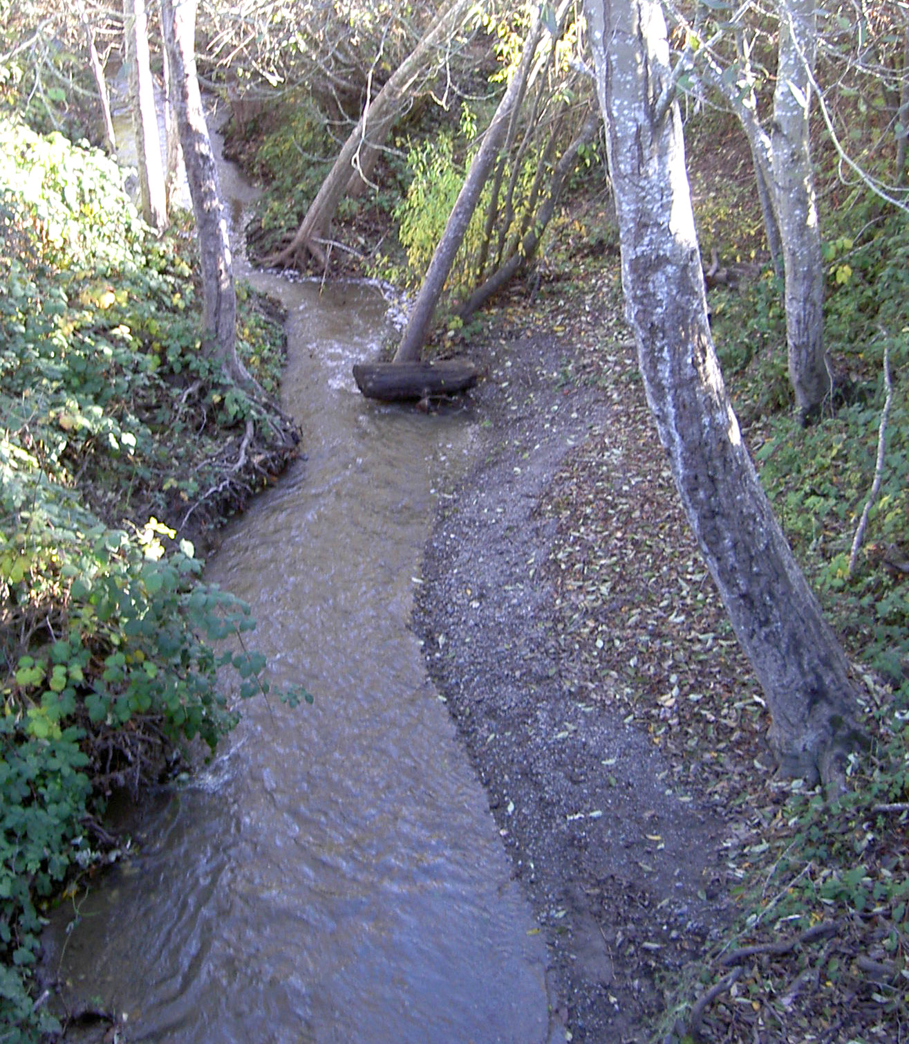
image_caption = Salmon Creek nearFreestone, California
country =United States
state =California
region = Sonoma County
district =
municipality =
parent =
tributary_left =
tributary_right = Nolan Creek
tributary_right1 = Tannery Creek
tributary_right2 = Fay Creek
tributary_right3 = Coleman Valley Creek
tributary_right4 = Finley Creek
city = Occidental
city1 = Freestone
city2 = Bodega
city3 = Salmon Creek
landmark =
river =
source =
source_location = convert|2|mi|km|0|lk=on|abbr=on west ofOccidental, California
source_region = | source_country =
source_elevation_imperial = 800
source_lat_d = 38 | source_lat_m = 23 | source_lat_s = 34 | source_lat_NS = N
source_long_d = 122 | source_long_m = 58 | source_long_s = 22 | source_long_EW = W
source_coordinates_note =Gnis|232281|Salmon Creek]
source1 =
source1_location = | source1_region = | source1_country =
source1_elevation_imperial =
source1_lat_d = | source1_lat_m = | source1_lat_s = | source1_lat_NS =
source1_long_d = | source1_long_m = | source1_long_s = | source1_long_EW =
source_confluence =
source_confluence_location = | source_confluence_region = | source_confluence_country =
source_confluence_elevation_imperial =
source_confluence_lat_d = | source_confluence_lat_m = | source_confluence_lat_s = | source_confluence_lat_NS =
source_confluence_long_d = | source_confluence_long_m = | source_confluence_long_s = | source_confluence_long_EW =
mouth =Pacific Ocean
mouth_location = west ofSalmon Creek, California
mouth_region = | mouth_country =
mouth_elevation_imperial = 0
mouth_lat_d = 38 | mouth_lat_m = 21 | mouth_lat_s = 18 | mouth_lat_NS = N
mouth_long_d = 123 | mouth_long_m = 4 | mouth_long_s = 4 | mouth_long_EW = W
mouth_coordinates_note =
length_imperial =
length_orientation =
width_imperial = | width_orientation =
depth_imperial =
volume_imperial =
watershed_imperial =
discharge_imperial =
discharge_max_imperial =
discharge_min_imperial =
free = | free_type =
map_caption =
map_background =
map_locator =
map_locator_x =
map_locator_y =
website =
footnotes =Salmon Creek is a
stream in westernSonoma County, California that springs from coastal hills west of the town of Occidental and empties into thePacific Ocean north ofBodega Head .Course
Salmon Creek originates about convert|2|mi|km|0|lk=on|abbr=on west of the town of Occidental near the junction of Joy Road and Bittner Road. It parallels Bittner Road eastward, passing just south of Occidental, where it turns right and follows Bohemian Highway to the town of Freestone. From there, it curves south and then west, paralleling Bodega Highway to a confluence with Nolan Creek just east of the town of Bodega. It flows through Bodega, then follows Salmon Creek Road westward into a narrow canyon, where it is joined by Tannery Creek, Fay Creek, Coleman Valley Creek, and Finley Creek. Salmon Creek emerges from the canyon between Irish Hill and Coleman Hill and crosses State Route 1 at milepost 12.49, entering
Sonoma Coast State Beach south of the ranger station. It parallels Bean Road to Salmon Creek Beach, which it bisects as it enters the Ocean.History
When European exporers first reached Salmon Creek, they found it inhabited by
Coast Miwok people. Six Coast Miwok villages near the creek have been authenticated: "Pulya-lakum", near the mouth of the creek, "Kennekono" and "Suwutenne" near the present-day town of Bodega, and three near the present day town of Freestone: "Oye-yomi", "Pakahuwe", and "Patawa-yomi".cite web|url=http://www.accessgenealogy.com/native/california/miwokindianhist.htm|publisher=Access Genealogy|title=Miwok Indian Tribe|accessdate=2007-12-04]In 1843-44, most of the Salmon Creek watershed was included in a convert|35000|acre|km2|-1|adj=on|lk=on|abbr=on land grant (named Rancho Bodega), awarded to Captain Stephen Smith.cite web|year=2006|url=http://www.bodeganet.com/SalmonCreek/SC%20Estuary%20Final.pdf|title=Salmon Creek Estuary: Study Results and Enhancement Recommendations|accessdate=2007-12-04]
In 1873, the
North Pacific Coast Railroad built a narrow-gauge line along the stretch of Salmon Creek between Freestone and Occidental.Habitat and pollution
As of 2000, Salmon Creek and its five named tributaries all supported
steelhead trout . Salmon Creek also harbored California freshwater shrimp, andcoho salmon were known to inhabit both Salmon Creek and Tannery Creek. [cite web|url=http://www.krisweb.com/biblio/marinsonoma_cdfg_cox_2000_streamsofsonoma.pdf|year=2000|first=Bill|last=Cox|title=Major Streams in Sonoma County|accessdate=2007-12-04] By 2006, however, the salmon run had ceased.Bridges
At least seven bridges span Salmon Creek. The newest and longest of these is the State Route 1 bridge, which is convert|200|ft|m|0|lk=on|abbr=on long and was built in 1983. Freestone Flat Road crosses on a steel truss convert|103|ft|m|0|abbr=on long which was built in 1955, making it the oldest of the seven. Bodega Highway crosses in two places: convert|0.9|mi|km|1|abbr=on from State Route 1 on a bridge convert|92|ft|m|0|abbr=on long built in 1962 and at Valley Ford-Freestone Road on a bridge convert|76|ft|m|0|abbr=on built in 1968. Salmon Creek Road spans the creek on a convert|78|ft|m|0|abbr=on bridge dating from 1958, Bohemian Highway crosses on a convert|70|ft|m|0|abbr=on bridge from 1971, and Scouts Camp Road crosses on a convert|57|ft|m|0|abbr=on structure from 1960.cite web|url=http://nationalbridges.com/|title=National Bridge Inventory Database]
References
External links
* [http://www.bodeganet.com/SalmonCreek/ Salmon Creek Watershed Council]
ee also
*
List of watercourses in the San Francisco Bay Area
*Salmon Creek Middle School
Wikimedia Foundation. 2010.