- Crofton, Nebraska
-
Crofton, Nebraska — City — Downtown Crofton: 2nd Street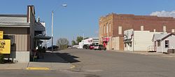 Location of Crofton, Nebraska
Coordinates: 42°43′50″N 97°29′53″W / 42.73056°N 97.49806°WCoordinates: 42°43′50″N 97°29′53″W / 42.73056°N 97.49806°W Country United States State Nebraska County Knox Area – Total 0.6 sq mi (1.7 km2) – Land 0.6 sq mi (1.7 km2) – Water 0.0 sq mi (0.0 km2) Elevation 1,421 ft (433 m) Population (2000) – Total 754 – Density 1,161.7/sq mi (448.6/km2) Time zone Central (CST) (UTC-6) – Summer (DST) CDT (UTC-5) ZIP code 68730 Area code(s) 402 FIPS code 31-11440[1] GNIS feature ID 0828463[2] Crofton is a city in Knox County, Nebraska, United States. The population was 754 at the 2000 census.
Geography
Crofton is located at 42°43′50″N 97°29′53″W / 42.73056°N 97.49806°W (42.730691, -97.497997)[3].
According to the United States Census Bureau, the city has a total area of 0.6 square miles (1.6 km2), all of it land.
Demographics
As of the census[1] of 2000, there were 754 people, 321 households, and 206 families residing in the city. The population density was 1,161.7 people per square mile (447.9/km²). There were 348 housing units at an average density of 536.2 per square mile (206.7/km²). The racial makeup of the city was 97.75% White, 0.40% Native American, 0.13% Asian, 0.13% from other races, and 1.59% from two or more races. Hispanic or Latino of any race were 1.19% of the population.
There were 321 households out of which 30.8% had children under the age of 18 living with them, 56.1% were married couples living together, 6.5% had a female householder with no husband present, and 35.8% were non-families. 35.2% of all households were made up of individuals and 21.2% had someone living alone who was 65 years of age or older. The average household size was 2.35 and the average family size was 3.07.
In the city the population was spread out with 28.0% under the age of 18, 5.2% from 18 to 24, 20.7% from 25 to 44, 25.1% from 45 to 64, and 21.1% who were 65 years of age or older. The median age was 43 years. For every 100 females there were 88.0 males. For every 100 females age 18 and over, there were 84.7 males.
The median income for a household in the city was $30,667, and the median income for a family was $42,083. Males had a median income of $26,667 versus $17,841 for females. The per capita income for the city was $15,506. About 6.5% of families and 7.7% of the population were below the poverty line, including 3.9% of those under age 18 and 15.2% of those age 65 or over.
References
- ^ a b "American FactFinder". United States Census Bureau. http://factfinder.census.gov. Retrieved 2008-01-31.
- ^ "US Board on Geographic Names". United States Geological Survey. 2007-10-25. http://geonames.usgs.gov. Retrieved 2008-01-31.
- ^ "US Gazetteer files: 2010, 2000, and 1990". United States Census Bureau. 2011-02-12. http://www.census.gov/geo/www/gazetteer/gazette.html. Retrieved 2011-04-23.
Municipalities and communities of Knox County, Nebraska Cities Bloomfield | Creighton | Crofton

Villages Townships Addison | Bohemia | Central | Cleveland | Columbia | Creighton | Dolphin | Dowling | Eastern | Frankfort | Harrison | Herrick | Hill | Jefferson | Lincoln | Logan | Miller | Morton | Niobrara | North Frankfort | Peoria | Raymond | Spade | Sparta | Union | Valley | Verdigre | Walnut Grove | Washington | Western
Unincorporated
communityLindy
Indian reservations Ponca Reservation | Santee Sioux Reservation
Categories:- Cities in Nebraska
- Populated places in Knox County, Nebraska


Wikimedia Foundation. 2010.