- Deerfield Township, Livingston County, Michigan
-
There are other Deerfield Townships in Michigan.
Deerfield Township, Michigan — Township — Location within the state of Michigan
 Deerfield Township, Michigan
Coordinates: 42°44′59″N 83°51′20″W / 42.74972°N 83.85556°WCoordinates: 42°44′59″N 83°51′20″W / 42.74972°N 83.85556°W Country United States State Michigan County Livingston Area – Total 37.7 sq mi (97.7 km2) – Land 36.4 sq mi (94.3 km2) – Water 1.3 sq mi (3.4 km2) Elevation 902 ft (275 m) Population (2000) – Total 4,087 – Density 112.2/sq mi (43.3/km2) Time zone Eastern (EST) (UTC-5) – Summer (DST) EDT (UTC-4) FIPS code 26-21220[1] GNIS feature ID 1626171[2] Deerfield Township is a civil township of Livingston County in the U.S. state of Michigan. The population was 4,087 at the 2000 census.
Contents
Communities
- Deer Creek is an unincoporated community on Wiggins Road south of Cohoctah Road at 42°45′36″N 84°54′26″W / 42.76°N 84.90722°W.[3]
- Deerfield Center is an unincoporated community on Center and Mack Roads 42°44′01″N 84°51′44″W / 42.73361°N 84.86222°W.[4]
Geography
According to the United States Census Bureau, the township has a total area of 37.7 square miles (97.7 km²), of which, 36.4 square miles (94.3 km²) of it is land and 1.3 square miles (3.4 km²) of it (3.45%) is water.
Demographics
As of the census[1] of 2000, there were 4,087 people, 1,386 households, and 1,118 families residing in the township. The population density was 112.2 per square mile (43.3/km²). There were 1,495 housing units at an average density of 41.1 per square mile (15.9/km²). The racial makeup of the township was 98.29% White, 0.51% Native American, 0.12% Asian, 0.10% from other races, and 0.98% from two or more races. Hispanic or Latino of any race were 1.25% of the population.
There were 1,386 households out of which 41.0% had children under the age of 18 living with them, 71.9% were married couples living together, 5.6% had a female householder with no husband present, and 19.3% were non-families. 15.1% of all households were made up of individuals and 3.7% had someone living alone who was 65 years of age or older. The average household size was 2.95 and the average family size was 3.30.
In the township the population was spread out with 29.9% under the age of 18, 6.3% from 18 to 24, 32.1% from 25 to 44, 25.2% from 45 to 64, and 6.5% who were 65 years of age or older. The median age was 36 years. For every 100 females there were 107.5 males. For every 100 females age 18 and over, there were 108.7 males.
The median income for a household in the township was $65,756, and the median income for a family was $69,750. Males had a median income of $47,202 versus $34,028 for females. The per capita income for the township was $28,140. About 1.3% of families and 2.4% of the population were below the poverty line, including 3.3% of those under age 18 and 4.1% of those age 65 or over.
References
- ^ a b "American FactFinder". United States Census Bureau. http://factfinder.census.gov. Retrieved 2008-01-31.
- ^ U.S. Geological Survey Geographic Names Information System: Deerfield Township, Livingston County, Michigan
- ^ U.S. Geological Survey Geographic Names Information System: Deer Creek, Michigan
- ^ U.S. Geological Survey Geographic Names Information System: Deerfield Center, Michigan
External links
Municipalities and communities of Livingston County, Michigan Cities 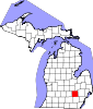
Villages Charter
townshipsGeneral law
townshipsUnincorporated
communitiesAnderson | Bullis Crossing | Chalkerville | Chilson | Cohoctah | Cohoctah Center | Deer Creek | Deerfield Center | Fleming | Green Oak | Gregory | Hallers Corners | Hamburg | Hell | Island Lake | Kaiserville | Lakeland | Nicholson ‡ | Oak Grove | Parkers Corners | Parshallville | Plainfield | Pettysville | Rushton | Tyrone Center | Unadilla | Whitmore Lake ‡ | Williamsville
Footnotes ‡This populated place also has portions in an adjacent county or counties
Categories:- Townships in Livingston County, Michigan


Wikimedia Foundation. 2010.