- Dublin, New Hampshire
-
Dublin, New Hampshire — Town — Mount Monadnock and Dublin Lake

SealLocation in Cheshire County, New Hampshire
Coordinates: 42°54′21″N 72°03′39″W / 42.90583°N 72.06083°WCoordinates: 42°54′21″N 72°03′39″W / 42.90583°N 72.06083°W Country United States State New Hampshire County Cheshire Incorporated 1771 Government – Board of Selectmen Charles F. Champagne, Chairman
Sterling Q. Abram
Curtis L. MerrickArea – Total 29.1 sq mi (75.3 km2) – Land 28.0 sq mi (72.5 km2) – Water 1.1 sq mi (2.8 km2) 3.78% Elevation 1,440 ft (439 m) Population (2010) – Total 1,597 – Density 54.9/sq mi (21.2/km2) Time zone Eastern (UTC-5) – Summer (DST) Eastern (UTC-4) ZIP code 03444 Area code(s) 603 FIPS code 33-19140 GNIS feature ID 0873581 Website www.townofdublin.org Dublin is a town in Cheshire County, New Hampshire, United States. The population was 1,597 at the 2010 census.[1] It is home to both the Dublin School and Yankee Magazine.
Contents
History
 Town center in 1906
In 1749, the Masonian proprietors granted the town as Monadnock No. 3 (or North Monadnock) to Matthew Thornton and 39 others. But the French and Indian War thwarted permanent settlement until the 1760s, when Henry Strongman moved from Peterborough. Other early settlers arrived from Sherborn, Massachusetts. In 1771, Governor John Wentworth incorporated the town, naming it after Strongman's birthplace: Dublin, Ireland.[2]
Like all towns in this area, the terrain features hills and valleys. Farmers found the soil hard and rocky, but with effort it yielded maize, oats, barley and potatoes, with some wheat and rye. Orchards were common. The first census, taken in 1790, reported 901 residents.[3] By 1859, there were 1,088.[2] Then in 1870, the small mill town of Harrisville voted to separate from Dublin, leaving the latter with only 455 residents during the 1880 census.[4]
Geography
According to the United States Census Bureau, the town has a total area of 29.1 square miles (75 km2), of which 28.0 sq mi (73 km2) is land and 1.1 sq mi (2.8 km2) is water, comprising 3.78% of the town. The northern slopes of Mount Monadnock occupy the southern part of town. The highest point in Dublin is along Monadnock's northeast ridge, where the elevation reaches 2,834 feet (864 m) above sea level at the town line. Roughly the western half of Dublin lies within the Connecticut River watershed, drained by tributaries of the Ashuelot River, with the eastern half located in the Merrimack River watershed, drained by tributaries of the Contoocook River.[5]
The town is crossed by New Hampshire Route 101 and New Hampshire Route 137.
Demographics
As of the census[6] of 2000, there were 1,476 people, 560 households, and 417 families residing in the town. The population density was 52.7 people per square mile (20.4/km2). There were 686 housing units at an average density of 24.5 per square mile (9.5/km2). The racial makeup of the town was 97.29% White, 0.34% African American, 0.54% Native American, 0.95% Asian, 0.41% from other races, and 0.47% from two or more races. Hispanic or Latino of any race were 1.15% of the population.
There were 560 households out of which 32.5% had children under the age of 18 living with them, 65.4% were married couples living together, 6.6% had a female householder with no husband present, and 25.4% were non-families. 21.1% of all households were made up of individuals and 6.6% had someone living alone who was 65 years of age or older. The average household size was 2.51 and the average family size was 2.89.
In the town the population was spread out with 23.4% under the age of 18, 5.9% from 18 to 24, 25.0% from 25 to 44, 32.5% from 45 to 64, and 13.2% who were 65 years of age or older. The median age was 43 years. For every 100 females there were 101.1 males. For every 100 females age 18 and over, there were 99.5 males.
The median income for a household in the town was $52,150, and the median income for a family was $57,578. Males had a median income of $36,853 versus $25,859 for females. The per capita income for the town was $27,028. About 6.0% of families and 10.6% of the population were below the poverty line, including 16.8% of those under age 18 and 5.0% of those age 65 or over.
Economy
Dublin is home to Yankee Publishing Inc., publisher of the Old Farmer's Almanac and Yankee magazine
Education
- Dublin School, a coeducational private boarding school, founded in 1935 by Paul W. Lehmann
- The Walden School, a summer music camp on the campus of Dublin School
- Dublin Christian Academy, founded in 1963
See also
Notable inhabitants
- Galen Clark, nature activist
- Doris Haddock, political activist
- Moses Mason, Jr., physician and congressman
- William Preston Phelps, artist
- Abbott Handerson Thayer, artist
- Mark Twain, author (summer resident, two years)[4]
References
- ^ United States Census Bureau, American FactFinder, 2010 Census figures. Retrieved March 23, 2011.
- ^ a b Coolidge, Austin J.; John B. Mansfield (1859). A History and Description of New England. Boston, Massachusetts. pp. 474–477. http://books.google.com/books?id=OcoMAAAAYAAJ&lpg=PA9&dq=coolidge%20mansfield%20history%20description%20new%20england%201859&pg=PA474#v=onepage&q=&f=false.
- ^ New Hampshire Economic and Labor Market Information Bureau Profile -- Dublin, New Hampshire
- ^ a b "About the Town of Dublin". Town of Dublin, New Hampshire. http://www.townofdublin.org/Pages/DublinNH_WebDocs/about. Retrieved 2008-12-23.
- ^ Foster, Debra H.; Batorfalvy, Tatianna N.; and Medalie, Laura (1995). Water Use in New Hampshire: An Activities Guide for Teachers. U.S. Department of the Interior and U.S. Geological Survey. http://nh.water.usgs.gov/Publications/nh.intro.html.
- ^ "American FactFinder". United States Census Bureau. http://factfinder.census.gov. Retrieved 2008-01-31.
External links
- Town website
- Dublin Public Library
- New Hampshire Economic and Labor Market Information Bureau Profile
Municipalities and communities of Cheshire County, New Hampshire City 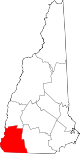
Towns Alstead | Chesterfield | Dublin | Fitzwilliam | Gilsum | Harrisville | Hinsdale | Jaffrey | Marlborough | Marlow | Nelson | Richmond | Rindge | Roxbury | Stoddard | Sullivan | Surry | Swanzey | Troy | Walpole | Westmoreland | Winchester
Villages Ashuelot | Chesham | Drewsville | East Swanzey | North Walpole | Poocham | Spofford | West Swanzey
Categories:- Towns in Cheshire County, New Hampshire


Wikimedia Foundation. 2010.