- Clarksville, New Hampshire
-
Clarksville, New Hampshire — Town — Location in Coos County, New Hampshire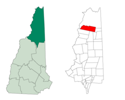
Coordinates: 45°01′03″N 71°24′50″W / 45.0175°N 71.41389°WCoordinates: 45°01′03″N 71°24′50″W / 45.0175°N 71.41389°W Country United States State New Hampshire County Coos Incorporated 1853 Government – Board of Selectmen Area – Total 62.2 sq mi (161.2 km2) – Land 60.1 sq mi (155.7 km2) – Water 2.1 sq mi (5.5 km2) 3.44% Elevation 1,980 ft (604 m) Population (2010) – Total 265 – Density 4.3/sq mi (1.6/km2) Time zone Eastern (UTC-5) – Summer (DST) Eastern (UTC-4) ZIP code 03592 Area code(s) 603 FIPS code 33-13220 GNIS feature ID 0871098 Clarksville is a town located in northern Coos County, New Hampshire, United States. The population was 265 at the 2010 census.[1] It is part of the Berlin, NH–VT Micropolitan Statistical Area.
Contents
History
The first census taken was in 1830; there were 88 residents.
Clarksville was incorporated in 1853, but known as Dartmouth College Grant until 1872. Clarksville derives its name from the Clark family, who cleared the land for settlement. The area was originally part of a tract granted to Dartmouth College; sections were sold off by the college to raise money. It was purchased by Benjamin Clark of Boston and Joseph Murdock of Norwich, Vermont.
In the late 19th century, major industries included starch and maple sugar. (Ref. 1874 NH Gazetteer.) For many years the largest employers in town have been logging companies.
Geography
Clarksville is bordered to the north and west by Pittsburg, and to the west by one mile of waterfront on the Connecticut River (across from the village of Beecher Falls, in Canaan, Vermont). To the south are Stewartstown, Dixville and Dix's Grant. The east borders on Atkinson and Gilmanton Academy Grant. State Route 145 traverses the western end of the township, running south from Pittsburg village into Stewartstown. Prior to the construction of U.S. Route 3, along the Connecticut, this was the only road north to Pittsburg.
According to the United States Census Bureau, the town has a total area of 62.2 square miles (161 km2), of which 60.1 sq mi (156 km2) is land and 2.1 sq mi (5.4 km2) is water, comprising 3.44% of the town.[2] The highest point in Clarksville is Crystal Mountain, at 3,230 feet (980 m) above sea level, near the town's southern border. Significant water bodies include portions of Lake Francis, Clarksville Pond, Carr Pond and Dead Water Stream. The western two-thirds of Clarksville lies within the Connecticut River watershed and the eastern third in the Androscoggin River watershed.[3]
Demographics
As of the census[4] of 2000 (and again, informally, in 2004), there were 294 people, 118 households, and 88 families residing in the town. The population density was 4.9 people per square mile (1.9/km²). There were 307 housing units at an average density of 5.1 per square mile (2.0/km²). The racial makeup of the town was 95.92% White (i.e., all but 12), none African American, 1.02% Native American, none Asian, none Pacific Islander, none from other races, and 3.06% from two or more races. Hispanic or Latino of any race were 1.70% of the population.
There were 118 households out of which 30.5% had children under the age of 18 living with them, 66.9% were married couples living together, 2.5% had a female householder with no husband present, and 25.4% were non-families. 19.5% of all households were made up of individuals and 5.9% had someone living alone who was 65 years of age or older. The average household size was 2.47 and the average family size was 2.80.
In the town the population was spread out with 22.8% under the age of 18, 4.1% from 18 to 24, 23.5% from 25 to 44, 38.1% from 45 to 64, and 11.6% who were 65 years of age or older. The median age was 44 years. For every 100 females there were 111.5 males. For every 100 females age 18 and over, there were 102.7 males.
The median income for a household in the town was $40,179, and the median income for a family was $44,688. Males had a median income of $32,750 versus $21,111 for females. The per capita income for the town was $18,090. About 5.4% of families and 3.7% of the population were below the poverty line, including none of those under the age of eighteen and 8.7% of those sixty five or over.
References
- ^ United States Census Bureau, American FactFinder, 2010 Census figures. Retrieved March 23, 2011.
- ^ "Geographic Identifiers: 2010 Demographic Profile Data (G001) - Clarksville town, New Hampshire". U.S. Census Bureau American Factfinder. http://factfinder2.census.gov. Retrieved November 8, 2011.
- ^ Foster, Debra H.; Batorfalvy, Tatianna N.; and Medalie, Laura (1995). Water Use in New Hampshire: An Activities Guide for Teachers. U.S. Department of the Interior and U.S. Geological Survey. http://nh.water.usgs.gov/Publications/nh.intro.html.
- ^ "American FactFinder". United States Census Bureau. http://factfinder.census.gov. Retrieved 2008-01-31.
External links
Municipalities and communities of Coös County, New Hampshire City 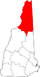
Towns Townships Atkinson and Gilmanton Academy Grant | Bean's Grant | Bean's Purchase | Cambridge | Chandler's Purchase | Crawford's Purchase | Cutt's Grant | Dix's Grant | Dixville | Erving's Location | Green's Grant | Hadley's Purchase | Kilkenny | Low and Burbank's Grant | Martin's Location | Millsfield | Odell | Pinkham's Grant | Sargent's Purchase | Second College Grant | Success | Thompson and Meserve's Purchase | Wentworth's Location
Villages Bretton Woods | Cascade | Dixville Notch | Groveton | Twin Mountain | West Stewartstown
Categories:- Towns in Coos County, New Hampshire
- Berlin micropolitan area


Wikimedia Foundation. 2010.