- Colebrook, New Hampshire
-
Colebrook, New Hampshire — Town — Main Street

SealLocation in Coos County, New Hampshire
Coordinates: 44°53′40″N 71°29′45″W / 44.89444°N 71.49583°WCoordinates: 44°53′40″N 71°29′45″W / 44.89444°N 71.49583°W Country United States State New Hampshire County Coos Incorporated 1796 Government – Board of Selectmen Roland Cotnoir
Marcel Ouellet
Rossiter HoltArea – Total 40.9 sq mi (105.9 km2) – Land 40.7 sq mi (105.4 km2) – Water 0.2 sq mi (0.5 km2) 0.50% Elevation 1,024 ft (312 m) Population (2010) – Total 2,301 – Density 56.3/sq mi (21.7/km2) Time zone Eastern (UTC-5) – Summer (DST) Eastern (UTC-4) ZIP code 03576 Area code(s) 603 FIPS code 33-13780 GNIS feature ID 0871097 Website www.colebrook-nh.com Colebrook is a town in Coos County, New Hampshire, United States. The population was 2,301 at the 2010 census.[1] Situated in the Great North Woods Region, it is bounded on the west by the Connecticut River and home to Beaver Brook Falls Natural Area.
The main village of the town, where 1,394 people resided at the 2010 census,[1] is defined as the Colebrook census-designated place (CDP), and is located at the junction of U.S. Route 3 with New Hampshire Route 26. The town also includes the villages of Kidderville, Upper Kidderville and Factory Village.
Colebrook is part of the Berlin, NH–VT Micropolitan Statistical Area.
Contents
History
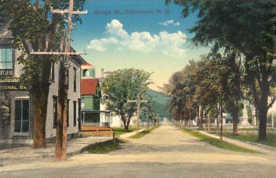
 Bridge Street c. 1915
First granted in 1762 by New Hampshire's Colonial Governor, Benning Wentworth, the territory was named Dryden, after English poet and playwright, John Dryden. Due to the inability of its original grantees to settle the remote area, however, it was regranted in 1770 by Colonial Governor John Wentworth, who renamed it Colebrook Town after Sir George Colebrooke, the East India Company's chairman of the board. Settled that same year, it would be incorporated as Colebrook June 11, 1796, and was for many years the shire town of the Northern Judicial District of Coos County. Today, it has a district branch of the Lancaster Superior Court.
The area was noted for excellent farming soil. According to the 1874 Gazetteer, Colebrook was the Potato Capital of New Hampshire, producing over 120,000 bushels per year, most of which were milled into potato starch. Some were distilled into "potato whiskey." After the Coos Trail through Dixville Notch was created in 1803, farmers loaded sleds each winter with potash, pearlash, wheat and other produce, including potato whiskey, to exchange in Portland, Maine for molasses, saltfish and other necessities. Abundant regional forests helped Colebrook become a lumbering center, with the first sawmill established at Beaver Brook in 1800. Between 1868 and 1915, the town was witness to great log drives.
During the Gilded Age, a grand hotel was once planned for Colebrook. Called The Metallak after Native American chief Metallak, the imposing Victorian structure was designed by architect John Calvin Stevens, and intended to attract tourists arriving by railroad to escape the summer heat and pollution in big cities. Construction began on Lombard's Hill, but a violent windstorm in April 1893 destroyed the frame, and investors abandoned the project. Stevens then reused the building's scheme, while reducing its size by two-fifths, to become The Bay of Naples Inn at Naples, Maine, which opened in 1899. Although The Metallak itself was never finished, its extensive plans are preserved among the architect's papers at the Maine Historical Society, making the ill-fated Colebrook hotel perhaps the most thoroughly documented design of its type in the White Mountains.
Serial killer Christopher Wilder's nationwide murder spree ended at a Colebrook gas station on April 13, 1984, when two New Hampshire state troopers attempted to apprehend him, but in a scuffle Wilder shot and killed himself as well as seriously wounding one of the troopers.
Notable inhabitants
- Irving W. Drew (1845–1922), U.S. senator
- Chester B. Jordan (1839–1914), governor of New Hampshire
- Horace White (1834–1916), co-owner and editor-in-chief of the Chicago Tribune
Geography
 Colebrook Main Street in 2009
Colebrook is the hub of northern Coos County, and is the largest town (by population) north of the county seat of Lancaster. Roads from Maine, Vermont, and Quebec all converge in the center of town. To the north is Stewartstown, to the east is Dixville and to the south is Columbia. Lemington, Vermont is located to the west of town, across the Connecticut River.
The town is located along U.S. Route 3. New Hampshire Route 26 crosses Colebrook from east to west, briefly overlapping U.S. 3. The southern terminus of New Hampshire Route 145 is also located in Colebrook, providing a second route northward to Pittsburg and Canada.
According to the United States Census Bureau, the town has a total area of 40.9 square miles (106 km2), of which 40.7 square miles (105 km2) is land and 0.2 square miles (0.52 km2) is water, comprising 0.50% of the town.[2] The highest point in Colebrook is Van Dyck Mountain, elevation 2,760 feet (840 m) above sea level. The town's western view is dominated by Monadnock Mountain, elevation 3,148 ft (960 m), in Lemington, Vermont. Colebrook is drained by Beaver Brook and the Mohawk River, which flows into the Connecticut River. The town lies almost fully within the Connecticut River watershed, with a tiny portion of the northeast corner of town lying in the Androscoggin River watershed.[3]
Climate
Climate data for Colebrook, NH Month Jan Feb Mar Apr May Jun Jul Aug Sep Oct Nov Dec Year Record high °F (°C) 61
(16)63
(17)79
(26)86
(30)90
(32)93
(34)94
(34)95
(35)94
(34)81
(27)71
(22)65
(18)95
(35)Average high °F (°C) 23.8
(−4.6)26.9
(−2.8)37.1
(2.8)50.0
(10.0)64.5
(18.1)72.7
(22.6)77.3
(25.2)74.8
(23.8)66.1
(18.9)54.2
(12.3)40.9
(4.9)28.6
(−1.9)51.41
(10.78)Average low °F (°C) 0.2
(−17.7)1.2
(−17.1)14.7
(−9.6)28.3
(−2.1)39.5
(4.2)49.3
(9.6)53.7
(12.1)51.7
(10.9)44.1
(6.7)32.5
(0.3)23.2
(−4.9)8.9
(−12.8)28.94
(−1.70)Record low °F (°C) −40
(−40)−42
(−41)−29
(−34)−8
(−22)17
(−8)27
(−3)31
(−1)29
(−2)18
(−8)7
(−14)−13
(−25)−38
(−39)−42
(−41)Precipitation inches (mm) 2.85
(72.4)1.96
(49.8)2.64
(67.1)2.63
(66.8)3.84
(97.5)4.13
(104.9)4.15
(105.4)4.45
(113)3.72
(94.5)3.40
(86.4)3.42
(86.9)2.80
(71.1)39.99
(1,015.7)Snowfall inches (cm) 21.2
(53.8)17.8
(45.2)13.8
(35.1)4.9
(12.4)trace 0
(0)0
(0)0
(0)trace 0.6
(1.5)8.7
(22.1)23.1
(58.7)90.1
(228.9)Source: NOAA [4] Demographics
 Monadnock House in c. 1915
At the first census of 1790 there were 29 residents. As of the census[5] of 2000, there were 2,321 people, 1,035 households, and 607 families residing in the town. The population density was 56.6 people per square mile (21.9/km²). There were 1,312 housing units at an average density of 32.0 per square mile (12.4/km²). The racial makeup of the town was 98.49% White, 0.26% Native American, 0.30% Asian, 0.17% from other races, and 0.78% from two or more races. Hispanic or Latino of any race were 0.39% of the population.
There were 1,035 households out of which 25.1% had children under the age of 18 living with them, 46.2% were married couples living together, 8.1% had a female householder with no husband present, and 41.3% were non-families. 34.0% of all households were made up of individuals and 14.3% had someone living alone who was 65 years of age or older. The average household size was 2.20 and the average family size was 2.76.
 Parsons Street in c. 1915
In the town the population was spread out with 22.2% under the age of 18, 7.2% from 18 to 24, 26.9% from 25 to 44, 27.2% from 45 to 64, and 16.5% who were 65 years of age or older. The median age was 41 years. For every 100 females there were 96.0 males. For every 100 females age 18 and over, there were 93.3 males.
The median income for a household in the town was $32,244, and the median income for a family was $42,260. Males had a median income of $31,833 versus $20,383 for females. The per capita income for the town was $18,390. About 6.5% of families and 12.0% of the population were below the poverty line, including 14.5% of those under age 18 and 20.2% of those age 65 or over.
See also
Sites of interest
- Beaver Brook Falls Natural Area
- Colebrook Area Historical Society & Museum, located in the Town Hall building
- Poore Family Homestead Farm Museum
References
- ^ a b United States Census Bureau, American FactFinder, 2010 Census figures. Retrieved March 23, 2011.
- ^ "Geographic Identifiers: 2010 Demographic Profile Data (G001) - Colebrook town, New Hampshire". U.S. Census Bureau American Factfinder. http://factfinder2.census.gov. Retrieved November 8, 2011.
- ^ Foster, Debra H.; Batorfalvy, Tatianna N.; and Medalie, Laura (1995). Water Use in New Hampshire: An Activities Guide for Teachers. U.S. Department of the Interior and U.S. Geological Survey. http://nh.water.usgs.gov/Publications/nh.intro.html.
- ^ "Climatography of the United States No. 20". NOAA. http://cdo.ncdc.noaa.gov/climatenormals/clim20/nh/271647.pdf. Retrieved March 5, 2011.
- ^ "American FactFinder". United States Census Bureau. http://factfinder.census.gov. Retrieved 2008-01-31.
Further reading
- Bryant F. Tolles, Jr., The Grand Resort Hotels of the White Mountains, 1998, David F. Godine, publisher, Boston, MA
External links
- Town website
- Colebrook Public Library
- The Colebrook Chronicle, weekly newspaper
- Beaver Brook Falls Wayside
- Colebrook Ski-Bees Snowmobile Club
- New Hampshire Economic and Labor Market Information Bureau Profile
- History of Colebrook, New Hampshire (1888)
Municipalities and communities of Coös County, New Hampshire City 
Towns Carroll | Clarksville | Colebrook | Columbia | Dalton | Dummer | Errol | Gorham | Jefferson | Lancaster | Milan | Northumberland | Pittsburg | Randolph | Shelburne | Stark | Stewartstown | Stratford | Whitefield
Townships Atkinson and Gilmanton Academy Grant | Bean's Grant | Bean's Purchase | Cambridge | Chandler's Purchase | Crawford's Purchase | Cutt's Grant | Dix's Grant | Dixville | Erving's Location | Green's Grant | Hadley's Purchase | Kilkenny | Low and Burbank's Grant | Martin's Location | Millsfield | Odell | Pinkham's Grant | Sargent's Purchase | Second College Grant | Success | Thompson and Meserve's Purchase | Wentworth's Location
Villages Bretton Woods | Cascade | Dixville Notch | Groveton | Twin Mountain | West Stewartstown
Categories:- Towns in Coos County, New Hampshire
- Berlin micropolitan area
- Populated places on the Connecticut River


Wikimedia Foundation. 2010.