- Goffstown, New Hampshire
-
Goffstown, New Hampshire — Town — 
SealLocation in Hillsborough County, New Hampshire
Coordinates: 43°01′13″N 71°36′01″W / 43.02028°N 71.60028°WCoordinates: 43°01′13″N 71°36′01″W / 43.02028°N 71.60028°W Country United States State New Hampshire County Hillsborough Incorporated 1761 Government – Board of Selectmen Scott Gross, Chair
Nick Campasano
Philip A. D'Avanza
Steve Fournier
David Pierce[1]Area – Total 37.5 sq mi (97.2 km2) – Land 36.9 sq mi (95.5 km2) – Water 0.6 sq mi (1.6 km2) 1.65% Elevation 308 ft (94 m) Population (20`0) – Total 17,651 Time zone EST (UTC-05) – Summer (DST) EDT (UTC-04) (UTC) ZIP code 03045 Area code(s) 603 FIPS code 33-29860 GNIS feature ID 0873606 Website www.goffstown.com Goffstown is a town in Hillsborough County, New Hampshire, United States. The population was 17,651 at the 2010 census.[2] The compact center of town, where 3,196 people resided at the 2010 census,[2] is defined by the U.S. Census Bureau as the Goffstown census-designated place and is located at the junction of New Hampshire routes 114 and 13. Goffstown also includes the villages of Grasmere and Pinardville. The town is home to Saint Anselm College (and its New Hampshire Institute of Politics) and the New Hampshire State Prison for Women.
Contents
History
 Main Street in 1887
 The Uncanoonuc Hotel in 1910
Prior to the arrival of European settlers, the area was frequented by Native Americans due to its ample fish population.[3]
The town was first granted as "Narragansett No. 4" in 1734 by Colonial Governor Jonathan Belcher of Massachusetts, which then held authority over New Hampshire. It was one of seven townships intended for soldiers (or their heirs) who had fought in the "Narragansett War" of 1675, also known as King Philip's War. In 1735, however, some grantees "found it so poor and barren as to be altogether incapable of making settlements," and were instead granted a tract in Greenwich, Massachusetts.
The community would be called "Piscataquog Village" and "Shovestown" before being regranted by Masonian proprietor Governor Benning Wentworth in 1748 to new settlers, including Rev. Thomas Parker of Dracut and Colonel John Goffe, for whom the town was named. It received its act of incorporation June 16, 1761, under the name of Goffstown,[3] which was conferred on it in honor of Colonel John Goffe, for several years a resident of Bedford, and the first judge of probate in the county of Hillsborough. A large part of the town was originally covered with valuable timber; and this being a good locality for fish, lumbering and fishing were the main occupations of the early settlers.[3] The village of Grasmere was named for Grasmere, England, home of poets William Wordsworth and Samuel Taylor Coleridge.
A Congregational church was organized about October 30, 1771, and small appropriations for preaching were made annually. There were two religious classes in the place—that in the south part was the Scotch-Irish stock and favored Presbyterianism, while the remainder were Congregationalists.[3] A meeting-house was erected in 1768; but it was not thoroughly completed for some years afterwards. The first minister was Rev. Joseph Currier, against whose settlement a remonstrance was put in by thirty-seven men, who favored Presbyterianism, and were determined not to give any thing towards his support. Mr. Currier was settled in 1771, and dismissed August 29, 1774, according to the town records, for intemperance. Seven years intervened without the settlement of a minister; and in 1781, the Congregationalists and the Presbyterians were organized separately, the former extending a call to Rev. Cornelius Waters, who became their pastor, and continued till 1795. The next minister was Rev. David L. Morril, who was settled March 3, 1802, and was jointly supported by the two societies under the name of the Congregational Presbyterian church. Mr. Morrill served the town and state civilly as well as ecclesiastically; he was representative of the town, senator in congress, and governor of the state.[3]
The Piscataquog River, which bisects the main village of Goffstown and was spanned by a covered bridge, provided water power for industry. In 1817, Goffstown had 20 sawmills, 7 grain mills, 2 textile mills, 2 carding machines and a cotton factory. A description of the town in 1859:[3]
The surface is comparatively level, the only elevations of note being two in the southwest part, called by the natives Uncanoonuck. There are considerable tracts of valuable interval[e], as well as extensive plains, which are generally productive. Piscataquog river is the principal stream, which furnishes quite a number of valuable mill privileges. It passes through in a central direction. Large quantities of lumber were formerly floated down this stream to the Merrimack, and the forests at one time supplied a large number of masts for the English navy. The New Hampshire Central Railroad passes through Goffstown. Then; are three villages — Goffstown, Goffstown Centre, and Parker's Mills; three church edifices — Baptist, Congregational, and Methodist; sixteen school districts; and two post-offices — Goffstown and Goffstown Centre : also, four stores, four saw-mills, two grist-mills, and one sash and blind factory. Population, 2,270; valuation, $599,615.—A History and Description of New England, General and LocalIn 1816, the Religious Union society was organized. A new house was erected in the west village, and meetings were held two thirds of the time in the new house, and one third in the old house at the centre.[3]
 Incline Railway c. 1914
In 1818-19 there was a deep religious interest in connection with the preaching of Rev. Abel Manning, and sixty-five persons were added to this then feeble church within a year. Rev. Benjamin H. Pitman was settled from 1820 to 1825; Rev. Henry Wood from 1826 to 1831; and Rev. Isaac Willey from 1837 to 1853. A Baptist church was formed in 1820.[3]
Islands on the Amoskeag falls, in the Merrimack River, lying westerly of the centre of "the Pulpit," or east stream would be annexed in 1825,[3] as was part of New Boston in 1836.
In the early part of 1841, a female commenced preaching here, and shortly more than half the voters in town came into her support. She professed no connection with any church. The excitement created by her preaching, however, soon died out, the result of it being the organization of the existing Methodist church. Dr. Jonathan Gove, a resident of this town, served in the legislature for many years.[3]
The Uncanoonuc Mountains in Goffstown once featured the Uncanoonuc Incline Railway, founded in 1903. It first carried tourists in 1907 to the summit of the south peak, on which was built that year the Uncanoonuc Hotel. The 5½ story building provided 37-38 guest rooms, and a dining room that accommodated 120. It also offered outstanding views of the surrounding valley, including Manchester, connected by electric trolley to the railway's base station. The hotel would burn in 1923, and the train was later used to transport skiers to the top. The railway peaked during the 1930s and 1940s, but was essentially abandoned by the 1950s. The summit of the south peak is now the site of numerous television and radio towers.
Grasmere Village straddles the Piscataquog River in the eastern region of Goffstown. The Hillsborough County Railroad Station was located at Grasmere on the southern side of the river. Rail-borne freight for Grasmere and other surrounding locales was retrieved at this station during the late nineteenth and early twentieth centuries. Another rail station in Goffstown was located further to the west nearer to the town center, and a third was Parker's Station to the west of the town center, nearing the border with Weare.[4]
In the mid-twentieth-century rail service through the town ceased. In the dawning years of the twenty-first century town and local organizations cooperating for a rails-to-trails effort completed conversion of the rail-beds into bicycling and walking trails.
The County Farm grounds were converted to the New Hampshire State Prison for Women (currently located at 317 Mast Road). The facility's most famous resident was convicted murderess Pamela Smart, who was incarcerated at the Prison for Women from March 22, 1991 to March 11, 1993, when she was transferred to Bedford Hills Correctional Facility in Bedford, New York.
Geography
 Westlawn Cemetery in Goffstown
Goffstown is located in the eastern part of Hillsborough County, directly to the west of Manchester, the state's largest city. Concord, the state capital, lies 16 miles (26 km) to the north. The town center is on the Piscataquog River near the western boundary of the town, around the intersection of New Hampshire Route 13 and 114. The village of Grasmere is located in the eastern part of town, and the neighborhood of Pinardville is located in the southeast corner of the town, essentially forming a continuous development with the adjoining city of Manchester.
According to the United States Census Bureau, the town has a total area of 37.5 square miles (97 km2), of which 36.9 sq mi (96 km2) is land and 0.6 sq mi (1.6 km2) is water, comprising 1.65% of the town. The Uncanoonuc Mountains (uhn-kuh-NOO-nuhk) are twin peaks. The north peak, the highest point in Goffstown, has an elevation of 1,324 feet (404 m) above sea level, and the south peak has an elevation of 1,321 feet (403 m). The town's climate is classified as a Dfa or Dfb on the Köppen climate classification charts.
Goffstown is drained by the Piscataquog River and lies fully within the Merrimack River watershed.[5]
Neighboring cities and towns

Weare Dunbarton Hooksett New Boston 
Manchester  Goffstown

New Boston Bedford Manchester Demographics
As of the census[6] of 2000, there were 16,929 people, 5,641 households, and 4,055 families residing in the town. The population density was 458.9 people per square mile (177.2/km²). There were 5,798 housing units at an average density of 157.2 per square mile (60.7/km²). The racial makeup of the town was 98.20% White, 0.25% African American, 0.24% Native American, 0.31% Asian, 0.01% Pacific Islander, 0.32% from other races, and 0.66% from two or more races. Hispanic or Latino of any race were 0.83% of the population.
There were 5,641 households out of which 35.3% had children under the age of 18 living with them, 60.5% were married couples living together, 7.8% had a female householder with no husband present, and 28.1% were non-families. 20.8% of all households were made up of individuals and 8.8% had someone living alone who was 65 years of age or older. The average household size was 2.64 and the average family size was 3.07.
In the town the population was spread out with 22.7% under the age of 18, 15.2% from 18 to 24, 29.1% from 25 to 44, 20.9% from 45 to 64, and 12.1% who were 65 years of age or older. The median age was 35 years. For every 100 females there were 91.6 males. For every 100 females age 18 and over, there were 88.9 males.
The median income for a household in the town was $55,833, and the median income for a family was $61,718. Males had a median income of $39,757 versus $30,000 for females. The per capita income for the town was $21,907. About 2.6% of families and 4.2% of the population were below the poverty line, including 3.3% of those under age 18 and 9.5% of those age 65 or over.
Law and government
Goffstown is governed by a five-member Board of Selectmen elected in the March general election to serve three-year staggered terms.
The New Hampshire Department of Corrections operates the New Hampshire State Prison for Women in Goffstown.
The United States Postal Service operates the Goffstown Post Office.[7]
Education
Goffstown is part of School Administrative Unit 19, serving Goffstown, Dunbarton and New Boston.
Primary and secondary
 Main entrance to Maple Avenue Elementary School
- Goffstown has one kindergarten, Glen Lake School.
- Goffstown has two first through fourth grade elementary schools, Bartlett and Maple Avenue.
- Mountain View Middle School serves Goffstown students in fifth through eighth grade, and seventh and eighth grade New Boston and Dunbarton students.
- Ninth through twelfth grade students from Goffstown, New Boston and Dunbarton attend Goffstown High School.
- The Villa Augustina School is an independent Catholic school founded in Goffstown in 1918. The school serves children in pre-Kindergarten through 8th grade.
Post-secondary
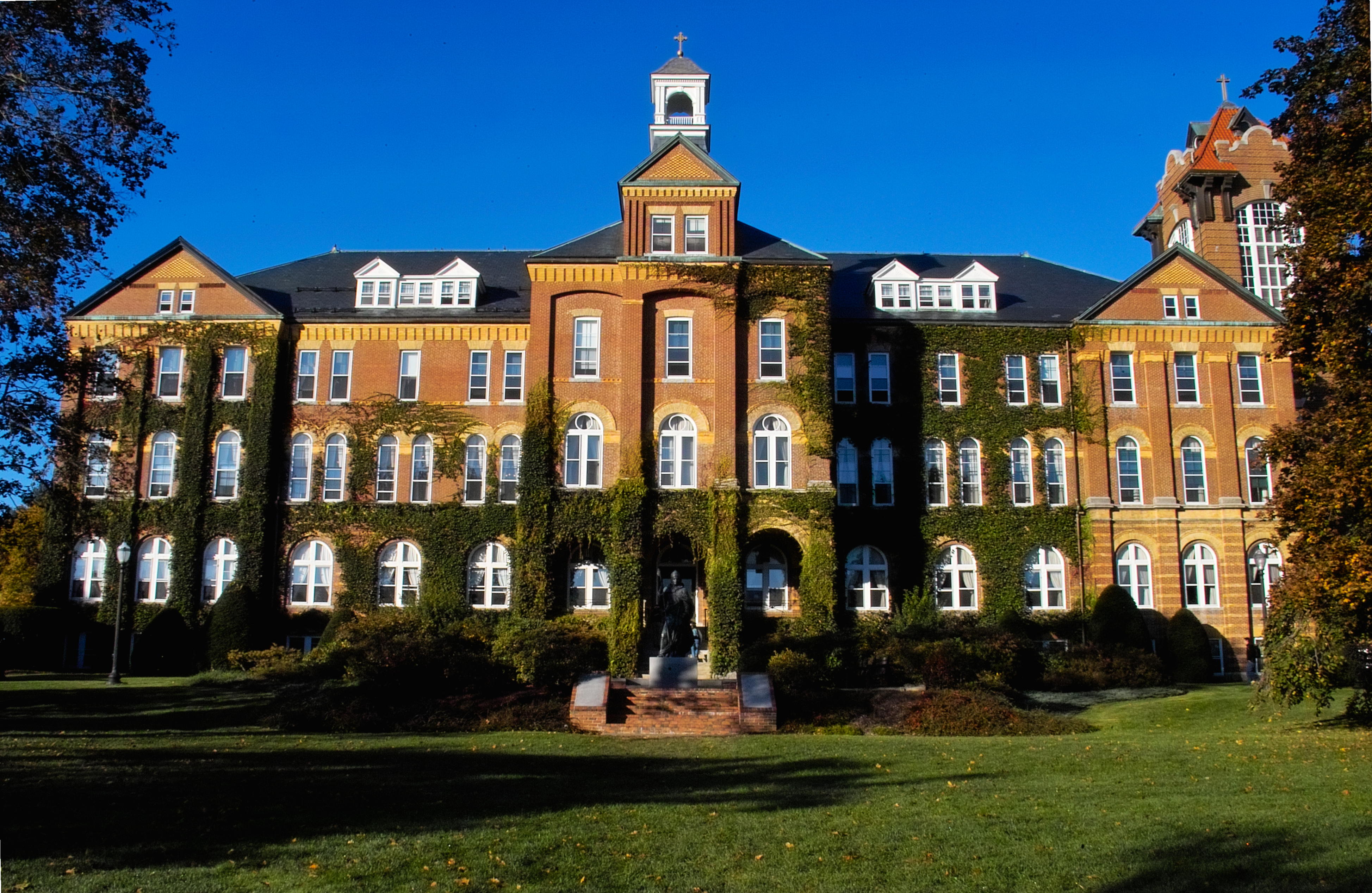
 Alumni Hall at Saint Anselm College near the Goffstown - Manchester - Bedford borders.
- Saint Anselm College is a Benedictine, Catholic liberal arts college in Goffstown, New Hampshire. The college has received significant national media attention in recent years ranging from several national presidential debates to its stringent anti grade inflation policy. Founded in 1889, the college has approximately 2000 undergraduate students who are very involved in the town through community service; the college also serves as a large part of the local economy as it employs many Goffstown residents and students patronize local businesses, bars, and stores. The New Hampshire Institute of Politics at Saint Anselm College brings hundreds of dignitaries and politicians to Goffstown annually, most notably for the New Hampshire primary presidential debates, which have been held at the college since 2004. The Saint Anselm College and Saint Anselm Abbey have been a substantial presence in the town of Goffstown.
References
- ^ http://www.goffstown.com/board-of-selectmen.html
- ^ a b United States Census Bureau, American FactFinder, 2010 Census figures. Retrieved March 23, 2011.
- ^ a b c d e f g h i j Coolidge, Austin Jacobs; Mansfield, John Brainard (1859), A History and Description of New England, General and Local, Boston: A.J. Coolidge, pp. 502–504, http://books.google.com/books?id=OcoMAAAAYAAJ&printsec=titlepage#PPA502,M1
- ^ New Hampshire Register, Farmer's Almanac, and Business Directory for 1898, Burlington, Vermont: Walton Register Company, 1897, p. 105, 108, http://books.google.com/books?id=8u4WAAAAIAAJ
- ^ Foster, Debra H.; Batorfalvy, Tatianna N.; and Medalie, Laura (1995). Water Use in New Hampshire: An Activities Guide for Teachers. U.S. Department of the Interior and U.S. Geological Survey. http://nh.water.usgs.gov/Publications/nh.intro.html.
- ^ "American FactFinder". United States Census Bureau. http://factfinder.census.gov. Retrieved 2008-01-31.
- ^ "Post Office™ Location - GOFFSTOWN." United States Postal Service. Retrieved on November 18, 2010.
Notes
External links
- Town website
- Historic District Commission
- Goffstown Public Library
- Goffstown Historical Society Museum
- Town records 1890-1900 online at Footnote.com
- Marriage and Death Records 2000-2005
- New Hampshire Economic and Labor Market Information Bureau Profile
Municipalities and communities of Hillsborough County, New Hampshire Cities 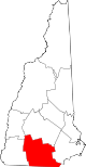
Towns Amherst | Antrim | Bedford | Bennington | Brookline | Deering | Francestown | Goffstown | Greenfield | Greenville | Hancock | Hillsborough | Hollis | Hudson | Litchfield | Lyndeborough | Mason | Merrimack | Milford | Mont Vernon | New Boston | New Ipswich | Pelham | Peterborough | Sharon | Temple | Weare | Wilton | Windsor
Villages East Merrimack | Grasmere | Pinardville
Categories:- Goffstown, New Hampshire
- Towns in Hillsborough County, New Hampshire


Wikimedia Foundation. 2010.