- Iatan, Missouri
Infobox Settlement
official_name = Iatan, Missouri
settlement_type = Village
nickname =
motto =
imagesize =
image_caption =
image_
imagesize =
image_caption =
image_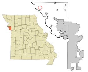
mapsize = 250x200px
map_caption = Location of Iatan, Missouri
mapsize1 =
map_caption1 =subdivision_type = Country
subdivision_name =United States
subdivision_type1 = State
subdivision_name1 =Missouri
subdivision_type2 = County
subdivision_name2 = Platte
government_footnotes =
government_type =
leader_title =
leader_name =
leader_title1 =
leader_name1 =
established_title =
established_date =unit_pref = Imperial
area_footnotes =
area_magnitude =
area_total_km2 = 0.1
area_land_km2 = 0.1
area_water_km2 = 0.0
area_total_sq_mi = 0.0
area_land_sq_mi = 0.0
area_water_sq_mi = 0.0population_as_of = 2000
population_footnotes =
population_total = 54
population_density_km2 = 540.1
population_density_sq_mi = 1399.0timezone = Central (CST)
utc_offset = -6
timezone_DST = CDT
utc_offset_DST = -5
elevation_footnotes =
elevation_m = 245
elevation_ft = 804
latd = 39 |latm = 28 |lats = 32 |latNS = N
longd = 94 |longm = 58 |longs = 57 |longEW = Wpostal_code_type =
postal_code =
area_code =
blank_name = FIPS code
blank_info = 29-34210GR|2
blank1_name = GNIS feature ID
blank1_info = 0720068GR|3
website =
footnotes = "This article is about the Missouri village. For the IATAN travel agreement, please seeInternational Association of Travel Agents Network ."Iatan is a village in Platte County,
Missouri ,United States . The population was 54 at the 2000 census.The community is said to derive its name from Iatan, a chief of the
Otoe tribe who supposedly derived his name from battles with theCommanche who were sometimes also referred to as Iatan. [ [http://books.google.com/books?id=5XfxzCm1qa4C&pg=PA176&dq=Comanche+Iatan&lr=&sig=0ETuXk7UjzsIQCeZFgwr0BUNW00 Native American Placenames of the United States by William Bright - University of Oklahoma Press - 2007] ISBN 0806135980]Iatan, first settled by John Dougherty in 1837, was one of the first communities to be established after the
Platte Purchase allowed white settlement on former Native American land (which was proclaimed in February 1837). It was initially an important trading port on theMissouri River but was soon overtaken byWeston, Missouri five miles (8 km) to the south andSt. Joseph, Missouri convert|20|mi|km to the north. [ [http://thelibrary.org/lochist/moser/platteco.html A Directory of Towns, Villages, and Hamlets Past and Presentof Platte County, Missouri Compiled by Arthur Paul Moser - the library.org] ]Iatan Power Plants
The community's name is applied to the Iatan 1 and Iatan 2 coal-fired power stations for
Kansas City Power & Light which is the largest coal fired generating plant in Missouri. [ [http://www.greatplainsenergy.com/investor/NR_Dec8_05.pdf Kansas City Power & Light Awards Iatan 2 Power Plant Project to Burns & McDonnell - Great Plains Energy Press Release - December 8, 2005] ]The Iatan 1 plant which opened in 1980 has a 651 megawatt capacity and had a convert|700|ft|m|sing=on high chimney when it opened. The tower is higher than any occupied building in the state including the
Gateway Arch . [http://skyscraperpage.com/cities/?buildingID=5929 Iatan Power Plant - Skyscraperpage.com]The Iatan 2 plant is scheduled to open in 2010 and will generate 850 Megawatts with a capacity to burn 494 tons of coal per hour. The new plant is to have a lower convert|60|ft|m|sing=on high mechanical
cooling tower . [ [ [http://www.nwk.usace.army.mil/regulatory/public_notices/200200121.pdf US Army Corp of Engeineers Report on Permit No. 200200121 - January 20, 2006] ]Geography
Iatan is located at coor dms|39|28|32|N|94|58|57|W|city (39.475594, -94.982509)GR|1.
According to the
United States Census Bureau , the village has a total area of 0.0 square miles (0.1 km²), all of it land.Demographics
As of the
census GR|2 of 2000, there were 54 people, 22 households, and 13 families residing in the village. Thepopulation density was 1,399.0 people per square mile (521.2/km²). There were 24 housing units at an average density of 621.8/sq mi (231.7/km²). The racial makeup of the village was 100.00% White.There were 22 households out of which 31.8% had children under the age of 18 living with them, 40.9% were married couples living together, 13.6% had a female householder with no husband present, and 40.9% were non-families. 31.8% of all households were made up of individuals and 4.5% had someone living alone who was 65 years of age or older. The average household size was 2.45 and the average family size was 3.31.
In the village the population was spread out with 24.1% under the age of 18, 7.4% from 18 to 24, 27.8% from 25 to 44, 31.5% from 45 to 64, and 9.3% who were 65 years of age or older. The median age was 40 years. For every 100 females there were 100.0 males. For every 100 females age 18 and over, there were 105.0 males.
The median income for a household in the village was $35,625, and the median income for a family was $36,250. Males had a median income of $22,188 versus $10,625 for females. The
per capita income for the village was $8,895. There were 25.0% of families and 16.4% of the population living below thepoverty line , including 15.6% of under eighteens and none of those over 64.References
External links
Wikimedia Foundation. 2010.