- Mount Ephraim, New Jersey
-
Mount Ephraim, New Jersey — Borough — Mount Ephraim highlighted in Camden County. Inset: Camden County highlighted in the State of New Jersey. Census Bureau map of Mount Ephraim, New Jersey
Coordinates: 39°52′52″N 75°05′29″W / 39.88111°N 75.09139°WCoordinates: 39°52′52″N 75°05′29″W / 39.88111°N 75.09139°W Country United States State New Jersey County Camden Incorporated March 23, 1926 Government – Type Walsh Act (New Jersey) – Mayor Joseph Wolk Area – Total 0.9 sq mi (2.3 km2) – Land 0.9 sq mi (2.3 km2) – Water 0.0 sq mi (0.0 km2) Elevation[1] 30 ft (9 m) Population (2010) – Total 4,676 – Density 5,100.1/sq mi (1,969.2/km2) Time zone Eastern (EST) (UTC-5) – Summer (DST) EDT (UTC-4) ZIP code 08059 Area code(s) 856 FIPS code 34-48750[2][3] GNIS feature ID 0885313[4] Website http://www.mountephraim-nj.com/ Mount Ephraim is a Borough in Camden County, New Jersey, United States. As of the United States 2010 Census, the borough population was 4,676.
Mount Ephraim was incorporated as a borough by an Act of the New Jersey Legislature on March 23, 1926, from portions of the now-defunct Centre Township. The boroughs of Bellmawr, Runnemede and Lawnside were simultaneously created during the same two-day period.[5]
Contents
Geography
Mount Ephraim is located at 39°52′52″N 75°05′29″W / 39.881113°N 75.091345°W (39.881113, -75.091345).[6]
According to the United States Census Bureau, the borough has a total area of 0.9 square mile (2.3 km2), of which 0.9 square mile (2.3 km2) is land and 1.11% is water.
Mount Ephraim borders Audubon, Bellmawr, Gloucester City, Haddon Heights, and Haddon Township.
Demographics
As of the census[2] of 2000, there were 4,495 people, and 1,174 families residing in the borough. The population density was 5,100.1 people per square mile (1,972.2/km2). There were 1,881 housing units at an average density of 2,134.2 per square mile (825.3/km2). The racial makeup of the borough was 97.51% White, 0.40% African American, 0.07% Native American, 0.62% Asian, 0.02% Pacific Islander, 0.65% from other races, and 0.73% from two or more races. Hispanic or Latino of any race were 1.98% of the population.
There were 1,818 households out of which 27.6% had children under the age of 18 living with them, 51.1% were married couples living together, 8.7% had a female householder with no husband present, and 35.4% were non-families. 30.6% of all households were made up of individuals and 15.5% had someone living alone who was 65 years of age or older. The average household size was 2.46 and the average family size was 3.13.
In the borough the population was spread out with 22.3% under the age of 18, 7.1% from 18 to 24, 30.1% from 25 to 44, 22.5% from 45 to 64, and 17.9% who were 65 years of age or older. The median age was 40 years. For every 100 females there were 93.6 males. For every 100 females age 18 and over, there were 93.3 males.
The median income for a household in the borough was $44,824, and the median income for a family was $59,468. Males had a median income of $41,455 versus $30,359 for females. The per capita income for the borough was $21,150. About 2.0% of families and 4.9% of the population were below the poverty line, including 1.7% of those under age 18 and 7.2% of those age 65 or over.
Historical populations Census Pop. %± 1930 2,319 — 1940 2,282 −1.6% 1950 4,449 95.0% 1960 5,447 22.4% 1970 5,625 3.3% 1980 4,863 −13.5% 1990 4,517 −7.1% 2000 4,495 −0.5% 2010 4,676 4.0% Population 1930 - 1990.[7] Government
Local government
Mount Ephraim Borough has been governed under the Walsh Act by a three member commission, since 1935.[8] Current commissioners as of 2010 are:[9]
- Mayor Joseph Wolk - Commissioner of Revenue and Finance
- Commissioner Andrew Gilmore - Commissioner of Public Affairs and Public Safety
- Commissioner Bruce Greenwald - Commissioner of Public Works, Parks and Public Property
Federal, state and county representation
Mount Ephraim is in the 1st Congressional district. New Jersey's First Congressional District is represented by Rob Andrews (D, Haddon Heights). New Jersey is represented in the United States Senate by Frank Lautenberg (D, Cliffside Park) and Bob Menendez (D, Hoboken).
Mount Ephraim is in the 5th district of the New Jersey Legislature, which is represented in the New Jersey Senate by Donald Norcross (D, Camden) and in the New Jersey General Assembly by Angel Fuentes (D, Camden) and Gilbert "Whip" Wilson (D, Camden).[10]
Camden County is governed by a Board of Chosen Freeholders, its seven members elected at-large to three-year terms office on a staggered basis, with two or three seats coming up for election each year.[11] As of 2011, Camden County's Freeholders are Freeholder Director Louis Cappelli, Jr. (Collingswood, term ends December 31, 2011)[12], Freeholder Deputy Director Edward McDonnell (Pennsauken Township, 2013)[13], Riletta L. Cream (Camden, 2011)[14], Rodney A. Greco (Gloucester Township, 2012)[15], Ian K. Leonard (Camden, 2012)[16], Jeffrey L. Nash (Cherry Hill, 2012)[17] and Carmen Rodriguez (Merchantville, 2013).[18][19][20][21]
Education
The Mount Ephraim Public Schools serve students in kindergarten through eighth grade. Schools in the district (with 2005-06 enrollment data from the National Center for Education Statistics[22]) are Mary Bray School for grades K-3 (270 students) and R.W. Kershaw School for grades 4-8 (197 students).
For grades 9-12, public school students attend Audubon High School, in Audubon, as part of a sending/receiving relationship with the Audubon School District.[23]
Transportation
Mount Ephraim is served by two New Jersey Transit bus lines. Service to Philadelphia on the 400 route, with local service on the 457 route.[24]
Interstate 76 (providing access to Philadelphia and to Interstate 295) and U.S. Route 130 are both accessible across borough lines in Gloucester City.
References
- ^ U.S. Geological Survey Geographic Names Information System: Borough of Mount Ephraim, Geographic Names Information System, accessed January 4, 2008.
- ^ a b "American FactFinder". United States Census Bureau. http://factfinder.census.gov. Retrieved 2008-01-31.
- ^ A Cure for the Common Codes: New Jersey, Missouri Census Data Center. Accessed July 14, 2008.
- ^ "US Board on Geographic Names". United States Geological Survey. 2007-10-25. http://geonames.usgs.gov. Retrieved 2008-01-31.
- ^ "The Story of New Jersey's Civil Boundaries: 1606-1968", John P. Snyder, Bureau of Geology and Topography; Trenton, New Jersey; 1969. p. 107.
- ^ "US Gazetteer files: 2010, 2000, and 1990". United States Census Bureau. 2011-02-12. http://www.census.gov/geo/www/gazetteer/gazette.html. Retrieved 2011-04-23.
- ^ Jersey Resident Population by Municipality: 1930 - 1990, Workforce New Jersey Public Information Network. Accessed March 1, 2007.
- ^ The Commission Form of Municipal Government, p. 53. Accessed August 11, 2007.
- ^ Who are the Commissioners of Mount Ephraim?, Borough of Mount Ephraim. Accessed June 9, 2010.
- ^ "Legislative Roster: 2010-2011 Session". New Jersey Legislature. http://www.njleg.state.nj.us/members/roster.asp. Retrieved 2010-02-08.
- ^ What is a Freeholder?, Camden County, New Jersey. Accessed January 3, 2011.
- ^ Louis Cappelli, Jr., Camden County, New Jersey. Accessed January 6, 2011.
- ^ Edward McDonnell, Camden County, New Jersey. Accessed January 6, 2011.
- ^ Riletta L. Cream, Camden County, New Jersey. Accessed January 6, 2011.
- ^ Rodney A. Greco, Camden County, New Jersey. Accessed January 6, 2011.
- ^ Ian K. Leonard, Camden County, New Jersey. Accessed January 6, 2011.
- ^ Jeffrey L. Nash, Camden County, New Jersey. Accessed January 6, 2011.
- ^ Carmen Rodriguez, Camden County, New Jersey. Accessed January 6, 2011.
- ^ Board of Freeholders, Camden County, New Jersey. Accessed January 3, 2011.
- ^ "Louis Cappelli Jr. and Edward McDonnell re-elected to leadership posts on Camden County Freeholder Board at Today’s Reorganization Meeting", Camden County, New Jersey press release dated January 5, 2011. Accessed January 6, 2011.
- ^ Osborne, James. "Democrats retain hold on Camden County freeholder board", The Philadelphia Inquirer, November 3, 2010. Accessed January 6, 2011.
- ^ Data for the Mount Ephraim Public Schools, National Center for Education Statistics. Accessed May 29, 2008.
- ^ Education in Audubon, Audubon, New Jersey. Accessed May 29, 2008. "Students in seventh grade through twelfth grade attend Audubon High School. Audubon High School also educates students from the Borough of Mt. Ephraim."
- ^ Camden County Bus/Rail Connections, New Jersey Transit. Accessed June 21, 2007.
External links
- Mount Ephraim Borough website
- Mount Ephraim Public Schools
- Mount Ephraim Public Schools's 2009–10 School Report Card from the New Jersey Department of Education
- Data for the Mount Ephraim Public Schools, National Center for Education Statistics
Municipalities and communities of Camden County, New Jersey Cities 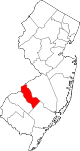
Boroughs Audubon | Audubon Park | Barrington | Bellmawr | Berlin | Brooklawn | Chesilhurst | Clementon | Collingswood | Gibbsboro | Haddon Heights | Haddonfield | Hi-Nella | Laurel Springs | Lawnside | Lindenwold | Magnolia | Merchantville | Mount Ephraim | Oaklyn | Pine Hill | Pine Valley | Runnemede | Somerdale | Stratford | Tavistock | Woodlynne
Townships Berlin | Cherry Hill | Gloucester | Haddon | Pennsauken | Voorhees | Waterford | Winslow
CDPs Communities Ancora | Atco | Blenheim | Blue Anchor | Cedar Brook | Chews Landing | Erial | Glendale | Kirkwood | Kresson | New Freedom | Osage | Sicklerville | Tansboro | West Berlin | Woodcrest
Categories:- Boroughs in Camden County, New Jersey
- Walsh Act


Wikimedia Foundation. 2010.