- Major roads in Metro Manila
-
 Metro Manila Roads
Metro Manila has a very extensive roadway system connecting the cities and municipalities of the metropolis and its surrounding provinces. The major roadways are the ten radial roads, braching from the capital city of Manila, and the five circumferential roads, which form semicircles around the city of Manila. It should be known that the Radial and Circumferential roads are not 'existing roads', per segment, but are labels that connect existing roads, so that they serve as guides. Some of the roads in Metro Manila are not yet paid to the government.
Contents
List of Roads
Radial Roads
The ten (10) radial roads that serves the purpose of conveying traffic in and out of the city of Manila to the surrounding cities of the metropolis, and to the provinces.
Road Photo # Street Remarks 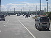
1 Delpan St.
Bonifacio Dr.
Roxas Blvd.
Gen. Emilio Aguinaldo Hwy.
Manila-Cavite Expressway
Tagaytay-Talisay Road.
Talisay-Lanurel Road.
A.MabiniBegins as Del Pan in San Nicolas district. Del Pan becomes Bonifacio Drive after crossing the Pasig River. Bonifacio Drive is the major road of the Manila South Harbor, and of Intramuros, the walled city. It then continues on as President Manuel Roxas Boulevard, formerly known as Admiral Dewey Boulevard, which is famous for its grand hotels, exquisite yacht clubs, embassies, and most of all, the famed Manila sunset. The Bangko Sentral ng Pilipinas (Central Bank of the Philippines in English), Museo Pambata (Children's Museum in English), Manila Yacht Club, the Embassy of the United States of America, and various seaside restaurants are on this road. The said boulevard has been the target of the beautification project of Manila mayor Lito Atienza. R-1 then continues to skirt the Manila bay coastline of the cities of Pasay, Parañaque, and Las Pinas as the Manila-Cavite Expressway (formerly called Coastal Road and General Emilio Aguinaldo Highway). R-1 is the main road of the Ermita district of Manila, and connects it with Cavite province. In Cavite, it passes through Bacoor, Imus, Dasmarinas, Silang, and Tagaytay City. Its extension ends in Talisay, Batangas (in front and north of Taal Lake). The road has many zigzags. 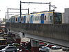
2 Antonio Villegas Rd.
Taft Ave.
Maharlika Highway
and E. Quirino Ave.Commences at the Manila City Hall in Intramuros as Antonio Villegas (former Arroceros)Road, passing through the Ermita and Malate districts. LRT-1 is built on this road. Taft Avenue houses many government offices, the University of the Philippines Manila campus, and the Philippine General Hospital. It is part of the Maharlika Highway. Also located on Taft Avenue are the Philippine Women's University, Philippine Christian University, and De La Salle University-Manila. R-2 continues on to Pasay City. Its major attraction in Pasay City is the Cartimar Pet Market, the hangout of many pet lovers. After crossing EDSA (C-4), it continues on as Quirino Avenue (different from Quirino Avenue in Malate, which is part of C-2) passing through Parañaque and Las Piñas, on to Bacoor town of Cavite, where it ends at R-1. R-2 is the main road of the Malate district of Manila, and connects it with Cavite province. 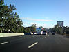
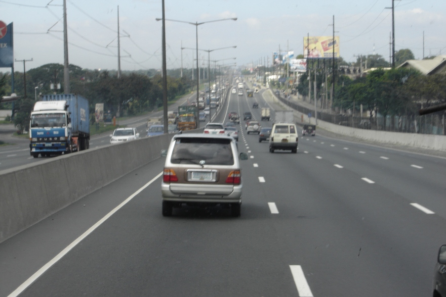
3 Metro Manila Skyway
South Luzon Expressway
STAR TollwayAlso known as the President Sergio Osmeña, Sr. Highway all throughout its course in Metro Manila, is also one of the widest roads in the Philippines. It begins at C-2 in the Paco district. R-3 connects Manila with Calamba City, Laguna province. In its course in the metropolis, it passes through the cities of Manila, Makati, Pasay, Parañaque, and Muntinlupa. The highway has two service lanes. R-3 is a tollway, and is popularly called South Luzon Expressway (SLEX) among the Manilenos. From the Metro Manila-Laguna province border, it is then called Dr. Jose Protacio Rizal Highway, after the Philippines' national hero. R-3 connects Manila with Laguna province and Cavite province. It passes STAR Tollway from Santo Tomas to its proposed extension's terminus in Batangas Port, Bauan. It will also pass the missing segment from Calamba City to Santo Tomas. 4 Pedro Gil St.
Tejeron St.
J.P. Rizal St..
J. P. Rizal Ext.
and Pasig River ExpresswayStarts at the junction of Pedro Gil St. and President Quirino Avenue (C-2) in Paco district. It then turns right on Tejeron (in Santa Ana district), then enters Makati City, where it is known as Dr. Jose P. Rizal Avenue. After crossing C-4, it becomes the Guadalupe-Pateros Road (now Dr. Jose P. Rizal Extension). R-4 currently ends at its junction with C-5 in eastern Makati. An extension into Pasig up to the proposed C-6 is planned, still following the route of the Pasig (Napindan) River. An alternative routing of R-4 is along the parallel Kalayaan Avenue in Makati. R-4 may be re-routed onto the proposed Pasig River Expressway (still never paid). 5 Old Ramon Magsaysay Blvd.
V. Mapa Blvd.
P. Sanchez St.
Shaw Blvd.
and Pasig Blvd.Branches off from R-6/Ramon Magsaysay Blvd. in the Santa Mesa district of Manila as Victorio Mapa Boulevard. It then follows P. Sanchez St., crossing the San Juan River, and becomes Shaw Boulevard after entering Mandaluyong. Shaw Boulevard houses many of Metro Manila's shopping centers, including the Marketplace, Manuela's, Puregold, and the posh Shangri-La Plaza. In Pasig City, it then follows Pasig Blvd., officially ending at its junction with C-5. R-5 is planned to be extended across the Marikina River through Pasig up to the proposed C-6. 6 Legarda St.
Pres. Ramon Magsaysay Blvd.
Aurora Blvd.
Marcos Hwy.Begins at C-1 as Legarda in the Sampaloc district. It is lined by the University of Manila, the Sampaloc Public Market, Arellano University and Sta. Catalina College. R-6 crosses C-2 and continues as the President Ramon Magsaysay Boulevard (formerly Santa Mesa Boulevard), then to San Juan and Quezon City as Aurora Boulevard. The route of the LRT-2 rail line follows R-6. In Marikina, R-6 continues along Marcos Highway it passes the SM City Marikina and LRT-2 Santolan Station, then it passes Antipolo in Rizal province. 
7 Quezon Blvd.
Lerma St.
España Boulevard
Quezon Ave.
Elliptical Rd., Commonwealth Avenue, Quirino Hwy.
and Manila-Del Monte-Garay Rd.Starts from the Manila Metropolitan Theater and crosses the Pasig River at Quezon Bridge. R-7 follows Quezon Blvd. in Quiapo, turns right at Lerma, which merges into España Boulevard. España runs through the University of Santo Tomas and the Mabuhay Rotonda. From the Mabuhay Rotonda, it then continues on to Quezon City as Quezon Avenue. Quezon Avenue is one of the scenic and comfortable roads in the metropolis. It runs smoothly through the center of Quezon City, and is lined at the island by palm trees, and on the sides by offices, stores, and nightclubs. It continues on as Elliptical Road, and Commonwealth Avenue. It curves northward and eventually ends at Quirino Highway (one of the branches of R-8). Quirino Highway reaches up to Norzagaray, Bulacan as Manila-Del Monte-Garay Road. R-7 is the main road of the Sampaloc district of Manila, and connects it with Bulacan province. 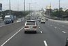
8 Alfonso Mendoza St.
Dimasalang St.
A. Bonifacio Ave.
and North Luzon ExpresswaySplits off from R-7 in Santa Cruz district as Alfonso Mendoza (formerly Andalucia) Street. The route then follows Dimasalang, and then continues on to Andres Bonifacio Avenue in Quezon City. R-8 splits just after the Balintawak cloverleaf into the Quirino Highway and the North Luzon Expressway (NLEX). R-8 is one of the main roads of the Santa Cruz district of Manila, and connects the latter with Bulacan through its two branches. The NLEX branch passes through Caloocan City and Valenzuela City before leaving Metro Manila. The Quirino Highway branch passes through the Novaliches district of Quezon City before reaching Bulacan province. 9 McArthur Bridge
Rizal Avenue
Manila North Road
McArthur Hwy.Starts from the Manila Metropolitan Theater, crosses the Pasig River at the McArthur Bridge, and then follows Rizal Avenue to the north. On Rizal Avenue (also called in Spanish as Avenida Rizal, or simply Avenida), there is an abundance of stores. LRT-1 is built on this road. It continues on from Caloocan City as the Manila North Road, officially named General Douglas MacArthur Highway, passing through Malabon and Valenzuela, and continues to the Central Luzon region. This is one of the main roads of the Santa Cruz district of Manila, and connects Manila with Bulacan province in the north up to Vigan City in Ilocos Sur. 10 Pres. F.E. Marcos Hwy.
and Manila-Bataan Coastal Rd.Begins in the San Nicolas district of Manila where it meets with Claro M. Recto Avenue (C-1) and Del Pan (R-1) as Ferdinand E. Marcos Highway. It continues north along the North Port through the Tondo district, and into Navotas town. At present, it formally ends at its intersection with C-4 in Navotas but may eventually be routed onto the proposed Manila-Bataan Coastal Road extension. The bridge will be named as Navotas-Bataan Boundary Bridge. It will connect the Bataan Provincial Expressway (BPEx) at Balanga City. Circumferential Roads
The five circumferential roads are arranged in concentric semicircles in and around Metro Manila, so as to get traffic from the northern part to the southern part as easily as possible. There is also a new circumferential road, the C-6, which is under construction.[citation needed] The routes are described from north to south (clockwise).
Road Image # Street Remarks 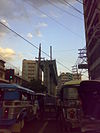
1 Claro M. Recto Ave.
P. Casal St.
Ayala Blvd.
and P. Burgos St.It starts from the Divisoria shopping district of Manila, passes through the Binondo and Quiapo districts, then turns sharply to the right to P. Casal Street, just after passing the University of the East. P. Casal Street goes through the San Miguel District and then crosses the Pasig River at Ayala Bridge. It then becomes Ayala Boulevard, passing by the Philippine Normal University and the Technological University of the Philippines. C-1 then merges onto P. Burgos where it connects back to Roxas Boulevard (R-1). C-1 is the main thoroughfare of the Binondo and Quiapo districts of Manila. 2 Tayuman Rd.
Arsenio Lacson Ave.
Nagtahan Blvd.
and Quirino Ave.begins at R-10 in Tondo district, becomes Tayuman Road in Sampaloc district, then continues on as Arsenio H. Lacson Avenue (formerly called Governor Forbes) as it skirts the old San Lazaro Hippodrome(now SM City San Lazaro). It crosses R-6 (Ramon Magsaysay Boulevard) then becomes Nagtahan Boulevard. Nagtahan Boulevard crosses the Nagtahan Bridge, the largest bridge of Pasig River, then becomes Quirino Avenue, which continues on until it reaches R-1 (Roxas Boulevard), passing through the Paco and Malate districts. 3 Libis Gocheco St.
5th Avenue
Sgt. E. Rivera St.
G. Araneta Ave.
South Avenue, Makati
Ayala Ave.
and Gil Puyat Ave.is a route that runs just outside the city limits of Manila. It runs eastward from R-10 in Navotas, passes through Caloocan City, and then as Sergeant Emilio Rivera Street after entering Quezon City. C-3 then turns southward along Gregorio Araneta Avenue in Quezon City. Gregorio Araneta Avenue (and C-3) ends at N. Domingo St. just after entering San Juan. The C-3 routing is resumed at the junction of South Avenue and Dr. Jose P. Rizal Avenue (R-4) in Makati, then enters Ayala Avenue and turns right to Gil Puyat (Formerly Buendia) Avenue, and until it ends at R-1 in Pasay City. The C-3 missing link from Makati(that will pass the proposed SM City Santa Ana at Barangay Carmona)through Mandaluyong to San Juan is currently planned as an elevated expressway.[citation needed] 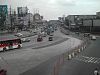
4 Letre Rd.
Samson Rd.
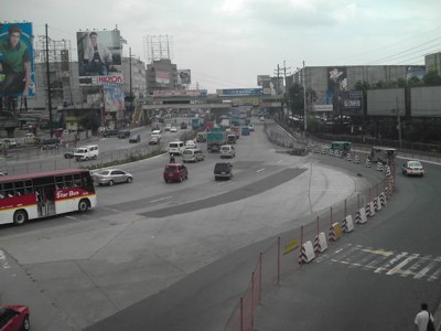
and EDSAEDSA is one of the widest roads (10-lanes) in the Philippines. EDSA utilizes a combination of grade-separated intersections, full interchanges and U-turn slots along most of its length. C-4 officially begins at R-10 in Navotas, passes through Malabon as Letre Road, and enters Caloocan City as Samson Road before becoming EDSA after crossing Rizal Avenue (R-9) at Monumento. C-4 officially ends at R-1 in Pasay City but EDSA Extension, the southern part of EDSA, extends to the Diosdado Macapagal Boulevard, and ends at the rotonda of the SM Mall of Asia. The MRT-3 rail line follows the route of C-4. EDSA passes through Caloocan City, Quezon City, Mandaluyong, Makati, and Pasay City. 
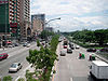
5 C.P. Garcia Ave.
E. Rodriguez Jr. Ave.
Boni Serrano Ave.
Katipunan Ave.
Congressional Avenue Extension
Tandang Sora Ave.
Mindanao Ave.
and NLEX Segments 8.1, 9 and 10Also utilizes grade separation for many of its intersections. Currently, it officially starts at the intersection of C.P. Garcia Avenue and Katipunan Avenue within the University of the Philippines Diliman campus in Quezon City. Katipunan Avenue continues north as a two-lane minor arterial road which eventually intersects Commonwealth Avenue (R-7). C-5/Katipunan Avenue runs southward and passes in front of the Ateneo de Manila University and Miriam College. After crossing between Aurora Boulevard (R-6) (via a flyover) and Marcos Highway towards Marikina City, the routing is shifted onto Eulogio Rodriguez Jr. Avenue at Santolan Road. C-5/Eulogio Rodriguez Jr. Avenue. It also passes at Libis area of Quezon City, in which the Eastwood City Cyberpark is located. It continues southward into Pasig City. Just south of Pasig Boulevard (R-5) and just north of the Pasig River, C-5 is called Carlos P. Garcia Avenue and it passes through a small portion of Makati, then through Taguig. In Taguig, it passes by the Fort Bonifacio Global City, then turns westward and formally ends at its junction with R-3/South Luzon Expressway at the boundary between Taguig City and Pasay City. Extensions of C-5 to the north and south are being planned.[citation needed] In the north, C-5 is now extended through Congressional Avenue Extension (westward) and Mindanao Avenue (north-westward) alignments until it reaches the North Luzon Expressway and McArthur Highway (R-9), The C-5 North Extension passes the NLEX Segments 8.1 and 9 and passing through northern Quezon City and Valenzuela City. A further expansion to R-10 in Navotas is also being planned up to Mariano Naval Avenue (now still Mariano Naval Street). In the south, C-5 will also be extended to R-1/Manila-Cavite Expressway, passing just south of the Ninoy Aquino International Airport Terminal 3. It is the main artery of the Bonifacio Global City developments and the NAIA Terminal 3. 6 Bulacan-Rizal-Manila-Cavite Regional Expressway Is a superhighway that is now under construction. It will act as a beltway of Metro Manila, so that buses and other transportation vehicles coming from the southern provinces to the northern provinces (and vice versa) need not pass through Metro Manila, thus lessening traffic in the metropolis. This will be named as Padre Jacinto Zamora Avenue. When built, C-6 will follow the proposed Metro Manila Tollway route eastward starting from its terminus at the North Luzon Expressway in Marilao in Bulacan province (expressway segment). C-6 will then pass through San Jose Del Monte City in Bulacan, turn southward and pass through Montalban, San Mateo, Antipolo City, Angono, and Taytay in Rizal province, finally entering Taguig. The Metro Manila Tollway will continue southwest to the South Luzon Expressway ending at the Bicutan interchange. C-6 will continue southward along the proposed Laguna de Bay Coastal Road running along the coast of the Laguna de Bay into Muntinlupa. C-6 will then turn westward, leaving the Laguna de Bay Coastal Road, pass through the elite Alabang district of Muntinlupa (passes South Luzon Expressway) and continue on to Cavite province (passes through Baccor, Imus, Kawit, Noveleta, and Cavite City), eventually connecting to R-1. 7 Marclo H. Pilar.
Jose P. Rizal Avenue.
Amang Rodriguez Avenue.
Doctor Sixto Antonio Avenue.
Apolinario Mabini.
R. Jacobson.
M. Almeda.
Manuel L. Quezon St.
Ilaya St.
San Guillermo St.
Rizal st. and Susana Heights Access Road.Starts at Rodriguez,Rizal then Turn left from J.P Rizal In C-7 U Turn in Marcos Highway in R6 then go to Amang Rodriguez Turn to Ortigas Avenue then To Dr Sixto Antonio Avenue crossing R12 Buendia ext Among Pasigs Go to Tagig and Multinlupa cross the Sucat then Alabang turn to Rizal street then turn to National Highway To Susana Heights Access road Ends At SLEX R3. Other Major Roads
Other Major Roads are:
 Quirino Highway near the Boundary of North Caloocan City and Quezon City.
- Commonwealth Avenue (Diliman, Commonwealth, Balara and Fairview areas of Quezon City)
- Del Monte Avenue (San Francisco Del Monte district of Quezon City)
- Mayon Avenue (La Loma district of Quezon City)
- Banawe Avenue (Santa Mesa Heights of Quezon City)
- North Avenue (Project 6 district of Quezon City)
- Timog Avenue (Laging Handa district of Quezon City) (Timog is Tagalog for South)
- East Avenue (Diliman district of Quezon City)
- West Avenue (Project 7 district of Quezon City)
- Ongpin Street (Chinatown district of Manila)
- Makati Avenue (San Lorenzo Village to Barangay Poblacion in Makati City)
- Ayala Avenue (Makati Central Business District to San Antonio, Makati City)
- Kalayaan Avenue (Singkamas to Rockwell in Makati and Pinagkaisahan, Makati City to Pasig City)
- Ortigas Avenue (Greenhills district of San Juan to Antipolo City, a.k.a. R-5A)
- A. Bonifacio Avenue (Aurora Blvd. to Marikina City)
- Sumulong Highway (Marikina City to highlands of Antipolo City)
- J. P. Rizal Avenue (Nangka bridge to Calumpang district, Marcos Highway of Marikina City)
- Gilmore Avenue - Near Broadway Centrum (New Manila district of Quezon City)
- Eulogio Rodriguez, Sr. Avenue (Welcome Rotunda to Cubao district of Quezon City)
- Alabang-Zapote Road (Alabang district of Muntinlupa-Zapote district of Bacoor, Cavite)
- J. Aguilar Avenue (CAA- BF International, Las Piñas City)
- Marcos Alvarez Avenue (Talon district of Las Piñas, Molino district of Bacoor, Cavite)
- Naga Road (Pulanglupa district of Las Piñas City)
- Daang Hari (Las Piñas, Muntinlupa, Bacoor, Cavite, San Pedro, Laguna)
- Dr. Arcadio Santos Avenue, or Sucat Road (Sucat district of Parañaque City)
- Doña Soledad Avenue (Bicutan district of Parañaque City).
- Quirino Highway (Norzagaray,Bulacan, San Jose del Monte City, Bulacan, Caloocan City (North) and Quezon City)
- Batasan Road (Batasan Hills, Quezon City)
- Quezon Avenue (Welcome Rotonda to Quezon Memorial Circle in Quezon City)
- Congressional Avenue (Luzon Avenue to EDSA in Quezon City)
- Roosevelt Avenue (Quezon Avenue to EDSA in Quezon City)
- G. Araneta Avenue (Aurora Boulevard to Sgt. Rivera Avenue in Quezon City)
- Sgt. Rivera Avenue (La Loma, Quezon City)
- 5th Avenue (Caloocan City)
- A. Bonifacio Avenue (Balintawak, La Loma, Quezon City)
- Gil Puyat Avenue (Buendia) (EDSA in Makati City to Macapagal Boulevard in Pasay City)
- Meralco Avenue (Ortigas Avenue to Shaw Boulevard in Pasig City)
- Batasan-San Mateo Road (Batasan Road in Quezon City to San Mateo, Rizal)
- NAIA Road (Macapagal Boulevard to NAIA - 2 in Pasay City)
- Ninoy Aquino Avenue - Location of NAIA - 1 (NAIA Road in Pasay City to Dr. Santos Avenue in Parañaque City)
- Visayas Avenue (Quezon Memorila Circle to Tandang Sora Avenue in Quezon City)
- Regalado Avenue (Commonwealth Avenue to Quirino Highway in Fairview, Quezon City)
- A. Roces Avenue (Quezon Avenue to Tomas Morato in Quezon City)
- Domestic Road - in front of Domestic Terminal (Airport Road or Andrews Avenue to NAIA Road in Pasay City)
- Airport Road (Roxas Boulevard to NAIA 3 Entrance Rotonda in Pasay City)
- Andrews Avenue (Sales to Airport Road in Pasay City located in front of Terminal 3)
- Sales Road (NAIA 3 Exit Rotonda to South Luzon Expressway in Pasay City located in front of Villamor Airbase)
- Agham Road (East to North Avenue in Quezon City)
- Kamuning Road (EDSA to Tomas Morato in Quezon City)
- D. Tuazon (Sgt. Rivera to E. Rodriguez, Sr. Avenue in Quezon City)
- Tomas Morato (ABS-CBN Compound in South Triangle to E. Rodriguez, Sr. Avenue in Quezon City)
- Diosdado Macapagal Boulevard - The main major road in Reclamation Area (Gil Puyat Avenue in Pasay City to Pacific Avenue in Parañaque City)
- National High Way - Major Road from Alabang Muntinlupa to Calamba City, Laguna.
Categories:- Roads in Manila


Wikimedia Foundation. 2010.