- Clayton, New Jersey
-
Clayton, New Jersey — Borough — Clayton Borough highlighted in Gloucester County. Inset map: Gloucester County highlighted in the State of New Jersey. Census Bureau map of Clayton, New Jersey
Coordinates: 39°39′33″N 75°04′58″W / 39.65917°N 75.08278°WCoordinates: 39°39′33″N 75°04′58″W / 39.65917°N 75.08278°W Country United States State New Jersey County Gloucester Incorporated February 5, 1858 as Clayton Township Reincorporated May 9, 1887 as Clayton Borough Government[1] - Type Borough (New Jersey) - Mayor Jeff Radio (2011)[2] - Administrator Sue Miller[3] Area - Total 7.4 sq mi (19.0 km2) - Land 7.2 sq mi (18.6 km2) - Water 0.2 sq mi (0.4 km2) Elevation[4] 128 ft (39 m) Population (2010 Census)[5] - Total 8,199 - Density 1,108/sq mi (431.5/km2) Time zone Eastern (EST) (UTC-5) - Summer (DST) EDT (UTC-4) ZIP code 08312 Area code(s) 856 FIPS code 34-13360[6][7] GNIS feature ID 0885185[8] Website http://claytonnj.com Clayton is a Borough in Gloucester County, New Jersey, United States. As of the 2010 United States Census, the borough population was 8,179.[5]
Jacob Fisler, who purchased much of the area that is now Clayton, established a community called Fislertown in 1850 that grew substantially after he opened a glass factory.[9] What is now Clayton was originally formed as Clayton Township, which was created on February 5, 1858, from portions of Franklin Township. Portions of the township were taken to form Glassboro Township on March 11, 1878. Clayton was formed as a borough by an Act of the New Jersey Legislature on May 9, 1887, from portions of Clayton Township. The remainder of Clayton Township was absorbed by the Borough of Clayton on April 14, 1908, and the township was dissolved.[10]
Contents
Geography
Clayton is located at 39°39′28″N 75°05′17″W / 39.657914°N 75.087983°W (39.657914, -75.087983).[11]
According to the United States Census Bureau, the borough has a total area of 7.3 square miles (19 km2), of which, 7.2 square miles (19 km2) of it is land and 0.2 square miles (0.52 km2) of it (2.31%) is water.
Clayton borders Glassboro, Elk Township, Franklin Township, and Monroe Township.
Demographics
Historical populations Census Pop. %± 1860 2,490 — 1870 3,674 47.6% 1880 1,981 −46.1% 1890 2,299 16.1% 1900 1,989 −13.5% 1910 1,926 −3.2% 1920 1,905 −1.1% 1930 2,351 23.4% 1940 2,320 −1.3% 1950 3,023 30.3% 1960 4,711 55.8% 1970 5,193 10.2% 1980 6,013 15.8% 1990 6,155 2.4% 2000 7,139 16.0% 2010 8,179 14.6% Population sources:[12][13]
1930 - 1990[14] 2000[15] 2010[5]As of the census[6] of 2000, there were 7,139 people, 2,464 households, and 1,884 families residing in the borough. The population density was 994.2 people per square mile (383.9/km2). There were 2,680 housing units at an average density of 373.2 per square mile (144.1/km2). The racial makeup of the borough was 79.23% White, 16.05% African American, 0.42% Native American, 0.66% Asian, 0.03% Pacific Islander, 0.95% from other races, and 2.66% from two or more races. Hispanic or Latino of any race were 3.28% of the population.[15]
There were 2,464 households out of which 39.4% had children under the age of 18 living with them, 57.5% were married couples living together, 13.9% had a female householder with no husband present, and 23.5% were non-families. 19.7% of all households were made up of individuals and 7.5% had someone living alone who was 65 years of age or older. The average household size was 2.89 and the average family size was 3.31.[15]
In the borough the population was spread out with 29.1% under the age of 18, 8.7% from 18 to 24, 31.6% from 25 to 44, 21.0% from 45 to 64, and 9.6% who were 65 years of age or older. The median age was 34 years. For every 100 females there were 91.7 males. For every 100 females age 18 and over, there were 89.8 males.[15]
The median income for a household in the borough was $53,219, and the median income for a family was $63,097. Males had a median income of $37,231 versus $29,063 for females. The per capita income for the borough was $20,006. About 3.1% of families and 2.9% of the population were below the poverty line, including 4.0% of those under age 18 and 1.7% of those age 65 or over.[15]
Government
Local government
Clayton is governed under the Borough form of New Jersey municipal government. The government consists of a Mayor and a Borough Council comprising six council members, with all positions elected at large. A Mayor is elected directly by the voters to a four-year term of office. The Borough Council consists of six members elected to serve three-year terms on a staggered basis, with two seats coming up for election each year.[1]
As of 2011[update], the Mayor of the Borough of Clayton is Jeff Radio, whose term of office ends on December 31, 2011. Members of the Borough Council are Council President Tom Bianco (2013), Franklin Brown (2012), Craig Conti (2011), Kim Robinson (2012), Tony Saban (2013) and Charles Simon (2011).[16]
Federal, state and county representation
Clayton is in the 2nd Congressional district and is part of New Jersey's 3rd state legislative district.[17] The legislative district was kept unchanged by the New Jersey Apportionment Commission based on the results of the 2010 Census.[5]
New Jersey's Second Congressional District is represented by Frank LoBiondo (R, Ventnor City). New Jersey is represented in the United States Senate by Frank Lautenberg (D, Cliffside Park) and Bob Menendez (D, Hoboken).
3rd legislative district of the New Jersey Legislature, which is represented in the New Jersey Senate by Stephen M. Sweeney (D, West Deptford Township) and in the New Jersey General Assembly by John J. Burzichelli (D, Paulsboro) and Celeste Riley (D, Bridgeton).[18] The Governor of New Jersey is Chris Christie (R, Mendham).[19] The Lieutenant Governor of New Jersey is Kim Guadagno (R, Monmouth Beach).[20]
Gloucester County is governed by a Board of Chosen Freeholders, whose seven members are elected at-large to three-year terms of office on a staggered basis, with two or three seats coming up for election each year. Each year, the Board selects a Freeholder Director and Deputy Director from among its members. As of 2011, Gloucester County's Freeholders are Freeholder Director Robert M. Damminger (D, West Deptford Township, 2012), Deputy Freeholder Director Dr. Warren S. Wallace (D, Washington Township, 2011), Giuseppe "Joe" Chila (D, Woolwich Township, 2012), Frank J. DiMarco (D, Deptford Township, 2011), Vincent H. Nestore, Jr. (R, Deptford Township, 2013), Heather Simmons (D, Glassboro Borough, 2011), Larry Wallace (R, Woolwich Township, 2013).[21]
Education
The Clayton Public Schools serve students in kindergarten through twelfth grade. Schools in the district (with 2009-10 enrollment data from the National Center for Education Statistics[22]) are Herma S. Simmons Elementary School for grades K-6 (803 students) and Clayton Middle/High School for grades 7-12 (194 students in grades 7 and 8; 337 in grades 9-12).
In September 2009, voters approved a referendum that covered a $20 million renovation and expansion project at the middle school / high school.[23]
References
- ^ a b 2005 New Jersey Legislative District Data Book, Rutgers University Edward J. Bloustein School of Planning and Public Policy, April 2005, p. 19.
- ^ 2011 New Jersey Mayors Directory, New Jersey Department of Community Affairs. Accessed July 19, 2011.
- ^ Borough Personnel, Borough of Clayton. Accessed July 19, 2011.
- ^ U.S. Geological Survey Geographic Names Information System: Borough of Clayton, Geographic Names Information System. Accessed June 13, 2008.
- ^ a b c d 2011 Apportionment Redistricting: Municipalities sorted alphabetically, New Jersey Department of State, p. 2. Accessed July 17, 2011.
- ^ a b "American FactFinder". United States Census Bureau. http://factfinder.census.gov. Retrieved 2008-01-31.
- ^ A Cure for the Common Codes: New Jersey, Missouri Census Data Center. Accessed July 14, 2008.
- ^ "US Board on Geographic Names". United States Geological Survey. 2007-10-25. http://geonames.usgs.gov. Retrieved 2008-01-31.
- ^ The History of the Borough of Clayton, Borough of Clayton. Accessed July 19, 2011.
- ^ "The Story of New Jersey's Civil Boundaries: 1606-1968", John P. Snyder, Bureau of Geology and Topography; Trenton, New Jersey; 1969. p. 137.
- ^ "US Gazetteer files: 2010, 2000, and 1990". United States Census Bureau. 2011-02-12. http://www.census.gov/geo/www/gazetteer/gazette.html. Retrieved 2011-04-23.
- ^ "U.S. Census Historical Data 1790-2000". http://www.census.gov/prod/www/abs/decennial/index.htm. Retrieved 2007-03-16.
- ^ 1860-1880, Clayton Township; 1890-1900, combined population of Clayton Township (1890: 492, 1900: 38) and Clayton borough; 1910-, Clayton borough
- ^ New Jersey Resident Population by Municipality: 1930 - 1990, Workforce New Jersey Public Information Network, backed up by the Internet Archive as of May 2, 2009. Accessed July 6, 2011.
- ^ a b c d e Census 2000 Demographic Profile Highlights: Clayton borough, New Jersey, United States Census Bureau. Accessed July 19, 2011.
- ^ Meet Our Mayor and Council Members, Borough of Clayton. Accessed July 19, 2011.
- ^ 2011 New Jersey Citizen's Guide to Government, New Jersey League of Women Voters, p. 56. Accessed July 17, 2011.
- ^ "Legislative Roster: 2010-2011 Session". New Jersey Legislature. http://www.njleg.state.nj.us/members/roster.asp. Retrieved 2010-02-08.
- ^ "About the Governor". New Jersey. http://www.nj.gov/governor/about/. Retrieved 2010-01-21.
- ^ "About the Lieutenant Governor". New Jersey. http://www.nj.gov/governor/lt/. Retrieved 2010-01-21.
- ^ Gloucester County Board of Chosen Freeholders, Gloucester County, New Jersey. Accessed May 27, 2011.
- ^ Data for the Clayton Public Schools, National Center for Education Statistics. Accessed July 19, 2011.
- ^ Driscoll, Jessica. "Clayton, Pitman prepare for OK'd school upgrade referendum work", Gloucester County Times, November 30, 2009. Accessed July 19, 2011. "Voters approved bond referendums for two local school districts in September and now district officials are working with architects to prepare bid specifications and prepare for construction.In Clayton, work will likely begin this spring on a $20 million renovation and expansion project at the high school/ middle school."
External links
- Borough of Clayton website
- Clayton Public Schools
- Clayton Public Schools's 2009–10 School Report Card from the New Jersey Department of Education
- Data for the Clayton Public Schools, National Center for Education Statistics
- Clayton forum
Municipalities and communities of Gloucester County, New Jersey County seat: Woodbury City 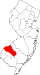
Boroughs Clayton | Glassboro | National Park | Newfield | Paulsboro | Pitman | Swedesboro | Wenonah | Westville | Woodbury Heights
Townships Deptford | East Greenwich | Elk | Franklin | Greenwich | Harrison | Logan | Mantua | Monroe | South Harrison | Washington | West Deptford | Woolwich
CDPs Communities Almonesson | Bridgeport | Clarksboro | Cooper | Cross Keys | Ferrell | Franklinville | Greenfields Village | Harrisonville | Hurffville | Malaga | Mickleton | Monroeville | Mount Royal | New Brooklyn | Red Bank | Repaupo | Richwood | Sewell | Thorofare
Categories:- 1867 establishments in the United States
- Populated places established in 1867
- Boroughs in Gloucester County, New Jersey
- Former townships in New Jersey


Wikimedia Foundation. 2010.