- Westville, New Jersey
Infobox Settlement
official_name = Westville, New Jersey
settlement_type = Borough
nickname =
motto =
imagesize =
image_caption =
image_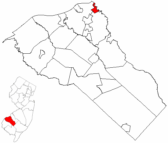
mapsize = 250x200px
map_caption = Westville highlighted in Gloucester County. Inset
mapsize1 = 250x200px
map_caption1 = Census Bureau map of Westville, New Jerseysubdivision_type = Country
subdivision_name =United States
subdivision_type1 = State
subdivision_name1 =New Jersey
subdivision_type2 = County
subdivision_name2 = Gloucester
government_footnotes =
government_type =Borough (New Jersey)
leader_title =Mayor
leader_name = Michael K. Galbraith
leader_title1 = Administrator
leader_name1 = William J. Bittner, Jr.
established_title = Incorporated
established_date =April 28 ,1914 unit_pref = Imperial
area_footnotes =
area_magnitude =
area_total_km2 = 3.5
area_land_km2 = 2.5
area_water_km2 = 1.0
area_total_sq_mi = 1.4
area_land_sq_mi = 1.0
area_water_sq_mi = 0.4population_as_of = 2006
population_footnotes =
population_total = 4458
population_density_km2 = 1801.6
population_density_sq_mi = 4666.1timezone = Eastern (EST)
utc_offset = -5
timezone_DST = EDT
utc_offset_DST = -4
elevation_footnotes = [Gnis|885440|Borough of Westville,Geographic Names Information System , accessedJanuary 4 ,2008 .]
elevation_m = 3
elevation_ft = 10
latd = 39 |latm = 52 |lats = 11 |latNS = N
longd = 75 |longm = 07 |longs = 47 |longEW = Wpostal_code_type =
ZIP code
postal_code = 08093
area_code = 856
blank_name = FIPS code
blank_info = 34-80120GR|2 [ [http://mcdc2.missouri.edu/webrepts/commoncodes/ccc_nj.html A Cure for the Common Codes: New Jersey] , Missouri Census Data Center. AccessedJuly 14 ,2008 .]
blank1_name = GNIS feature ID
blank1_info = 0885440GR|3
website = http://www.westville-nj.com
footnotes =Westville is a Borough in Gloucester County,
New Jersey , USA. As of theUnited States 2000 Census , the borough population was 4,501. The Borough of Westville is known as "The Gateway toSouth Jersey ." [ [http://www2.westville-nj.com/transportation/ Westville Borough History: Transportation] , Borough of Westville. AccessedJune 18 ,2007 .]Westville was formed as a borough by an Act of the
New Jersey Legislature onApril 7 ,1914 , from portions of Deptford Township and West Deptford Township, based on the results of a referendum held onApril 28 ,1914 . The borough was reincorporated onMarch 8 ,1924 ."The Story of New Jersey's Civil Boundaries: 1606-1968", John P. Snyder, Bureau of Geology and Topography; Trenton, New Jersey; 1969. p. 140.] [ [http://www2.westville-nj.com/boro-incorporated/ Boro Incorporated] , Borough of Westville. AccessedJune 18 ,2007 .]Geography
Westville is located at coor dms|39|52|5|N|75|7|39|W|city (39.868013, -75.127564)GR|1.
According to the
United States Census Bureau , the borough has a total area of 1.4square mile s (3.5km² ), of which, 1.0 square miles (2.5 km²) of it is land and 0.4 square miles (1.0 km²) of it (28.68%) is water.Westville borders Deptford Township, West Deptford Township, and Camden County.
Demographics
USCensusPop
1930= 3462
1940= 3585
1950= 4731
1960= 4951
1970= 5170
1980= 4786
1990= 4573
2000= 4500
estimate= 4458
estyear=2006
estref= [http://factfinder.census.gov/servlet/SAFFPopulation?_event=Search&geo_id=06000US3401578800&_geoContext=01000US%7C04000US34%7C05000US34015%7C06000US3401578800&_street=&_county=westville&_cityTown=westville&_state=04000US34&_zip=&_lang=en&_sse=on&ActiveGeoDiv=geoSelect&_useEV=&pctxt=fph&pgsl=060&_submenuId=population_0&ds_name=null&_ci_nbr=null&qr_name=null®=null%3Anull&_keyword=&_industry= Census data for Westville Borough] ,United States Census Bureau . AccessedSeptember 29 ,2007 .]
footnote=Population 1930 - 1990. [ [http://www.wnjpin.net/OneStopCareerCenter/LaborMarketInformation/lmi01/poptrd6.htm New Jersey Resident Population by Municipality: 1930 - 1990] , Workforce New Jersey Public Information Network. AccessedMarch 1 ,2007 .] As of thecensus GR|2 of 2000, there were 4,500 people, 1,812 households, and 1,125 families residing in the borough. Thepopulation density was 4,666.1 people per square mile (1,809.9/km²). There were 1,938 housing units at an average density of 2,009.5/sq mi (779.4/km²). The racial makeup of the borough was 93.47% White, 2.71% African American, 0.13% Native American, 1.00% Asian, 0.02% Pacific Islander, 1.29% from other races, and 1.38% from two or more races. Hispanic or Latino of any race were 2.96% of the population.There were 1,812 households out of which 29.5% had children under the age of 18 living with them, 45.4% were married couples living together, 12.2% had a female householder with no husband present, and 37.9% were non-families. 31.8% of all households were made up of individuals and 11.9% had someone living alone who was 65 years of age or older. The average household size was 2.48 and the average family size was 3.15.
In the borough the population was spread out with 24.5% under the age of 18, 8.0% from 18 to 24, 32.0% from 25 to 44, 21.5% from 45 to 64, and 14.1% who were 65 years of age or older. The median age was 37 years. For every 100 females there were 94.2 males. For every 100 females age 18 and over, there were 91.4 males.
The median income for a household in the borough was $39,570, and the median income for a family was $49,005. Males had a median income of $35,909 versus $27,220 for females. The
per capita income for the borough was $18,747. About 7.4% of families and 8.7% of the population were below thepoverty line , including 13.9% of those under age 18 and 5.9% of those age 65 or over.Government
Local government
Westville is governed under the Borough form of New Jersey municipal government. The government consists of a Mayor and a Borough Council comprising six council members, with all positions elected at large. A Mayor is elected directly by the voters to a four-year term of office. The Borough Council consists of six members elected to serve three-year terms on a staggered basis, with two seats coming up for election each year. ["2005 New Jersey Legislative District Data Book",
Rutgers University Edward J. Bloustein School of Planning and Public Policy , April 2005, p. 28.]The
Mayor of Westville is . Members of the Westville Borough Council are Council President Russell Welsh, George Baker, Michael O. Ledrich, Ronald Muhlbaier, James Pennington and Sue Rodgers. [http://www2.westville-nj.com/administration-2/ Administration] , Borough of Westville. AccessedMarch 12 ,2008 .]Federal, state and county representation
Westville is in the First Congressional District and is part of New Jersey's 5th Legislative District. [ [http://www.lwvnj.org/pubs/CG06.pdf 2006 New Jersey Citizen's Guide to Government] , New Jersey
League of Women Voters , p. 63. AccessedAugust 30 ,2006 .]Education
The
Westville School District is a community public school district that serves students in Preschool through Sixth grade. Parkview Elementary School, home of the Panthers, served an enrollment of 358 students as of the 2005-06 school year. [ [http://nces.ed.gov/ccd/schoolsearch/school_list.asp?Search=1&DistrictID=3417790 Data for the Parkview Elementary School] ,National Center for Education Statistics . AccessedFebruary 28 ,2008 .]For seventh through twelfth grade, students attend Gateway Regional High School, a regional public high school serving students from the boroughs of National Park, Wenonah, Westville and Woodbury Heights, as part of the Gateway Regional High School District. [ [http://education.state.nj.us/rc/rc07/narrative/15/1715/15-1715-000.html Gateway Regional High School District 2007 School Report Card] ,
New Jersey Department of Education . AccessedFebruary 28 ,2008 . "Gateway Regional High School District is comprised of one 7th-12th-grade school located in Woodbury Heights, NJ. It serves the secondary students from the municipalities of National Park, Wenonah, Westville, and Woodbury Heights."]Noted residents
Notable current and former residents of Westville include:
*Milt Plum , NFLQuarterback with theCleveland Browns (1957-1961),Detroit Lions (1962-1967), Los Angeles Rams (1968) and theNew York Giants (1969). [ [http://www.courierpostonline.com/apps/pbcs.dll/article?AID=/20061019/SPECIAL20/610190384/-1/Westville "Westville: Once a part of two other townships"] , "Courier-Post ",October 19 ,2006 . AccessedJune 18 ,2007 . "Milt Plum, who played quarterback for the Cleveland Browns, Detroit Lions, Los Angeles Rams and New York Giants during a 13-year NFL career that lasted from 1957 to 1969, was born in Westville on Jan. 20, 1935."]References
External links
* [http://www.westville-nj.com/ Westville Borough website]
* [http://www.westville.k12.nj.us/ Parkview Elementary School]
*NJReportCard|15|5740|0|Parkview Elementary School
* [http://nces.ed.gov/ccd/schoolsearch/school_list.asp?Search=1&DistrictID=3417790 Data for the Parkview Elementary School] ,National Center for Education Statistics
* [http://www.gatewayhs.com/ Gateway Regional High School]

Wikimedia Foundation. 2010.